Ex-Ingrid north of Leewards
Moderator: S2k Moderators
-
mattpetre
- Category 2

- Posts: 510
- Age: 54
- Joined: Mon Sep 19, 2005 3:20 pm
- Location: Missouri City,TX & Galleria
- Contact:
Re: Ex-Ingrid (still on NRL) north of Leewards
Scary thing is if Ingrid does not recurve and follows 93L into the Gulf maybe next week sometime... I know that's not likely, but could be a really crappy scenario that is not at all impossible.
0 likes
-
CrazyC83
- Professional-Met

- Posts: 34316
- Joined: Tue Mar 07, 2006 11:57 pm
- Location: Deep South, for the first time!
Re: Ex-Ingrid (still on NRL) north of Leewards
mattpetre wrote:Scary thing is if Ingrid does not recurve and follows 93L into the Gulf maybe next week sometime... I know that's not likely, but could be a really crappy scenario that is not at all impossible.
So true! That path is wide open now - that would be the Katrina scenario all over again...
0 likes
Re: Ex-Ingrid (still on NRL) north of Leewards (Threads Merged)
I don't know - the convection east of the old Ingrid circulation is very distant from it, so, it doesn't seem that impressive to me...
http://www.goes.noaa.gov/browsh2.html
and, the system east of Florida, while it looks more organized, if it moves westward, is at a latitude that it'll pass over the wider area of North-Central Florida, before reaching the Gulf (if it does), and, would still be close to land at that point, so, as the NHC says, any development would be slow to occur...
P.S. NHC has not updated their satellite page for either area, so, they must not think it very impressive at this time...
0 likes

Re: Ex-Ingrid (still on NRL) north of Leewards (Threads Merged)
FWIW, Canadian brings it back in the latest run,and strong..
http://moe.met.fsu.edu/cgi-bin/cmctc2.c ... =Animation
http://moe.met.fsu.edu/cgi-bin/cmctc2.c ... =Animation
0 likes


Oh its looking goooood.  i just look at a shear map and i see that ex ingrid is
in 20kts of shear. hmmmm
has ex ingrid been in 20kts shear since it dissipated?
http://www.ssd.noaa.gov/PS/TROP/DATA/gparm/xyrshr.gif
http://cimss.ssec.wisc.edu/tropic/real- ... wg8shr.GIF
in 20kts of shear. hmmmm
has ex ingrid been in 20kts shear since it dissipated?
http://www.ssd.noaa.gov/PS/TROP/DATA/gparm/xyrshr.gif
http://cimss.ssec.wisc.edu/tropic/real- ... wg8shr.GIF
0 likes

-
DESTRUCTION5

- Category 5

- Posts: 4430
- Age: 44
- Joined: Wed Sep 03, 2003 11:25 am
- Location: Stuart, FL
-
Lowpressure

- S2K Supporter

- Posts: 2032
- Age: 59
- Joined: Sun Sep 14, 2003 9:17 am
- Location: Charlotte, North Carolina
Re:
DESTRUCTION5 wrote:As much as I would love to ignore this thread..I am drawn to the fact that this friggin thing looks good..
I was about to post the same thing.
0 likes
-
brunota2003

- S2K Supporter
- Posts: 9476
- Age: 35
- Joined: Sat Jul 30, 2005 9:56 pm
- Location: Stanton, KY...formerly Havelock, NC
- Contact:
-
gatorcane

- S2K Supporter
- Posts: 23708
- Age: 48
- Joined: Sun Mar 13, 2005 3:54 pm
- Location: Boca Raton, FL
Re: Ex-Ingrid (still on NRL) north of Leewards (Threads Merged)
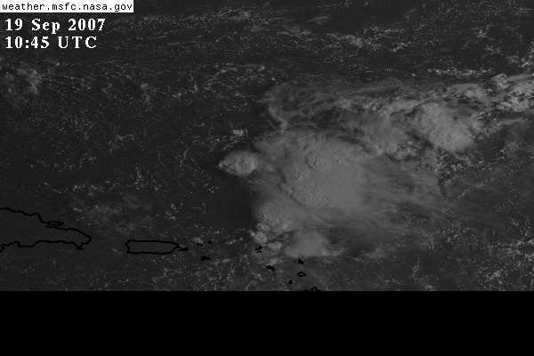
folks I'm ex-Ingrid may just be the focus instead of 93L
I think this is where she makes her run. She is now in a marginally favorable environment.
I notice the thread saying I think she will be back has been merged to this one.
She may be back folks.
I think this is where she makes her run. She is now in a marginally favorable environment.
I notice the thread saying I think she will be back has been merged to this one.
She may be back folks.
Last edited by gatorcane on Wed Sep 19, 2007 7:46 am, edited 2 times in total.
0 likes
-
DESTRUCTION5
- Category 5
- Posts: 4430
- Age: 44
- Joined: Wed Sep 03, 2003 11:25 am
- Location: Stuart, FL
-
Three Blind Mice

- Tropical Storm

- Posts: 202
- Joined: Thu Jul 29, 2004 9:28 am
- Location: Wrightsville Beach, NC
Re: Ex-Ingrid (still on NRL) north of Leewards (Threads Merged)
starting to fire up closer to the presumed LLC, if there is one.
http://www.esl.lsu.edu/special_gifs/trop_lant4col.gif
http://www.esl.lsu.edu/special_gifs/trop_lant4col.gif
0 likes


Who is online
Users browsing this forum: No registered users and 2 guests