Tropical Depression TEN: Discussions & Images

Moderator: S2k Moderators

Message
Author
User avatar
Tampa Bay Hurricane
Category 5
Category 5
Posts: 5597
Age: 37
Joined: Fri Jul 22, 2005 7:54 pm
Location: St. Petersburg, FL

Re: INVEST 93L (ATL): Discussion & Images

#261 Postby Tampa Bay Hurricane » Tue Sep 18, 2007 3:14 pm

Air Force Met wrote:
Tampa Bay Hurricane wrote: Observed at: Foots Cay, Foots Cay, Abaco
Elevation: 30 ft / 9 m

Temperature: 78.7 °F / 25 °C
Humidity: 100%
Dew Point: 79 °F / 26 °C
Wind: 14.5 mph / 23 km/h from the ENE
Wind Gust: 16.2 mph / 26 km/h
Pressure: 29.77 in / 1008.0 hPa
Heat Index: 83 °F / 28 °C


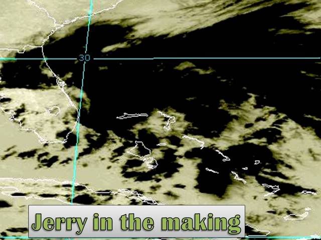
The pressure is almost certainly wrong. There have been issues in the past from reports in the Bahamas with the pressure being too low...and this pressure seems too low by about 5 MB. All other pressures from buoys...and other reporting stations in that area indicate a loose pressure gradient around the low and that it is near 1011-1012 as all other reports are in the 1012-1013 mb range. If a pressure of 1008 existed you would see evidence of a tight LLC on the hi-res vis...and there is none. So...the pressure is obviously way too low.[/quote]

Oh okay thanks- I could not really find a source exept a blog so probably a
typo.,
0 likes   

Air Force Met
Military Met
Military Met
Posts: 4372
Age: 56
Joined: Tue Jul 08, 2003 9:30 am
Location: Roan Mountain, TN

Re:

#262 Postby Air Force Met » Tue Sep 18, 2007 3:15 pm

Dean4Storms wrote:Sure is coming together quickly with the aid of the ULL. I think it'll battle the sub to purely tropical status till it gets into the GOM. From there should take off as the shear lessens if the models are correct.

I think most of the stronger winds will be on the north side where the gradient is steepest, if the low passes to your north as it moves westward you may not see much rain or even wind at all.


Give Dean a cigar...
0 likes   

User avatar
cycloneye
Admin
Admin
Posts: 145300
Age: 68
Joined: Thu Oct 10, 2002 10:54 am
Location: San Juan, Puerto Rico

Re: INVEST 93L (ATL): Discussion & Images

#263 Postby cycloneye » Tue Sep 18, 2007 3:15 pm

caneman wrote:Well the fact that they're sending NOAA right now tells me they deem it important because so close to land and need upper air pattern to get a better feel for where it may go.


Well not right now,but tommorow night around 00:00 UTC or 8 PM EDT.It will help to feed the models with upper enviroment data.
0 likes   

rockyman
Category 5
Category 5
Posts: 1967
Joined: Thu Jun 26, 2003 12:24 pm
Location: Dauphin Island, AL

#264 Postby rockyman » Tue Sep 18, 2007 3:18 pm

For anyone interested, James Spann's (ABC 33/40 in Birmingham)afternoon update entitled "Jerry's Birth?"

http://www.alabamawx.com/
0 likes   

Air Force Met
Military Met
Military Met
Posts: 4372
Age: 56
Joined: Tue Jul 08, 2003 9:30 am
Location: Roan Mountain, TN

Re: INVEST 93L (ATL): Discussion & Images

#265 Postby Air Force Met » Tue Sep 18, 2007 3:18 pm

Tampa Bay Hurricane wrote:Oh okay thanks- I could not really find a source exept a blog so probably a
typo.,


I don't think its a typo. It may be but I seem to recall having this issue with another system moving through the Bahamas a couple/3 years ago and we came to the same conclusion...and I think it might have been this same station. Sometimes these weather station's barometers aren't calibrated right....they are either high or low by a few mb's and the bar tender doesn't know any better. :lol:
Last edited by Air Force Met on Tue Sep 18, 2007 3:19 pm, edited 1 time in total.
0 likes   

User avatar
gatorcane
S2K Supporter
S2K Supporter
Posts: 23691
Age: 47
Joined: Sun Mar 13, 2005 3:54 pm
Location: Boca Raton, FL

#266 Postby gatorcane » Tue Sep 18, 2007 3:19 pm

Look at all of the heavy showers and thunderstorms (probably with very gusty winds) looming offhsore SE Florida between the peninsula and the Bahamas....

Wow :eek:

http://radar.weather.gov/radar.php?rid= ... 1&loop=yes
0 likes   

Stormcenter
S2K Supporter
S2K Supporter
Posts: 6684
Joined: Wed Sep 03, 2003 11:27 am
Location: Houston, TX

Re: INVEST 93L (ATL): Discussion & Images

#267 Postby Stormcenter » Tue Sep 18, 2007 3:20 pm

This from the NWS Lake Charles, LA afternoon discsussion.


LONG TERM...HOLD ON TO YOUR HATS AS THE NEXT FEW FORECASTS COULD
REFLECT A RATHER ROUGH RIDE. MODEL CONSISTENCY IS LACKING WITH A
PREVIOUS GFS TRACK TAKING THE DEVELOPING TROPICAL LOW INTO THE
UPPER TEXAS COAST OR SABINE PASS. THE CURRENT GUIDANCE LOOKS MORE
REASONABLE NOT TO MENTION MORE FRIENDLY WITH THE TROPICAL LOW
ROUTING INTO THE MID GULF STATES. WE ARE IN AGREEMENT WITH NCEP
THAT A SUBTROPICAL LOW OF THIS TYPE WOULD LIKELY BE DEVELOPING
FURTHER NORTH CLOSER TO THE COOLER AIR WHICH IS WHAT THE CURRENT
GFS HAS.
THIS LOOKS TO KEEP OUR REGION ON THE SUBSIDENT AND COOLER
NOT TO MENTION MUCH DRIER SIDE. OF COURSE THIS COULD CHANGE SHOULD
STAY TUNED. WILL BE ISSUING STATEMENTS ONCE CERTAINTY IS BETTER
ESTABLISHED.
0 likes   

User avatar
HURAKAN
Professional-Met
Professional-Met
Posts: 46086
Age: 38
Joined: Thu May 20, 2004 4:34 pm
Location: Key West, FL
Contact:

#268 Postby HURAKAN » Tue Sep 18, 2007 3:20 pm

Latest:

Image
0 likes   

User avatar
carversteve
Tropical Storm
Tropical Storm
Posts: 161
Joined: Sat Aug 18, 2007 7:40 am

Re: INVEST 93L (ATL): Discussion & Images

#269 Postby carversteve » Tue Sep 18, 2007 3:21 pm

All i know is..Long beach mississippi does not even need a low end hurricane.I was down there in 2005 to help with some of the clean-up....All i can say is WOW...Neve seen such destruction.And i'm sure they still have a long ways to go
0 likes   

Cyclone1
Category 5
Category 5
Posts: 2739
Age: 33
Joined: Tue Jun 12, 2007 12:03 pm
Location: Florida

INVEST 93L (ATL): Discussion & Images=5:30 PM TWO Shortly

#270 Postby Cyclone1 » Tue Sep 18, 2007 3:21 pm

Wow! I just set that as my background...
0 likes   

Air Force Met
Military Met
Military Met
Posts: 4372
Age: 56
Joined: Tue Jul 08, 2003 9:30 am
Location: Roan Mountain, TN

Re:

#271 Postby Air Force Met » Tue Sep 18, 2007 3:22 pm

gatorcane wrote:Look at all of the heavy showers and thunderstorms (probably with very gusty winds) looming offhsore SE Florida between the peninsula and the Bahamas....

Wow :eek:

http://radar.weather.gov/radar.php?rid= ... 1&loop=yes


One thing about it...as impressive as it looks organizationally on satellite...it looks equally unimpressive on radar in terms of organization. With the upper low over Florida...it will be some time before you get any kind of stacked warm core system.
0 likes   

User avatar
HURAKAN
Professional-Met
Professional-Met
Posts: 46086
Age: 38
Joined: Thu May 20, 2004 4:34 pm
Location: Key West, FL
Contact:

#272 Postby HURAKAN » Tue Sep 18, 2007 3:23 pm

Image
0 likes   

Cyclone1
Category 5
Category 5
Posts: 2739
Age: 33
Joined: Tue Jun 12, 2007 12:03 pm
Location: Florida

#273 Postby Cyclone1 » Tue Sep 18, 2007 3:23 pm

This reminds me of Tammy somewhat.
0 likes   

RL3AO
Moderator-Pro Met
Moderator-Pro Met
Posts: 16308
Joined: Thu Jun 14, 2007 10:03 pm
Location: NC

#274 Postby RL3AO » Tue Sep 18, 2007 3:24 pm

Hurakan = JB?

I'm just kidding!

I just got home...and I won't bother to go through 14 pages. All I will say is I guess it looks ok.
0 likes   

User avatar
canegrl04
Category 5
Category 5
Posts: 2486
Joined: Thu Aug 26, 2004 5:37 pm
Location: Texas

Re: INVEST 93L (ATL): Discussion & Images

#275 Postby canegrl04 » Tue Sep 18, 2007 3:24 pm

Didn't Katrina start out as a wave in this area? :eek: No deja vu please
0 likes   

User avatar
cycloneye
Admin
Admin
Posts: 145300
Age: 68
Joined: Thu Oct 10, 2002 10:54 am
Location: San Juan, Puerto Rico

Re: INVEST 93L (ATL): Discussion & Images

#276 Postby cycloneye » Tue Sep 18, 2007 3:25 pm

canegrl04 wrote:Didn't Katrina start out as a wave in this area? :eek: No deja vu please


What created Katrina formed more east from where this is now.
0 likes   

Cyclone1
Category 5
Category 5
Posts: 2739
Age: 33
Joined: Tue Jun 12, 2007 12:03 pm
Location: Florida

Re: INVEST 93L (ATL): Discussion & Images

#277 Postby Cyclone1 » Tue Sep 18, 2007 3:26 pm

canegrl04 wrote:Didn't Katrina start out as a wave in this area? :eek: No deja vu please


Katrina formed east of the Lesser Antilles as td-10, which regenerated in this area. Completely different conditions.
0 likes   

User avatar
Pearl River
S2K Supporter
S2K Supporter
Posts: 825
Age: 66
Joined: Fri Dec 09, 2005 6:07 pm
Location: SELa

Re: INVEST 93L (ATL): Discussion & Images

#278 Postby Pearl River » Tue Sep 18, 2007 3:27 pm

CarverSteve wrote:

All i know is..Long beach mississippi does not even need a low end hurricane.I was down there in 2005 to help with some of the clean-up....All i can say is WOW...Neve seen such destruction.And i'm sure they still have a long ways to go


Yep...Long Beach and Waveland. I pass them both everyday on Hwy 90 and it still brings a tear to the eye's.
0 likes   

User avatar
cycloneye
Admin
Admin
Posts: 145300
Age: 68
Joined: Thu Oct 10, 2002 10:54 am
Location: San Juan, Puerto Rico

Re: INVEST 93L (ATL): Discussion & Images

#279 Postby cycloneye » Tue Sep 18, 2007 3:28 pm

The LATEST at 20:15 UTC

Image
0 likes   

OuterBanker
S2K Supporter
S2K Supporter
Posts: 1731
Joined: Wed Feb 26, 2003 10:53 am
Location: Nags Head, NC
Contact:

#280 Postby OuterBanker » Tue Sep 18, 2007 3:29 pm

WOW, that's a lot of energy. Miami radar showing circ. Unlike Gabby I think this one means business. Lookout Gulf.
0 likes   


Return to “2007”

Who is online

Users browsing this forum: No registered users and 1 guest