Tropical Depression INGRID: Global & BAM Models

Moderator: S2k Moderators

Message
Author
User avatar
cycloneye
Admin
Admin
Posts: 145286
Age: 68
Joined: Thu Oct 10, 2002 10:54 am
Location: San Juan, Puerto Rico

Re: 91L: Global & BAM Models

#101 Postby cycloneye » Tue Sep 11, 2007 6:49 am

408
WHXX04 KWBC 111122
CHGQLM
ATTENTION...NATIONAL HURRICANE CENTER

NCEP COUPLED GFDL HURRICANE MODEL FORECAST MADE FOR

TROPICAL DEPRESSION INVEST 91L

INITIAL TIME 6Z SEP 11

DISCLAIMER ... THIS INFORMATION IS PROVIDED AS GUIDANCE. IT
REQUIRES INTERPRETATION BY HURRICANE SPECIALISTS AND SHOULD
NOT BE CONSIDERED AS A FINAL PRODUCT. PLEASE SEE THE TPC/NHC
OFFICIAL FORECAST.


FORECAST STORM POSITION

HOUR LATITUDE LONGITUDE HEADING/SPEED(KT)

0 10.1 42.3 285./12.0
6 11.0 43.6 307./15.6
12 11.4 43.4 31./ 4.5
18 11.4 43.5 260./ 1.7
24 11.5 43.9 295./ 4.0
30 11.9 44.6 303./ 7.6
36 12.4 45.4 300./ 9.7
42 12.6 46.2 284./ 8.2
48 12.9 47.3 283./10.3
54 13.4 48.2 297./10.7
60 13.9 48.9 311./ 8.3
66 14.2 49.1 319./ 3.6
72 14.7 49.5 323./ 6.6
78 15.1 50.1 304./ 6.7
84 15.7 50.4 331./ 7.1
90 16.1 50.8 309./ 5.0
96 16.5 51.6 299./ 8.5
102 16.9 52.4 294./ 8.8
108 17.0 53.0 287./ 6.1
114 17.0 53.9 267./ 8.4
120 17.3 54.6 291./ 7.1
126 17.2 55.9 269./12.6


6z GFDL goes west but with a odd track.

Image

GFDL is the blue line.
0 likes   

User avatar
Meso
Category 5
Category 5
Posts: 1609
Age: 38
Joined: Mon Aug 09, 2004 12:14 pm
Location: South Africa
Contact:

#102 Postby Meso » Tue Sep 11, 2007 7:00 am

0 likes   

HURRICANELONNY
Category 5
Category 5
Posts: 1383
Joined: Wed May 07, 2003 6:48 am
Location: HOLLYWOOD.FL

Re: 91L: Global & BAM Models=6z GFDL at page 6

#103 Postby HURRICANELONNY » Tue Sep 11, 2007 7:12 am

I don't think any model can be close to right until a system is initialized. When a depression/ storm is declared then the models should be looked at. As long as it is a wave the track goes west. When it's a storm it feels more of the upper winds. That's why some models look so comical. :roll:
0 likes   

tgenius
S2K Supporter
S2K Supporter
Posts: 1160
Joined: Mon May 15, 2006 5:31 pm
Location: Miami, FL

Re: 91L: Global & BAM Models=6z GFDL at page 6

#104 Postby tgenius » Tue Sep 11, 2007 7:15 am

I find it a bit interesting that most of the model runs do have it gaining some lattitude instead of plowing to the west ala Dean and Felix... not overly concerned, just an interesting observation and a break from the "norm" we have been experiencing for the last month in storm tracking :)
0 likes   

Derek Ortt

#105 Postby Derek Ortt » Tue Sep 11, 2007 7:17 am

a model can be used before it forms

The idea that it cannot be used is a myth. The globals, GFDL, or HWRF do not need an initial center to get the general track correct
0 likes   

HURRICANELONNY
Category 5
Category 5
Posts: 1383
Joined: Wed May 07, 2003 6:48 am
Location: HOLLYWOOD.FL

Re: 91L: Global & BAM Models=6z GFDL at page 6

#106 Postby HURRICANELONNY » Tue Sep 11, 2007 7:27 am

They can and do use models. As we all know when there is an invest. All I'm saying is don't put much validity in then till it forms. :roll:
0 likes   

User avatar
Gustywind
Category 5
Category 5
Posts: 12334
Joined: Mon Sep 03, 2007 7:29 am
Location: Baie-Mahault, GUADELOUPE

Re: 91L: Global & BAM Models=6z GFDL at page 6

#107 Postby Gustywind » Tue Sep 11, 2007 7:31 am

HURRICANELONNY wrote:I don't think any model can be close to right until a system is initialized. When a depression/ storm is declared then the models should be looked at. As long as it is a wave the track goes west. When it's a storm it feels more of the upper winds. That's why some models look so comical. :roll:


Hope so and quickly....for the islands....but for Felix the were not so comical,
tell them to chang and go fishing ....
More seriously , all models trend to get sterred more west....feel the effects of the ridge building maybe......and apparentlyl the gfdl wants to drift west at 17n very suspicious...perhaps the ridge seems or will be more strong than expected in the last runs....but too early to speculate as there's no real initialization of this system at least td, :eek: :eek: but..... :double:something to watch once again :eek: :?:
0 likes   

User avatar
cycloneye
Admin
Admin
Posts: 145286
Age: 68
Joined: Thu Oct 10, 2002 10:54 am
Location: San Juan, Puerto Rico

Re: 91L: Global & BAM Models=6z HWRF Animation at page 6

#108 Postby cycloneye » Tue Sep 11, 2007 7:37 am

6z HWRF Animation

A 104 kt cat 3 at the end.
0 likes   

User avatar
ronjon
Category 5
Category 5
Posts: 4822
Joined: Fri Aug 19, 2005 5:17 pm
Location: Hernando Beach, FL

Re: 91L: Global & BAM Models=6z HWRF Animation at page 6

#109 Postby ronjon » Tue Sep 11, 2007 7:38 am

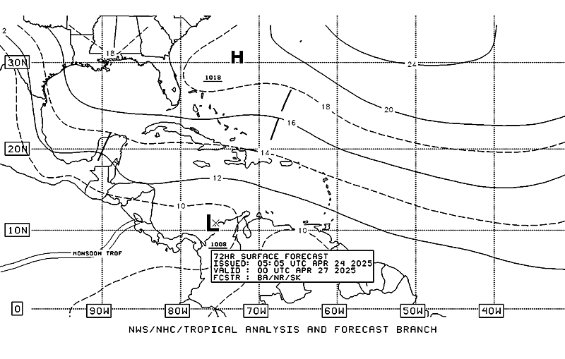
TPC's 72 hr forecast position of 91L.

Image
0 likes   

User avatar
Gustywind
Category 5
Category 5
Posts: 12334
Joined: Mon Sep 03, 2007 7:29 am
Location: Baie-Mahault, GUADELOUPE

Re: 91L: Global & BAM Models=6z GFDL at page 6

#110 Postby Gustywind » Tue Sep 11, 2007 7:41 am

tgenius wrote:I find it a bit interesting that most of the model runs do have it gaining some lattitude instead of plowing to the west ala Dean and Felix... not overly concerned, just an interesting observation and a break from the "norm" we have been experiencing for the last month in storm tracking :)


Absolutely tgenius but always on the carib or not ?N??, maybe higher than 14.0 N lool, the 15°n record...will it broke it :eek: Do you tkink a system higher than 14N, where do see that to cross if if if it happens afterall?
0 likes   

User avatar
Gustywind
Category 5
Category 5
Posts: 12334
Joined: Mon Sep 03, 2007 7:29 am
Location: Baie-Mahault, GUADELOUPE

#111 Postby Gustywind » Tue Sep 11, 2007 7:49 am

Waouw :eek: :eek: maybe the third major cane of the season if its verifies... :double: :bday: ( far away for the fish!)
0 likes   

User avatar
cycloneye
Admin
Admin
Posts: 145286
Age: 68
Joined: Thu Oct 10, 2002 10:54 am
Location: San Juan, Puerto Rico

Re: 91L: Global & BAM Models=6z HWRF Animation at page 6

#112 Postby cycloneye » Tue Sep 11, 2007 8:00 am


DISCLAIMER...NUMERICAL MODELS ARE SUBJECT TO LARGE ERRORS.
PLEASE REFER TO NHC OFFICIAL FORECASTS FOR TROPICAL CYCLONE
AND SUBTROPICAL CYCLONE INFORMATION.

ATLANTIC OBJECTIVE AIDS FOR

DISTURBANCE INVEST (AL912007) 20070911 1200 UTC

...00 HRS... ...12 HRS... ...24 HRS. .. ...36 HRS...
070911 1200 070912 0000 070912 1200 070913 0000

LAT LON LAT LON LAT LON LAT LON
BAMS 11.0N 42.2W 11.5N 43.6W 12.0N 44.8W 12.6N 46.0W
BAMD 11.0N 42.2W 11.5N 43.9W 11.8N 45.6W 12.3N 47.1W
BAMM 11.0N 42.2W 11.5N 43.7W 11.9N 45.2W 12.3N 46.6W
LBAR 11.0N 42.2W 11.7N 44.3W 12.2N 46.5W 12.9N 48.7W
SHIP 25KTS 31KTS 37KTS 44KTS
DSHP 25KTS 31KTS 37KTS 44KTS

...48 HRS... ...72 HRS... ...96 HRS. .. ..120 HRS...
070913 1200 070914 1200 070915 1200 070916 1200

LAT LON LAT LON LAT LON LAT LON
BAMS 13.1N 47.3W 14.0N 49.0W 15.1N 50.5W 16.1N 52.4W
BAMD 12.6N 48.5W 13.2N 50.5W 14.1N 52.1W 15.2N 53.5W
BAMM 12.7N 47.8W 13.3N 49.7W 14.1N 51.2W 14.9N 52.8W
LBAR 13.6N 50.7W 15.2N 54.5W 17.5N 58.2W 19.8N 61.0W
SHIP 53KTS 64KTS 69KTS 70KTS
DSHP 53KTS 64KTS 69KTS 70KTS

...INITIAL CONDITIONS...
LATCUR = 11.0N LONCUR = 42.2W DIRCUR = 295DEG SPDCUR = 9KT
LATM12 = 10.0N LONM12 = 41.1W DIRM12 = 303DEG SPDM12 = 9KT
LATM24 = 9.4N LONM24 = 38.8W
WNDCUR = 25KT RMAXWD = 60NM WNDM12 = 20KT
CENPRS = 1010MB OUTPRS = 1013MB OUTRAD = 200NM SDEPTH = M
RD34NE = 0NM RD34SE = 0NM RD34SW = 0NM RD34NW = 0NM

Image
0 likes   

dolebot_Broward_NW
Category 2
Category 2
Posts: 529
Joined: Fri Sep 10, 2004 6:38 am

Re: 91L: Global & BAM Models=12:00 UTC BAMS at page 6

#113 Postby dolebot_Broward_NW » Tue Sep 11, 2007 8:11 am

Big shift north and east in the models shown here since earlier this morning.


Image
0 likes   

User avatar
hurricanetrack
HurricaneTrack.com
HurricaneTrack.com
Posts: 1781
Joined: Tue Dec 02, 2003 10:46 pm
Location: Wilmington, NC
Contact:

Re: 91L: Global & BAM Models

#114 Postby hurricanetrack » Tue Sep 11, 2007 8:50 am

In the wxunderground graphic, it shows SHIPS at 80 knots in 120 hours. Yet the text output shows 70 knots. Was it re-run and now shows 80 kts or is the wunderground graphic incorrect?
0 likes   

hcane27
Tropical Storm
Tropical Storm
Posts: 231
Joined: Tue Jan 31, 2006 7:33 pm

Re: 91L: Global & BAM Models

#115 Postby hcane27 » Tue Sep 11, 2007 8:58 am

The graphic is incorrect ... it has not been re-run
0 likes   

Stratosphere747
Category 5
Category 5
Posts: 3772
Joined: Thu Sep 11, 2003 8:34 pm
Location: Surfside Beach/Freeport Tx
Contact:

Re: 91L: Global & BAM Models

#116 Postby Stratosphere747 » Tue Sep 11, 2007 10:50 am

12z GFS finally picks up on 91L.

48hrs -

Image
0 likes   

User avatar
Blown Away
S2K Supporter
S2K Supporter
Posts: 10145
Joined: Wed May 26, 2004 6:17 am

Re: 91L: Global & BAM Models

#117 Postby Blown Away » Tue Sep 11, 2007 11:16 am

What's the long term after 5 day thinking for 91L/Humberto? Jeff Masters thinking possible EC threat, so I assume the high must build back pushing 91L/Humberto W after it makes the NW jog near the Islands.
0 likes   

User avatar
cycloneye
Admin
Admin
Posts: 145286
Age: 68
Joined: Thu Oct 10, 2002 10:54 am
Location: San Juan, Puerto Rico

Re: 91L: Global & BAM Models

#118 Postby cycloneye » Tue Sep 11, 2007 11:20 am

Image

126 hours still has the 91L low moving wnw.
0 likes   

User avatar
cycloneye
Admin
Admin
Posts: 145286
Age: 68
Joined: Thu Oct 10, 2002 10:54 am
Location: San Juan, Puerto Rico

Re: 91L: Global & BAM Models

#119 Postby cycloneye » Tue Sep 11, 2007 11:36 am

Image

At 168 hours GFS loses the low.
0 likes   

User avatar
gatorcane
S2K Supporter
S2K Supporter
Posts: 23691
Age: 47
Joined: Sun Mar 13, 2005 3:54 pm
Location: Boca Raton, FL

Re: 91L: Global & BAM Models

#120 Postby gatorcane » Tue Sep 11, 2007 11:38 am

Blown_away wrote:What's the long term after 5 day thinking for 91L/Humberto? Jeff Masters thinking possible EC threat, so I assume the high must build back pushing 91L/Humberto W after it makes the NW jog near the Islands.


I'm not saying this will happen. Look at the track of the 1947 South Florida Hurricane which coincidentally was traversing the Atlantic about now. Point is that even if this moves NE of the islands it can easily bend back west even in mid or late September.

Image

4 Hurricane #4 4-21 SEP 140 947 5
0 likes   


Return to “2007”

Who is online

Users browsing this forum: No registered users and 9 guests