
wxmann_91 wrote:Really not looking good now. Suspect that the wave behind will take over.
Huh? When was it "not looking good"?
Moderator: S2k Moderators
cycloneye wrote:Blown_away wrote:cycloneye wrote:I posted at the title the position of the SSD dvorak T numbers in the title of thread as the system has passed 40w.There has been talk about the 48w longitud being important to the U.S. mainland,because that 48w line demarks a U.S. landfall to the east coast or not.I think it was Larrywx who brought the interesting stat about a system moving 315 degrees at 48w is not a threat to the East U.S. coast.
Does the latitude matter w/ this formula?
I was thinking of the latitud factor too,but the best person to answer that is Larrywx.


njweather wrote:wxmann_91 wrote:Really not looking good now. Suspect that the wave behind will take over.
Huh? When was it "not looking good"?

wxmann_91 wrote:njweather wrote:wxmann_91 wrote:Really not looking good now. Suspect that the wave behind will take over.
Huh? When was it "not looking good"?
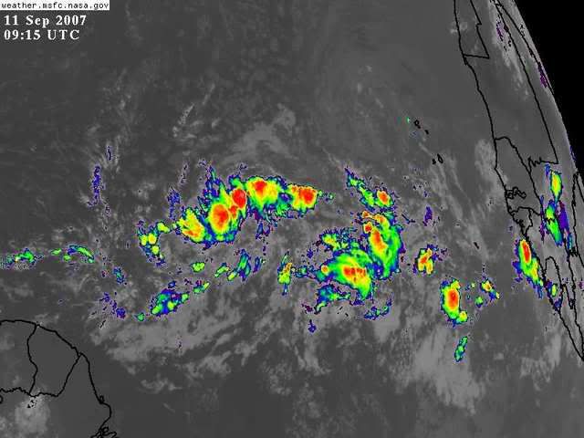
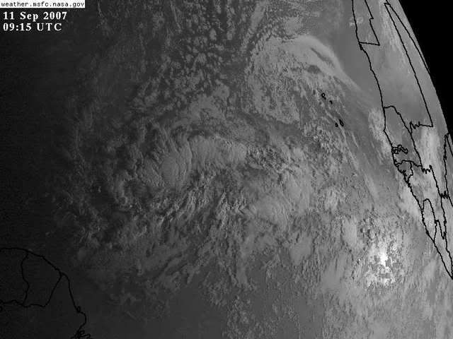
Sorry, should've clarified. The convection is rather minimal near the center and instead is concentrated in the "rooster tail" (forgot what Derek called it; I mean the boundary between the SAL to the north and the moist environment along the ITCZ)... anyhow, that says some mid-level dry air intrusion and a transfer of energy from 91L closer to the wave to the east.
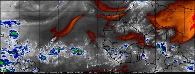
philnyc wrote:Sorry, wxmann_91, my friend, but that is really negligible dry air at mid-levels and is pretty well north of it. Also, it appears that 91L is moving faster than the one behind it, so it is not likely to "transfer" any energy to the eastern one. We'll see when the eclipse ends at 0615.
Phil


wxmann_91 wrote:philnyc wrote:Sorry, wxmann_91, my friend, but that is really negligible dry air at mid-levels and is pretty well north of it. Also, it appears that 91L is moving faster than the one behind it, so it is not likely to "transfer" any energy to the eastern one. We'll see when the eclipse ends at 0615.
Phil
Well, there's definitely at least some stable air to the north of 91L given the stratocumulus deck. 0Z GFS initializations did indicate some SAL in the area. SAL analysis, even though somewhat unreliable, does agree.


Users browsing this forum: No registered users and 100 guests


