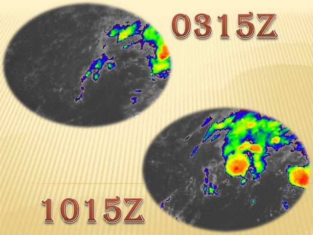
Invest 99L:Off E Coast-Discussions

Moderator: S2k Moderators

Message
Author
User avatar
hial2
S2K Supporter
S2K Supporter
Posts: 809
Joined: Fri Oct 10, 2003 9:20 pm
Location: Indian trail N.C.

Re: Re:

#1461 Postby hial2 » Fri Sep 07, 2007 4:37 am

BUD wrote:
We need rain very bad also in Horry county in SC.There are ponds behind my house that have very nice Bass,catfish ect and I NEVER seen these ponds this low.The sad part is the fish is going to die soon if we get no rain. :cry:


Let me know where you are and I'll give the catfish a mercy killing..I love catfish!
0 likes   

User avatar
HURAKAN
Professional-Met
Professional-Met
Posts: 46086
Age: 38
Joined: Thu May 20, 2004 4:34 pm
Location: Key West, FL
Contact:

#1462 Postby HURAKAN » Fri Sep 07, 2007 4:38 am

Latest:

Image
0 likes   

User avatar
HURAKAN
Professional-Met
Professional-Met
Posts: 46086
Age: 38
Joined: Thu May 20, 2004 4:34 pm
Location: Key West, FL
Contact:

#1463 Postby HURAKAN » Fri Sep 07, 2007 4:53 am

SHIP S 0900 31.90 -70.10 234 359 80 41.0 - - - - - 29.81

Interesting reading.

07/0645 UTC 28.4N 69.8W ST1.5/1.5 99L

Subtropical according to Dvorak.
0 likes   

User avatar
KWT
Category 5
Category 5
Posts: 31415
Joined: Tue Aug 17, 2004 11:02 am
Location: UK!!!

#1464 Postby KWT » Fri Sep 07, 2007 4:59 am

Well its better then its extratropical rating it had yesterday, does look like its trying to get better organised though shear is still present given the convection has increased again maybe its just starting to ease a little bit.
I presume recon is going intothe system still later today?
0 likes   

User avatar
HURAKAN
Professional-Met
Professional-Met
Posts: 46086
Age: 38
Joined: Thu May 20, 2004 4:34 pm
Location: Key West, FL
Contact:

#1465 Postby HURAKAN » Fri Sep 07, 2007 5:00 am

Yes!

I. ATLANTIC REQUIREMENTS
1. SUSPECT AREA (OFF FLORIDA- GEORGIA COAST)
FLIGHT ONE
A. 07/2100Z
B. AFXXX 02GGA INVEST
C. 07/1715Z
D. 30.0N 72.0W
E. 07/2030Z TO 08/0030Z
F. SFC TO 10,000 FT

FLIGHT TWO
A. 08/0600,1200Z
B. AFXXX 03GGA CYCLONE
C. 08/0230Z
D. 31.0N 74.5W
E. 08/0500Z TO 08/1130Z
F. SFC TO 10,000 FT

2. SUCCEEDING DAY OUTLOOK: CONTINUE 6-HRLY FIXES
IF SYSTEM DEVELOPS AND IS A THREAT.
0 likes   

Matt-hurricanewatcher

Re: Invest 99L,Off U.S.E.Coast: Discussions-Analysis & Imagery

#1466 Postby Matt-hurricanewatcher » Fri Sep 07, 2007 5:01 am

I'm feeling really good about the development of a tropical cyclone out of 99L this morning. For one the trough is lifting out...In which case is leaving the ULL at 25 north/74 or so west behind to cut off. As this trough lifted out the flow went from south to north...That is the flow of high level clouds at 20,000-35,000 feet up. The shear also appears to have lowered from 30-35 knots thursday afternoon, to around 20 knots now. That is why convection is forming over the defined LLC. The upper level ridge is starting develop west and north of our system...In which case we only have this ull hurting development. As time go's by the shear should weaken even more as the ULL becomes more cutt off. In based on lattest satellite the convection is only slightly displaced away from the core of the LLC. It is looking much more tropical...In fact if this keeps up for another 6-12 hours recon should find us a tropical depression-tropical storm this afternoon. That is if the ULL does not do anything that would shear the convection away...

The high(surface)to its north has built quite strongly this morning. So a westward movement should be seen for the next 24-36 hours. The system we are watching to weaken the high is over the midwest right now...This system is not expected to make it north of the high for another 36-48 hours...The latest gfs(00z) does not show enough weaking of the ridge to turn it northward before this system heads inland in around 52-60 hours.

I feel good about the shear level going down to 10 knots if the ULL cuts off. If so this should develop as it moves over the gulf stream. Right now I expect a tropical storm. Thats all I will say.
0 likes   

User avatar
HURAKAN
Professional-Met
Professional-Met
Posts: 46086
Age: 38
Joined: Thu May 20, 2004 4:34 pm
Location: Key West, FL
Contact:

#1467 Postby HURAKAN » Fri Sep 07, 2007 5:10 am

Latest:

Image

Continues to look much better.
0 likes   

User avatar
Nimbus
Category 5
Category 5
Posts: 5300
Joined: Mon Jul 19, 2004 10:54 am

Re: Invest 99L,Off U.S.E.Coast: Discussions-Analysis & Imagery

#1468 Postby Nimbus » Fri Sep 07, 2007 5:28 am

LLC is near 28N 72W, if it crosses the 30N line near 75W SC/NC would be the likely landfall target. The question is how strong will it get in the 48 to 60 hours it has before landfall?

Probably won't be a TS till tonight or possibly after tommorrow mornings D max. The ULL looks like it will roll southwest and ventilate the outflow once the storm develops.
0 likes   

User avatar
HURAKAN
Professional-Met
Professional-Met
Posts: 46086
Age: 38
Joined: Thu May 20, 2004 4:34 pm
Location: Key West, FL
Contact:

#1469 Postby HURAKAN » Fri Sep 07, 2007 5:31 am

Latest:

Image

Continues to increase in convection. Taking full advantage of the DMAX.
0 likes   

User avatar
KWT
Category 5
Category 5
Posts: 31415
Joined: Tue Aug 17, 2004 11:02 am
Location: UK!!!

#1470 Postby KWT » Fri Sep 07, 2007 5:34 am

The LLC is a bit further east then that Nimbus, the Dvorak estimates put it at 69.8W. I always feel these sorts of systems with long lasting LLC's tend to develop in the end though its always a case of waiting and seeing. Right now its on its way to becoming something again, though its only in the early stages right now it has to be said, it does look a good deal better then yesterday, if thats saying anything!

vis. images will be very interesting to see how the LLC is doing and where it is relation to that convection.
0 likes   

User avatar
HURAKAN
Professional-Met
Professional-Met
Posts: 46086
Age: 38
Joined: Thu May 20, 2004 4:34 pm
Location: Key West, FL
Contact:

#1471 Postby HURAKAN » Fri Sep 07, 2007 5:45 am

TROPICAL WEATHER DISCUSSION
NWS TPC/NATIONAL HURRICANE CENTER MIAMI FL
805 AM EDT FRI SEP 07 2007

...SPECIAL FEATURES...
A 1012 MB LOW LOCATED ABOUT 360 NM SW OF BERMUDA NEAR 28.5N70W
WITH A SURFACE TROUGH EXTENDING SSW FROM THE LOW TO NEAR 24N72W.
THE LOW-LEVEL CENTER REMAINS COMPLETELY EXPOSED BUT IS STARTING
TO DRIFT NORTHWARDS. THERE ARE SCATTERED SHOWERS/THUNDERSTORMS N
AND E OF THE LOW ASSOCIATED WITH A WEAKENING FRONTAL BOUNDARY
ALONG 32. SCATTERED SHOWERS/ISOLATED THUNDERSTORMS ARE S OF 27N
FROM 70W-77W WITH SHOWERS/THUNDERSTORMS BETWEEN THE BAHAMAS AND
CUBA W OF 76W THROUGH THE FLORIDA STRAITS INTO THE GULF OF
MEXICO. THE SYSTEM CONTINUES TO INTERACT WITH AN UPPER TROUGH TO
THE W OF THE SURFACE LOW/TROUGH. UPPER-LEVEL WINDS ARE CURRENTLY
NOT FAVORABLE FOR DEVELOPMENT. HOWEVER...CONDITIONS COULD BECOME
MORE FAVORABLE AS THE LOW MOVES TOWARD THE N/NW AND A
SUBTROPICAL OR TROPICAL CYCLONE COULD FORM DURING THE NEXT
COUPLE OF DAYS.
0 likes   

User avatar
vacanechaser
Category 5
Category 5
Posts: 1461
Joined: Wed Dec 03, 2003 9:34 pm
Location: Portsmouth, Va
Contact:

Re:

#1472 Postby vacanechaser » Fri Sep 07, 2007 5:48 am

HURAKAN wrote:TROPICAL WEATHER DISCUSSION
NWS TPC/NATIONAL HURRICANE CENTER MIAMI FL
805 AM EDT FRI SEP 07 2007

...SPECIAL FEATURES...
A 1012 MB LOW LOCATED ABOUT 360 NM SW OF BERMUDA NEAR 28.5N70W
WITH A SURFACE TROUGH EXTENDING SSW FROM THE LOW TO NEAR 24N72W.
THE LOW-LEVEL CENTER REMAINS COMPLETELY EXPOSED BUT IS STARTING
TO DRIFT NORTHWARDS. THERE ARE SCATTERED SHOWERS/THUNDERSTORMS N
AND E OF THE LOW ASSOCIATED WITH A WEAKENING FRONTAL BOUNDARY
ALONG 32. SCATTERED SHOWERS/ISOLATED THUNDERSTORMS ARE S OF 27N
FROM 70W-77W WITH SHOWERS/THUNDERSTORMS BETWEEN THE BAHAMAS AND
CUBA W OF 76W THROUGH THE FLORIDA STRAITS INTO THE GULF OF
MEXICO. THE SYSTEM CONTINUES TO INTERACT WITH AN UPPER TROUGH TO
THE W OF THE SURFACE LOW/TROUGH. UPPER-LEVEL WINDS ARE CURRENTLY
NOT FAVORABLE FOR DEVELOPMENT. HOWEVER...CONDITIONS COULD BECOME
MORE FAVORABLE AS THE LOW MOVES TOWARD THE N/NW AND A
SUBTROPICAL OR TROPICAL CYCLONE COULD FORM DURING THE NEXT
COUPLE OF DAYS.


something is strange about that... look at the time stamp.... 805am, its only 647am???? what gives there...


Jesse V. Bass III
http;//www.vastormphoto.com
Hurricane Intercept Research Team
0 likes   

User avatar
HURAKAN
Professional-Met
Professional-Met
Posts: 46086
Age: 38
Joined: Thu May 20, 2004 4:34 pm
Location: Key West, FL
Contact:

Re: Re:

#1473 Postby HURAKAN » Fri Sep 07, 2007 5:49 am

vacanechaser wrote:something is strange about that... look at the time stamp.... 805am, its only 647am???? what gives there...

Jesse V. Bass III
http;//www.vastormphoto.com
Hurricane Intercept Research Team


Breakfast anyone!!!

By the way,

SHIP S 0900 31.90 -70.10 241 347 80 41.0 - - - - - 29.81 - 77.5 - - - - - - - - - -
SHIP S 0600 30.90 -69.60 177 350 80 40.0 - - - - - 29.78 - 79.0

There are 2 ship reports from 3 hours showing almost the same wind reading. Could it be the same ship? And, could the anenometer be malfuntioning since the NHC is not calling this a gale center?
Last edited by HURAKAN on Fri Sep 07, 2007 5:51 am, edited 2 times in total.
0 likes   

User avatar
Chacor
Category 5
Category 5
Posts: 10229
Joined: Mon Oct 02, 2006 10:43 pm
Location: Singapore

#1474 Postby Chacor » Fri Sep 07, 2007 5:49 am

Again... the 8:05 TWD uses surface analysis from 06Z (2 am EDT) and satellite imagery up to 0945 UTC (5:45 am EDT). Therefore the TWD can come out any time after 0945.
0 likes   

User avatar
Thunder44
Category 5
Category 5
Posts: 5922
Age: 44
Joined: Mon Jun 09, 2003 7:53 pm
Location: New York City

Re:

#1475 Postby Thunder44 » Fri Sep 07, 2007 5:50 am

HURAKAN wrote:SHIP S 0900 31.90 -70.10 234 359 80 41.0 - - - - - 29.81

Interesting reading.

07/0645 UTC 28.4N 69.8W ST1.5/1.5 99L

Subtropical according to Dvorak.


That ship report is couple hundred miles NNW of the center, and is probably more due to increasing pressure gradient from between low and building high north of the system. You can see it build on water vapor imagery. Nevertheless, there is some meaningful convection this morning flaring mainly north of the center.
0 likes   

User avatar
Thunder44
Category 5
Category 5
Posts: 5922
Age: 44
Joined: Mon Jun 09, 2003 7:53 pm
Location: New York City

Re: Re:

#1476 Postby Thunder44 » Fri Sep 07, 2007 5:55 am

HURAKAN wrote:
vacanechaser wrote:something is strange about that... look at the time stamp.... 805am, its only 647am???? what gives there...

Jesse V. Bass III
http;//www.vastormphoto.com
Hurricane Intercept Research Team


Breakfast anyone!!!

By the way,

SHIP S 0900 31.90 -70.10 241 347 80 41.0 - - - - - 29.81 - 77.5 - - - - - - - - - -
SHIP S 0600 30.90 -69.60 177 350 80 40.0 - - - - - 29.78 - 79.0

There are 2 ship reports from 3 hours showing almost the same wind reading. Could it be the same ship? And, could the anenometer be malfuntioning since the NHC is not calling this a gale center?


It probably is the same ship. KSO49 are call letters I get from google. Again, I don't these winds are directly associated with the low center. But the increased pressure graident from the high to the north.
0 likes   

Matt-hurricanewatcher

Re: Invest 99L,Off U.S.E.Coast: Discussions-Analysis & Imagery

#1477 Postby Matt-hurricanewatcher » Fri Sep 07, 2007 5:58 am

The LLC is near 28.5 north/69.9 west...It is not moving northward but slowly westward. Also the convection is starting to move over "most" of the LLC. This is not exposed any more. It would not suprize me if those 40+ knot reports where true because of the pressure grad between the low and the strong high to the north.
0 likes   

User avatar
HURAKAN
Professional-Met
Professional-Met
Posts: 46086
Age: 38
Joined: Thu May 20, 2004 4:34 pm
Location: Key West, FL
Contact:

#1478 Postby HURAKAN » Fri Sep 07, 2007 6:00 am

Image

Thanks thunder44 for the explanation. Now they make more sense.
0 likes   

User avatar
HURAKAN
Professional-Met
Professional-Met
Posts: 46086
Age: 38
Joined: Thu May 20, 2004 4:34 pm
Location: Key West, FL
Contact:

#1479 Postby HURAKAN » Fri Sep 07, 2007 6:01 am

FIRST VISIBLE:

Image

LLC doesn't appear to be exposed.
0 likes   

User avatar
Weatherfreak14
Category 5
Category 5
Posts: 1383
Joined: Sat Sep 24, 2005 3:40 pm
Location: Beaufort, SC
Contact:

Re: Invest 99L,Off U.S.E.Coast: Discussions-Analysis & Imagery

#1480 Postby Weatherfreak14 » Fri Sep 07, 2007 6:03 am

wow i think we have something now..... not a storm but something a loty better organized. Getting packed up to go to chraleston for some waves saturday...
0 likes   


Return to “2007”

Who is online

Users browsing this forum: No registered users and 9 guests