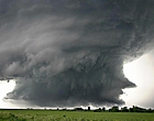
CAT 5 Hurricane Dean - Archived threads

Moderator: S2k Moderators

Message
Author
CrazyC83
Professional-Met
Professional-Met
Posts: 34002
Joined: Tue Mar 07, 2006 11:57 pm
Location: Deep South, for the first time!

Re: Major Hurricane DEAN: (8 PM page 291) Discussions, Analysis

#10681 Postby CrazyC83 » Mon Aug 20, 2007 8:26 pm

Beam wrote:
theworld wrote:Chetumal, Quintana Roo,
http://www.delange.org/Chetumal/Chetumal.htm

Image


What a beautiful place... about to be ruined.


Sadly, that is probably what will happen. Hopefully they are all evacuated or in very strong shelter capable of withstanding 190 mph wind gusts. Property can be replaced though. Lives cannot.

This is like a giant EF4 tornado out there...
0 likes   

User avatar
cheezyWXguy
Category 5
Category 5
Posts: 6108
Joined: Mon Feb 13, 2006 12:29 am
Location: Dallas, TX

Re: Re:

#10682 Postby cheezyWXguy » Mon Aug 20, 2007 8:28 pm

ZeeNL wrote:
Scorpion wrote:The 18Z HWRF says 892 mb at landfall


IIRC, HWRF was predicting crazy low pressures all the time, so I think we can discard it.

Dont. The HWRF was the only one predicting winds of at least cat4 in the eastern caribbean. (Maybe GFDL) It maybe slightly overdone but has been fairly accurate to some extent in terms of intensity. I gotta say though, if Dean continues to strengthen,I believe we could see a 165-175 mph storm before landfall tomorrow morning, with pressures below 910.
0 likes   

User avatar
artist
Category 5
Category 5
Posts: 9792
Joined: Mon Jun 06, 2005 3:26 pm
Location: West Palm

Re: HURRICANE DEAN - Threat Area - Jamaica, Caymans, Hispanola

#10683 Postby artist » Mon Aug 20, 2007 8:28 pm

hey Derrick - Beverly Hills and Meadow Brooke (that may be Brook) in St. Andrews is where my friends family lives. She still hasn't been able to get in touch with them either. This may actually be Kingston - just the are of it. She told me Kingston first then Beverly Hills and Meadowbrook ?. If you can find out anything if they know of those areas that would be wonderful.

NCSU - sorry you still haven't either. The waiting is just dreadful, isn't it? You are all still in my prayers. Let me know if you hear anything and Derrick if you can find anything out it we would be so grateful,.
0 likes   

User avatar
Zadok
Tropical Storm
Tropical Storm
Posts: 232
Joined: Sun Aug 29, 2004 7:32 am
Location: USA East Coast

Re: Major Hurricane DEAN: (8 PM page 291) Discussions, Analysis

#10684 Postby Zadok » Mon Aug 20, 2007 8:30 pm

Hopefully they are all evacuated or in very strong shelter capable of withstanding 190 mph wind gusts.


Well that Holiday Inn looks like it ought to do the trick! :P
0 likes   

Sanibel
Category 5
Category 5
Posts: 10375
Joined: Mon Aug 30, 2004 11:06 pm
Location: Offshore SW Florida

Re: Major Hurricane DEAN: (8 PM page 291) Discussions, Analysis

#10685 Postby Sanibel » Mon Aug 20, 2007 8:30 pm

My opinions are not endorsed by Storm2k or to be taken as official:


The landfall is pretty much pegged by NHC. The storm is perfectly positioned to drain Bahia De Chetumal out into the Caribbean. Keith drained it dry all the way across. This one should be worse. It should push surge across the backside of Ambergris Caye. If the track holds, Ambergris will be in the south side hurricane core at about the half point. I guess at least 100mph sustained.
0 likes   

miamicanes177
Category 5
Category 5
Posts: 1131
Joined: Tue Aug 01, 2006 10:53 pm

Re: Re:

#10686 Postby miamicanes177 » Mon Aug 20, 2007 8:31 pm

cheezyWXguy wrote:I gotta say though, if Dean continues to strengthen,I believe we could see a 165-175 mph storm before landfall tomorrow morning, with pressures below 910.
I can not imagine the hell of a strengthening cat 5 landfall. You hear about how bad a strengthening cat 2 or 3 can be. Even Katrina in south florida caught people off guard by how strong it was. I can not imagine the fury of a 5 at peak organization and strength.
0 likes   

User avatar
theworld
Tropical Storm
Tropical Storm
Posts: 197
Joined: Fri Aug 26, 2005 12:33 pm
Location: DelMarVa

Re: Major Hurricane DEAN: (8 PM page 291) Discussions, Analysis

#10687 Postby theworld » Mon Aug 20, 2007 8:31 pm

Matt-hurricanewatcher wrote:This thing keeps looking better and better. A soild red ring has finally formed around the eye. In the eye has cleared out big time. Wish recon would of stayed...This could go easly sub 910.


Dean did just tighten up a bit... Rainbow Color IR Loop

http://www.ssd.noaa.gov/goes/flt/t1/loop-rb.html
0 likes   

ZeeNL
Tropical Low
Tropical Low
Posts: 14
Joined: Tue Aug 31, 2004 5:13 pm
Location: Enschede, The Netherlands

#10688 Postby ZeeNL » Mon Aug 20, 2007 8:32 pm

disclaimer: newby opinion, don't read if you are in the path.

Luckily, landfalling cat 5's are rare. There is a big chance this thing will weaken into a cat 3/4, but that is just from the statistical information I just read. A cat 4 of this size will be catastrophic enough.
0 likes   

CrazyC83
Professional-Met
Professional-Met
Posts: 34002
Joined: Tue Mar 07, 2006 11:57 pm
Location: Deep South, for the first time!

Re:

#10689 Postby CrazyC83 » Mon Aug 20, 2007 8:34 pm

ZeeNL wrote:disclaimer: newby opinion, don't read if you are in the path.

Luckily, landfalling cat 5's are rare. There is a big chance this thing will weaken into a cat 3/4, but that is just from the statistical information I just read. A cat 4 of this size will be catastrophic enough.


It is moving fast enough that peak intensity will probably be 2 hours or so before landfall. The final approach may weaken the storm 5 mph, or 10 mph maximum. That would keep it a high-end Cat 4 at least. If it can get past 165 mph, there is no turning back.
0 likes   

Raebie
Category 3
Category 3
Posts: 822
Joined: Fri Sep 12, 2003 8:00 pm
Location: Charlotte, NC

#10690 Postby Raebie » Mon Aug 20, 2007 8:34 pm

Wishful thinking I'm afraid.
0 likes   

User avatar
Aquawind
Category 5
Category 5
Posts: 6714
Age: 62
Joined: Mon Jun 16, 2003 10:41 pm
Location: Salisbury, NC
Contact:

#10691 Postby Aquawind » Mon Aug 20, 2007 8:34 pm

What a beast Dean has become today! Looks like some serious flooding for the Yucatan and then the Dean swath of devistation. Kinda takes the fun outta hurricane watching knowing what is really going to happen at landfall..
0 likes   

O Town
S2K Supporter
S2K Supporter
Posts: 5205
Age: 52
Joined: Wed Sep 07, 2005 9:37 pm
Location: Orlando, Florida 28°35'35"N 81°22'55"W

Re:

#10692 Postby O Town » Mon Aug 20, 2007 8:34 pm

ZeeNL wrote:How many hours till landfall now?

By this map I would guess about 5am, I was wondering that myself.

Image
0 likes   

User avatar
PTPatrick
Category 5
Category 5
Posts: 1831
Joined: Sat Jun 12, 2004 8:38 am

Re: DEAN -Threat Area -Yucatan Peninsula-Mainland Mexico

#10693 Postby PTPatrick » Mon Aug 20, 2007 8:34 pm

Looks like northrn eyewall will most likely hit Punta Allen and the Sian Ka'an Biosphere Reserve...I can only hope these ares are sparsely populated. Tulum is not far from that area either. Cancun, Cozumel, and playa del carmen look like they should be in better shape, of course they will still have probably have cat 2 sustained and cat 3 gusts up there...
0 likes   

Stratosphere747
Category 5
Category 5
Posts: 3772
Joined: Thu Sep 11, 2003 8:34 pm
Location: Surfside Beach/Freeport Tx
Contact:

Re: Major Hurricane DEAN: (8 PM page 291) Discussions, Analysis

#10694 Postby Stratosphere747 » Mon Aug 20, 2007 8:34 pm

Chetumal while devastated, survived hurricane Janet.

With that said -

There is a chaser that I have become friends with that is now in Chetmual. I had planned on guiding/chasing with him in Texas if Dean had came our way.

Needless to say my thoughts are now with him.
0 likes   

User avatar
theworld
Tropical Storm
Tropical Storm
Posts: 197
Joined: Fri Aug 26, 2005 12:33 pm
Location: DelMarVa

Re: Major Hurricane DEAN: (8 PM page 291) Discussions, Analysis

#10695 Postby theworld » Mon Aug 20, 2007 8:36 pm

0 likes   

SunnyThoughts
Category 5
Category 5
Posts: 2263
Joined: Wed Jul 09, 2003 12:42 pm
Location: Pensacola, Florida

Re: Major Hurricane DEAN: (8 PM page 291) Discussions, Analysis

#10696 Postby SunnyThoughts » Mon Aug 20, 2007 8:37 pm

Stratosphere...I"ve been watching the chasers posts on another board as well who is now in Chetumal. I too wish him the best and hope he remains safe.
0 likes   

User avatar
theworld
Tropical Storm
Tropical Storm
Posts: 197
Joined: Fri Aug 26, 2005 12:33 pm
Location: DelMarVa

Re: Major Hurricane DEAN: (8 PM page 291) Discussions, Analysis

#10697 Postby theworld » Mon Aug 20, 2007 8:38 pm

WebCam Message at Quintana Roo
http://www.margaritadelsol.com/toppage2.htm
Image
0 likes   

User avatar
jimvb
Category 1
Category 1
Posts: 397
Joined: Wed Sep 15, 2004 8:03 am
Location: Richmond, Virginia
Contact:

Re: Major Hurricane DEAN: (8 PM page 291) Discussions, Analysis

#10698 Postby jimvb » Mon Aug 20, 2007 8:42 pm

Don't temperature gradients cause wind as well? Hot air rises, cold air sinks, setting up a circulation. Isn't it both pressure and temperature gradients?
0 likes   

User avatar
KatDaddy
Category 5
Category 5
Posts: 2815
Joined: Mon Oct 21, 2002 6:23 pm
Location: League City, Texas

#10699 Postby KatDaddy » Mon Aug 20, 2007 8:42 pm

Which storm chaser's are at Chetumal?
0 likes   

NCSUwpack
Tropical Low
Tropical Low
Posts: 39
Joined: Thu Aug 16, 2007 9:33 pm

Re:

#10700 Postby NCSUwpack » Mon Aug 20, 2007 8:43 pm

Derek Ortt wrote:which part of Jamaica are your family from

The main secretary here has family in jamaica and they have reported only minor damage, at least to well built structures. That was a little NW of Kingston, I believe


Hi Derek, i'm listening to you talking to somebody with a live feed on the internet right now. They live in Kingston toward the southwest. If you've got some information on the damage in that area please let me know.

Thanks.
0 likes   


Return to “2007”

Who is online

Users browsing this forum: No registered users and 15 guests