
Does anyone have a rough ETA of arrival in South Florida area if models hold up?
Special K
Palm Beach Gardens, Floria
Invest 92L,West Atlantic
Moderator: S2k Moderators


Re: Invest 92L,West Atlantic-18:00 UTC models posted
mutley wrote:gtalum wrote:Evil Jeremy wrote:...bears watching...
You mean like these bears?
Or more like these?


Hey guys, I have to make a question. Please excuse my ignorance but I'm not familiarized with this. When you said "is bear watching" for all those systems in their very first development steps, what this mean? What is the sense behind this phrase?
Thanks!
0 likes
-
destruction92
- Category 1

- Posts: 312
- Joined: Sun Jul 22, 2007 10:43 pm
Re: Invest 92L,West Atlantic-Discussions-Analysis and Images
ronjon wrote:From NWS Melbourne AFD:
FRI-SUN...FCST WILL DEPEND ON FUTURE TRACK/DEVELOPMENT OF THE
DISORGANIZED T-WAVE BTWN 50W-60W. ATTM...MID-RANGE HPC/NHC
COORDINATED FCST BRINGS A SPOT LOW ACROSS THE CENTRAL FL PENINSULA FRI-SAT. GIVEN THE UNCERTAINTIES IN BOTH TRACK AND DEVELOPMENT... WILL NOT MAKE ANY CHANGES TO THE FCST THRU THIS TIME FRAME.
Once again, even if 92L develops and affects Florida, it should stay well north of SE Florida.
0 likes
-
gatorcane

- S2K Supporter

- Posts: 23708
- Age: 48
- Joined: Sun Mar 13, 2005 3:54 pm
- Location: Boca Raton, FL
Also click on this link which shows there is a clear mid-level rotation in that area that I said above...
something is definitely forming:
http://www.ssd.noaa.gov/goes/flt/t2/loop-avn.html
something is definitely forming:
http://www.ssd.noaa.gov/goes/flt/t2/loop-avn.html
0 likes
-
tolakram
- Admin

- Posts: 20189
- Age: 62
- Joined: Sun Aug 27, 2006 8:23 pm
- Location: Florence, KY (name is Mark)
Re: Invest 92L,West Atlantic-Discussions-Analysis and Images
I think a low has formed, according to the text of the TCFA.
http://www.ssd.noaa.gov/goes/flt/t2/loop-vis.html
I can see rotation below the cirrus, I think anyway.
http://www.ssd.noaa.gov/goes/flt/t2/loop-vis.html
I can see rotation below the cirrus, I think anyway.
0 likes
-
windstorm99

- S2K Supporter
- Posts: 1578
- Age: 48
- Joined: Sat May 26, 2007 8:10 am
- Location: Miami, Florida
- Contact:
Re: Invest 92L,West Atlantic-Discussions-Analysis and Images
92L Intensity...

Last edited by windstorm99 on Mon Aug 20, 2007 2:38 pm, edited 1 time in total.
0 likes
-
gatorcane
- S2K Supporter
- Posts: 23708
- Age: 48
- Joined: Sun Mar 13, 2005 3:54 pm
- Location: Boca Raton, FL
Re: Invest 92L,West Atlantic-Discussions-Analysis and Images
destruction92 wrote:ronjon wrote:From NWS Melbourne AFD:
FRI-SUN...FCST WILL DEPEND ON FUTURE TRACK/DEVELOPMENT OF THE
DISORGANIZED T-WAVE BTWN 50W-60W. ATTM...MID-RANGE HPC/NHC
COORDINATED FCST BRINGS A SPOT LOW ACROSS THE CENTRAL FL PENINSULA FRI-SAT. GIVEN THE UNCERTAINTIES IN BOTH TRACK AND DEVELOPMENT... WILL NOT MAKE ANY CHANGES TO THE FCST THRU THIS TIME FRAME.
Once again, even if 92L develops and affects Florida, it should stay well north of SE Florida.
Nope...with a ridge building to the north a W to WSW track for a couple of days is very possible...many storms have done this: Katrina, Andrew, Jeanne, etc.
0 likes
-
Blown Away

- S2K Supporter
- Posts: 10253
- Joined: Wed May 26, 2004 6:17 am
Re: Invest 92L,West Atlantic-Discussions-Analysis and Images
ronjon wrote:From NWS Melbourne AFD:
FRI-SUN...FCST WILL DEPEND ON FUTURE TRACK/DEVELOPMENT OF THE
DISORGANIZED T-WAVE BTWN 50W-60W. ATTM...MID-RANGE HPC/NHC
COORDINATED FCST BRINGS A SPOT LOW ACROSS THE CENTRAL FL PENINSULA FRI-SAT. GIVEN THE UNCERTAINTIES IN BOTH TRACK AND DEVELOPMENT... WILL NOT MAKE ANY CHANGES TO THE FCST THRU THIS TIME FRAME.
Maybe an undeveloped low across Central FL. Named systems landfalling from the East between Vero Beach through Georgia are very rare. I'll error on no developed system coming to FL unless it happens S of Vero Beach. It has and can happen, but I will always bet on climatology when it comes to landfalls between Vero and Georgia. JMHO
0 likes


-
Canelaw99

- S2K Supporter
- Posts: 2128
- Age: 49
- Joined: Tue Aug 31, 2004 8:27 am
- Location: Homestead, FL
Re: Invest 92L,West Atlantic-Discussions-Analysis and Images
I've seen the current SST map, but where might I find the one that shows the pressure and winds that could be sustained by the water? Thanks!
0 likes
-
gatorcane
- S2K Supporter
- Posts: 23708
- Age: 48
- Joined: Sun Mar 13, 2005 3:54 pm
- Location: Boca Raton, FL
Re: Invest 92L,West Atlantic-Discussions-Analysis and Images
windstorm99 wrote:92L Intensity...
wow SHIPS brings it to 75K already -- not a good sign
0 likes


Re: Invest 92L,West Atlantic-Discussions-Analysis and Images
Here is the 7 day forecast from HCP-TPC coordinated track of 92L. Again, this 5-7 days out so I wouldn't focus on the exact placement of the low whether it's central or south FL.
http://www.hpc.ncep.noaa.gov/basicwx/day0-7loop.html
http://www.hpc.ncep.noaa.gov/basicwx/day0-7loop.html
0 likes
-
Tampa Bay Hurricane

- Category 5

- Posts: 5597
- Age: 38
- Joined: Fri Jul 22, 2005 7:54 pm
- Location: St. Petersburg, FL
Re: Invest 92L,West Atlantic-Discussions-Analysis and Images
This needs to be watched closely. Gonna be windy and rainy in the next
week...possibly.
week...possibly.
0 likes


Re: Invest 92L,West Atlantic-Discussions-Analysis and Images
floater 2 pic  of remmnants of erin?
0 likes
Re:
RL3AO wrote:I don't think the models intensified Dean that quickly when it first became an invest.
Much warmer water and better environment in the western Atlantic ocean versus the eastern Atlantic.
0 likes
-
windstorm99
- S2K Supporter
- Posts: 1578
- Age: 48
- Joined: Sat May 26, 2007 8:10 am
- Location: Miami, Florida
- Contact:

-
gatorcane
- S2K Supporter
- Posts: 23708
- Age: 48
- Joined: Sun Mar 13, 2005 3:54 pm
- Location: Boca Raton, FL
Re: Invest 92L,West Atlantic-Discussions-Analysis and Images
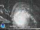
Okay looking at windstorm's graphic I think the center is forming in the square between 25 and 20N and 55 and 60W
0 likes
Who is online
Users browsing this forum: Google [Bot] and 115 guests