#22 Postby AJC3 » Wed Jan 31, 2007 12:15 pm
A few things to keep in mind...
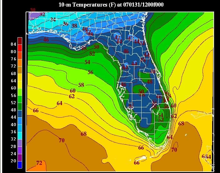
1) When using ADAS "surface analysis", it's important to note that this is actually an interpolation of surface and mesonet data laid on the background field of an initialization panel of the WRF mesomodel.
2) The field is 10-meter temps, not standard 2-meter temps, which are often colder
3) While 12 UTC temps are often a good proxy for mins, since mins generally occur right around (or sometimes a little bit after) sunrise, they fail to take into account several factors such as between hour temperature drops, and, obviously situations when the low temperature occurs well before sunrise. Such was the case during both Tuesday and Wednesday mornings.
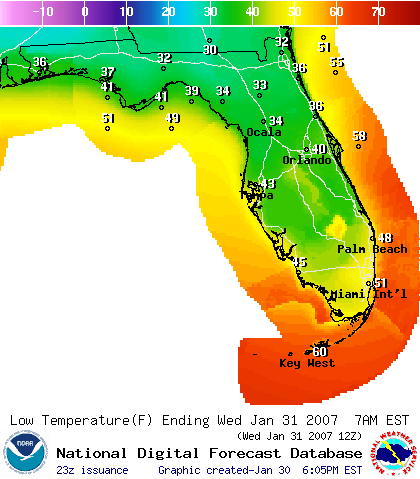
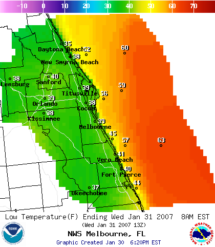
Granted, the low temperature forecasts were too high on both mornings due to extensive high cloudiness. However, they weren't quite as bad as the graphics would lead one to believe.
For instance, on Tuesday morning, lows in the middle 30s were common throughout almost the entirety of east central Florida - outside of the Metro Orlando area, where temperatures hovered around 40F, and along coastal areas of Martin County (M-U40s), which was where the biggest forecast "bust" occurred.
On Wednesday morning, outside of the Orlando urban heat island (46-50F) lows at all the major reporting stations were in the lower 40s (43-44F). Again, higher than originally forecast by about a category (U30s), but not an egregious miss (IMNSHO).
Just some food for thought. Hopefully, this won't be taken as "spin".
0 likes


 The posts in this forum are NOT official forecast and should not be used as such. They are just the opinion of the poster and may or may not be backed by sound meteorological data. They are NOT endorsed by any professional institution or

