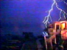
TV Media just loves to exaggerate for better ratings. A local TV met has gone all the way to calling for a hard freeze north of I-4, I know he means interior Volusia and Lake Counties, but half of the Orlando's population lies on the northern side of I-4, so many local residents are counting on a hard freeze:
ORLANDO, Fla. -- A blast of arctic air will drop temperatures in Orlando and other surrounding Central Florida cities below freezing early Tuesday, bringing the region its coldest day in four years, according to Local 6 meteorologist Larry Mowry.
"This is cold arctic air that has dropped down all the way from the North Pole and has moved into the state of Florida," Mowry said. "The core of that colder air will be right on top of us tonight and into tomorrow morning and that is why we are expecting colder temperatures tonight rather than what we are seeing Monday morning."
A freeze warning was issued for Orange County Tuesday, along with many other Central Florida counties.
Clear skies in Central Florida will allow temperatures to quickly drop after the sun sets Monday.
"Temperatures will be below 32 degrees for at least a couple of hours," Mowry said. "I'm expecting a hard freeze north of Interstate 4 and again this will be about the coldest night in four years here in Orlando."
Does this met knows what a hard freeze is?
I'll hate to see what the headlines would be when a true Arctic airmass moves over central FL.
Seriously, NWS office in Melbourne had a good AFD posted this afternoon for tonight's lows:
AREA FORECAST DISCUSSION
NATIONAL WEATHER SERVICE MELBOURNE FL
250 PM EST MON JAN 29 2007
...FREEZING TEMPERATURES LIKELY TONIGHT FROM ORLANDO NORTHWARD AND
ACROSS PORTIONS OF OSCEOLA AND OKEECHOBEE COUNTIES...
...AREAS OF FROST POSSIBLE ACROSS ALL OF EAST CENTRAL FLORIDA...
.DISCUSSION...
TONIGHT...SURFACE HIGH ACROSS THE DEEP SOUTH WILL SLIDE EASTWARD
ACROSS NORTHERN FL. TEMPERATURES WILL DROP LIKE A ROCK AFTER SUNSET
AS FAVORABLE RADIATIONAL COOLING CONDITIONS DEVELOP. LATEST GFS IS A
BIT CONTRADICTORY...INDICATING THAT THE CIRRUS SHIELD WILL MOVE IN
AS EARLY AS THIS EVENING BUT SUGGESTING MIN TEMPS WILL BE ABOUT 2-3
DEGREES BELOW THOSE REFLECTED IN THE EARLIER 00Z GUIDANCE. PERHAPS
THIS IS DUE TO THE FACT THAT TEMPERATURES THIS AFTERNOON HAVE NOT
WARMED MUCH...ESPECIALLY ACROSS THE NORTHERN COUNTIES.
THERE ARE SEVERAL FACTORS TO CONSIDER FOR THIS EVENT. FROM A LARGER
SCALE CLIMATOLOGICAL PERSPECTIVE...
FREEZING TEMPERATURES ARE NOT
COMMON DURING EL NINO EPISODES. EL NINO-LIKE JET ACROSS MEXICO AND
THE GULF COAST WILL TRANSLATE RAPIDLY EASTWARD OVERNIGHT...PLACING
THE STATE IN A REGION OF RELATIVELY STRONG DIVERGENCE. NOT ONLY WILL
HIGH CLOUDS ADVECT ACROSS FL...BUT THEY MAY IN FACT FLOURISH OVER
THE REGION AS WELL TOWARDS SUNRISE. THE 00Z MAVS DID A REASONABLY
GOOD JOB WITH TEMPERATURES EARLY THIS MORNING. WILL FORECAST MINS
ABOVE THE LATEST 12Z MAVS (TAKING INTO ACCOUNT INCREASING CIRRUS)
AND CLOSE TO THE 00Z NUMBERS. THIS STILL PLACES A LARGE CHUNK OF THE
FORECAST AREA BELOW FREEZING. FREEZING TEMPS ARE STILL LIKELY NORTH
OF ORLANDO BUT THE CIRRUS CANOPY WILL LIKELY TEMPER THE MAGNITUDE OF
THE COLD. IN OTHER WORDS...HARD FREEZE MAY BE AVOIDED ACROSS THE
NORTHERN ZONES AND INSTEAD ONLY A FEW HOURS OF 28-32 DEGREE TEMPS
WILL BE REALIZED.
ONE MORE THING TO CONSIDER IS THE ANTHROPOGENIC EFFECTS ASSOCIATED
WITH INCREASED URBANIZATION NEAR ORLANDO. PAST RADIATIONAL COOLING
EVENTS HAVE NOT MATERIALIZED NEAR THE CITY AS TEMPERATURES OFTEN
BOTTOM OUT A FEW DEGREES WARMER THAN THE GUIDANCE INDICATES.
HOWEVER...WITH TEMPERATURES NEAR FREEZING...AREAS OF FROST ARE
LIKELY IN SPOTS THAT DO NOT FREEZE...SO THE IMPACT ON LOCAL
AGRICULTURE MAY BE STILL BE SIGNIFICANT. WILL BE ISSUING A FROST
ADVISORY FOR INTERIOR PORTIONS OF THE COUNTIES NOT INCLUDED IN THE
FREEZE WARNING.
 The posts in this forum are NOT official forecast and should not be used as such. They are just the opinion of the poster and may or may not be backed by sound meteorological data. They are NOT endorsed by any professional institution or