 The posts in this forum are NOT official forecast and should not be used as such. They are just the opinion of the poster and may or may not be backed by sound meteorological data. They are NOT endorsed by any professional institution or


Local mets were talking about the possibility of a squall line forming in the gulf. But... I dont see anything out there yet

SPC does mention
POTENTIAL WILL EXIST FOR SURFACE-BASED OR NEAR
SURFACE-BASED STORMS TO MOVE ONTO THE FL PENINSULA LATER TONIGHT
NEAR OR TO THE S OF SLOWLY RETREATING WARM FRONT. HERE...FORECAST
SOUNDINGS INDICATE THAT LAPSE RATES AND RESULTANT INSTABILITY WILL
REMAIN QUITE WEAK /SBCAPES AOB 300-400 J PER KG/...HOWEVER BOTH LOW
AND DEEP-LAYER SHEAR WILL INCREASE MARKEDLY.
AS SUCH...SOME THREAT FOR AN ISOLATED...BRIEF TORNADO OR WIND GUST
WILL EXIST WITH ANY MORE ORGANIZED STORMS MOVING ONSHORE. THIS
THREAT WILL BE LIMITED BY THE WEAK INSTABILITY AND TENDENCY FOR
STORMS TO BE SLIGHTLY ELEVATED.
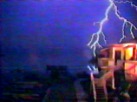
Just to compare to the last major squall line we had here in Florida on Dec 25 looked like this...
 (that's a decent looking squall line).
So.. Concerning thunderstorm potential for Florida early Sunday let's just
say I'll believe it when I see it.
