TX Winter Wx Threat # 8--- TX Ice Storm
Moderator: S2k Moderators
Forum rules
 The posts in this forum are NOT official forecast and should not be used as such. They are just the opinion of the poster and may or may not be backed by sound meteorological data. They are NOT endorsed by any professional institution or STORM2K.

The posts in this forum are NOT official forecast and should not be used as such. They are just the opinion of the poster and may or may not be backed by sound meteorological data. They are NOT endorsed by any professional institution or STORM2K.


-
Extremeweatherguy

- Category 5

- Posts: 11095
- Joined: Mon Oct 10, 2005 8:13 pm
- Location: Florida
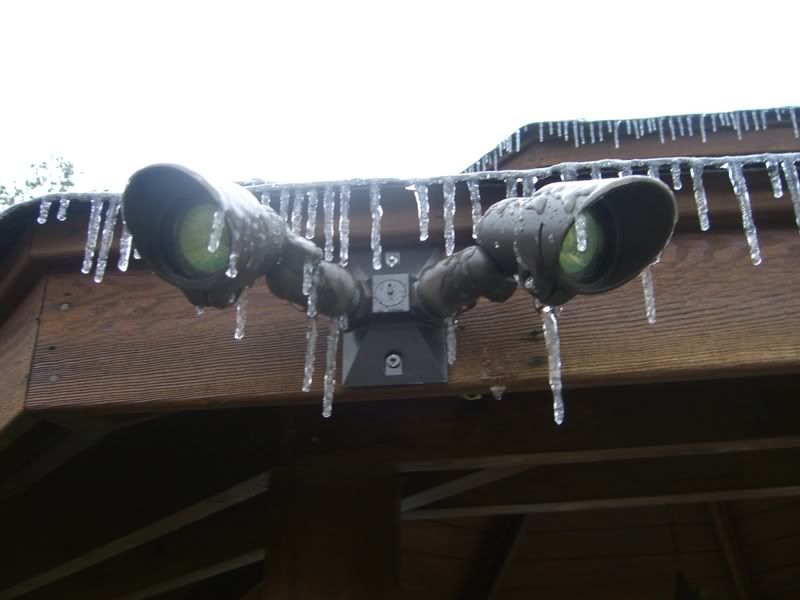
I am just glad things are melting when they are. If this would have continued, then tree limb damage would likely have begun really soon in my area (rain gauge showing over 0.20" of ice accumulation..and since it was likely missing some of the sideways blown rain, my real total was likely closer to 0.25")..
Here are some pictures:
^^Just after sunrise^^
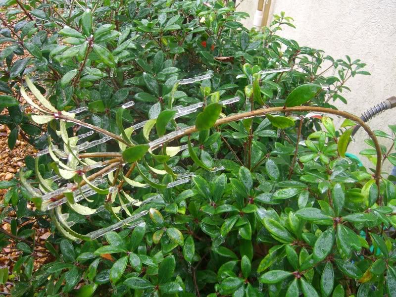
^^Plant being bent by weight of the ice^^
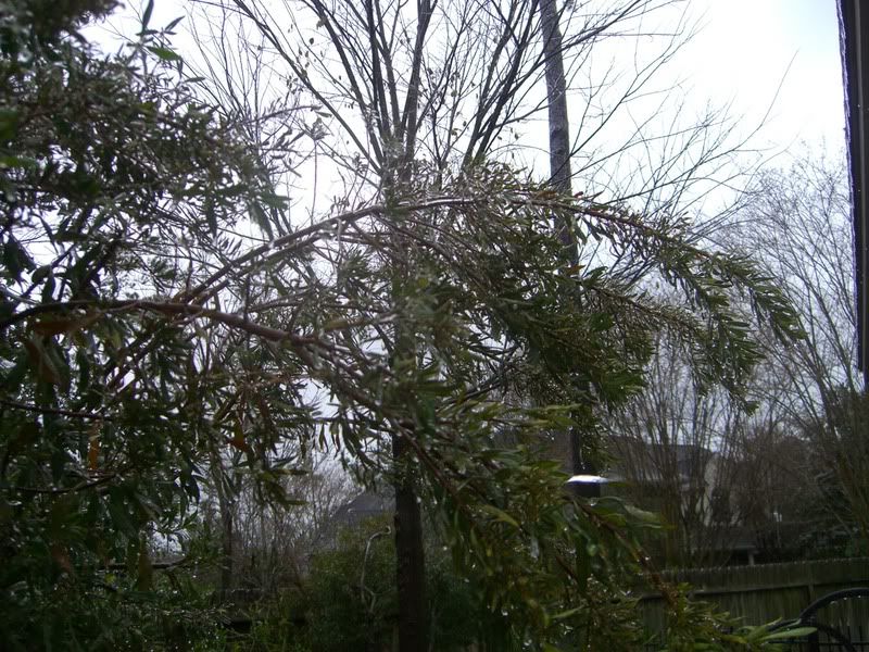
^^Weighed down tree limbs^^
Here are some pictures:
^^Just after sunrise^^
^^Plant being bent by weight of the ice^^
^^Weighed down tree limbs^^
0 likes
-
TexasStooge

- Category 5
- Posts: 38127
- Joined: Tue Mar 25, 2003 1:22 pm
- Location: Irving (Dallas County), TX
- Contact:
Here's some good news for the North Texas area:
Yeah, I knew there's a bit of bad news on the roads re-freezing overnight.
SHORT TERM FORECAST
NATIONAL WEATHER SERVICE FORT WORTH TX
1159 AM CST WED JAN 17 2007
TXZ091>095-100>107-115>123-129>135-141>148-156>162-174-175-172029-
ANDERSON-BELL-BOSQUE-COLLIN-COMANCHE-COOKE-CORYELL-DALLAS-DELTA-
DENTON-EASTLAND-ELLIS-ERATH-FALLS-FANNIN-FREESTONE-GRAYSON-HAMILTON-
HENDERSON-HILL-HOOD-HOPKINS-HUNT-JACK-JOHNSON-KAUFMAN-LAMAR-LAMPASAS-
LEON-LIMESTONE-MCLENNAN-MILAM-MILLS-MONTAGUE-NAVARRO-PALO PINTO-
PARKER-RAINS-ROBERTSON-ROCKWALL-SOMERVELL-STEPHENS-TARRANT-VAN ZANDT-
WISE-YOUNG-
1159 AM CST WED JAN 17 2007
.NOW...
THE THREAT OF ADDITIONAL SNOW OR ICE ACCUMULATION IS DIMINISHING
WEST OF THE I-35 CORRIDOR AND THIS WILL WORK EASTWARD DURING THE
EARLY AFTERNOON. A MIXTURE OF LIGHT WINTRY PRECIPITATION...
SNOW...FREEZING RAIN...SLEET AND FREEZING DRIZZLE...WILL CONTINUE
EAST OF THE I-35 CORRIDOR WITH AREAS FROM ROCKWALL TO EMORY AND
SULPHUR SPRINGS...AND FROM FAIRFIELD TO PALESTINE WILL SEE THE MOST
PRECIPITATION...AND MAY SEE SEE ADDITIONAL ACCUMULATIONS FROM A TRACE
TO 1/2 INCH BY MID AFTERNOON.
BRIDGES...OVERPASSES AND SHADED ROADWAYS WILL REMAIN ICE COVERED AND
SLIPPERY INTO THE AFTERNOON HOURS. OPEN ROADS MAY THAW OUT SOME...BUT
WILL REFREEZE SHORTLY BEFORE DARK. DRIVE SLOW AND CAUTIOUSLY IF YOU
MUST BE OUT TODAY.
A WINTER STORM WARNING REMAINS IN AFFECT SOUTH OF A LAMPASAS...
WACO...PALESTINE LINE WHILE A SNOW ADVISORY REMAINS IN AFFECT TO
THE NORTH UNTIL 600 PM.
Yeah, I knew there's a bit of bad news on the roads re-freezing overnight.
0 likes

For N TX
Large arctic outbreak responsible for ice storm this weekend and over night snow event remains in place.
Cold arctic air is firmly entrenched over N TX and many locations have not been above freezing since last Saturday...not going to do it today either.
Discussion:
Short wave that brought the snow and sleet to N TX this morning is moving NE out of the area and the radar returns are weakening with snow tapering off. Accumulations this morning ranged nearly 3.0 inches down south to .5 to 1.5 inches across the metro areas. Bridges and overpasses and is bad shape across the region and with temps. hovering in the upper 20's little improvement is expected until sometime Thursday. Icing in the southern counties over the past 48 hours has accumulated up to .5 of an inch and some tree limbs and power lines are starting to come down.
Extended:
Very cold temps. will remain in place into next week...however temps. should be able to move above freezing for a short time Thursday and help to melt some of the ice and snow accumulation.
Next storm system in strong sub-tropical flow approaches N TX over the weekend. Timing of next arctic surge is penciled in for late Friday, but will only re-enforce the cold air and not really bring significant cooling. There may be some freezing rain/sleet mix Saturday night or Sunday morning over N TX mainly N of I-20...however this is very uncertain at this time.
Upper pattern looks cold into early Feb and such upper air patterns with long term arctic outbreaks usually have multiple winter weather events and this one may be no different given persistent sub-tropical flow over the cold arctic dome.
0 likes
-
cctxhurricanewatcher

- Category 5
- Posts: 1206
- Joined: Sun Sep 12, 2004 8:53 pm
- Location: Corpus Christi, Texas
cctxhurricanewatcher wrote:Bastardi headline for today:
"WEDNESDAY NOON: FLORIDA, TEXAS CITRUS SHOULD BE THREATENED BY FREEZES BEFORE SEASON ENDS. "
I was afraid of that - Florida citrus groves haven't recovered from the hurricanes of 2004-2005, California citrus crop is almost all frozen and now the Texas crop.
They grow alot of oranges in South America (Brazil I think) but the US doesn't import them. Why? Ask the US orange growers.
0 likes
-
cctxhurricanewatcher
- Category 5
- Posts: 1206
- Joined: Sun Sep 12, 2004 8:53 pm
- Location: Corpus Christi, Texas
Shoshana wrote:cctxhurricanewatcher wrote:Bastardi headline for today:
"WEDNESDAY NOON: FLORIDA, TEXAS CITRUS SHOULD BE THREATENED BY FREEZES BEFORE SEASON ENDS. "
I was afraid of that - Florida citrus groves haven't recovered from the hurricanes of 2004-2005, California citrus crop is almost all frozen and now the Texas crop.
They grow alot of oranges in South America (Brazil I think) but the US doesn't import them. Why? Ask the US orange growers.
Time to cash in my oil stocks for orange juice futures.
0 likes
-
TrekkerCC

- S2K Supporter

- Posts: 263
- Joined: Sat Sep 06, 2003 10:19 pm
- Location: North Central Texas (Dallas Area)
Winter Weather Advisory has replaced the Snow Advisory in the North Texas area. It is possible that we could have some real problems tomorrow morning as the snow/ice refreezes on many streets/bridges/overpasses.
NWS Ft. Worth Office wrote:URGENT - WINTER WEATHER MESSAGE
NATIONAL WEATHER SERVICE FORT WORTH TX
1225 PM CST WED JAN 17 2007
...SOUTHEAST HALF OF NORTH TEXAS CHANGED TO A WINTER WEATHER
ADVISORY...WITH NO ADDITIONAL WINTER WEATHER EXPECTED OVER THE
NORTHWEST HALF OF NORTH TEXAS...
.SYSTEM THAT RESULT IN ALL THE LIGHT SNOW IN THE NORTH PORTIONS OF
NORTH TEXAS...AND WINTRY MIX IN THE SOUTH HAS CONTINUED TO WEAKEN
AND SHIFT SLOWLY EAST TODAY. AS A RESULT...WINTER PRECIPITATION
HAS STOPPED ACROSS NORTHWEST SECTIONS OF NORTH TEXAS...WITH A
LIGHT WINTRY MIX OF LIGHT FREEZING RAIN...LIGHT FREEZING DRIZZLE
AND LIGHT SLEET ACROSS SOUTHEAST SECTIONS OF THE AREA. EXPECT THE
WINTRY MIX TO END SOMETIME BY 6 PM OR SHORTLY AFTER OVER ALL OF
NORTH TEXAS...AS THE WEAKENING SYSTEM MOVES EAST OF THE REGION.
TXZ104-105-107-118>123-133>135-145-146-180000-
/O.CAN.KFWD.SN.Y.0001.000000T0000Z-070118T0000Z/
/O.NEW.KFWD.WW.Y.0004.070117T1825Z-070118T0000Z/
COLLIN-HUNT-HOPKINS-TARRANT-DALLAS-ROCKWALL-KAUFMAN-VAN ZANDT-
RAINS-JOHNSON-ELLIS-HENDERSON-HILL-NAVARRO-
INCLUDING THE CITIES OF...PLANO...GREENVILLE...COMMERCE...
SULPHUR SPRINGS...FORT WORTH...ARLINGTON...DALLAS...ROCKWALL...
TERRELL...KAUFMAN...FORNEY...WILLS POINT...CANTON...
GRAND SALINE...VAN...EDGEWOOD...EMORY...POINT...EAST TAWAKONI...
CLEBURNE...BURLESON...WAXAHACHIE...ENNIS...MIDLOTHIAN...
GLENN HEIGHTS...ATHENS...GUN BARREL CITY...HILLSBORO...CORSICANA
1225 PM CST WED JAN 17 2007
...SNOW ADVISORY IS CANCELLED...
...WINTER WEATHER ADVISORY IN EFFECT UNTIL 6 PM CST THIS
AFTERNOON...
THE NATIONAL WEATHER SERVICE IN FORT WORTH HAS ISSUED A WINTER
WEATHER ADVISORY...WHICH IS IN EFFECT UNTIL 6 PM CST THIS
AFTERNOON. THE SNOW ADVISORY HAS BEEN CANCELED.
PATCHY...LIGHT FREEZING RAIN OR DRIZZLE...PERIODICALLY MIXED WITH
LIGHT SLEET WILL CONTINUE THROUGH LATE AFTERNOON...THEN END BY
THIS EVENING.
EVEN SO...PATCHY ICE ON ROADS AND HIGHWAYS...PARTICULARLY BRIDGES AND
OVERPASSES WILL CONTINUE TO BE A PROBLEM AS TEMPERATURES REMAIN
BELOW FREEZING.
$$
0 likes
-
TrekkerCC
- S2K Supporter
- Posts: 263
- Joined: Sat Sep 06, 2003 10:19 pm
- Location: North Central Texas (Dallas Area)
jeff wrote:For N TX
Large arctic outbreak responsible for ice storm this weekend and over night snow event remains in place.
Cold arctic air is firmly entrenched over N TX and many locations have not been above freezing since last Saturday...not going to do it today either.
Discussion:
Short wave that brought the snow and sleet to N TX this morning is moving NE out of the area and the radar returns are weakening with snow tapering off. Accumulations this morning ranged nearly 3.0 inches down south to .5 to 1.5 inches across the metro areas. Bridges and overpasses and is bad shape across the region and with temps. hovering in the upper 20's little improvement is expected until sometime Thursday. Icing in the southern counties over the past 48 hours has accumulated up to .5 of an inch and some tree limbs and power lines are starting to come down.
Extended:
Very cold temps. will remain in place into next week...however temps. should be able to move above freezing for a short time Thursday and help to melt some of the ice and snow accumulation.
Next storm system in strong sub-tropical flow approaches N TX over the weekend. Timing of next arctic surge is penciled in for late Friday, but will only re-enforce the cold air and not really bring significant cooling. There may be some freezing rain/sleet mix Saturday night or Sunday morning over N TX mainly N of I-20...however this is very uncertain at this time.
Upper pattern looks cold into early Feb and such upper air patterns with long term arctic outbreaks usually have multiple winter weather events and this one may be no different given persistent sub-tropical flow over the cold arctic dome.
Thanks Jeff. JB is also on board with a winter weather threat this weekend. Will the arctic surge bust temperatures like they did last week? Will it keep us around freezing during the afternoon hours during the weekend?
0 likes
-
wxman57

- Moderator-Pro Met

- Posts: 23175
- Age: 68
- Joined: Sat Jun 21, 2003 8:06 pm
- Location: Houston, TX (southwest)
I've already had a few questions about my thoughts for this weekend's event. Just posted something about it in the KHOU forum so I'll just paste it here below. Looks like a north TX/OK event (then moving ENE-NE) rather than a southeast TX event. Could be A LOT of snow in west Texas with it:
As for this weekend's event, the 5-10" I spoke of are for west Texas where upslope conditions for 24 hours or more will lead to some fairly significant accumulations. Could be more, actually. What I'm seeing with this next system is a much sharper boundary between snow/sleet and rain. That boundary, at least according to the latest GFS, extends almost directly over Dallas/Ft. Worth on Saturday.
Here, take a look at this 12Z GFS graphic for 3am Saturday:
http://myweb.cableone.net/nolasue/saturday.gif
You can see that the 850mb (5000ft) and surface (2 meter) freeze lines meet directly over Dallas. That means a very sharp transition between rain and sleet/snow. No large area of freezing rain this weekend. But the 850mb and surface freezing lines are inching northward on Saturday. The red contour lines are precipitation. That heavy snow in the southern Panhandle will move northeast on Saturday, producing snow in Abilene and maybe briefly into Ft. Worth/Dallas area but I think the snow will stay north of Dallas up around the red River and into Oklahoma. Amounts there will be significantly lower than out in west Texas, as the storm system will be on the move and there will be no orographic lifting to enhance the snowfall. could see 3-5 inches, though. Just an extimate this far out.
Finally, note that for this weekend the freezing line will be WELL north of our area, so no threat here. Just more cold rain.
Last edited by wxman57 on Wed Jan 17, 2007 2:50 pm, edited 1 time in total.
0 likes
-
TrekkerCC
- S2K Supporter
- Posts: 263
- Joined: Sat Sep 06, 2003 10:19 pm
- Location: North Central Texas (Dallas Area)
wxman57 wrote:I've already had a few questions about my thoughts for this weekend's event. Just posted something about it in the KHOU forum so I'll just paste it here below. Looks like a north TX/OK event (then moving ENE-NE) rather than a southeast TX event. Could be A LOT of snow in west Texas with it:
As for this weekend's event, the 5-10" I spoke of are for west Texas where upslope conditions for 24 hours or more will lead to some fairly significant accumulations. Could be more, actually. What I'm seeing with this next system is a much sharper boundary between snow/sleet and rain. That boundary, at least according to the latest GFS, extends almost directly over Dallas/Ft. Worth on Saturday.
Here, take a look at this 12Z GFS graphic for 3am Saturday:
You can see that the 850mb (5000ft) and surface (2 meter) freeze lines meet directly over Dallas. That means a very sharp transition between rain and sleet/snow. No large area of freezing rain this weekend. But the 850mb and surface freezing lines are inching northward on Saturday. The red contour lines are precipitation. That heavy snow in the southern Panhandle will move northeast on Saturday, producing snow in Abilene and maybe briefly into Ft. Worth/Dallas area but I think the snow will stay north of Dallas up around the red River and into Oklahoma. Amounts there will be significantly lower than out in west Texas, as the storm system will be on the move and there will be no orographic lifting to enhance the snowfall. could see 3-5 inches, though. Just an extimate this far out.
Finally, note that for this weekend the freezing line will be WELL north of our area, so no threat here. Just more cold rain.

Thanks wxman57 for your thoughts. I am hoping that Dallas/Ft. Worth area could get maybe an inch or more of snow from this weekend system, but it looks like it is going to be very dicey on what precipitation types result. NWS Ft. Worth Office is at least on board with us seeing some frozen precipitation during the morning hours over the weekend, it will be interesting weekend if it verifies.
0 likes
-
AggieSpirit
- Tropical Storm

- Posts: 223
- Joined: Sat Nov 29, 2003 5:18 am
- Location: Midlothian, TX
wxman57 wrote:I've already had a few questions about my thoughts for this weekend's event. Just posted something about it in the KHOU forum so I'll just paste it here below. Looks like a north TX/OK event (then moving ENE-NE) rather than a southeast TX event. Could be A LOT of snow in west Texas with it:
As for this weekend's event, the 5-10" I spoke of are for west Texas where upslope conditions for 24 hours or more will lead to some fairly significant accumulations. Could be more, actually. What I'm seeing with this next system is a much sharper boundary between snow/sleet and rain. That boundary, at least according to the latest GFS, extends almost directly over Dallas/Ft. Worth on Saturday.
Here, take a look at this 12Z GFS graphic for 3am Saturday:
You can see that the 850mb (5000ft) and surface (2 meter) freeze lines meet directly over Dallas. That means a very sharp transition between rain and sleet/snow. No large area of freezing rain this weekend. But the 850mb and surface freezing lines are inching northward on Saturday. The red contour lines are precipitation. That heavy snow in the southern Panhandle will move northeast on Saturday, producing snow in Abilene and maybe briefly into Ft. Worth/Dallas area but I think the snow will stay north of Dallas up around the red River and into Oklahoma. Amounts there will be significantly lower than out in west Texas, as the storm system will be on the move and there will be no orographic lifting to enhance the snowfall. could see 3-5 inches, though. Just an extimate this far out.
Finally, note that for this weekend the freezing line will be WELL north of our area, so no threat here. Just more cold rain.
Sounds like more fun.
0 likes
-
Extremeweatherguy
- Category 5
- Posts: 11095
- Joined: Mon Oct 10, 2005 8:13 pm
- Location: Florida
-
Extremeweatherguy
- Category 5
- Posts: 11095
- Joined: Mon Oct 10, 2005 8:13 pm
- Location: Florida
It's above freezing now (33ish) and the ice is slowly melting.
The first slide show :
Jan 16
second slide show:
Jan 17
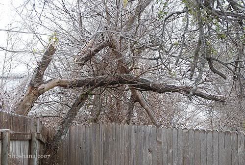
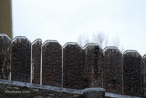
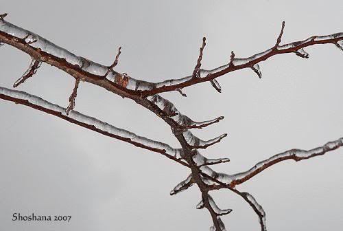
Meanwhile here are a few pics from the second slideshow.
Damage to the hackberries
Ice buildup on the fence
Ice on our cedar elm
There are a few more at the Jan 17 slide show link. I didn't want to bog down everyone's connection!
Let me now if you have trouble seeing the slideshow.
The first slide show :
Jan 16
second slide show:
Jan 17
Meanwhile here are a few pics from the second slideshow.
Damage to the hackberries
Ice buildup on the fence
Ice on our cedar elm
There are a few more at the Jan 17 slide show link. I didn't want to bog down everyone's connection!
Let me now if you have trouble seeing the slideshow.
0 likes
-
whereverwx
- Category 5
- Posts: 1107
- Joined: Mon May 31, 2004 10:15 pm
-
Yankeegirl

- Category 5
- Posts: 3417
- Age: 50
- Joined: Sun May 23, 2004 11:59 pm
- Location: Cy-Fair, Northwest Houston
- Contact:
-
wxman57
- Moderator-Pro Met
- Posts: 23175
- Age: 68
- Joined: Sat Jun 21, 2003 8:06 pm
- Location: Houston, TX (southwest)
Extremeweatherguy wrote:wxman57...
do you see any more ice/snow threats possibly reaching the Houston area within the next few weeks?
Not for us. But the more I look at precipitation values for this weekend across north and west Texas, the more I'm thinking 12-24 inches of snow across SE New Mexico into west Texas and maybe 8-12 inches across the Red River of Texas and into southern Oklahoma.
0 likes
Who is online
Users browsing this forum: No registered users and 112 guests