Invest 91L,E Caribbean,Comments,Sat Pics,Models Thread #3

This is the general tropical discussion area. Anyone can take their shot at predicting a storms path.

Moderator: S2k Moderators

Forum rules

The posts in this forum are NOT official forecasts and should not be used as such. They are just the opinion of the poster and may or may not be backed by sound meteorological data. They are NOT endorsed by any professional institution or STORM2K. For official information, please refer to products from the National Hurricane Center and National Weather Service.

Help Support Storm2K
Message
Author
User avatar
Extremeweatherguy
Category 5
Category 5
Posts: 11095
Joined: Mon Oct 10, 2005 8:13 pm
Location: Florida

#21 Postby Extremeweatherguy » Tue Aug 08, 2006 8:02 pm

Stratosphere747 wrote:
Extremeweatherguy wrote:none of these models are really right for this kind of situation. Also, they all contradict what I have heard from many pro mets...that this is going into the Caribbean.


Who?

57 is the only one, at least from this site that mentioned the possiblity of whatever this is, going into the Caribbean.
I have seen one or two TV mets mention it over the last few days. Also, Jeff Master's said on his blog that it could possibly be going into the Caribbean. Then, as you had mentioned, wxman57 also said that it may go that way.

Have these ideas changed since this morning? Is the ridge suppose to now weaken or retreat east? As of yesterday and this morning I thought it wasn't. Any new pro met opinions?


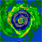
From Jeff Master's blog:

The wave should move through the Lesser Antilles Islands on Thursday morning. At this point, if I had travel plans in the Caribbean, I wouldn't change them, since any development of this system is likely to be slow. However, I would check the situation frequently, as surprises are common. The Hurricane Hunters are on call to investigate the wave on Wednesday at 2pm EDT.


Oh yeah..JB also thinks this will head west the next 5 days (as of his evening post), but he is not sure if it will survive.
Last edited by Extremeweatherguy on Tue Aug 08, 2006 8:12 pm, edited 1 time in total.
0 likes   

Derek Ortt

#22 Postby Derek Ortt » Tue Aug 08, 2006 8:04 pm

and even the model guidance is not intended for the public (and most is not disimanated via the usual messages), but is intended for the mets
0 likes   

User avatar
ROCK
Category 5
Category 5
Posts: 9490
Age: 54
Joined: Tue Aug 17, 2004 7:30 am
Location: Kemah, Texas

#23 Postby ROCK » Tue Aug 08, 2006 8:06 pm

Stratosphere747 wrote:
Extremeweatherguy wrote:none of these models are really right for this kind of situation. Also, they all contradict what I have heard from many pro mets...that this is going into the Caribbean.


Who?

57 is the only one, at least from this site that mentioned the possiblity of whatever this is, going into the Caribbean.


I have heard also that this small cloud will be entering the carib..... :lol: if it keeps its present speed and stays west it won't take long for those models to shift back to the left.
0 likes   

User avatar
senorpepr
Military Met/Moderator
Posts: 12542
Age: 43
Joined: Fri Aug 22, 2003 9:22 pm
Location: Mackenbach, Germany
Contact:

#24 Postby senorpepr » Tue Aug 08, 2006 8:06 pm

stormtruth wrote:It isn't public in the sense that the public can't or shouldn't use them. It doesn't warn the public not to use them on the About page.
http://www.nhc.noaa.gov/aboutnhcprod.shtml

The whole website is available to everyone.


Let me clarify myself... I'm saying the public CAN'T use the discussions nor will the police show up at someone's door and arrest them for using the discussions. What I am saying is that they are not intented for use by the public and that they are not responsible for any actions taken by the public after using the product.

Matter of fact... in the not so distant past, NHC discussions were labelled for "intergovernmental use only"...
Last edited by senorpepr on Tue Aug 08, 2006 8:07 pm, edited 1 time in total.
0 likes   

User avatar
Extremeweatherguy
Category 5
Category 5
Posts: 11095
Joined: Mon Oct 10, 2005 8:13 pm
Location: Florida

#25 Postby Extremeweatherguy » Tue Aug 08, 2006 8:07 pm

ROCK wrote:
Stratosphere747 wrote:
Extremeweatherguy wrote:none of these models are really right for this kind of situation. Also, they all contradict what I have heard from many pro mets...that this is going into the Caribbean.


Who?

57 is the only one, at least from this site that mentioned the possiblity of whatever this is, going into the Caribbean.


I have heard also that this small cloud will be entering the carib..... :lol: if it keeps its present speed and stays west it won't take long for those models to shift back to the left.
:lol:
0 likes   

Stratosphere747
Category 5
Category 5
Posts: 3772
Joined: Thu Sep 11, 2003 8:34 pm
Location: Surfside Beach/Freeport Tx
Contact:

#26 Postby Stratosphere747 » Tue Aug 08, 2006 8:15 pm

Rock,

I demand to know which Houston area Met even mentioned the possiblity of a "small cloud" entering the Caribbean....;)


Models, tracking a wave....

N 18z, S 0z, W 18z, E 0z......
0 likes   

User avatar
cycloneye
Admin
Admin
Posts: 146181
Age: 69
Joined: Thu Oct 10, 2002 10:54 am
Location: San Juan, Puerto Rico

#27 Postby cycloneye » Tue Aug 08, 2006 8:22 pm

SUBJ/TROPICAL CYCLONE FORMATION ALERT//
WTNT01 KNGU 090301
REF/A/RMG/NAVLANTMETOCCEN NORFOLK VA/090000ZAUG06//
AMPN/REF A IS TROPICAL CYCLONE FORMATION ALERT (WTNT01 KNGU)//
RMKS/
1. FORMATION OF A TROPICAL CYCLONE IS POSSIBLE WITHIN
100 NM EITHER SIDE OF A LINE FROM 13.0N 50.0W TO 15.0N 56.0W
WITHIN THE NEXT 24 HOURS. AVAILABLE DATA DOES NOT JUSTIFY
ISSUANCE OF NUMBERED TROPICAL CYCLONE WARNINGS AT THIS TIME.
WINDS IN THE AREA ARE ESTIMATED TO BE 20 TO 25 GUSTS 30 KNOTS.
2. REMARKS: A 1009 MB LOW CENTERED NEAR 13.0N 50.0W HAS BEEN MOVING
WESTERLY FOR THE LAST 72 HOURS. THE SYSTEM MOVED INTO AN AREA OF DRY
AIR INDICATED BY WATER VAPOR SATELLITE IMAGERY THE LAST TWO DAYS
AND WEAKENED SLIGHTLY. DEEP CONVECTION HAS RECENTLY DEVELOPED OVER
THE LOW CENTER INCREASING TROPICAL CYCLONE FEATURES. UPPER LEVEL
WINDS HAVE BECOME FAVORABLE FOR TROPCIAL CYCLONE FORMATION.
WIND SHEAR HAS DECREASED OVER THE LAST 6 HOURS WITH SHEAR VALUES
OF 10 TO 15 KNOTS OVER THE AREA. SHORT TO MEDIUM RANGE MODEL GUIDANCE
DOES NOT DEVELOP THIS SYSTEM INTO A MAJOR TROPICAL CYCLONE AT THIS
TIME, HOWEVER EXPECT MODEL GUIDANCE TO ANALYZE THE SYSTEM MORE ACCURATELY
IN THE NEAR FUTURE. SEA SURFACE TEMPERATURE AT THE LOW CENTER HAS BEEN
ANALYZED AT 81F(27C). CURRENT MOVEMENT INTO WARMER SEA SURFACE TEMPERATURES
ALONG THE ANTILLES WILL ALSO ENHANCE DEVELOPMENT. THE SYSTEM MOVEMENT
FORECAST IS WEST TO WEST-NORTHWEST THROUGH THE NEXT 72 HOURS.
3. THIS ALERT WILL BE REISSUED, UPGRADED TO WARNING OR CANCELLED BY
100001Z AUG 06.//


I forgot to post the text of the TCFA but here it is now.
0 likes   
Visit the Caribbean-Central America Weather Thread where you can find at first post web cams,radars
and observations from Caribbean basin members Click Here

HurricaneHunter914
Category 5
Category 5
Posts: 4439
Age: 31
Joined: Fri Mar 10, 2006 7:36 pm
Location: College Station, TX

#28 Postby HurricaneHunter914 » Tue Aug 08, 2006 8:31 pm

Until this can actually gain some persistent convection without the flaring up and flaring down, TD formation appears kinda unlikely at this time.
0 likes   
Personal Forecast Disclaimer:
The posts in this forum are NOT official forecast and should not be used as such. They are just the opinion of the poster and may or may not be backed by sound meteorological data. They are NOT endorsed by any professional institution or storm2k.org. For official information, please refer to the NHC and NWS products.

User avatar
SouthFloridawx
S2K Supporter
S2K Supporter
Posts: 8346
Age: 46
Joined: Tue Jul 26, 2005 1:16 am
Location: Sarasota, FL
Contact:

#29 Postby SouthFloridawx » Tue Aug 08, 2006 8:32 pm

cycloneye wrote:SUBJ/TROPICAL CYCLONE FORMATION ALERT//
WTNT01 KNGU 090301
REF/A/RMG/NAVLANTMETOCCEN NORFOLK VA/090000ZAUG06//
AMPN/REF A IS TROPICAL CYCLONE FORMATION ALERT (WTNT01 KNGU)//
RMKS/
1. FORMATION OF A TROPICAL CYCLONE IS POSSIBLE WITHIN
100 NM EITHER SIDE OF A LINE FROM 13.0N 50.0W TO 15.0N 56.0W
WITHIN THE NEXT 24 HOURS. AVAILABLE DATA DOES NOT JUSTIFY
ISSUANCE OF NUMBERED TROPICAL CYCLONE WARNINGS AT THIS TIME.
WINDS IN THE AREA ARE ESTIMATED TO BE 20 TO 25 GUSTS 30 KNOTS.
2. REMARKS: A 1009 MB LOW CENTERED NEAR 13.0N 50.0W HAS BEEN MOVING
WESTERLY FOR THE LAST 72 HOURS. THE SYSTEM MOVED INTO AN AREA OF DRY
AIR INDICATED BY WATER VAPOR SATELLITE IMAGERY THE LAST TWO DAYS
AND WEAKENED SLIGHTLY. DEEP CONVECTION HAS RECENTLY DEVELOPED OVER
THE LOW CENTER INCREASING TROPICAL CYCLONE FEATURES. UPPER LEVEL
WINDS HAVE BECOME FAVORABLE FOR TROPCIAL CYCLONE FORMATION.
WIND SHEAR HAS DECREASED OVER THE LAST 6 HOURS WITH SHEAR VALUES
OF 10 TO 15 KNOTS OVER THE AREA. SHORT TO MEDIUM RANGE MODEL GUIDANCE
DOES NOT DEVELOP THIS SYSTEM INTO A MAJOR TROPICAL CYCLONE AT THIS
TIME, HOWEVER EXPECT MODEL GUIDANCE TO ANALYZE THE SYSTEM MORE ACCURATELY
IN THE NEAR FUTURE. SEA SURFACE TEMPERATURE AT THE LOW CENTER HAS BEEN
ANALYZED AT 81F(27C). CURRENT MOVEMENT INTO WARMER SEA SURFACE TEMPERATURES
ALONG THE ANTILLES WILL ALSO ENHANCE DEVELOPMENT. THE SYSTEM MOVEMENT
FORECAST IS WEST TO WEST-NORTHWEST THROUGH THE NEXT 72 HOURS.
3. THIS ALERT WILL BE REISSUED, UPGRADED TO WARNING OR CANCELLED BY
100001Z AUG 06.//


I forgot to post the text of the TCFA but here it is now.


Do you have a link for that?
0 likes   

User avatar
Cyclenall
Category 5
Category 5
Posts: 6667
Joined: Thu Jun 08, 2006 10:01 pm
Location: Ontario, Canada

#30 Postby Cyclenall » Tue Aug 08, 2006 8:33 pm

I still don't see Invest 91L up on the main NRL site.
0 likes   

User avatar
cycloneye
Admin
Admin
Posts: 146181
Age: 69
Joined: Thu Oct 10, 2002 10:54 am
Location: San Juan, Puerto Rico

#31 Postby cycloneye » Tue Aug 08, 2006 8:34 pm

SouthFloridawx wrote:
cycloneye wrote:SUBJ/TROPICAL CYCLONE FORMATION ALERT//
WTNT01 KNGU 090301
REF/A/RMG/NAVLANTMETOCCEN NORFOLK VA/090000ZAUG06//
AMPN/REF A IS TROPICAL CYCLONE FORMATION ALERT (WTNT01 KNGU)//
RMKS/
1. FORMATION OF A TROPICAL CYCLONE IS POSSIBLE WITHIN
100 NM EITHER SIDE OF A LINE FROM 13.0N 50.0W TO 15.0N 56.0W
WITHIN THE NEXT 24 HOURS. AVAILABLE DATA DOES NOT JUSTIFY
ISSUANCE OF NUMBERED TROPICAL CYCLONE WARNINGS AT THIS TIME.
WINDS IN THE AREA ARE ESTIMATED TO BE 20 TO 25 GUSTS 30 KNOTS.
2. REMARKS: A 1009 MB LOW CENTERED NEAR 13.0N 50.0W HAS BEEN MOVING
WESTERLY FOR THE LAST 72 HOURS. THE SYSTEM MOVED INTO AN AREA OF DRY
AIR INDICATED BY WATER VAPOR SATELLITE IMAGERY THE LAST TWO DAYS
AND WEAKENED SLIGHTLY. DEEP CONVECTION HAS RECENTLY DEVELOPED OVER
THE LOW CENTER INCREASING TROPICAL CYCLONE FEATURES. UPPER LEVEL
WINDS HAVE BECOME FAVORABLE FOR TROPCIAL CYCLONE FORMATION.
WIND SHEAR HAS DECREASED OVER THE LAST 6 HOURS WITH SHEAR VALUES
OF 10 TO 15 KNOTS OVER THE AREA. SHORT TO MEDIUM RANGE MODEL GUIDANCE
DOES NOT DEVELOP THIS SYSTEM INTO A MAJOR TROPICAL CYCLONE AT THIS
TIME, HOWEVER EXPECT MODEL GUIDANCE TO ANALYZE THE SYSTEM MORE ACCURATELY
IN THE NEAR FUTURE. SEA SURFACE TEMPERATURE AT THE LOW CENTER HAS BEEN
ANALYZED AT 81F(27C). CURRENT MOVEMENT INTO WARMER SEA SURFACE TEMPERATURES
ALONG THE ANTILLES WILL ALSO ENHANCE DEVELOPMENT. THE SYSTEM MOVEMENT
FORECAST IS WEST TO WEST-NORTHWEST THROUGH THE NEXT 72 HOURS.
3. THIS ALERT WILL BE REISSUED, UPGRADED TO WARNING OR CANCELLED BY
100001Z AUG 06.//


I forgot to post the text of the TCFA but here it is now.


Do you have a link for that?


http://www.nrlmry.navy.mil/atcf_web/index1.html
0 likes   
Visit the Caribbean-Central America Weather Thread where you can find at first post web cams,radars
and observations from Caribbean basin members Click Here

User avatar
brunota2003
S2K Supporter
S2K Supporter
Posts: 9476
Age: 34
Joined: Sat Jul 30, 2005 9:56 pm
Location: Stanton, KY...formerly Havelock, NC
Contact:

#32 Postby brunota2003 » Tue Aug 08, 2006 8:36 pm

Cyclenall wrote:I still don't see Invest 91L up on the main NRL site.
along with that, the backup site hasnt done the 0000Z update...its still the 1800Z
0 likes   

User avatar
cycloneye
Admin
Admin
Posts: 146181
Age: 69
Joined: Thu Oct 10, 2002 10:54 am
Location: San Juan, Puerto Rico

#33 Postby cycloneye » Tue Aug 08, 2006 8:38 pm

brunota2003 wrote:
Cyclenall wrote:I still don't see Invest 91L up on the main NRL site.
along with that, the backup site hasnt done the 0000Z update...its still the 1800Z


No doubt they are having problems with the sites tonight.
0 likes   
Visit the Caribbean-Central America Weather Thread where you can find at first post web cams,radars
and observations from Caribbean basin members Click Here

User avatar
SouthFloridawx
S2K Supporter
S2K Supporter
Posts: 8346
Age: 46
Joined: Tue Jul 26, 2005 1:16 am
Location: Sarasota, FL
Contact:

#34 Postby SouthFloridawx » Tue Aug 08, 2006 8:38 pm

Thanks Luis
0 likes   

User avatar
Trugunzn
Category 2
Category 2
Posts: 549
Joined: Tue Apr 11, 2006 6:59 pm

#35 Postby Trugunzn » Tue Aug 08, 2006 8:47 pm

Its not lookin so good right now.
0 likes   

User avatar
calculatedrisk
Tropical Depression
Tropical Depression
Posts: 76
Joined: Fri Jul 15, 2005 3:39 pm

#36 Postby calculatedrisk » Tue Aug 08, 2006 8:49 pm

91L Aug 9 00:45 IR with isotherms, moving into 28+ degree water tonight.

Image

SST Source:
http://www.aoml.noaa.gov/phod/dataphod1 ... 9atsst.png
0 likes   

miamicanes177
Category 5
Category 5
Posts: 1131
Joined: Tue Aug 01, 2006 10:53 pm

#37 Postby miamicanes177 » Tue Aug 08, 2006 8:52 pm

0 likes   

User avatar
wxman57
Moderator-Pro Met
Moderator-Pro Met
Posts: 23019
Age: 67
Joined: Sat Jun 21, 2003 8:06 pm
Location: Houston, TX (southwest)

#38 Postby wxman57 » Tue Aug 08, 2006 9:00 pm

The problem with the BAM models is they probably don't see the large ridge building north of the eastern Caribbean in a few days. That ridge will likely remain north of 91L as it moves west through the Caribbean. Take a look at the dynamic models below. I removed the BAM model plots and just plotted the models that take into account the changing flow pattern in advance of 91L.

Now, looking at 91L tonight, it's pretty pathetic. Looks more like Chris when it was dissipating. I don't think there's too much chance of this developing, maybe 20%. Here are the dynamic models. I'm forecasting it to be near the Yucatan moving due west by late Sunday or Monday, maybe the southern Yucatan.

Image
Last edited by wxman57 on Tue Aug 08, 2006 9:03 pm, edited 1 time in total.
0 likes   

User avatar
Windspeed
Tropical Storm
Tropical Storm
Posts: 129
Joined: Thu Jun 10, 2004 11:38 am

#39 Postby Windspeed » Tue Aug 08, 2006 9:02 pm

Cyclenall wrote:I still don't see Invest 91L up on the main NRL site.


91L is still active on NRL:

http://www.nrlmry.navy.mil/tc-bin/tc_di ... YLE=Frames
Last edited by Windspeed on Tue Aug 08, 2006 9:03 pm, edited 1 time in total.
0 likes   

User avatar
tailgater
S2K Supporter
S2K Supporter
Posts: 3339
Joined: Sun Jul 11, 2004 9:13 pm
Location: St. Amant La.

#40 Postby tailgater » Tue Aug 08, 2006 9:02 pm

I'm not sure if this was posted yet but!
http://www.nhc.noaa.gov/tafb_latest/atl ... BW_sm3.gif
0 likes   


Return to “Talkin' Tropics”

Who is online

Users browsing this forum: Hurricane2022, ouragans, SconnieCane and 40 guests