Invest 91L E Windwards,Comments,Sat Pics,Models Thread #2

This is the general tropical discussion area. Anyone can take their shot at predicting a storms path.

Moderator: S2k Moderators

Forum rules

The posts in this forum are NOT official forecasts and should not be used as such. They are just the opinion of the poster and may or may not be backed by sound meteorological data. They are NOT endorsed by any professional institution or STORM2K. For official information, please refer to products from the National Hurricane Center and National Weather Service.

Help Support Storm2K
Message
Author
Stratosphere747
Category 5
Category 5
Posts: 3772
Joined: Thu Sep 11, 2003 8:34 pm
Location: Surfside Beach/Freeport Tx
Contact:

#41 Postby Stratosphere747 » Mon Aug 07, 2006 1:52 pm

rnbaida wrote:This is 100% a fish... It wont even come close to the bahamas.


Why's that?
0 likes   

flhurricaneguy
Tropical Storm
Tropical Storm
Posts: 197
Joined: Mon Sep 26, 2005 10:21 am

#42 Postby flhurricaneguy » Mon Aug 07, 2006 1:52 pm

Posted: Mon Aug 07, 2006 2:50 pm Post subject:


This is 100% a fish... It wont even come close to the bahamas.


how can you be so sure?
0 likes   

User avatar
skysummit
S2K Supporter
S2K Supporter
Posts: 5305
Age: 49
Joined: Tue Aug 31, 2004 11:09 pm
Location: Ponchatoula, LA
Contact:

#43 Postby skysummit » Mon Aug 07, 2006 1:53 pm

rnbaida wrote:This is 100% a fish... It wont even come close to the bahamas.


Dude you have no clue about that. Please people do not take that prediction seriously.
0 likes   

User avatar
mike815
Category 5
Category 5
Posts: 1460
Joined: Fri Jul 22, 2005 8:21 am
Location: palm bay fl

#44 Postby mike815 » Mon Aug 07, 2006 1:54 pm

yea man no offense but just yesterday everyone was sayin rhis was goin into the careabbean
0 likes   

User avatar
cycloneye
Admin
Admin
Posts: 146181
Age: 69
Joined: Thu Oct 10, 2002 10:54 am
Location: San Juan, Puerto Rico

#45 Postby cycloneye » Mon Aug 07, 2006 1:55 pm

rnbaida wrote:This is 100% a fish... It wont even come close to the bahamas.


That is a very Bold Statement.Anything to backup that?
0 likes   
Visit the Caribbean-Central America Weather Thread where you can find at first post web cams,radars
and observations from Caribbean basin members Click Here

User avatar
HURAKAN
Professional-Met
Professional-Met
Posts: 46086
Age: 38
Joined: Thu May 20, 2004 4:34 pm
Location: Key West, FL
Contact:

#46 Postby HURAKAN » Mon Aug 07, 2006 1:56 pm

Image

Covection is very shallow at the moment, but it has increased over the past few hours.
0 likes   

Bailey1777
S2K Supporter
S2K Supporter
Posts: 962
Joined: Mon Jul 31, 2006 6:23 pm
Location: Houston, Texas

#47 Postby Bailey1777 » Mon Aug 07, 2006 1:56 pm

My thoughts exactly. Back it up with your sound data!
0 likes   

User avatar
DESTRUCTION5
Category 5
Category 5
Posts: 4423
Age: 43
Joined: Wed Sep 03, 2003 11:25 am
Location: Stuart, FL

#48 Postby DESTRUCTION5 » Mon Aug 07, 2006 1:58 pm

flhurricaneguy wrote:
Posted: Mon Aug 07, 2006 2:50 pm Post subject:


This is 100% a fish... It wont even come close to the bahamas.


how can you be so sure?


newbie..He will take his Lumps..LOL
0 likes   

User avatar
ConvergenceZone
Category 5
Category 5
Posts: 5201
Joined: Fri Jul 29, 2005 1:40 am
Location: Northern California

#49 Postby ConvergenceZone » Mon Aug 07, 2006 1:58 pm

I'd say that IF it develops, it has a greater chance NOT to be a fish THAN to be a fish. ...
0 likes   

Matt-hurricanewatcher

#50 Postby Matt-hurricanewatcher » Mon Aug 07, 2006 1:59 pm

If that convection can blow up over that center we should have td4 by 11pm. But if it can't then we wait longer.
0 likes   

User avatar
NONAME
Category 1
Category 1
Posts: 373
Age: 35
Joined: Sat Mar 18, 2006 8:15 am
Location: Where the Wind Blows

#51 Postby NONAME » Mon Aug 07, 2006 2:00 pm

Convection isn't look to bad flaring up a little. I say it will be a Tropical depression by umm the time the NHC decide it is.
0 likes   

User avatar
DESTRUCTION5
Category 5
Category 5
Posts: 4423
Age: 43
Joined: Wed Sep 03, 2003 11:25 am
Location: Stuart, FL

#52 Postby DESTRUCTION5 » Mon Aug 07, 2006 2:01 pm

I think its a Depression now...Gots its LLC, Convection(little) and nice rotation..Better than Chris looked in his final hrs..LOL
Last edited by DESTRUCTION5 on Mon Aug 07, 2006 2:12 pm, edited 1 time in total.
0 likes   

Brent
S2K Supporter
S2K Supporter
Posts: 38116
Age: 37
Joined: Sun May 16, 2004 10:30 pm
Location: Tulsa Oklahoma
Contact:

#53 Postby Brent » Mon Aug 07, 2006 2:04 pm

I think we'll have a TD at 11 if that convection continues to flare.

Oh and YAY! The floater got moved. :D
0 likes   
#neversummer

Matt-hurricanewatcher

#54 Postby Matt-hurricanewatcher » Mon Aug 07, 2006 2:04 pm

Its a depression when recon gets into the system they will find a LLC. The nhc is just waiting for convection to blow up. Which is kind of a double standard but what can I do.
0 likes   

User avatar
mike815
Category 5
Category 5
Posts: 1460
Joined: Fri Jul 22, 2005 8:21 am
Location: palm bay fl

#55 Postby mike815 » Mon Aug 07, 2006 2:09 pm

no wont need recon though i know what your sayin but the nhc seems confident
Last edited by mike815 on Mon Aug 07, 2006 2:11 pm, edited 1 time in total.
0 likes   

User avatar
Normandy
Category 5
Category 5
Posts: 2293
Joined: Sun Oct 10, 2004 12:31 am
Location: Houston, TX

#56 Postby Normandy » Mon Aug 07, 2006 2:11 pm

For the ULL-killing-91L fans, at least gets its movement right. Its moving SW, not due S.
0 likes   

User avatar
Windspeed
Tropical Storm
Tropical Storm
Posts: 129
Joined: Thu Jun 10, 2004 11:38 am

#57 Postby Windspeed » Mon Aug 07, 2006 2:13 pm

Swimdude wrote:The models take this system right near where Chris was. Also - I find it amusing that 91L already has a lower pressure [1009mb] than Chris did during most of his miserable life. :lol:


If I am recalling correctly, Chris reached 1003mb when it was most "healthy" just northeast of the Lesser Antilles. Chris was also imbedded within a surface pressure about 6-8mb above normal average on the southern axis of a strong surface high. It maintained its circulation quite well until its surface pressure got too close to background levels, devoid of convection, meeting its doom in the southern Bahamas.

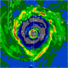
91L has a moderately strong surface high ENE to its axis that's running around 1029mb. Pressures directly north of the system is probably somewhere between 1024-1026. There is a 1024 surface high around Bermuda. There should be a lower background pressure for whatever becomes of 91L versus the lower level conditions Chris encountered. 1009mb surface low isn't too shabby for a wave. This thing still has solid organization, it just needs convection and more defined westerly component on the southside to get those T numbers over 2.0. This still one of stronger systems we have had over the MDR this year, but overall it is still unimpressive versus waves around this time in 2004 and 2003 (not counting last year). I still think this becomes a depression and a tropical storm, but it will be sheered apart if it gets too stacked prior to encountering strong upper-level shear. It may actually be more of a threat if it manages to remain a weak/shallow system, slips wsw of the ULL, and makes it into the Eastern Caribbean late week. Things could get much more interesting then.
Last edited by Windspeed on Mon Aug 07, 2006 2:15 pm, edited 2 times in total.
0 likes   

Bailey1777
S2K Supporter
S2K Supporter
Posts: 962
Joined: Mon Jul 31, 2006 6:23 pm
Location: Houston, Texas

#58 Postby Bailey1777 » Mon Aug 07, 2006 2:14 pm

New Dvorak 1.0 / 1.0
0 likes   

Sanibel
Category 5
Category 5
Posts: 10375
Joined: Mon Aug 30, 2004 11:06 pm
Location: Offshore SW Florida

#59 Postby Sanibel » Mon Aug 07, 2006 2:30 pm

There's obviously an inhibiting environment preventing convection this year.
0 likes   

User avatar
Hybridstorm_November2001
S2K Supporter
S2K Supporter
Posts: 2813
Joined: Sat Aug 21, 2004 2:50 pm
Location: SW New Brunswick, Canada
Contact:

#60 Postby Hybridstorm_November2001 » Mon Aug 07, 2006 2:32 pm

rnbaida wrote:This is 100% a fish... It wont even come close to the bahamas.


No one can know that at this stage of the game.
0 likes   


Return to “Talkin' Tropics”

Who is online

Users browsing this forum: Google Adsense [Bot], ouragans, SconnieCane and 45 guests