
Invest 91L,E of Windwards,Comments,Sat Pics,Models Thread
Moderator: S2k Moderators
Forum rules

The posts in this forum are NOT official forecasts and should not be used as such. They are just the opinion of the poster and may or may not be backed by sound meteorological data. They are NOT endorsed by any professional institution or STORM2K. For official information, please refer to products from the National Hurricane Center and National Weather Service.
-
cycloneye

- Admin

- Posts: 149508
- Age: 69
- Joined: Thu Oct 10, 2002 10:54 am
- Location: San Juan, Puerto Rico
0 likes
Visit the Caribbean-Central America Weather Thread where you can find at first post web cams,radars
and observations from Caribbean basin members Click Here
and observations from Caribbean basin members Click Here
-
Derek Ortt
-
Matt-hurricanewatcher
The shear is quite strong out of the southwest right now...Based on the clouds shearing off the big ball of convection in front of the low. Eastly shear is pounding all the convection to the west...Which has not allowed for the LLC to form any convection. But the LLC looks to be moving west-northwest away from the core of the eastly shear shown on the cimss 850 millibar maps. Maybe north of 12 now. You can also see that the small MLC/LLC feature has went under the new developing clouds over the last frame. I'm not 100 percent sure about this but I'm sure about the overall broad LLC.
So as it moves more north=less eastly shear. Also the convection(Wave derek is talking about) should make a little space north of 12 for slightly more faverable enviroment for some slow development.
So as it moves more north=less eastly shear. Also the convection(Wave derek is talking about) should make a little space north of 12 for slightly more faverable enviroment for some slow development.
0 likes

-
SouthFloridawx

- S2K Supporter

- Posts: 8346
- Age: 47
- Joined: Tue Jul 26, 2005 1:16 am
- Location: Sarasota, FL
- Contact:
I think the 805's Position is not quite correct.
I see it being east of there.

http://hadar.cira.colostate.edu/ramsdis ... at2_0.html
I see it being east of there.
http://hadar.cira.colostate.edu/ramsdis ... at2_0.html
0 likes
-
SouthFloridawx
- S2K Supporter
- Posts: 8346
- Age: 47
- Joined: Tue Jul 26, 2005 1:16 am
- Location: Sarasota, FL
- Contact:
As it moves west it may be in a much better environment with less shear.
http://cimss.ssec.wisc.edu/tropic/real- ... g8sht.html
http://cimss.ssec.wisc.edu/tropic/real- ... g8sht.html
0 likes
-
Derek Ortt
-
CrazyC83
- Professional-Met

- Posts: 34315
- Joined: Tue Mar 07, 2006 11:57 pm
- Location: Deep South, for the first time!
SouthFloridawx wrote:As it moves west it may be in a much better environment with less shear.
http://cimss.ssec.wisc.edu/tropic/real- ... g8sht.html
Less shear? More like NO shear...
0 likes

-
Matt-hurricanewatcher
-
ConvergenceZone
.gif)
- Category 5

- Posts: 5241
- Joined: Fri Jul 29, 2005 1:40 am
- Location: Northern California
Matt-hurricanewatcher wrote:This is just amazing on how unfaverable the Atlantic is turning out to be. I think the SOI talking about on the other thread being neg. Which makes everything like a el nino have something to do with it.
That's why I"m wondering how the heck do any hurricanes suppose to develop this year in the Atlantic? And where's the evidence that this shear and hostile conditions will even decrease as time goes on??
I'm starting to get a bit skeptical about this season myelf now. I just don't see any evidence that things are changing and conditions are getting better.
0 likes
-
cycloneye
- Admin
- Posts: 149508
- Age: 69
- Joined: Thu Oct 10, 2002 10:54 am
- Location: San Juan, Puerto Rico
ABNT20 KNHC 070221
TWOAT
TROPICAL WEATHER OUTLOOK
NWS TPC/NATIONAL HURRICANE CENTER MIAMI FL
1030 PM EDT SUN AUG 6 2006
FOR THE NORTH ATLANTIC...CARIBBEAN SEA AND THE GULF OF MEXICO...
SHOWER ACTIVITY HAS INCREASED THIS EVENING WITH THE AREA OF LOW
PRESSURE LOCATED ABOUT 1500 MILES EAST OF THE SOUTHERN WINDWARD
ISLANDS. THE SYSTEM CONTINUES TO IMPROVE IN ORGANIZATION AND A
TROPICAL DEPRESSION COULD FORM DURING THE NEXT DAY OR SO AS THE
SYSTEM MOVES WESTWARD AT 10 TO 15 MPH.
ELSEWHERE...TROPICAL STORM FORMATION IS NOT EXPECTED THROUGH
TUESDAY.
$$
FORECASTER MAINELLI/FRANKLIN
0 likes
Visit the Caribbean-Central America Weather Thread where you can find at first post web cams,radars
and observations from Caribbean basin members Click Here
and observations from Caribbean basin members Click Here
-
Extremeweatherguy

- Category 5
- Posts: 11095
- Joined: Mon Oct 10, 2005 8:13 pm
- Location: Florida
wow. That is an impressive TWO from Franklin.cycloneye wrote:ABNT20 KNHC 070221
TWOAT
TROPICAL WEATHER OUTLOOK
NWS TPC/NATIONAL HURRICANE CENTER MIAMI FL
1030 PM EDT SUN AUG 6 2006
FOR THE NORTH ATLANTIC...CARIBBEAN SEA AND THE GULF OF MEXICO...
SHOWER ACTIVITY HAS INCREASED THIS EVENING WITH THE AREA OF LOW
PRESSURE LOCATED ABOUT 1500 MILES EAST OF THE SOUTHERN WINDWARD
ISLANDS. THE SYSTEM CONTINUES TO IMPROVE IN ORGANIZATION AND A
TROPICAL DEPRESSION COULD FORM DURING THE NEXT DAY OR SO AS THE
SYSTEM MOVES WESTWARD AT 10 TO 15 MPH.
ELSEWHERE...TROPICAL STORM FORMATION IS NOT EXPECTED THROUGH
TUESDAY.
$$
FORECASTER MAINELLI/FRANKLIN
0 likes
-
Brent
- S2K Supporter
- Posts: 38755
- Age: 37
- Joined: Sun May 16, 2004 10:30 pm
- Location: Tulsa Oklahoma
- Contact:
cycloneye wrote:ABNT20 KNHC 070221
TWOAT
TROPICAL WEATHER OUTLOOK
NWS TPC/NATIONAL HURRICANE CENTER MIAMI FL
1030 PM EDT SUN AUG 6 2006
FOR THE NORTH ATLANTIC...CARIBBEAN SEA AND THE GULF OF MEXICO...
SHOWER ACTIVITY HAS INCREASED THIS EVENING WITH THE AREA OF LOW
PRESSURE LOCATED ABOUT 1500 MILES EAST OF THE SOUTHERN WINDWARD
ISLANDS. THE SYSTEM CONTINUES TO IMPROVE IN ORGANIZATION AND A
TROPICAL DEPRESSION COULD FORM DURING THE NEXT DAY OR SO AS THE
SYSTEM MOVES WESTWARD AT 10 TO 15 MPH.
ELSEWHERE...TROPICAL STORM FORMATION IS NOT EXPECTED THROUGH
TUESDAY.
$$
FORECASTER MAINELLI/FRANKLIN
Debby? Is that you?
0 likes
#neversummer
-
AJC3

- Admin
- Posts: 4156
- Age: 62
- Joined: Tue Aug 31, 2004 7:04 pm
- Location: Ballston Spa, New York
- Contact:
Matt-hurricanewatcher wrote:This is just amazing on how unfaverable the Atlantic is turning out to be. I think the SOI talking about on the other thread being neg. Which makes everything like a el nino have something to do with it.
http://www.ssd.noaa.gov/PS/TROP/genesis.html
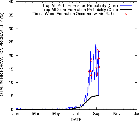
None of the genesis paramaters in the tropical Atlantic MDR have been particularly unfavorable for any length of time. WVBT has been a bit above normal, perhaps signifying a little more drying/subsidence than normal. However, shear and instability haven't looked particularly detrimental to TC genesis.
In fact, the current formation probability is well above the climo.
I don't need to remind ya that it's only 6 August, do I?
0 likes
-
HurricaneMaster_PR

- Category 2

- Posts: 795
- Joined: Tue Jul 22, 2003 6:23 pm
- Location: San Juan, Puerto Rico
AJC3 wrote:Matt-hurricanewatcher wrote:This is just amazing on how unfaverable the Atlantic is turning out to be. I think the SOI talking about on the other thread being neg. Which makes everything like a el nino have something to do with it.
http://www.ssd.noaa.gov/PS/TROP/genesis.html
None of the genesis paramaters in the tropical Atlantic MDR have been particularly unfavorable for any length of time. WVBT has been a bit above normal, perhaps signifying a little more drying/subsidence than normal. However, shear and instability haven't looked particularly detrimental to TC genesis.
In fact, the current formation probability is well above the climo.
I don't need to remind ya that it's only 6 August, do I?
Well said AJ!
0 likes

-
Weatherfreak14

- Category 5
- Posts: 1381
- Joined: Sat Sep 24, 2005 3:40 pm
- Location: Beaufort, SC
- Contact:
-
caneman
Who is online
Users browsing this forum: Ulf and 181 guests