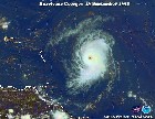
Atlantic Tropical Waves,Comments,Sat Pics Thread #2

This is the general tropical discussion area. Anyone can take their shot at predicting a storms path.

Moderator: S2k Moderators

Forum rules

The posts in this forum are NOT official forecasts and should not be used as such. They are just the opinion of the poster and may or may not be backed by sound meteorological data. They are NOT endorsed by any professional institution or STORM2K. For official information, please refer to products from the National Hurricane Center and National Weather Service.

Help Support Storm2K
Message
Author
User avatar
skysummit
S2K Supporter
S2K Supporter
Posts: 5305
Age: 49
Joined: Tue Aug 31, 2004 11:09 pm
Location: Ponchatoula, LA
Contact:

#81 Postby skysummit » Wed Jul 05, 2006 11:56 pm

LaBreeze wrote:We watch KATC Channel 3 with Rob Perillo, KLFY Channel 10 -both out of Lafayette, and KPLC Channel 7 out of Lake Charles. Do you get any of these? Rob is really good.


No we don't get those here in Houma. I probably could if I had a long range antenna though. Our cable company has WWL, WDSU, FOX8, WGNO from New Orleans, and the 3 Baton Rouge stations.
0 likes   

O Town
S2K Supporter
S2K Supporter
Posts: 5205
Age: 52
Joined: Wed Sep 07, 2005 9:37 pm
Location: Orlando, Florida 28°35'35"N 81°22'55"W

#82 Postby O Town » Thu Jul 06, 2006 6:51 am

Pretty decent wave exiting Africa today. How long before it goes POOF? :P

Image

http://img68.imageshack.us/img68/6261/waveola3hc.jpg
0 likes   

User avatar
cycloneye
Admin
Admin
Posts: 146196
Age: 69
Joined: Thu Oct 10, 2002 10:54 am
Location: San Juan, Puerto Rico

#83 Postby cycloneye » Thu Jul 06, 2006 7:25 am

Full Disk

:uarrow: :uarrow: :uarrow:

O Town showed a good wave is emerging Western Africa.Above is a good view from the full disk image.
0 likes   

User avatar
DESTRUCTION5
Category 5
Category 5
Posts: 4423
Age: 43
Joined: Wed Sep 03, 2003 11:25 am
Location: Stuart, FL

#84 Postby DESTRUCTION5 » Thu Jul 06, 2006 7:29 am

Both GFS and canadian show some pretty nice TW's running under a pretty huge Bermuda high over the nxt 5 days..Lets see if they develop further in runs to come
0 likes   
GATOR NATION IS E V E R Y W H E R E !

HurricaneHunter914
Category 5
Category 5
Posts: 4439
Age: 31
Joined: Fri Mar 10, 2006 7:36 pm
Location: College Station, TX

#85 Postby HurricaneHunter914 » Thu Jul 06, 2006 10:21 am

http://www.ssd.noaa.gov/PS/TROP/DATA/RT/EATL/IR4/20.jpg

Nice looking wave emerging off the coast of Africa.
0 likes   
Personal Forecast Disclaimer:
The posts in this forum are NOT official forecast and should not be used as such. They are just the opinion of the poster and may or may not be backed by sound meteorological data. They are NOT endorsed by any professional institution or storm2k.org. For official information, please refer to the NHC and NWS products.

User avatar
Weathermaster
Tropical Depression
Tropical Depression
Posts: 79
Joined: Thu Sep 04, 2003 10:33 am
Location: Carolina, PR

Look at the one on longitude 35

#86 Postby Weathermaster » Thu Jul 06, 2006 11:01 am

This wave has increase since this morning, and some slow development could be expected according to NWS in San Juan. It looks like the Atlantic is ready to rumble!!!.
0 likes   

HurricaneHunter914
Category 5
Category 5
Posts: 4439
Age: 31
Joined: Fri Mar 10, 2006 7:36 pm
Location: College Station, TX

#87 Postby HurricaneHunter914 » Thu Jul 06, 2006 11:10 am

Wow a CapeVerdeWave with some slow development possible? That was really quick.
0 likes   
Personal Forecast Disclaimer:
The posts in this forum are NOT official forecast and should not be used as such. They are just the opinion of the poster and may or may not be backed by sound meteorological data. They are NOT endorsed by any professional institution or storm2k.org. For official information, please refer to the NHC and NWS products.

User avatar
SouthFloridawx
S2K Supporter
S2K Supporter
Posts: 8346
Age: 46
Joined: Tue Jul 26, 2005 1:16 am
Location: Sarasota, FL
Contact:

#88 Postby SouthFloridawx » Thu Jul 06, 2006 11:13 am

HurricaneHunter914 wrote:Wow a CapeVerdeWave with some slow development possible? That was really quick.


No this is a CapeVerdeWave and he is probably not going to develope into a tropical system. http://www.storm2k.org/phpbb2/profile.p ... ile&u=6447 :lol: :lol: :lol:
0 likes   

HurricaneHunter914
Category 5
Category 5
Posts: 4439
Age: 31
Joined: Fri Mar 10, 2006 7:36 pm
Location: College Station, TX

#89 Postby HurricaneHunter914 » Thu Jul 06, 2006 11:15 am

I knew someone would do that. :ggreen: :lol: :lol:
0 likes   
Personal Forecast Disclaimer:
The posts in this forum are NOT official forecast and should not be used as such. They are just the opinion of the poster and may or may not be backed by sound meteorological data. They are NOT endorsed by any professional institution or storm2k.org. For official information, please refer to the NHC and NWS products.

User avatar
NONAME
Category 1
Category 1
Posts: 373
Age: 35
Joined: Sat Mar 18, 2006 8:15 am
Location: Where the Wind Blows

Re: Look at the one on longitude 35

#90 Postby NONAME » Thu Jul 06, 2006 11:18 am

Weathermaster wrote:This wave has increase since this morning, and some slow development could be expected according to NWS in San Juan. It looks like the Atlantic is ready to rumble!!!.


Can you give me the link to San Juan's Disscusion please.
0 likes   

User avatar
skysummit
S2K Supporter
S2K Supporter
Posts: 5305
Age: 49
Joined: Tue Aug 31, 2004 11:09 pm
Location: Ponchatoula, LA
Contact:

Re: Look at the one on longitude 35

#91 Postby skysummit » Thu Jul 06, 2006 11:40 am

NONAME wrote:
Weathermaster wrote:This wave has increase since this morning, and some slow development could be expected according to NWS in San Juan. It looks like the Atlantic is ready to rumble!!!.


Can you give me the link to San Juan's Disscusion please.


From the San Juan Disco:

THE GFS MODEL IS SUGGESTING A SLOW DEVELOPMENT OF A TROPICAL WAVE
NOW LOCATED AT AROUND 35 W. THIS WAVE IS EXPECTED TO MOVE ACROSS
OUR LOCAL REGION BETWEEN SUNDAY NIGHT AND MONDAY. THEREFORE
STARTED TO INTRODUCED ACTIVE WEATHER ASSOCIATED TO THE WAVE ON
SUNDAY NIGHT.

http://www.srh.noaa.gov/data/JSJ/AFDSJU
0 likes   

User avatar
Ola
Category 1
Category 1
Posts: 299
Joined: Mon Apr 21, 2003 11:24 pm
Location: Dorado, Puerto Rico

Re: Look at the one on longitude 35

#92 Postby Ola » Thu Jul 06, 2006 11:42 am

NONAME wrote:
Weathermaster wrote:This wave has increase since this morning, and some slow development could be expected according to NWS in San Juan. It looks like the Atlantic is ready to rumble!!!.


Can you give me the link to San Juan's Disscusion please.


http://www.srh.noaa.gov/port/pil.php?pi ... &version=0

area forecast discussion
national weather service san juan pr
505 am ast thu jul 6 2006

. discussion ... the doppler radar showed isolated to scattered
showers over the atlantic and eastern waters of puerto rico. a few
of these showers moved inland without producing any significant
rainfall accumulations. these showers will continue to move
inland and affect the eastern and northern coastal sections of
puerto rico.

today ... limited moisture will interact with local effects and
produce isolated to scattered showers mainly over the
interior ... west and southwest sections of puerto rico. an increase
on moisture will occur on friday afternoon as a reflection of tutt
is expected to move across the local region. most of the weather
activity will occur on friday night through saturday morning.

the gfs model is suggesting a slow development of a tropical wave
now located at around 35 w. this wave is expected to move across
our local region between sunday night and monday. therefore
started to introduced active weather associated to the wave on
sunday night.

&&

. synopsis ... a 1030 mb surface high will extend from the east
central atlantic west southwest to the u. s. southeast coast ... the
bahamas and the northeast caribbean through monday ... producing a
moderate to fresh trade wind flow across the regional waters. a
tropical wave will move across the local area on sunday
night and monday.

&&

. marine ... mariners should exercise caution across all local waters
due to 15 to 19 knots winds producing choppy conditions across all
local waters. a significant increase on winds and seas will occur
on sunday and monday as
0 likes   

User avatar
SouthFloridawx
S2K Supporter
S2K Supporter
Posts: 8346
Age: 46
Joined: Tue Jul 26, 2005 1:16 am
Location: Sarasota, FL
Contact:

#93 Postby SouthFloridawx » Thu Jul 06, 2006 11:45 am

marine ... mariners should exercise caution across all local waters
due to 15 to 19 knots winds producing choppy conditions across all
local waters. a significant increase on winds and seas will occur
on sunday and monday as


As what???
0 likes   

User avatar
ammmyjjjj
Tropical Low
Tropical Low
Posts: 27
Joined: Wed Jun 07, 2006 4:23 pm
Location: Houston

#94 Postby ammmyjjjj » Thu Jul 06, 2006 4:41 pm

http://headlines.accuweather.com/news-s ... &article=3


Just wondering what you guys thought of this analysis
0 likes   

User avatar
Windtalker1
S2K Supporter
S2K Supporter
Posts: 523
Age: 37
Joined: Sun Jul 31, 2005 11:00 am
Location: Mesa, Arizona

#95 Postby Windtalker1 » Thu Jul 06, 2006 4:46 pm

Looks like a wave around 42/9 is starting to get it's act together. Slight spin noticed.........Does it look like it to those more experienced? http://www.ssd.noaa.gov/goes/east/catl/loop-avn.html
0 likes   

User avatar
SouthFloridawx
S2K Supporter
S2K Supporter
Posts: 8346
Age: 46
Joined: Tue Jul 26, 2005 1:16 am
Location: Sarasota, FL
Contact:

#96 Postby SouthFloridawx » Thu Jul 06, 2006 6:10 pm

Moved to the other thread.
Last edited by SouthFloridawx on Thu Jul 06, 2006 7:36 pm, edited 1 time in total.
0 likes   

User avatar
cycloneye
Admin
Admin
Posts: 146196
Age: 69
Joined: Thu Oct 10, 2002 10:54 am
Location: San Juan, Puerto Rico

#97 Postby cycloneye » Thu Jul 06, 2006 6:19 pm

SouthFloridawx,Also behind that piece of energy are more and at the end one bigger one emerging Africa.
0 likes   
Visit the Caribbean-Central America Weather Thread where you can find at first post web cams,radars
and observations from Caribbean basin members Click Here

User avatar
SouthFloridawx
S2K Supporter
S2K Supporter
Posts: 8346
Age: 46
Joined: Tue Jul 26, 2005 1:16 am
Location: Sarasota, FL
Contact:

#98 Postby SouthFloridawx » Thu Jul 06, 2006 7:16 pm

...TROPICAL WAVES...
TROPICAL WAVE IS ALONG 42W S OF 13N MOVING W 15-20 KT. BROAD
LOW/MID LEVEL SIGNATURE CURVATURE IS OBSERVED ON SATELLITE
IMAGERY. NO ASSOCIATED DEEP SHOWERS/TSTMS. COMPUTER MODELS
FORECAST THE WAVE TO AFFECT THE LESSER ANTILLES LATE SATURDAY
AND PUERTO RICO PROBABLY ON SUNDAY.


Comments on the energy I'm talking about above.
0 likes   

User avatar
cycloneye
Admin
Admin
Posts: 146196
Age: 69
Joined: Thu Oct 10, 2002 10:54 am
Location: San Juan, Puerto Rico

#99 Postby cycloneye » Thu Jul 06, 2006 7:39 pm

Full Disk

:uarrow: :uarrow:

Above is a full disk view of wave at 42w and parade in Africa.
0 likes   

User avatar
skysummit
S2K Supporter
S2K Supporter
Posts: 5305
Age: 49
Joined: Tue Aug 31, 2004 11:09 pm
Location: Ponchatoula, LA
Contact:

#100 Postby skysummit » Thu Jul 06, 2006 7:40 pm

Geez Luis...that train goes all the way into the Indian Ocean!
0 likes   


Return to “Talkin' Tropics”

Who is online

Users browsing this forum: jgh and 34 guests