Invest 90L,W.Caribbean,Comments,Sat Pics,Models Thread

This is the general tropical discussion area. Anyone can take their shot at predicting a storms path.

Moderator: S2k Moderators

Forum rules

The posts in this forum are NOT official forecasts and should not be used as such. They are just the opinion of the poster and may or may not be backed by sound meteorological data. They are NOT endorsed by any professional institution or STORM2K. For official information, please refer to products from the National Hurricane Center and National Weather Service.

Help Support Storm2K
Message
Author
MiamiensisWx

#121 Postby MiamiensisWx » Thu Jun 08, 2006 11:41 am

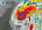
jschlitz wrote:Stratus - yes, very true, a lot will change. I don't think we'll have a good idea on what will happen until it emerges into the GOM.

This reminds me a lot of Cindy last year. I just think the outcome will be different.


I agree that it will be critical on what setup and synoptics will be taking place as it slowly moves into the BOC/Gulf area off the Yucatan. I also think it resembles Cindy in some ways, and there is potential the track may be somewhat similar, though different in terms of landfall area.
0 likes   

User avatar
lester
S2K Supporter
S2K Supporter
Posts: 1305
Age: 36
Joined: Sat Aug 27, 2005 5:21 pm
Location: Washington, DC
Contact:

#122 Postby lester » Thu Jun 08, 2006 11:42 am

Scorpion wrote:Time to lock the model discussion. :P

lol
CAT 5 IN MIAMI!! RUN!! :D :eek: :lol:
0 likes   

User avatar
coriolis
Retired Staff
Retired Staff
Posts: 8314
Joined: Wed Feb 05, 2003 10:58 pm
Location: Muncy, PA

#123 Postby coriolis » Thu Jun 08, 2006 11:44 am

:uarrow:

That was obviously a joke. However we try to avoid yelling FIRE in a crowed theater, if you know what I mean.
0 likes   
This space for rent.

User avatar
isobar0512
Tropical Low
Tropical Low
Posts: 12
Joined: Wed Jun 07, 2006 11:03 am
Location: Alabama Gulf Coast

#124 Postby isobar0512 » Thu Jun 08, 2006 11:46 am

What track did Cindy take?
0 likes   

MiamiensisWx

#125 Postby MiamiensisWx » Thu Jun 08, 2006 11:47 am

isobar0512 wrote:What track did Cindy take?


Hey, welcome to the boards!

:D :D :D :D

Here is Cindy's track...

http://weather.unisys.com/hurricane/atlantic/2005/CINDY/track.gif
0 likes   

User avatar
AnnularCane
S2K Supporter
S2K Supporter
Posts: 2882
Joined: Thu Jun 08, 2006 9:18 am
Location: Wytheville, VA

#126 Postby AnnularCane » Thu Jun 08, 2006 11:48 am

Cindy came to Southeast La. It seems to me that wherever the first storm of the season goes, the others tend to follow somewhat.
0 likes   

User avatar
Scott_inVA
Storm2k Forecaster
Storm2k Forecaster
Posts: 1238
Joined: Sat Oct 12, 2002 5:44 pm
Location: Lexington, Virginia
Contact:

#127 Postby Scott_inVA » Thu Jun 08, 2006 11:48 am

boca_chris wrote:Throw them out until an actual center can be positioned. The flow in that region as been SW to NE for a while now. To see it just stop is not likely in my opinion - i say it will edge northward into the Southern GOM and hitch a ridge on a trough that will dive down into the Southern US next week.


Overall, correct. Trof progged to dig down will enhance shear SW of FL. No surprise that's right where the tropicals end the "storm" in 120 hours.

Scott
0 likes   

User avatar
isobar0512
Tropical Low
Tropical Low
Posts: 12
Joined: Wed Jun 07, 2006 11:03 am
Location: Alabama Gulf Coast

#128 Postby isobar0512 » Thu Jun 08, 2006 11:49 am

Thanks for the info. Hope that doesn't repeat itself. Mississippi coastal residents don't even need TS winds.
0 likes   

User avatar
jasons2k
Storm2k Executive
Storm2k Executive
Posts: 8247
Age: 51
Joined: Wed Jul 06, 2005 12:32 pm
Location: The Woodlands, TX

#129 Postby jasons2k » Thu Jun 08, 2006 11:50 am

isobar0512 wrote:What track did Cindy take?


http://weather.unisys.com/hurricane/atl ... /track.gif

I wasn't referring to the final track though. It was more about the current position, and how it slowly tracked across the Yucatan before getting going. Also, the forecasts jumped a LOT, initally - from Mexico, then Texas (for awhile it really looked like Galveston was going to get it), but then she curved NE towards NOLA. There wasn't a good handle on its forecasted path until after she was out in the GOM with an organized center. I expect that to be the case with this system, if it even forms.
0 likes   

MiamiensisWx

#130 Postby MiamiensisWx » Thu Jun 08, 2006 11:52 am

I think here will be the two most likely synoptics and outcomes...

1. The storm slowly develops as the trough pulls away and the system edges into the BOC/southwestern to central Gulf off the Yucatan and begins to slowly move westward to northwestward as the second trough from the Texas area and Great Plains moves over the top of the system and developing ridge

2. The scenario boca_chris and Scott_inVa agrees on

The synoptics and how they play out will be critical over the next 24 hours and beyond. Just my two cents and analysis.
0 likes   

rockyman
Category 5
Category 5
Posts: 1967
Joined: Thu Jun 26, 2003 12:24 pm
Location: Dauphin Island, AL

#131 Postby rockyman » Thu Jun 08, 2006 12:09 pm

As usual, the crucial question right now is where does the low level center eventual coalesce....Right now, there's lots of vorticity and a couple of centers seem to be competing along a surface trough...if the southern one wins out, the system could die over Central America or even move into the E Pac...if the northern one wins out, we could have another Cindy-type scenario....or they could "meet in the middle", which would be a toss-up.

Right now, the southern end of the system has the best synoptics...low shear

My thoughts:

Image
0 likes   

User avatar
tailgater
S2K Supporter
S2K Supporter
Posts: 3339
Joined: Sun Jul 11, 2004 9:13 pm
Location: St. Amant La.

#132 Postby tailgater » Thu Jun 08, 2006 12:16 pm

Atlantic Tropical Weather Discussion
--------------------------------------------------------------------------------


000
AXNT20 KNHC 081658
TWDAT

TROPICAL WEATHER DISCUSSION
NWS TPC/NATIONAL HURRICANE CENTER MIAMI FL
205 PM EDT THU JUN 08 2006


.

...DISCUSSION...
.

CARIBBEAN SEA AND ATLANTIC OCEAN W OF 55W...
A DEEP-LAYER TROUGH/RIDGE PATTERN COVERS THIS REGION. THE DEEP
TROUGH AXIS RUNS FROM THE SE U.S. INTO THE SE GULF. THE
MID-UPPER RIDGE LIES TO THE EAST OF THE TROUGH CENTERED NEAR
23N66W WITH UPPER RIDGING EXTENDING SWWARD TO THE SW CARIBBEAN
AND NEWARD TO 32N54W. ABUNDANT TROPICAL MOISTURE IS BETWEEN
THESE FEATURES WHERE UPPER LEVEL DIFFLUENCE IS THE STRONGEST. AS
OF 1500 UTC...A SFC TROUGH EXTENDS FROM 32N66W ACROSS THE
BAHAMAS AND W CUBA TO OVER GUATEMALA. THIS BOUNDARY HAS BEEN IN
THIS VICINITY FOR MUCH OF THE WEEK...BUT TODAY CONVECTION HAS
BLOSSOMED ACROSS A GOOD PART OF THE AREA. THE MOST UNSETTLED
WEATHER IS WITHIN 280 NM E OF THE SFC TROUGH AXIS. A
BROAD/ILL-DEFINED AREA OF LOW PRES APPEARS TO BE FORMING AT THE
BASE OF THE SFC TROUGH NEAR BELIZE. SOME OF THE GLOBAL MODELS
SUGGEST THAT TC FORMATION MAY OCCUR FROM THIS ENERGY SOURCE OVER
THE NEXT FEW DAYS AS UPPER LEVEL WINDS BECOME A BIT LESS
HOSTILE. THE SFC TROUGH AND ASSOCIATED WEATHER WILL DRIFT WWARD
OVER THE YUCATAN PENINSULA AND INTO THE GULF OF MEXICO THIS
WEEKEND. IN THE EASTERN CARIBBEAN...DRY WEATHER CONTINUES UNDER
PLENTY OF STRONG SUBSIDENCE GENERATING BY THE UPPER RIDGE.
MAINLY FAIR WEATHER...BESIDES FOR SOME HIGH CLOUDINESS IS ALSO
OCCURRING IN THE ATLC BEYOND 360 NM OF THE SFC BOUNDARY DUE TO
HIGH PRES RIDGING FROM THE CENTRAL ATLC.
0 likes   

User avatar
terstorm1012
S2K Supporter
S2K Supporter
Posts: 1314
Age: 43
Joined: Fri Sep 10, 2004 5:36 pm
Location: Millersburg, PA

#133 Postby terstorm1012 » Thu Jun 08, 2006 12:16 pm

*deleted*

it was the TWD, already posted above.
0 likes   

User avatar
Extremeweatherguy
Category 5
Category 5
Posts: 11095
Joined: Mon Oct 10, 2005 8:13 pm
Location: Florida

#134 Postby Extremeweatherguy » Thu Jun 08, 2006 12:18 pm

tailgater wrote:Atlantic Tropical Weather Discussion
--------------------------------------------------------------------------------


000
AXNT20 KNHC 081658
TWDAT

TROPICAL WEATHER DISCUSSION
NWS TPC/NATIONAL HURRICANE CENTER MIAMI FL
205 PM EDT THU JUN 08 2006


.

...DISCUSSION...
.

CARIBBEAN SEA AND ATLANTIC OCEAN W OF 55W...
A DEEP-LAYER TROUGH/RIDGE PATTERN COVERS THIS REGION. THE DEEP
TROUGH AXIS RUNS FROM THE SE U.S. INTO THE SE GULF. THE
MID-UPPER RIDGE LIES TO THE EAST OF THE TROUGH CENTERED NEAR
23N66W WITH UPPER RIDGING EXTENDING SWWARD TO THE SW CARIBBEAN
AND NEWARD TO 32N54W. ABUNDANT TROPICAL MOISTURE IS BETWEEN
THESE FEATURES WHERE UPPER LEVEL DIFFLUENCE IS THE STRONGEST. AS
OF 1500 UTC...A SFC TROUGH EXTENDS FROM 32N66W ACROSS THE
BAHAMAS AND W CUBA TO OVER GUATEMALA. THIS BOUNDARY HAS BEEN IN
THIS VICINITY FOR MUCH OF THE WEEK...BUT TODAY CONVECTION HAS
BLOSSOMED ACROSS A GOOD PART OF THE AREA. THE MOST UNSETTLED
WEATHER IS WITHIN 280 NM E OF THE SFC TROUGH AXIS. A
BROAD/ILL-DEFINED AREA OF LOW PRES APPEARS TO BE FORMING AT THE
BASE OF THE SFC TROUGH NEAR BELIZE. SOME OF THE GLOBAL MODELS
SUGGEST THAT TC FORMATION MAY OCCUR FROM THIS ENERGY SOURCE OVER
THE NEXT FEW DAYS AS UPPER LEVEL WINDS BECOME A BIT LESS
HOSTILE. THE SFC TROUGH AND ASSOCIATED WEATHER WILL DRIFT WWARD
OVER THE YUCATAN PENINSULA AND INTO THE GULF OF MEXICO THIS
WEEKEND.
IN THE EASTERN CARIBBEAN...DRY WEATHER CONTINUES UNDER
PLENTY OF STRONG SUBSIDENCE GENERATING BY THE UPPER RIDGE.
MAINLY FAIR WEATHER...BESIDES FOR SOME HIGH CLOUDINESS IS ALSO
OCCURRING IN THE ATLC BEYOND 360 NM OF THE SFC BOUNDARY DUE TO
HIGH PRES RIDGING FROM THE CENTRAL ATLC.


Just wanted that sentence to be highlighted.
0 likes   

User avatar
AnnularCane
S2K Supporter
S2K Supporter
Posts: 2882
Joined: Thu Jun 08, 2006 9:18 am
Location: Wytheville, VA

#135 Postby AnnularCane » Thu Jun 08, 2006 12:23 pm

Extremeweatherguy wrote:
tailgater wrote:Atlantic Tropical Weather Discussion
--------------------------------------------------------------------------------


000
AXNT20 KNHC 081658
TWDAT

TROPICAL WEATHER DISCUSSION
NWS TPC/NATIONAL HURRICANE CENTER MIAMI FL
205 PM EDT THU JUN 08 2006


.

...DISCUSSION...
.

CARIBBEAN SEA AND ATLANTIC OCEAN W OF 55W...
A DEEP-LAYER TROUGH/RIDGE PATTERN COVERS THIS REGION. THE DEEP
TROUGH AXIS RUNS FROM THE SE U.S. INTO THE SE GULF. THE
MID-UPPER RIDGE LIES TO THE EAST OF THE TROUGH CENTERED NEAR
23N66W WITH UPPER RIDGING EXTENDING SWWARD TO THE SW CARIBBEAN
AND NEWARD TO 32N54W. ABUNDANT TROPICAL MOISTURE IS BETWEEN
THESE FEATURES WHERE UPPER LEVEL DIFFLUENCE IS THE STRONGEST. AS
OF 1500 UTC...A SFC TROUGH EXTENDS FROM 32N66W ACROSS THE
BAHAMAS AND W CUBA TO OVER GUATEMALA. THIS BOUNDARY HAS BEEN IN
THIS VICINITY FOR MUCH OF THE WEEK...BUT TODAY CONVECTION HAS
BLOSSOMED ACROSS A GOOD PART OF THE AREA. THE MOST UNSETTLED
WEATHER IS WITHIN 280 NM E OF THE SFC TROUGH AXIS. A
BROAD/ILL-DEFINED AREA OF LOW PRES APPEARS TO BE FORMING AT THE
BASE OF THE SFC TROUGH NEAR BELIZE. SOME OF THE GLOBAL MODELS
SUGGEST THAT TC FORMATION MAY OCCUR FROM THIS ENERGY SOURCE OVER
THE NEXT FEW DAYS AS UPPER LEVEL WINDS BECOME A BIT LESS
HOSTILE. THE SFC TROUGH AND ASSOCIATED WEATHER WILL DRIFT WWARD
OVER THE YUCATAN PENINSULA AND INTO THE GULF OF MEXICO THIS
WEEKEND.
IN THE EASTERN CARIBBEAN...DRY WEATHER CONTINUES UNDER
PLENTY OF STRONG SUBSIDENCE GENERATING BY THE UPPER RIDGE.
MAINLY FAIR WEATHER...BESIDES FOR SOME HIGH CLOUDINESS IS ALSO
OCCURRING IN THE ATLC BEYOND 360 NM OF THE SFC BOUNDARY DUE TO
HIGH PRES RIDGING FROM THE CENTRAL ATLC.


Just wanted that sentence to be highlighted.


What does that highlighted sentence mean?
0 likes   

User avatar
drezee
S2K Supporter
S2K Supporter
Posts: 3664
Joined: Mon Jun 09, 2003 12:49 pm
Location: FL

#136 Postby drezee » Thu Jun 08, 2006 12:30 pm

JB's video's are late today
0 likes   

HurricaneHunter914
Category 5
Category 5
Posts: 4439
Age: 31
Joined: Fri Mar 10, 2006 7:36 pm
Location: College Station, TX

#137 Postby HurricaneHunter914 » Thu Jun 08, 2006 12:31 pm

Well who would want to see JB's videos.
0 likes   
Personal Forecast Disclaimer:
The posts in this forum are NOT official forecast and should not be used as such. They are just the opinion of the poster and may or may not be backed by sound meteorological data. They are NOT endorsed by any professional institution or storm2k.org. For official information, please refer to the NHC and NWS products.

User avatar
drezee
S2K Supporter
S2K Supporter
Posts: 3664
Joined: Mon Jun 09, 2003 12:49 pm
Location: FL

#138 Postby drezee » Thu Jun 08, 2006 12:34 pm

515
WHXX04 KWBC 081732
CHGQLM
ATTENTION...NATIONAL HURRICANE CENTER

NCEP COUPLED GFDL HURRICANE MODEL FORECAST MADE FOR

TROPICAL DEPRESSION INVEST 90L

INITIAL TIME 12Z JUN 8

DISCLAIMER ... THIS INFORMATION IS PROVIDED AS GUIDANCE. IT
REQUIRES INTERPRETATION BY HURRICANE SPECIALISTS AND SHOULD
NOT BE CONSIDERED AS A FINAL PRODUCT. PLEASE SEE THE TPC/NHC
OFFICIAL FORECAST.


FORECAST STORM POSITION

HOUR LATITUDE LONGITUDE HEADING/SPEED(KT)

0 17.4 87.9 355./ 7.0
6 17.2 88.2 243./ 3.0
12 17.0 88.1 167./ 2.6
18 16.8 88.3 231./ 2.1
24 16.7 88.0 123./ 2.7
30 16.6 88.1 186./ 1.0
36 16.2 88.3 214./ 4.2
42 16.4 88.2 41./ 1.9
48 16.5 88.3 324./ 1.8
54 16.7 88.3 347./ 1.3
60 16.2 88.7 222./ 5.8
66 16.5 88.5 31./ 3.1
72 16.5 88.9 272./ 3.6
78 16.8 88.9 9./ 2.4
84 17.5 90.2 298./14.6
90 18.1 90.6 329./ 7.9
96 18.8 91.6 303./11.3
102 19.4 92.4 307./ 9.3
108 19.7 93.2 290./ 8.2
114 20.1 94.1 293./ 9.5
120 20.5 95.1 296./10.5
126 20.9 95.7 301./ 7.1
0 likes   

HurricaneHunter914
Category 5
Category 5
Posts: 4439
Age: 31
Joined: Fri Mar 10, 2006 7:36 pm
Location: College Station, TX

#139 Postby HurricaneHunter914 » Thu Jun 08, 2006 12:37 pm

TROPICAL DEPRESSION INVEST 90L


TROPICAL DEPRESSION?!
0 likes   
Personal Forecast Disclaimer:
The posts in this forum are NOT official forecast and should not be used as such. They are just the opinion of the poster and may or may not be backed by sound meteorological data. They are NOT endorsed by any professional institution or storm2k.org. For official information, please refer to the NHC and NWS products.

User avatar
Regit
Category 5
Category 5
Posts: 2341
Joined: Mon Sep 15, 2003 9:02 pm
Location: Myrtle Beach

#140 Postby Regit » Thu Jun 08, 2006 12:38 pm

Hurricane Hunter 914 wrote:Well who would want to see JB's videos.


Plenty of people, obviously
0 likes   


Return to “Talkin' Tropics”

Who is online

Users browsing this forum: kevin, Ulf and 16 guests