
92E Invest at EPAC,Comments,Sat Pics,Models Thread
Moderator: S2k Moderators
Forum rules

The posts in this forum are NOT official forecasts and should not be used as such. They are just the opinion of the poster and may or may not be backed by sound meteorological data. They are NOT endorsed by any professional institution or STORM2K. For official information, please refer to products from the National Hurricane Center and National Weather Service.
-
cycloneye

- Admin

- Posts: 148791
- Age: 69
- Joined: Thu Oct 10, 2002 10:54 am
- Location: San Juan, Puerto Rico
Broad elongated low pressure.
0 likes
Visit the Caribbean-Central America Weather Thread where you can find at first post web cams,radars
and observations from Caribbean basin members Click Here
and observations from Caribbean basin members Click Here


-
cycloneye
- Admin
- Posts: 148791
- Age: 69
- Joined: Thu Oct 10, 2002 10:54 am
- Location: San Juan, Puerto Rico
ABPZ20 KNHC 022251
TWOEP
TROPICAL WEATHER OUTLOOK
NWS TPC/NATIONAL HURRICANE CENTER MIAMI FL
400 PM PDT FRI JUN 2 2006
FOR THE EASTERN NORTH PACIFIC...EAST OF 140 DEGREES WEST LONGITUDE..
A LARGE AREA OF DISTURBED WEATHER CENTERED AROUND 350 MILES
SOUTHWEST OF ACAPULCO MEXICO HAS CHANGED LITTLE IN ORGANIZATION
THIS AFTERNOON. HOWEVER...ENVIRONMENTAL CONDITIONS APPEAR TO BE
FAVORABLE FOR A TROPICAL DEPRESSION TO FORM DURING THE NEXT DAY OR
TWO AS THE SYSTEM DRIFTS GENERALLY NORTHWARD.
ELSEWHERE...TROPICAL STORM FORMATION IS NOT EXPECTED THROUGH
SATURDAY.
FORECASTER MAINELLI/BEVEN
$$
0 likes
Visit the Caribbean-Central America Weather Thread where you can find at first post web cams,radars
and observations from Caribbean basin members Click Here
and observations from Caribbean basin members Click Here
-
feederband

- S2K Supporter

- Posts: 3423
- Joined: Wed Oct 01, 2003 6:21 pm
- Location: Lakeland Fl
cycloneye wrote:ABPZ20 KNHC 022251
TWOEP
TROPICAL WEATHER OUTLOOK
NWS TPC/NATIONAL HURRICANE CENTER MIAMI FL
400 PM PDT FRI JUN 2 2006
FOR THE EASTERN NORTH PACIFIC...EAST OF 140 DEGREES WEST LONGITUDE..
A LARGE AREA OF DISTURBED WEATHER CENTERED AROUND 350 MILES
SOUTHWEST OF ACAPULCO MEXICO HAS CHANGED LITTLE IN ORGANIZATION
THIS AFTERNOON. HOWEVER...ENVIRONMENTAL CONDITIONS APPEAR TO BE
FAVORABLE FOR A TROPICAL DEPRESSION TO FORM DURING THE NEXT DAY OR
TWO AS THE SYSTEM DRIFTS GENERALLY NORTHWARD.
ELSEWHERE...TROPICAL STORM FORMATION IS NOT EXPECTED THROUGH
SATURDAY.
FORECASTER MAINELLI/BEVEN
$$
0 likes
-
feederband
- S2K Supporter
- Posts: 3423
- Joined: Wed Oct 01, 2003 6:21 pm
- Location: Lakeland Fl


-
SouthFloridawx

- S2K Supporter
- Posts: 8346
- Age: 47
- Joined: Tue Jul 26, 2005 1:16 am
- Location: Sarasota, FL
- Contact:


-
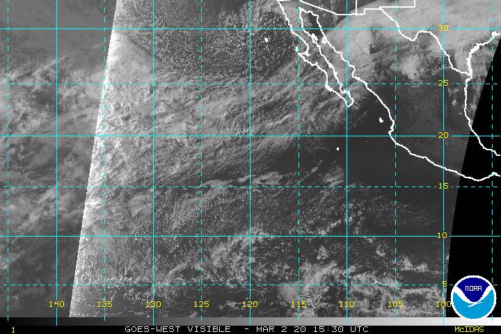
MiamiensisWx
Looks a bit better and closer to a tropical depression now, but the environment continues to be unfavorable...
Infra-red imagery
Visible imagery
Compared to just earlier, convective organization has improved and consolidated over the center, and banding features have improved. NOW it looks more like a tropical depression.
Infra-red imagery
Visible imagery
Compared to just earlier, convective organization has improved and consolidated over the center, and banding features have improved. NOW it looks more like a tropical depression.
0 likes
-
SouthFloridawx
- S2K Supporter
- Posts: 8346
- Age: 47
- Joined: Tue Jul 26, 2005 1:16 am
- Location: Sarasota, FL
- Contact:


-
SouthFloridawx
- S2K Supporter
- Posts: 8346
- Age: 47
- Joined: Tue Jul 26, 2005 1:16 am
- Location: Sarasota, FL
- Contact:

-
SouthFloridawx
- S2K Supporter
- Posts: 8346
- Age: 47
- Joined: Tue Jul 26, 2005 1:16 am
- Location: Sarasota, FL
- Contact:
000
ABPZ20 KNHC 022251
TWOEP
TROPICAL WEATHER OUTLOOK
NWS TPC/NATIONAL HURRICANE CENTER MIAMI FL
400 PM PDT FRI JUN 2 2006
FOR THE EASTERN NORTH PACIFIC...EAST OF 140 DEGREES WEST LONGITUDE..
A LARGE AREA OF DISTURBED WEATHER CENTERED AROUND 350 MILES
SOUTHWEST OF ACAPULCO MEXICO HAS CHANGED LITTLE IN ORGANIZATION
THIS AFTERNOON. HOWEVER...ENVIRONMENTAL CONDITIONS APPEAR TO BE
FAVORABLE FOR A TROPICAL DEPRESSION TO FORM DURING THE NEXT DAY OR
TWO AS THE SYSTEM DRIFTS GENERALLY NORTHWARD.
ELSEWHERE...TROPICAL STORM FORMATION IS NOT EXPECTED THROUGH
SATURDAY.
FORECASTER MAINELLI/BEVEN
$$
0 likes
-
SouthFloridawx
- S2K Supporter
- Posts: 8346
- Age: 47
- Joined: Tue Jul 26, 2005 1:16 am
- Location: Sarasota, FL
- Contact:
CapeVerdeWave wrote:Any links to the newest QUICKSCAT?
http://manati.orbit.nesdis.noaa.gov/quikscat/
0 likes
-
MiamiensisWx
-
SouthFloridawx
- S2K Supporter
- Posts: 8346
- Age: 47
- Joined: Tue Jul 26, 2005 1:16 am
- Location: Sarasota, FL
- Contact:
000
AXPZ20 KNHC 022156
TWDEP
TROPICAL WEATHER DISCUSSION
NWS TPC/NATIONAL HURRICANE CENTER MIAMI FL
2205 UTC FRI JUN 02 2006
TROPICAL WEATHER DISCUSSION FOR THE EASTERN PACIFIC OCEAN FROM
THE EQUATOR TO 32N...EAST OF 140W. THE FOLLOWING INFORMATION IS
BASED ON SATELLITE IMAGERY...WEATHER OBSERVATIONS...RADAR...AND
METEOROLOGICAL ANALYSIS.
BASED ON 1800 UTC SURFACE ANALYSIS AND SATELLITE IMAGERY THROUGH
2145 UTC.
...SPECIAL FEATURE...
A 1006 MB LOW IS CENTERED ABOUT 350 NM SW OF ACAPULCO MEXICO
NEAR 13N103W WITH ONLY A SLIGHT NW DRIFT. VISIBLE SATELLITE
IMAGERY CONTINUES TO SUGGESTS THAT THE LOW IS EMBEDDED WITHIN AN
ELONGATED TROUGH THAT EXTENDS NE TOWARDS ACAPULCO. AN UPPER
LEVEL ANTICYCLONE IS CENTERED OVER THIS AREA NEAR 15N103W AND
DIVERGENCE ALOFT IS INITIATING A CLUSTER OF CONVECTION W OF THE
SURFACE LOW AS WELL AS ALONG THE TROUGH. NUMEROUS
MODERATE/STRONG CONVECTION IS NOTED W OF THE LOW CENTER WITHIN
60-75 NM OF 12.5N105.5W. SCATTERED MODERATE ISOLATED STRONG WAS
NOTED ELSEWHERE FROM 10N TO 15N BETWEEN 95W AND 103W.
THE OVERALL CIRCULATION OF THE SYSTEM IS STILL TOO
ELONGATED...BUT TROPICAL CYCLONE DEVELOPMENT STILL APPEARS
POSSIBLE WITHIN THE NEXT 24-36 HRS.
0 likes
-
StormScanWx
- Category 5

- Posts: 1242
- Joined: Mon Dec 05, 2005 7:53 pm

Who is online
Users browsing this forum: wwizard and 156 guests