91L Invest,Comments,Sat Pics,Models Thread
Moderator: S2k Moderators
Forum rules

The posts in this forum are NOT official forecasts and should not be used as such. They are just the opinion of the poster and may or may not be backed by sound meteorological data. They are NOT endorsed by any professional institution or STORM2K. For official information, please refer to products from the National Hurricane Center and National Weather Service.
-
JamesFromMaine2

- Category 4

- Posts: 989
- Joined: Tue Jul 19, 2005 1:38 am
- Location: Portland Maine USA
- Contact:
-
SouthFloridawx

- S2K Supporter

- Posts: 8346
- Age: 47
- Joined: Tue Jul 26, 2005 1:16 am
- Location: Sarasota, FL
- Contact:
-
SouthFloridawx
- S2K Supporter
- Posts: 8346
- Age: 47
- Joined: Tue Jul 26, 2005 1:16 am
- Location: Sarasota, FL
- Contact:
-
JamesFromMaine2
- Category 4
- Posts: 989
- Joined: Tue Jul 19, 2005 1:38 am
- Location: Portland Maine USA
- Contact:
-
MiamiensisWx
-
JamesFromMaine2
- Category 4
- Posts: 989
- Joined: Tue Jul 19, 2005 1:38 am
- Location: Portland Maine USA
- Contact:
-
cycloneye

- Admin

- Posts: 148797
- Age: 69
- Joined: Thu Oct 10, 2002 10:54 am
- Location: San Juan, Puerto Rico
Remember dont post superlong links that the members have to scroll. 
0 likes
Visit the Caribbean-Central America Weather Thread where you can find at first post web cams,radars
and observations from Caribbean basin members Click Here
and observations from Caribbean basin members Click Here
-
SouthFloridawx
- S2K Supporter
- Posts: 8346
- Age: 47
- Joined: Tue Jul 26, 2005 1:16 am
- Location: Sarasota, FL
- Contact:


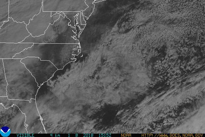


So it begins then!
It looks useless though, then again at this time of year they very rarely do look any good!
Still there is some obvious circulation about though looking at that image above.
It looks useless though, then again at this time of year they very rarely do look any good!
Still there is some obvious circulation about though looking at that image above.
0 likes
Personal Forecast Disclaimer:
The posts in this forum are NOT official forecast and should not be used as such. They are just the opinion of the poster and may or may not be backed by sound meteorological data. They are NOT endorsed by any professional institution or storm2k.org. For official information, please refer to the NHC and NWS products
The posts in this forum are NOT official forecast and should not be used as such. They are just the opinion of the poster and may or may not be backed by sound meteorological data. They are NOT endorsed by any professional institution or storm2k.org. For official information, please refer to the NHC and NWS products
-
cycloneye
- Admin
- Posts: 148797
- Age: 69
- Joined: Thu Oct 10, 2002 10:54 am
- Location: San Juan, Puerto Rico
James I took out the superlong link and posted the hypertext smaller version.
0 likes
Visit the Caribbean-Central America Weather Thread where you can find at first post web cams,radars
and observations from Caribbean basin members Click Here
and observations from Caribbean basin members Click Here
-
stormtruth

- Category 2

- Posts: 651
- Joined: Thu Mar 16, 2006 4:15 pm
-
MiamiensisWx
-
SouthFloridawx
- S2K Supporter
- Posts: 8346
- Age: 47
- Joined: Tue Jul 26, 2005 1:16 am
- Location: Sarasota, FL
- Contact:
CapeVerdeWave wrote:I really doubt it will develop. This is very similar to the previous Bahamas system in characteristics and environment to some degree. Who agrees?
An invest was not issued for that system as it was not needed. It was an upper level low.
From the 205pm twd
ATLANTIC OCEAN...
THE WESTERN SW N ATLC CONTINUES TO BE DOMINATED BY A SHORTWAVE
TROUGH WITH ITS MEAN AXIS LYING N TO S ALONG 73W. DIFFLUENCE E
OF THE TROUGH ASSOCIATED WITH A SURFACE COLD FRONT CONTINUES TO
ENHANCING CONVECTION AHEAD. THE FRONT CURRENTLY EXTENDS FROM A
1008 MB LOW NEAR 32N72W TO 22N87W. THE CONVECTION WELL OUT IN
FRONT AND IS CONCENTRATED WITHIN 60 NM EITHER SIDE OF LINE FROM
30N67W 27N70W. IMMEDIATELY E...A SHORTWAVE RIDGE EXTENDS N FROM
NEAR 19N61W ALONG 26N57W 32N56W...THEN CONTINUES NE TO WELL N
OF THE AREA EFFECTIVELY SEPARATING THE TROUGH ALONG THE E COAST
OF CONUS FROM A LONGWAVE TROUGH THAT DOMINATES THE CENTRAL N
ATLC. AT THE SURFACE...1030 MB HIGH LOCATED NEAR 39N41W WITH
RIDGE EXTENDING SW TO NEAR 25N64W CONTINUES TO DOMINATE.
THE EXTREME E ATLC...AN UPPER ANTICYCLONE IS ESTIMATED NEAR 8N7E
AND RIDGES W ALONG 7N47W.
0 likes
-
MiamiensisWx
-
SouthFloridawx
- S2K Supporter
- Posts: 8346
- Age: 47
- Joined: Tue Jul 26, 2005 1:16 am
- Location: Sarasota, FL
- Contact:

Who is online
Users browsing this forum: Steve and 96 guests