Possible tropical System Forming in the Bahamas?
Moderator: S2k Moderators
Forum rules

The posts in this forum are NOT official forecasts and should not be used as such. They are just the opinion of the poster and may or may not be backed by sound meteorological data. They are NOT endorsed by any professional institution or STORM2K. For official information, please refer to products from the National Hurricane Center and National Weather Service.


-
Evil Jeremy

- S2K Supporter

- Posts: 5463
- Age: 32
- Joined: Mon Apr 10, 2006 2:10 pm
- Location: Los Angeles, CA

Turks & Caicos
Weather again here today is not looking good......very dark and very dreary.
Cistern is now full from all the rain we have been receiving here over the past few days or so...roads here are an absolute mess.....
Gretchen
Cistern is now full from all the rain we have been receiving here over the past few days or so...roads here are an absolute mess.....
Gretchen
0 likes
-
cheezyWXguy

- Category 5

- Posts: 6247
- Joined: Mon Feb 13, 2006 12:29 am
- Location: Dallas, TX
-
Weatherfreak000
-
weatherwoman132

- Category 1

- Posts: 305
- Joined: Wed Mar 08, 2006 7:26 pm
-
Air Force Met
- Military Met

- Posts: 4372
- Age: 56
- Joined: Tue Jul 08, 2003 9:30 am
- Location: Roan Mountain, TN
weatherwoman132 wrote:it does look sorta tropical
Gotta disagree there. It doesn't look at all tropical. If you look at the Vis, IR and WV images together, it looks like a classic baroclinic system. ONce you look at the maps, you see a stacked upper level low from the sfc to the 200 mb level...accompanied by a 110 kt jet at 200mb's. The largest area of showers is located in the divergent quad of that jet...b/w 20-25N and 65-70W.
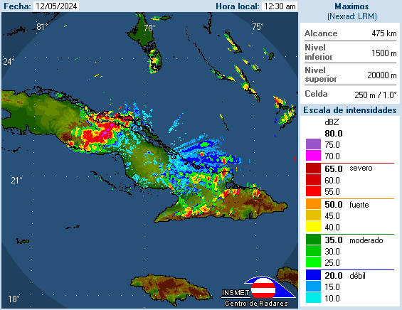
There is another area of showers near Cuba and this is due to the cold core nature of the upper low. If you look at the location of the showers, and an upper level chart, the showers are located directly beneath the upper level low. This is not uncommon in the tropics and is due to the instability caused by the lapse rates. They are increased due to the cold pocket that is sitting near the center of the upper low and the warm, tropical waters at the sfc. Cold over Warm= showers...especially in the tropics...but it doesn't mean it's tropical...it's still cold core.
0 likes
-
Weatherfreak000
You gotta figure, the upper low is headed through Cuba now. However a moisture feed is cranking up copious amounts of moisture into Puerto Rico where heavy rains have been an issue as of late. Heaviest rain is situated just west of Puerto Rico, but could affect the island later today.
A flash flood watch is in effect for northwestern Puerto Rico for the afternoon. The upper trough located west of Puerto Rico is brining copious amounts of moisture from the southwest. The moisture is further enhanced by an unstable atmosphere and orographic lifting in the area.
Jim
A flash flood watch is in effect for northwestern Puerto Rico for the afternoon. The upper trough located west of Puerto Rico is brining copious amounts of moisture from the southwest. The moisture is further enhanced by an unstable atmosphere and orographic lifting in the area.
Jim
0 likes
-
hurricanefloyd5

- Category 5
- Posts: 1659
- Age: 45
- Joined: Sun May 02, 2004 10:53 am
- Location: Spartanburg
- Contact:
-
Evil Jeremy
- S2K Supporter
- Posts: 5463
- Age: 32
- Joined: Mon Apr 10, 2006 2:10 pm
- Location: Los Angeles, CA
-
Air Force Met
- Military Met
- Posts: 4372
- Age: 56
- Joined: Tue Jul 08, 2003 9:30 am
- Location: Roan Mountain, TN
hurricanefloyd5 wrote:could it be at lease a subtropical system or something???????????????????????
No. There is nothing at the sfc. Whatever weak low there is is well removed from the upper level low, which is classic extra-tropical/baroclinic. If it was subtropical, there would be an established sfc low (and there isn't) and it would be MUCH closer to the upper low.
0 likes
-
SouthFloridawx

- S2K Supporter
- Posts: 8346
- Age: 47
- Joined: Tue Jul 26, 2005 1:16 am
- Location: Sarasota, FL
- Contact:
THIS IS NOT AN OFFICIAL FORCAST. FOR OFFICIAL FORCAST PLEASE SEE http://www.noaa.gov or http://www.nhc.noaa.gov .
here was the latest disco at 8:05 am.
This is my take on it all. Highlighted in blue Surface low still attached to the front but, some models suggest it will convert to a cold core system and head generally towards the E or NE. Highlighted in red is the low pressure system you all are talking about which is an upper level low identified in this disco. There is no talk about it coming to the surface. The surface low pressure I have posted a graphic below showing what I'm talking about.
TROPICAL WEATHER DISCUSSION
NWS TPC/NATIONAL HURRICANE CENTER MIAMI FL
805 AM EDT THU APR 13 2006
TROPICAL WEATHER DISCUSSION FOR NORTH AMERICA...CENTRAL
AMERICA...THE GULF OF MEXICO...THE CARIBBEAN SEA...NORTHEASTERN
SECTIONS OF SOUTH AMERICA...AND THE ATLANTIC OCEAN TO THE
AFRICAN COAST FROM THE EQUATOR TO 32N. THE FOLLOWING INFORMATION
IS BASED ON SATELLITE IMAGERY...WEATHER OBSERVATIONS...
RADAR...AND METEOROLOGICAL ANALYSIS.
BASED ON 0600 UTC SURFACE ANALYSIS AND SATELLITE IMAGERY THROUGH
1045 UTC.
...ITCZ...
ITCZ AXIS IS CENTERED ALONG 7N10W 1N20W EQ30W 1S40W 2S45W. SMALL
CLUSTERS OF MODERATE CONVECTION ARE WITHIN 250 NM ON EITHER SIDE
OF THE AXIS W OF 15W. A SFC TROUGH IS LOCATED TO THE N OF THE
AXIS ALONG 34W FROM 3N-9N ENHANCING SMALL-SCALE SHOWERS AND
TSTMS.
...DISCUSSION...
THE CARIBBEAN SEA AND THE ATLANTIC OCEAN W OF 60W...
AN UPPER TROUGH TO THE E OF THE GULF RIDGE HAS BEEN STUCK IN THE
NW CARIBBEAN MUCH OF THE WEEK. THIS TROUGH APPEARS TO HAVE
BECOME SOME-WHAT CUT-OFF IN THE AREA. A 1010 MB SFC LOW IS
LOCATED IN THE E BAHAMAS NEAR 21N72W AND SITS ON A STATIONARY
FRONT WHICH EXTENDS NEWD FROM THE LOW TO BEYOND 32N56W. AN UPPER
LOW IS CENTERED TO THE W OF THE SFC LOW IN THE CENTRAL BAHAMAS. UPPER LEVEL DIVERGENCE AND SFC FORCING IS PRODUCING A SHIELD OF
OVERCAST SKIES...SCATTERED SHOWERS AND POSSIBLE TSTMS FROM
21N-32N BETWEEN 58W-73W. THE MOST ORGANIZED SHOWER ACTIVITY IS
WITHIN 200 NM OF THE STATIONARY FRONT AND THE NEAR THE UPPER LOW
N OF CUBA. THE UPPER LOW APPEARS TO DRIFTING TO THE SW. A SFC
TROUGH IS DRAPED FROM THE LOW SWD OVER HISPANIOLA. SAN JUAN
DOPPLER RADAR INDICATES A BATCH OF SOLID MODERATE RAIN WITH
EMBEDDED TSTMS TO THE W OF THE ISLAND. CONSIDERABLE MOISTURE IS
DRAWN NWD FROM THE EPAC AND S AMERICA ON THE E SIDE OF THE
TROUGH AXIS AND IS RACING NEWARD MOVING INTO THE DEEP MOISTURE
NEAR PUERTO RICO AND HISPANIOLA. VERY DRY/STABLE AIR IS TO THE W
OF THE TROUGH AXIS ACROSS THE NW CARIBBEAN KEEPING SKIES MOSTLY
CLEAR FROM CUBA TO NICARAGUA. GFS SUGGESTS THAT THE SFC LOW WILL
BEGIN TO PULL NEWARD TOMORROW AS THE UPPER TROUGH BEGINS TO
FLATTEN. THE UNSETTLED WEATHER WILL CONTINUE TO SHIFT SLIGHTLY
EWD TOMORROW BEFORE BECOME SOMEWHAT DIFFUSE BY THE WEEKEND. THE
DEEPEST MOISTURE WILL CONTINUE NEAR PUERTO RICO AND HISPANIOLA
NEWD TO THE CENTRAL ATLC TODAY.
Surface low transitioning to a cold core system.
GFS

UKMET

Nogaps

CMC

That is my two cents....
ProMets please tell me if you think i got a handle on what i'm talking about. I am not a met but, I have over the past years start to come to some type of understanding. Let me know...
here was the latest disco at 8:05 am.
This is my take on it all. Highlighted in blue Surface low still attached to the front but, some models suggest it will convert to a cold core system and head generally towards the E or NE. Highlighted in red is the low pressure system you all are talking about which is an upper level low identified in this disco. There is no talk about it coming to the surface. The surface low pressure I have posted a graphic below showing what I'm talking about.
TROPICAL WEATHER DISCUSSION
NWS TPC/NATIONAL HURRICANE CENTER MIAMI FL
805 AM EDT THU APR 13 2006
TROPICAL WEATHER DISCUSSION FOR NORTH AMERICA...CENTRAL
AMERICA...THE GULF OF MEXICO...THE CARIBBEAN SEA...NORTHEASTERN
SECTIONS OF SOUTH AMERICA...AND THE ATLANTIC OCEAN TO THE
AFRICAN COAST FROM THE EQUATOR TO 32N. THE FOLLOWING INFORMATION
IS BASED ON SATELLITE IMAGERY...WEATHER OBSERVATIONS...
RADAR...AND METEOROLOGICAL ANALYSIS.
BASED ON 0600 UTC SURFACE ANALYSIS AND SATELLITE IMAGERY THROUGH
1045 UTC.
...ITCZ...
ITCZ AXIS IS CENTERED ALONG 7N10W 1N20W EQ30W 1S40W 2S45W. SMALL
CLUSTERS OF MODERATE CONVECTION ARE WITHIN 250 NM ON EITHER SIDE
OF THE AXIS W OF 15W. A SFC TROUGH IS LOCATED TO THE N OF THE
AXIS ALONG 34W FROM 3N-9N ENHANCING SMALL-SCALE SHOWERS AND
TSTMS.
...DISCUSSION...
THE CARIBBEAN SEA AND THE ATLANTIC OCEAN W OF 60W...
AN UPPER TROUGH TO THE E OF THE GULF RIDGE HAS BEEN STUCK IN THE
NW CARIBBEAN MUCH OF THE WEEK. THIS TROUGH APPEARS TO HAVE
BECOME SOME-WHAT CUT-OFF IN THE AREA. A 1010 MB SFC LOW IS
LOCATED IN THE E BAHAMAS NEAR 21N72W AND SITS ON A STATIONARY
FRONT WHICH EXTENDS NEWD FROM THE LOW TO BEYOND 32N56W. AN UPPER
LOW IS CENTERED TO THE W OF THE SFC LOW IN THE CENTRAL BAHAMAS. UPPER LEVEL DIVERGENCE AND SFC FORCING IS PRODUCING A SHIELD OF
OVERCAST SKIES...SCATTERED SHOWERS AND POSSIBLE TSTMS FROM
21N-32N BETWEEN 58W-73W. THE MOST ORGANIZED SHOWER ACTIVITY IS
WITHIN 200 NM OF THE STATIONARY FRONT AND THE NEAR THE UPPER LOW
N OF CUBA. THE UPPER LOW APPEARS TO DRIFTING TO THE SW. A SFC
TROUGH IS DRAPED FROM THE LOW SWD OVER HISPANIOLA. SAN JUAN
DOPPLER RADAR INDICATES A BATCH OF SOLID MODERATE RAIN WITH
EMBEDDED TSTMS TO THE W OF THE ISLAND. CONSIDERABLE MOISTURE IS
DRAWN NWD FROM THE EPAC AND S AMERICA ON THE E SIDE OF THE
TROUGH AXIS AND IS RACING NEWARD MOVING INTO THE DEEP MOISTURE
NEAR PUERTO RICO AND HISPANIOLA. VERY DRY/STABLE AIR IS TO THE W
OF THE TROUGH AXIS ACROSS THE NW CARIBBEAN KEEPING SKIES MOSTLY
CLEAR FROM CUBA TO NICARAGUA. GFS SUGGESTS THAT THE SFC LOW WILL
BEGIN TO PULL NEWARD TOMORROW AS THE UPPER TROUGH BEGINS TO
FLATTEN. THE UNSETTLED WEATHER WILL CONTINUE TO SHIFT SLIGHTLY
EWD TOMORROW BEFORE BECOME SOMEWHAT DIFFUSE BY THE WEEKEND. THE
DEEPEST MOISTURE WILL CONTINUE NEAR PUERTO RICO AND HISPANIOLA
NEWD TO THE CENTRAL ATLC TODAY.
Surface low transitioning to a cold core system.
GFS
UKMET
Nogaps
CMC
That is my two cents....
ProMets please tell me if you think i got a handle on what i'm talking about. I am not a met but, I have over the past years start to come to some type of understanding. Let me know...
0 likes
-
Air Force Met
- Military Met
- Posts: 4372
- Age: 56
- Joined: Tue Jul 08, 2003 9:30 am
- Location: Roan Mountain, TN
SouthFloridawx wrote:
ProMets please tell me if you think i got a handle on what i'm talking about. I am not a met but, I have over the past years start to come to some type of understanding. Let me know...
I think it's on the money...it's a weak system...and cold core in nature...it is becoming more so as time goes on.
0 likes
-
Hybridstorm_November2001

- S2K Supporter
- Posts: 2817
- Joined: Sat Aug 21, 2004 2:50 pm
- Location: SW New Brunswick, Canada
- Contact:
-
Air Force Met
- Military Met
- Posts: 4372
- Age: 56
- Joined: Tue Jul 08, 2003 9:30 am
- Location: Roan Mountain, TN

-
SouthFloridawx
- S2K Supporter
- Posts: 8346
- Age: 47
- Joined: Tue Jul 26, 2005 1:16 am
- Location: Sarasota, FL
- Contact:


Who is online
Users browsing this forum: kevin and 58 guests