

This is taken out of Tampa NWS.
LONG TERM (SAT NGT-WED)...LATEST MDL RUNS SUGGEST THE LONG TERM
PERIOD WILL BE CHARACTERIZED MAINLY BY PERSISTENT RIDGING AT THE SFC
AND ALOFT...WITH EACH POTENTIAL COLD FRONT STAYING TO OR DISSIPATING
TO OUR NORTH. THIS SOLUTION SEEMS REASONABLE GIVEN RECENT
PERSISTENCE OF MID LVL RIDGING OVER THE GOM. AS SUCH...LONG TERM PD
SHOULD BE MAINLY DRY (POPS AOB 10 PCNT EACH DAY) WITH TEMPS A FEW
DEGREE ABOVE NORMAL.
Let's hope a pattern change for upcoming hurricane season.
Moderator: S2k Moderators
Forum rules

The posts in this forum are NOT official forecasts and should not be used as such. They are just the opinion of the poster and may or may not be backed by sound meteorological data. They are NOT endorsed by any professional institution or STORM2K. For official information, please refer to products from the National Hurricane Center and National Weather Service.
-
CHRISTY


-
skysummit

- S2K Supporter

- Posts: 5305
- Age: 50
- Joined: Tue Aug 31, 2004 11:09 pm
- Location: Ponchatoula, LA
- Contact:
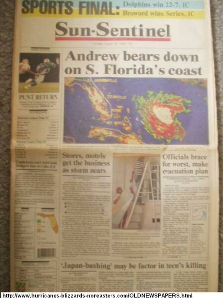
Well, if the high is persistant and strong into the season, and no fronts or troughs digging down into the deep south, Christy is right...southern Florida would be a prime target....and you know what happens when storms cross southern Florida, they almost ALWAYS get into the gulf. Two storms come to mind when thinking of crossing southern Florida.....Andrew and Katrina.
0 likes
-
MiamiensisWx
Miami NWS latest discussion... sounds VERY similar to 2004...
000
FXUS62 KMFL 301353
AFDMFL
AREA FORECAST DISCUSSION
NATIONAL WEATHER SERVICE MIAMI FL
853 AM EST THU MAR 30 2006
.UPDATE...HIGH PRESUURE RIDGE NORTH OF THE CWA PRODUCING EASTERLY
FLOW ACROSS THE AREA. UNFORTUNATELY, NO CHANCES OF RAIN FOR A
WHILE. HAVE UPDATED CWF WITH A BIT HIGHER WINDS IN THE ATLANTIC.
FOR THE ZFP, ALL LOOKS ON TRACK.
&&
.PREV DISCUSSION...ANOTHER DRY FORECAST FOR SOUTH FLORIDA...BOTH
IN THE SHORT TERM AND EXTENDED FORECAST. FOR THE SHORT TERM...THE
MODEL GUIDANCE OVER THE LAST TWO DAYS HAS INDICATED THAT A SURFACE
HIGH WILL BEGIN TO BUILD AND STRENGTHEN ACROSS THE MID ATLANTIC
STATES AND EXTEND SOUTHWESTWARD ACROSS THE COASTAL CAROLINAS INTO
THE FLORIDA PENINSULA. AT THE SAME TIME THE MID TO UPPER LEVELS
WILL PROVIDE SUBSIDENCE...FURTHER STABILIZING THE LOCAL ATMOSPHERE
AND SUPPRESSING CHANCES OF ANY PRECIPITATION. WHILE THE LARGE
COMPLEX LOW DEVELOPING OVER THE PLAINS STATES WILL EVENTUALLY HELP
TO DISPLACE THE AFOREMENTIONED RIDGE OVER THE WESTERN ATLANTIC BY
THE WEEKEND...THE MID TO UPPER LEVELS ARE FORECAST TO DEVELOP A
RIDGE OVER THE NORTHERN GULF OF MEXICO BY THE WEEKEND WHICH WILL
CONTINUE TO SUPPRESS MUCH CHANCE OF HAVING ANY PRECIPITATION. SO
IN SUMMARY...DRY CONDITIONS SHOULD PREVAIL FOR BOTH THE SHORT TO
LONG TERM.
ONE IMPORTANT POINT TO NOTE ABOUT THE RIDGE BUILDING ACROSS THE
EAST COAST...THIS WILL INCREASE THE LOCAL PRESSURE GRADIENT AND
THE SURFACE WINDS ACROSS THE FLORIDA PENINSULA STARTING LATER THIS
AFTERNOON AND LIKELY THROUGH FRIDAY.
FOR MARINE CONDITIONS...AS MENTIONED ABOVE THE SURFACE WINDS ARE
FORECAST TO INCREASE THIS AFTERNOON TO 10 TO 15 KNOT RANGE OVER
THE OFF SHORE ATLANTIC WATERS AND BY TONIGHT ARE EXPECTED TO
INCREASE FURTHER TO 15 TO 20 KNOT RANGE...AND SLIGHTLY LESS IN THE OFF
SHORE GULF WATERS. SO BY TONIGHT LOCAL SEAS COULD BE IN THE 4 TO 6
FOOT RANGE IN BOTH THE LOCAL OFF SHORE ATLANTIC AND GULF
WATERS...WITH NEAR 7 FOOT SEAS POSSIBLE IN THE OFF SHORE ATLANTIC
WATERS. SO EITHER A PRECAUTIONARY STATEMENT OR MAYBE SCA MAY BE
REQUIRED BY TONIGHT.
FIRE WEATHER...
AS MENTIONED ABOVE...THE SURFACE WINDS...MAINLY EASTERLY... ARE
EXPECTED TO INCREASE THIS AFTERNOON. IN ADDITION...LATEST GUIDANCE
INDICATED THAT THERE WOULD BE AN INCREASE IN THE DEW POINTS ACROSS
MOST OF SOUTH FLORIDA TODAY. THIS WILL HELP BRING MORE LOW LEVEL
MOISTURE EVEN FURTHER WEST INTO THE INTERIOR PORTIONS OF SOUTH
FLORIDA THIS AFTERNOON. BOTH LOCAL ANALYSIS AND LATEST MESOSCALE
MODEL RUN SUGGEST THAT THERE MAY BE AREAS IN WESTERN COLLIER
COUNTY THAT MAY REACH CRITICAL RELATIVE HUMIDITY THRESHOLDS IN THE
AFTERNOON...BUT MAYBE ONLY FOR TWO OR SO HOURS AND SHOULD RECOVER
THEREAFTER. THEREFORE...NO WATCH OR WARNING IN EFFECT.
&&
.MFL WATCHES/WARNINGS/ADVISORIES...
FL...NONE.
AM...NONE.
GM...NONE.
&&
$$
18
Here is a comparison to a discussion from May 24th, 2004...
000
FXUS62 KTBW 240540
AFDTBW
WEST CENTRAL AND SOUTHWEST FLORIDA FORECAST DISCUSSION
NATIONAL WEATHER SERVICE TAMPA BAY AREA - RUSKIN FL
140 AM EDT MON MAY 24 2004
.SHORT TERM (TODAY-WED)...SKIES ARE GENERALLY CLEAR...ALTHOUGH THE
LAST OF THE SEA BREEZE CLOUDS ARE MOVING NORTHWEST THROUGH LEVY
COUNTY AT THIS TIME. ALL AREAS WILL START THE DAY TODAY MOSTLY SUNNY
WITH LIGHT WINDS. SEA BREEZE WILL DEVELOP EARLY ALONG THE COAST AND
WORK ITS WAY INLAND...MUCH LIKE YESTERDAY. ATMOSPHERE JUST TOO DRY
FOR SHOWER DEVELOPMENT BUT WE SHOULD SEE A LINE OF CLOUDS AGAIN
WITH SOME AREAS POSSIBLY SEEING MORE CLOUDS THAN SUN FOR AN HOUR OR
SO WHERE SEA BREEZE CONVERGENCE SETS UP OVERHEAD. WILL LEAVE ZERO
POPS IN PLACE DESPITE GOOD LOW-LEVEL CONVERGENCE. TEMPERATURES WILL
AGAIN BE IN THE MIDDLE TO UPPER 80S RIGHT ON THE BEACHES ON UP TO THE
LOWER 90S INLAND.
VERY LITTLE CHANGE TO TAKE PLACE FOR TUESDAY AND WEDNESDAY...
ALTHOUGH INLAND AREAS COULD BE A DEGREE OR TWO WARMER AS TEMPS AND
HEIGHTS RISE A BIT ALOFT. STILL NO MOISTURE TO WORK WITH SO RAIN
CHANCES WILL REMAIN NIL.
.LONG TERM (WED NIGHT-SUN)...LITTLE CHANGE EXPECTED DURING THIS TIME
FRAME. DEEP LAYERED RIDGING ACROSS THE GULF AND FLORIDA PENINSULA
WILL CONTINUE TO SUPPORT HOT AND DRY CONDITIONS EACH DAY THROUGH THE
PERIOD. A VERY WEAK PRESSURE PATTERN WILL ALLOW FOR DAILY AFTERNOON
SEA BREEZE CIRCULATIONS TO DEVELOP...WHICH WILL KEEP COASTAL
LOCATIONS A TAD COOLER WITH MAX TEMPERATURES CLIMBING TO ~90 EACH
DAY...OTHERWISE LOWER TO MIDDLE 90S WILL BE THE RULE OVER INLAND
LOCATIONS.
&&
.MARINE...CONTINUED TRANQUIL PATTERN WITH LOW-LEVEL RIDGE REMAINING
OVER THE COASTAL WATERS THROUGH THE WEEK. SEAS HAVE BEEN RUNNING 2
FEET OR LESS AND WINDS LARGELY DOMINATED BY SEA BREEZE CIRCULATIONS
AND SEE NO REASON FOR ANY CHANGE. NO HIGHLIGHTS.
&&
.FIRE WEATHER...NEXT 2 OR 3 DAYS WILL CONTINUE MUCH LIKE THE
PREVIOUS FEW WHERE RH VALUES DROP BELOW 35 PERCENT FOR 1 TO 3 HOURS.
AGAIN...WILL NOT ISSUE RFW AT THIS TIME BUT ALLOW DAY SHIFT TO
MONITOR FOR POSSIBLE SHORT-FUSED ISSUANCE.
&&
.PRELIMINARY POINT TEMPS/POPS...
TPA 090 071 090 071 / 00 00 00 00
FMY 091 068 091 068 / 00 00 00 00
GIF 091 068 093 068 / 00 00 00 00
SRQ 087 067 087 068 / 00 00 00 00
BKV 091 063 092 062 / 00 00 00 00
&&
.TBW WATCHES/WARNINGS/ADVISORIES...NONE.
&&
$$
SHORT TERM...JILLSON
LONG TERM...MCMICHAEL
000
FXUS62 KMFL 301353
AFDMFL
AREA FORECAST DISCUSSION
NATIONAL WEATHER SERVICE MIAMI FL
853 AM EST THU MAR 30 2006
.UPDATE...HIGH PRESUURE RIDGE NORTH OF THE CWA PRODUCING EASTERLY
FLOW ACROSS THE AREA. UNFORTUNATELY, NO CHANCES OF RAIN FOR A
WHILE. HAVE UPDATED CWF WITH A BIT HIGHER WINDS IN THE ATLANTIC.
FOR THE ZFP, ALL LOOKS ON TRACK.
&&
.PREV DISCUSSION...ANOTHER DRY FORECAST FOR SOUTH FLORIDA...BOTH
IN THE SHORT TERM AND EXTENDED FORECAST. FOR THE SHORT TERM...THE
MODEL GUIDANCE OVER THE LAST TWO DAYS HAS INDICATED THAT A SURFACE
HIGH WILL BEGIN TO BUILD AND STRENGTHEN ACROSS THE MID ATLANTIC
STATES AND EXTEND SOUTHWESTWARD ACROSS THE COASTAL CAROLINAS INTO
THE FLORIDA PENINSULA. AT THE SAME TIME THE MID TO UPPER LEVELS
WILL PROVIDE SUBSIDENCE...FURTHER STABILIZING THE LOCAL ATMOSPHERE
AND SUPPRESSING CHANCES OF ANY PRECIPITATION. WHILE THE LARGE
COMPLEX LOW DEVELOPING OVER THE PLAINS STATES WILL EVENTUALLY HELP
TO DISPLACE THE AFOREMENTIONED RIDGE OVER THE WESTERN ATLANTIC BY
THE WEEKEND...THE MID TO UPPER LEVELS ARE FORECAST TO DEVELOP A
RIDGE OVER THE NORTHERN GULF OF MEXICO BY THE WEEKEND WHICH WILL
CONTINUE TO SUPPRESS MUCH CHANCE OF HAVING ANY PRECIPITATION. SO
IN SUMMARY...DRY CONDITIONS SHOULD PREVAIL FOR BOTH THE SHORT TO
LONG TERM.
ONE IMPORTANT POINT TO NOTE ABOUT THE RIDGE BUILDING ACROSS THE
EAST COAST...THIS WILL INCREASE THE LOCAL PRESSURE GRADIENT AND
THE SURFACE WINDS ACROSS THE FLORIDA PENINSULA STARTING LATER THIS
AFTERNOON AND LIKELY THROUGH FRIDAY.
FOR MARINE CONDITIONS...AS MENTIONED ABOVE THE SURFACE WINDS ARE
FORECAST TO INCREASE THIS AFTERNOON TO 10 TO 15 KNOT RANGE OVER
THE OFF SHORE ATLANTIC WATERS AND BY TONIGHT ARE EXPECTED TO
INCREASE FURTHER TO 15 TO 20 KNOT RANGE...AND SLIGHTLY LESS IN THE OFF
SHORE GULF WATERS. SO BY TONIGHT LOCAL SEAS COULD BE IN THE 4 TO 6
FOOT RANGE IN BOTH THE LOCAL OFF SHORE ATLANTIC AND GULF
WATERS...WITH NEAR 7 FOOT SEAS POSSIBLE IN THE OFF SHORE ATLANTIC
WATERS. SO EITHER A PRECAUTIONARY STATEMENT OR MAYBE SCA MAY BE
REQUIRED BY TONIGHT.
FIRE WEATHER...
AS MENTIONED ABOVE...THE SURFACE WINDS...MAINLY EASTERLY... ARE
EXPECTED TO INCREASE THIS AFTERNOON. IN ADDITION...LATEST GUIDANCE
INDICATED THAT THERE WOULD BE AN INCREASE IN THE DEW POINTS ACROSS
MOST OF SOUTH FLORIDA TODAY. THIS WILL HELP BRING MORE LOW LEVEL
MOISTURE EVEN FURTHER WEST INTO THE INTERIOR PORTIONS OF SOUTH
FLORIDA THIS AFTERNOON. BOTH LOCAL ANALYSIS AND LATEST MESOSCALE
MODEL RUN SUGGEST THAT THERE MAY BE AREAS IN WESTERN COLLIER
COUNTY THAT MAY REACH CRITICAL RELATIVE HUMIDITY THRESHOLDS IN THE
AFTERNOON...BUT MAYBE ONLY FOR TWO OR SO HOURS AND SHOULD RECOVER
THEREAFTER. THEREFORE...NO WATCH OR WARNING IN EFFECT.
&&
.MFL WATCHES/WARNINGS/ADVISORIES...
FL...NONE.
AM...NONE.
GM...NONE.
&&
$$
18
Here is a comparison to a discussion from May 24th, 2004...
000
FXUS62 KTBW 240540
AFDTBW
WEST CENTRAL AND SOUTHWEST FLORIDA FORECAST DISCUSSION
NATIONAL WEATHER SERVICE TAMPA BAY AREA - RUSKIN FL
140 AM EDT MON MAY 24 2004
.SHORT TERM (TODAY-WED)...SKIES ARE GENERALLY CLEAR...ALTHOUGH THE
LAST OF THE SEA BREEZE CLOUDS ARE MOVING NORTHWEST THROUGH LEVY
COUNTY AT THIS TIME. ALL AREAS WILL START THE DAY TODAY MOSTLY SUNNY
WITH LIGHT WINDS. SEA BREEZE WILL DEVELOP EARLY ALONG THE COAST AND
WORK ITS WAY INLAND...MUCH LIKE YESTERDAY. ATMOSPHERE JUST TOO DRY
FOR SHOWER DEVELOPMENT BUT WE SHOULD SEE A LINE OF CLOUDS AGAIN
WITH SOME AREAS POSSIBLY SEEING MORE CLOUDS THAN SUN FOR AN HOUR OR
SO WHERE SEA BREEZE CONVERGENCE SETS UP OVERHEAD. WILL LEAVE ZERO
POPS IN PLACE DESPITE GOOD LOW-LEVEL CONVERGENCE. TEMPERATURES WILL
AGAIN BE IN THE MIDDLE TO UPPER 80S RIGHT ON THE BEACHES ON UP TO THE
LOWER 90S INLAND.
VERY LITTLE CHANGE TO TAKE PLACE FOR TUESDAY AND WEDNESDAY...
ALTHOUGH INLAND AREAS COULD BE A DEGREE OR TWO WARMER AS TEMPS AND
HEIGHTS RISE A BIT ALOFT. STILL NO MOISTURE TO WORK WITH SO RAIN
CHANCES WILL REMAIN NIL.
.LONG TERM (WED NIGHT-SUN)...LITTLE CHANGE EXPECTED DURING THIS TIME
FRAME. DEEP LAYERED RIDGING ACROSS THE GULF AND FLORIDA PENINSULA
WILL CONTINUE TO SUPPORT HOT AND DRY CONDITIONS EACH DAY THROUGH THE
PERIOD. A VERY WEAK PRESSURE PATTERN WILL ALLOW FOR DAILY AFTERNOON
SEA BREEZE CIRCULATIONS TO DEVELOP...WHICH WILL KEEP COASTAL
LOCATIONS A TAD COOLER WITH MAX TEMPERATURES CLIMBING TO ~90 EACH
DAY...OTHERWISE LOWER TO MIDDLE 90S WILL BE THE RULE OVER INLAND
LOCATIONS.
&&
.MARINE...CONTINUED TRANQUIL PATTERN WITH LOW-LEVEL RIDGE REMAINING
OVER THE COASTAL WATERS THROUGH THE WEEK. SEAS HAVE BEEN RUNNING 2
FEET OR LESS AND WINDS LARGELY DOMINATED BY SEA BREEZE CIRCULATIONS
AND SEE NO REASON FOR ANY CHANGE. NO HIGHLIGHTS.
&&
.FIRE WEATHER...NEXT 2 OR 3 DAYS WILL CONTINUE MUCH LIKE THE
PREVIOUS FEW WHERE RH VALUES DROP BELOW 35 PERCENT FOR 1 TO 3 HOURS.
AGAIN...WILL NOT ISSUE RFW AT THIS TIME BUT ALLOW DAY SHIFT TO
MONITOR FOR POSSIBLE SHORT-FUSED ISSUANCE.
&&
.PRELIMINARY POINT TEMPS/POPS...
TPA 090 071 090 071 / 00 00 00 00
FMY 091 068 091 068 / 00 00 00 00
GIF 091 068 093 068 / 00 00 00 00
SRQ 087 067 087 068 / 00 00 00 00
BKV 091 063 092 062 / 00 00 00 00
&&
.TBW WATCHES/WARNINGS/ADVISORIES...NONE.
&&
$$
SHORT TERM...JILLSON
LONG TERM...MCMICHAEL
0 likes
-
MiamiensisWx
Here is another discussion comparison... this is from July 20th, 2004...
::THE BOUNDARY MENTIONED ABOVE WILL CONTINUE TO PUSH
SOUTHEASTWARD...VERY DIFFUSE, OF COURSE...BUT WILL CONTINUE TO ACT
AS FOCUSING MECHANISM FOR CONVECTION. SO WILL KEEP SCT POPS TONIGHT
AND WED AFTERNOON. HOWEVER...UPPER LEVEL PATTERN WILL NO LONGER
SUPPORT WIDESPREAD ACTIVITY...FURTHER MORE GFS INDICATES A SLIGHTLY
DRIER AIRMASS SPREADING SOUTH OVER THE LOCAL AREA BY WED NIGHT
BEHIND THE FRONTAL BOUNDARY...SO WILL GO WITH A DECREASING TREND IN
POPS STARTING WED EVENING. A RETURN TO AN EASTERLY FLOW IS EXPECTED
BY SATURDAY WITH SCT SHOWERS/TSTMS AGAIN IN THE FORECAST.::
0 likes
-
MiamiensisWx
Here are some comparison topics from 2004...
http://www.storm2k.org/phpbb2/viewtopic.php?p=522700&highlight=#522700
http://www.storm2k.org/phpbb2/viewtopic.php?p=524503&highlight=#524503
http://www.storm2k.org/phpbb2/viewtopic.php?p=529786&highlight=#529786
http://www.storm2k.org/phpbb2/viewtopic.php?p=528464&highlight=#528464
http://www.storm2k.org/phpbb2/viewtopic.php?p=530473&highlight=#530473
Look how similar they are to now!
0 likes
-
MiamiensisWx
Discussion from 2004...
.SHORT-RANGE FORECAST...TODAY THROUGH SUNDAY NIGHT...
AFTER A BRIEF WEAKNESS IN THE DEEP LAYERED (1000-500 MB) SUBTROPICAL
RIDGE OVER THE FLORIDA PENINSULA TODAY AND TONIGHT...THE RIDGE WILL
ONCE AGAIN BUILD WESTWARD INTO THE GULF OF MEXICO LATE SATURDAY. THE
RIDGE WILL THEN LIFT NORTHWARD AS LOW PRESSURE LIFTS OUT OF THE
EASTERN UNITED STATES. MEANWHILE...AN UPPER LEVEL (200-300 MB)
TROUGH EXTENDING SOUTHWARD ACROSS THE FLORIDA PENINSULA AND ISLAND
OF CUBA...WILL GRADUALLY DISSIPATE BY SUNDAY NIGHT. DESPITE MODERATE
INSTABILITY...NO DISCERNIBLE LOW LEVEL PERTURBATIONS WITHIN THE
EASTERLY FLOW ARE FORESEEN. IN ADDITION...THE OVERALL STEERING FLOW
DOES NOT INDICATE SOUTH FLORIDA OR THE ISLAND OF CUBA WILL BE A
DIRECT RISK FOR SHOWERS AND THUNDERSTORMS. HOWEVER...AMPLE MOISTURE
(PWAT 1.5 INCHES) AND POSSIBLE OUTFLOW BOUNDARIES WILL PROMPT
ISOLATED SHOWERS AND THUNDERSTORMS THROUGH THE PERIOD.
.MEDIUM-RANGE FORECAST...MONDAY THROUGH THURSDAY...
A RATHER SUBSTANTIAL DIFFERENCE BETWEEN EUROPEAN AND MRF NEXT
WEEK...AS MRF RETREATS THE WESTERN ATLANTIC RIDGE AND LOWERS HEIGHTS
CONSIDERABLY OVER THE GULF AND FLORIDA PENINSULA.
CONVERSELY...EUROPEAN HOLDS THE WESTERN ATLANTIC RIDGE ACROSS THE
FLORIDA PENINSULA. WITH PERSISTENCE IN MIND...WILL LEAN TOWARD THE
EUROPEAN AND MAINTAIN A LOW SCATTERED POP AND NEAR NORMAL
TEMPERATURES THROUGH THURSDAY.
0 likes
-
Hybridstorm_November2001

- S2K Supporter
- Posts: 2817
- Joined: Sat Aug 21, 2004 2:50 pm
- Location: SW New Brunswick, Canada
- Contact:
That is too bad. I'm hoping that things change for you guys this season. Unlike last year this time, it is VERY dry up and down most all of the East Coast. In my area they are starting the Forest Fire watch two weeks early. My neighbors in Maine and Nova Scotia are in the same pickle. The Greenland Block, and the High pressure that drives it in the Atlantic, has been quite strong this Winter causing the lack of rain/snow.
0 likes
-
gatorcane

- S2K Supporter
- Posts: 23703
- Age: 47
- Joined: Sun Mar 13, 2005 3:54 pm
- Location: Boca Raton, FL
you guys might very well be right. Many people on here just don't agree...but later on in the season when that ridge is sitting htere in the Western Atlantic with some tropical system moving west around it. They will believe it.
Of course we will see breaks in this ridging but it just seems that each discussion that come out from the NWS - they see this problematic pattern - they are implying it by the fact they keep repeating, dry and ridging...
Of course we will see breaks in this ridging but it just seems that each discussion that come out from the NWS - they see this problematic pattern - they are implying it by the fact they keep repeating, dry and ridging...
0 likes
-
Blown Away

- S2K Supporter
- Posts: 10253
- Joined: Wed May 26, 2004 6:17 am
http://www.sfwmd.gov/curre/rainmaps/monthly.html
Check out March's rainfall totals for SFL 04, 05, 06!
04- Very Dry
05- Wet
06- Very Dry
Check out March's rainfall totals for SFL 04, 05, 06!
04- Very Dry
05- Wet
06- Very Dry
0 likes
-
CHRISTY
i think you guys maybe right i think this year is the year we get the big one here in the southeast ! we have been very lucky here for such a long time but something tells me our luck is going to run out sometime during this season....i hope everyone has there hurricane plans in place come june 1.i think andrew will be nothing compared to what we might get!!we are in a new era of more frequent stronger hurricanes.soooo all i can say is we will see what happens! 
0 likes
-
wobblehead
- Tropical Storm

- Posts: 133
- Joined: Fri Jul 15, 2005 12:51 pm
- Location: Mobile.Al
Here in Mobile we will set a new record for dryest March on record with April forecsted to be cooler and dryer than normal. A tidbit from the recent hurricane conference held here "the gulf coast has a 47% chance of having a hurricane making landfall". I'm not sure what our "normal" average is however 50/50 is too close for comfort.
0 likes
-
MiamiensisWx
wobblehead wrote:Here in Mobile we will set a new record for dryest March on record with April forecsted to be cooler and dryer than normal. A tidbit from the recent hurricane conference held here "the gulf coast has a 47% chance of having a hurricane making landfall". I'm not sure what our "normal" average is however 50/50 is too close for comfort.
Drier and warmer conditions are forecast for the rest of the southeastern U.S. through June...
0 likes
-
MiamiensisWx
Here's something even more unsettling...
SOUTHEAST FLORIDA GOT HIT IN SEPTEMBER 1947 IN PALM BEACH AND BROWARD COUNTIES BY A CATEGORY FOUR HURRICANE FROM THE EAST - STEERED BY A RIDGE - EVEN THOUGH MAY AND ALL OTHER EARLY MONTHS WERE UNUSUALLY WET.
We are not even safe in wetter years from east hits; this year, we will likely be very hot and dry...
0 likes
-
MiamiensisWx
-
CHRISTY
-
skysummit
- S2K Supporter
- Posts: 5305
- Age: 50
- Joined: Tue Aug 31, 2004 11:09 pm
- Location: Ponchatoula, LA
- Contact:
CHRISTY wrote:yea i know...but i have a feelin hurricane katrina will not hold the title for to long for the worst US natural disaster.it will be taken from here this season just wait and see!
Ok, it's one thing to say you're worried about having a major storm strike you area this season, but to predict the worst natural disaster in history??? Come on.....no sense to start a panic over this.
0 likes
Who is online
Users browsing this forum: No registered users and 79 guests