
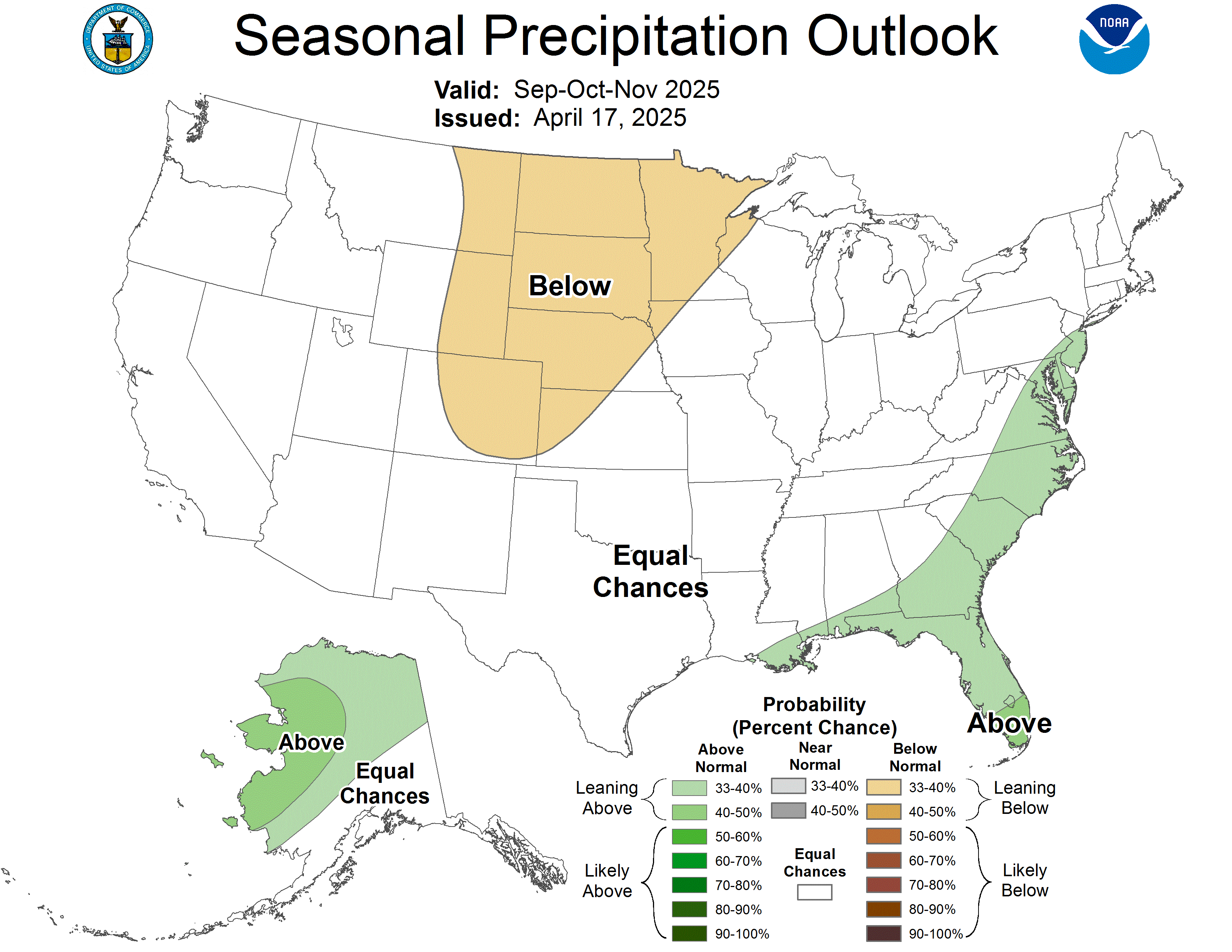
Based on the expectation of a greater than normal chance of rainfall in the SE, specifically Florida it would give credence that NCEP is expecting Tropical activity to be above normal in this location during the peak of the season
http://www.cpc.ncep.noaa.gov/products/p ... 5_prcp.gif
NCEP 3/16 Wetter than normal for Florida Aug/Sept/Oct
Moderator: S2k Moderators
Forum rules

The posts in this forum are NOT official forecasts and should not be used as such. They are just the opinion of the poster and may or may not be backed by sound meteorological data. They are NOT endorsed by any professional institution or STORM2K. For official information, please refer to products from the National Hurricane Center and National Weather Service.
-
SouthFloridawx

- S2K Supporter

- Posts: 8346
- Age: 47
- Joined: Tue Jul 26, 2005 1:16 am
- Location: Sarasota, FL
- Contact:

-
SouthFloridawx
- S2K Supporter
- Posts: 8346
- Age: 47
- Joined: Tue Jul 26, 2005 1:16 am
- Location: Sarasota, FL
- Contact:
dhweather wrote:I don't think that is necessarily true. I don't believe that NCEP is going to
use tropical cyclone activity in their precipitation forecasts.
If nothing hits Florida, then what?
I was not saying that I agree that tropical activity would but, I was wondering if there were any other models that show above average precipitation during those months.
0 likes


-
MiamiensisWx
-
gatorcane

- S2K Supporter
- Posts: 23703
- Age: 47
- Joined: Sun Mar 13, 2005 3:54 pm
- Location: Boca Raton, FL
A wetter than normal SE can really mean only one thing:
STRONG BERMUDA HIGH is forecasted.
The reason is that most of the rain in the SE US in the months of July - September is primarily from afternoon/evenings T-storms that feed off of the deep SE pump of moisture from the Bermuda High.
That is what I think they mean....
With a strong High means increased chances of tropical wave activity....which brings more rain to FL typically in August/September
The orientation of the High is key for the SE US...because it could mean the difference between storms going to the Carolinas vs storms going through the Straits of Florida. Either way could still mean increased moisture and rain for the SE
0 likes
Who is online
Users browsing this forum: gib and 90 guests