Met Dr. Steve Lyons: his thoughts on Katrina, etc.

This is the general tropical discussion area. Anyone can take their shot at predicting a storms path.

Moderator: S2k Moderators

Forum rules

The posts in this forum are NOT official forecasts and should not be used as such. They are just the opinion of the poster and may or may not be backed by sound meteorological data. They are NOT endorsed by any professional institution or STORM2K. For official information, please refer to products from the National Hurricane Center and National Weather Service.

Help Support Storm2K
Message
Author
MiamiensisWx

#81 Postby MiamiensisWx » Sat Feb 25, 2006 10:59 am

senorpepr wrote:First... it doesn't contradict cat 4 gusts in NO. This map does NOT show gusts.

Second... Michoud instruments are not certified/initialized and... therefore... considered unofficial. Therefore, they will not appear on the map. That is pointed out on NOAA's report.


I wouldn't be surprised if New Orleans - both downtown and the heavily-damaged eastern half - received gusts to Category Three or even a bit higher in microbursts. Such gusts caused much of the Wilma damage in southern Florida, along with the lower sustained Category One winds.
0 likes   

MiamiensisWx

#82 Postby MiamiensisWx » Sat Feb 25, 2006 11:00 am

senorpepr wrote:You would be amazed what little land can create enough friction. The circulation can be over water, but the shear proximity to land creates enough friction.


I never said ALL of southeast Louisiana received sustained Category Three winds. I meant that very small portions of that sparsely populated area probably received some brief sustained Category Three conditions.
0 likes   

User avatar
Audrey2Katrina
Category 5
Category 5
Posts: 4252
Age: 76
Joined: Fri Dec 23, 2005 10:39 pm
Location: Metaire, La.

#83 Postby Audrey2Katrina » Sat Feb 25, 2006 11:01 am

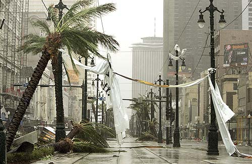
CapeVerdeWave wrote:Audrey2Katrina, Buras might have received at least sustained Category Two winds, if not higher. The land there is flat and sparsely populated; also, the highest sustained winds in a storm are almost never recorded. Do you agree with these points?


With all due respect, CVW, and I mean that sincerely, I prefer to not even go there. To suggest based on more speculation than solid information that this site of initial landfall of what Lyons is convinced was a 4, and Mayfield says brought cat 3 winds to New Orleans, only received sustained cat 2 winds goes beyond the pale of reasonable, in my honest estimation. Personally, it's even beyond absurd. I know the land around Buras well--travel there, or at least used to, several times a year. In the words now often cited, "that is the grossest misunderstimation I've seen yet on this storm." That the highest sustained winds are almost never recorded is not only a fair, but pretty much undeniable point--but it can hardly be used to justify the kind of over-reaching speculation I see in that particular map. But hey, let each be fully persuaded (not going biblical here :wink: ) even our own estimable pro mets concede we can take it or leave it. I prefer to leave that one!

A2K
0 likes   

Opal storm

#84 Postby Opal storm » Sat Feb 25, 2006 11:02 am

senorpepr wrote:
Opal storm wrote:I don't think these charts are that accurate.The chart of Dennis showed T.S force winds in Pensacola when actaully Pensacola had hurricane force winds.That might not be a big deal but that tells me these charts can't be 100% accurate on everything.


Hmmm... they show hurricane force winds in Pensacola...
It matches up very well with the reports listed in the NHC Report.

[img]ftp://ftp.aoml.noaa.gov/pub/hrd/hwind/2005/al04.2005/0710/1930/col02deg.png[/img]

Sorry then,I must have looked at it wrong.
0 likes   

User avatar
senorpepr
Military Met/Moderator
Posts: 12542
Age: 43
Joined: Fri Aug 22, 2003 9:22 pm
Location: Mackenbach, Germany
Contact:

#85 Postby senorpepr » Sat Feb 25, 2006 11:02 am

I said cat 4 (as quoted) but I meant 3. Anyway... I wouldn't be surprised either if they received those GUSTS, but sustained... no way. Too many people think they've been in stronger systems than they really did. They think "I was in a cat 3" when in fact they may have saw cat 1 winds (depending upon their location... maybe even lower), but they did see gusts of cat 2 or 3. That's been a big point many here are trying to bring across. People tend to forget about these gusts.
0 likes   

User avatar
Extremeweatherguy
Category 5
Category 5
Posts: 11095
Joined: Mon Oct 10, 2005 8:13 pm
Location: Florida

#86 Postby Extremeweatherguy » Sat Feb 25, 2006 11:04 am

I would find it hard to believe that N.O. on the WESTERN side of the storm would see sustained Cat. 3 force winds. What I had read had Steve Lyons saying Cat. 2 force in N.O. (he didn't say Cat. 3?), and that could have been in eastern N.O. too.

Also...


Max Mayfield, the director of the NHC said this very month, Feb, 10 I believe, from the following article:

"Mayfield pointed out that New Orleans was to the west of where Katrina made landfall, which is supposed to be on the weak side of the hurricane. He said the strongest winds hit Mississippi. Katrina reached category five velocity before going ashore, but Mayfield said New Orleans felt category three winds from the storm."


Where is that Mayfield comment from? what source did you use? What part of N.O. is he referring to?
Last edited by Extremeweatherguy on Sat Feb 25, 2006 11:08 am, edited 2 times in total.
0 likes   

User avatar
senorpepr
Military Met/Moderator
Posts: 12542
Age: 43
Joined: Fri Aug 22, 2003 9:22 pm
Location: Mackenbach, Germany
Contact:

#87 Postby senorpepr » Sat Feb 25, 2006 11:05 am

CapeVerdeWave wrote:
senorpepr wrote:You would be amazed what little land can create enough friction. The circulation can be over water, but the shear proximity to land creates enough friction.


I never said ALL of southeast Louisiana received sustained Category Three winds. I meant that very small portions of that sparsely populated area probably received some brief sustained Category Three conditions.

I didn't say you did. My statement was toward Pearl River who said, "There is not enough actual landmass there to cause that much friction."
0 likes   

MiamiensisWx

#88 Postby MiamiensisWx » Sat Feb 25, 2006 11:08 am

Audrey2Katrina wrote:With all due respect, CVW, and I mean that sincerely, I prefer to not even go there. To suggest based on more speculation than solid information that this site of initial landfall of what Lyons is convinced was a 4, and Mayfield says brought cat 3 winds to New Orleans, only received sustained cat 2 winds goes beyond the pale of reasonable, in my honest estimation. Personally, it's even beyond absurd. I know the land around Buras well--travel there, or at least used to, several times a year. In the words now often cited, "that is the grossest misunderstimation I've seen yet on this storm." That the highest sustained winds are almost never recorded is not only a fair, but pretty much undeniable point--but it can hardly be used to justify the kind of over-reaching speculation I see in that particular map. But hey, let each be fully persuaded (not going biblical here :wink: ) even our own estimable pro mets concede we can take it or leave it. I prefer to leave that one!

A2K


I never said Buras received ONLY Category Two winds. I said Buras received AT LEAST Category Two sustained winds, IF NOT HIGHER. Sorry if I was being bad...

:cry: :cry: :cry: :cry:
0 likes   

Derek Ortt

#89 Postby Derek Ortt » Sat Feb 25, 2006 11:16 am

it is quite possible that Buras did not receive cat 3 winds, while the immediate MS coast did. That is due to the expansion of the windfield. Similar occurrance in Hugo in Charleston from a storm, based upon 141KT at a 4000m flight level (reduction factor is non existant), may have been a cat 5 at landfall, but Charleston in the eye received cat 1 winds. The 4/5 winds were about 30-40 miles away. H-Wind is very consistent with all of the objective reports and does not diminish any of the damage. Should actually increase awareness as to what cat 2 winds can do (which we should have remembered from isabel, which nearly flattened Hatteras with 90KT winds)
0 likes   

User avatar
senorpepr
Military Met/Moderator
Posts: 12542
Age: 43
Joined: Fri Aug 22, 2003 9:22 pm
Location: Mackenbach, Germany
Contact:

#90 Postby senorpepr » Sat Feb 25, 2006 11:19 am

Derek Ortt wrote:it is quite possible that Buras did not receive cat 3 winds, while the immediate MS coast did. That is due to the expansion of the windfield. Similar occurrance in Hugo in Charleston from a storm, based upon 141KT at a 4000m flight level (reduction factor is non existant), may have been a cat 5 at landfall, but Charleston in the eye received cat 1 winds. The 4/5 winds were about 30-40 miles away. H-Wind is very consistent with all of the objective reports and does not diminish any of the damage. Should actually increase awareness as to what cat 2 winds can do (which we should have remembered from isabel, which nearly flattened Hatteras with 90KT winds)
:notworthy:
Well said, Derek.
0 likes   

MiamiensisWx

#91 Postby MiamiensisWx » Sat Feb 25, 2006 11:20 am

Derek Ortt wrote:it is quite possible that Buras did not receive cat 3 winds, while the immediate MS coast did. That is due to the expansion of the windfield. Similar occurrance in Hugo in Charleston from a storm, based upon 141KT at a 4000m flight level (reduction factor is non existant), may have been a cat 5 at landfall, but Charleston in the eye received cat 1 winds. The 4/5 winds were about 30-40 miles away. H-Wind is very consistent with all of the objective reports and does not diminish any of the damage. Should actually increase awareness as to what cat 2 winds can do (which we should have remembered from isabel, which nearly flattened Hatteras with 90KT winds)


I agree; Category Two winds can be very destructive! However, is it possible that the area immediately adjacent to Buras received sustained Category Three winds?
0 likes   

User avatar
Audrey2Katrina
Category 5
Category 5
Posts: 4252
Age: 76
Joined: Fri Dec 23, 2005 10:39 pm
Location: Metaire, La.

#92 Postby Audrey2Katrina » Sat Feb 25, 2006 11:22 am

senorpepr wrote:Second... Michoud instruments are not certified/initialized and... therefore... considered unofficial. Therefore, they will not appear on the map. That is pointed out on NOAA's report.


Point taken; albeit it also doesn't assert that those winds didn't happen. Look, I respect your/their opinion, I just don't happen to agree with it.

Incidentally the chart doesn't show where any Cat 4 winds were at all, just curious if you left those off because they'd be well offshore before landfall, or if that map doesn't show any Cat 4 winds in that particular grid?

A2K
0 likes   

User avatar
Extremeweatherguy
Category 5
Category 5
Posts: 11095
Joined: Mon Oct 10, 2005 8:13 pm
Location: Florida

#93 Postby Extremeweatherguy » Sat Feb 25, 2006 11:23 am

Ok....here is some evidence to support the fact that N.O. DID NOT see Cat. 2 or 3 sustained winds...

Image
^^Yes, this looks like a ton of damage, but on closer inspection it is really not too bad. First off, it looks like all these light poles remained standing, second off...look at that sign on the building in the upper right side of the picture, it received no damage at all.^^

Image
^^Yes, the flooding is bad in this picture..but to think that a Cat. 2 or 3 just blew through and there is only one bent power pole along this whole street is crazy. Also, those homes in the background seemed to have suffered little to no damage to their roofs.^^

Image
^^Here is a picture I found online of someone returning to New Orleans. Notice this house has no shingle or wall damage. I doubt the area where this picture was taken even saw Cat. 1 force winds.^^

Image
^^Why are all these signs standing and barely bent?^^

Image
^^Yes, this is bad...but a similar situation happened in Galveston, TX with just 60-70mph wind gusts. Also, notice that the lights and building in the background seem un-damaged.^^

Image
^^As you head outside the city it is clear that the damage gets much worse...but even this kind of damage can be done by a Cat. 1 force wind.^^

Image
^^In places like Kenner, the damage gets even worse...but still, a Cat. 1 force wind can do this kind of damage.^^


..And that is my evidence on why I do not think N.O. or it's surrounding areas saw Cat. 3 force winds...and unless in the far east side, I doubt most areas saw above Cat. 1 force..
Last edited by Extremeweatherguy on Sat Feb 25, 2006 11:27 am, edited 3 times in total.
0 likes   

User avatar
senorpepr
Military Met/Moderator
Posts: 12542
Age: 43
Joined: Fri Aug 22, 2003 9:22 pm
Location: Mackenbach, Germany
Contact:

#94 Postby senorpepr » Sat Feb 25, 2006 11:24 am

Audrey2Katrina wrote:
senorpepr wrote:Second... Michoud instruments are not certified/initialized and... therefore... considered unofficial. Therefore, they will not appear on the map. That is pointed out on NOAA's report.


Point taken; albeit it also doesn't assert that those winds didn't happen. Look, I respect your/their opinion, I just don't happen to agree with it.

Incidentally the chart doesn't show where any Cat 4 winds were at all, just curious if you left those off because they'd be well offshore before landfall, or if that map doesn't show any Cat 4 winds in that particular grid?

A2K


On that chart there weren't any. Adjust the chart southward a bit and you'll see the category four and five.
0 likes   

User avatar
Audrey2Katrina
Category 5
Category 5
Posts: 4252
Age: 76
Joined: Fri Dec 23, 2005 10:39 pm
Location: Metaire, La.

#95 Postby Audrey2Katrina » Sat Feb 25, 2006 11:29 am

Extremeweatherguy wrote:I would find it hard to believe that N.O. on the WESTERN side of the storm would see sustained Cat. 3 force winds. What I had read had Steve Lyons saying Cat. 2 force in N.O. (he didn't say Cat. 3?), and that could have been in eastern N.O. too.

Also...


Max Mayfield, the director of the NHC said this very month, Feb, 10 I believe, from the following article:

"Mayfield pointed out that New Orleans was to the west of where Katrina made landfall, which is supposed to be on the weak side of the hurricane. He said the strongest winds hit Mississippi. Katrina reached category five velocity before going ashore, but Mayfield said New Orleans felt category three winds from the storm."


Where is that Mayfield comment from? what source did you use? What part of N.O. is he referring to?


That was a direct quote from Mayfield's addressing some insurance folk in Florida, I believe on February 10. You want the article? Follow this link, it's about his caution that 2006 could be as bad--or worse than 2005.

http://www.insurancejournal.com/news/southeast/2006/02/10/65247.htm

A2K
0 likes   

User avatar
Audrey2Katrina
Category 5
Category 5
Posts: 4252
Age: 76
Joined: Fri Dec 23, 2005 10:39 pm
Location: Metaire, La.

#96 Postby Audrey2Katrina » Sat Feb 25, 2006 11:36 am

CapeVerdeWave wrote:
Audrey2Katrina wrote:With all due respect, CVW, and I mean that sincerely, I prefer to not even go there. To suggest based on more speculation than solid information that this site of initial landfall of what Lyons is convinced was a 4, and Mayfield says brought cat 3 winds to New Orleans, only received sustained cat 2 winds goes beyond the pale of reasonable, in my honest estimation. Personally, it's even beyond absurd. I know the land around Buras well--travel there, or at least used to, several times a year. In the words now often cited, "that is the grossest misunderstimation I've seen yet on this storm." That the highest sustained winds are almost never recorded is not only a fair, but pretty much undeniable point--but it can hardly be used to justify the kind of over-reaching speculation I see in that particular map. But hey, let each be fully persuaded (not going biblical here :wink: ) even our own estimable pro mets concede we can take it or leave it. I prefer to leave that one!

A2K


I never said Buras received ONLY Category Two winds. I said Buras received AT LEAST Category Two sustained winds, IF NOT HIGHER. Sorry if I was being bad...

:cry: :cry: :cry: :cry:


Cape: 'haps it's time we all lighten up. I didn't mean to aim any barbs in your direction at all--actually not in ANYONE's direction. No offense intended at all and sorry if I gave the wrong impression. You've been a voice of reason in a clash of some pretty polarized viewpoints here, and I appreciate that. It's just that this map shows Buras which has virtually NO landmass--or even "marsh" for that matter- between itself and this storms coming right off the water, and this map shows it in only Cat 2 sustained windfield--and that I find incomprehensible. Now that I've said that, I reiterate--to each his/her own opinions. And I agree with you--SE La. (certain areas) most certainly were in the sustained Cat 3 windfield regardless of what maps/charts/models/scattered data seem to suggest to others--in MY opinion.

A2K
0 likes   

MiamiensisWx

#97 Postby MiamiensisWx » Sat Feb 25, 2006 11:39 am

Audrey2Katrina wrote:Cape: 'haps it's time we all lighten up. I didn't mean to aim any barbs in your direction at all--actually not in ANYONE's direction. No offense intended at all and sorry if I gave the wrong impression. You've been a voice of reason in a clash of some pretty polarized viewpoints here, and I appreciate that. It's just that this map shows Buras which has virtually NO landmass--or even "marsh" for that matter- between itself and this storms coming right off the water, and this map shows it in only Cat 2 sustained windfield--and that I find incomprehensible. Now that I've said that, I reiterate--to each his/her own opinions. And I agree with you--SE La. (certain areas) most certainly were in the sustained Cat 3 windfield regardless of what maps/charts/models/scattered data seem to suggest to others--in MY opinion.

A2K


Thanks! That is exactly my point, Audrey2Katrina. Also, can you answer this question for me I'm asking you?

I agree; Category Two winds can be very destructive! However, is it possible that the area immediately adjacent to Buras received sustained Category Three winds?
0 likes   

User avatar
Audrey2Katrina
Category 5
Category 5
Posts: 4252
Age: 76
Joined: Fri Dec 23, 2005 10:39 pm
Location: Metaire, La.

#98 Postby Audrey2Katrina » Sat Feb 25, 2006 11:43 am

Derek Ortt wrote:it is quite possible that Buras did not receive cat 3 winds, while the immediate MS coast did. That is due to the expansion of the windfield. Similar occurrance in Hugo in Charleston from a storm, based upon 141KT at a 4000m flight level (reduction factor is non existant), may have been a cat 5 at landfall, but Charleston in the eye received cat 1 winds. The 4/5 winds were about 30-40 miles away. H-Wind is very consistent with all of the objective reports and does not diminish any of the damage. Should actually increase awareness as to what cat 2 winds can do (which we should have remembered from isabel, which nearly flattened Hatteras with 90KT winds)


Point taken, and yet I must assert Katrina was NOT Hugo. No two storms are alike, and no two storms are going to show the same gradients, windfields, or inland degradation, so the comparison is non-sequitur. Buras was not Charleston, nor the landscapes remotely similar as well. All this "if" "might have been" "could have been" "it is possible" "may well be," etc. etc. ad nauseum, achieves nothing beyond speculation. Suffice it to say, this is one issue that will, in all likelihood never be resolved between those who read charts and scattered data--and those who've been there and seen it. We simply disagree.

A2K
0 likes   

User avatar
Audrey2Katrina
Category 5
Category 5
Posts: 4252
Age: 76
Joined: Fri Dec 23, 2005 10:39 pm
Location: Metaire, La.

#99 Postby Audrey2Katrina » Sat Feb 25, 2006 11:45 am

CapeVerdeWave wrote:
Audrey2Katrina wrote:Cape: 'haps it's time we all lighten up. I didn't mean to aim any barbs in your direction at all--actually not in ANYONE's direction. No offense intended at all and sorry if I gave the wrong impression. You've been a voice of reason in a clash of some pretty polarized viewpoints here, and I appreciate that. It's just that this map shows Buras which has virtually NO landmass--or even "marsh" for that matter- between itself and this storms coming right off the water, and this map shows it in only Cat 2 sustained windfield--and that I find incomprehensible. Now that I've said that, I reiterate--to each his/her own opinions. And I agree with you--SE La. (certain areas) most certainly were in the sustained Cat 3 windfield regardless of what maps/charts/models/scattered data seem to suggest to others--in MY opinion.

A2K


Thanks! That is exactly my point, Audrey2Katrina. Also, can you answer this question for me I'm asking you?

I agree; Category Two winds can be very destructive! However, is it possible that the area immediately adjacent to Buras received sustained Category Three winds?


Absolutely! :)

A2K
0 likes   

User avatar
Extremeweatherguy
Category 5
Category 5
Posts: 11095
Joined: Mon Oct 10, 2005 8:13 pm
Location: Florida

#100 Postby Extremeweatherguy » Sat Feb 25, 2006 11:50 am

A2K...you keep referring to the idea that the people who live there and see the damage automatically can tell what Cat. 3 damage looks like. Really, though, this seems to just be your "opinion" of what Cat. 3 damage is. Now I know you may want to refer back to previous storms that you have gone through, but how do you know for sure that you saw Cat. 3 damage from those storms? What you might have considered Cat. 2 or 3 damage in the past may have actually just been Cat. 1 damage, and now when Katrina hit and the damage was to the same level or worse...you automatically assume it was just as bad or worse than the Cat. 2 or 3 winds you thought you had seen before.
Last edited by Extremeweatherguy on Sat Feb 25, 2006 11:51 am, edited 1 time in total.
0 likes   


Return to “Talkin' Tropics”

Who is online

Users browsing this forum: Google Adsense [Bot], ljmac75 and 67 guests