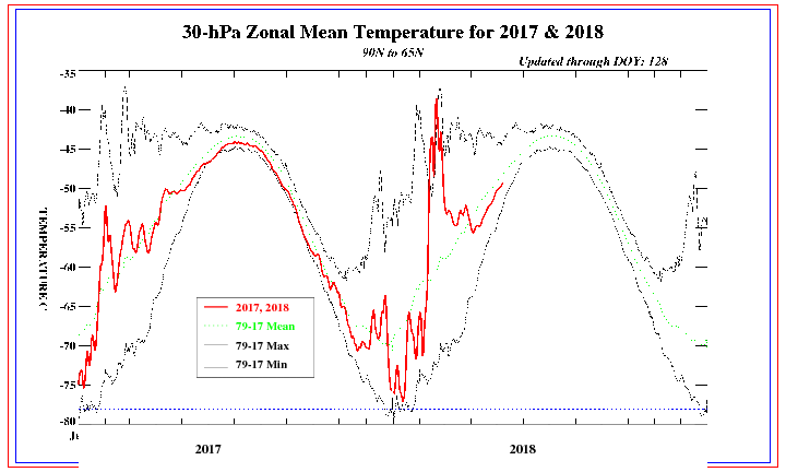
The warming in the stratopshere has continued to our north. This shows the 30 mb temperature between 65-90N. Just relax. The dam will burst and the cold weather will head our way. Like I mentioned a while back it takes time. They do NOT go hand and hand.
http://www.cpc.ncep.noaa.gov/products/s ... mb9065.gif
Jim
The Empire of Warmth Begins to Decay But Will Not Fall Soon
Moderator: S2k Moderators
Forum rules
 The posts in this forum are NOT official forecast and should not be used as such. They are just the opinion of the poster and may or may not be backed by sound meteorological data. They are NOT endorsed by any professional institution or STORM2K.

The posts in this forum are NOT official forecast and should not be used as such. They are just the opinion of the poster and may or may not be backed by sound meteorological data. They are NOT endorsed by any professional institution or STORM2K.
-
Jim Hughes
- Category 3

- Posts: 825
- Joined: Sun Jul 24, 2005 1:52 pm
- Location: Martinsburg West Virginia
-
donsutherland1
- S2K Analyst

- Posts: 2718
- Joined: Mon Sep 15, 2003 8:49 pm
- Location: New York
Re: The Empire of Warmth Begins to Decay But Will Not Fall S
Data continues to support the idea of a late-month pattern change:
- The 1/18 0z NCEP ensemble mean 500 mb height anomalies continue to point to the development of a strengthening trough in the East albeit a little later than previous runs.
- The 1/18 0z experimental ensembles remain consistent in terms of timing and have a signature that has sometimes preceded outbreaks of extreme cold. Any such cold is not likely to occur until February (~February 10-20?).
- The GFS ensemble forecast continues to point to a negative NAO down the road and some members now take the NAO to around -2.5 at the beginning of February.
All said, the data continues to argue for a shift to a colder pattern. Last night, I provided a summary that showed the various impacts of a negative NAO on temperatures in the New York City area.
Select mean temperature impacts for the February 1-15 period were:
NAO:
> 0: 34.2°
0 to -0.99: 34.0°
-1.00 to -1.99: 30.8°
-2.00 to -2.99: 30.0°
For comparative purposes, I'll provide the figures for Washington, D.C. (DCA). In general, once the NAO falls to -1.00 or below, one sees a drop-off in Washington, D.C.'s temperatures, just as is the case with New York City. There was also a marked increase in the tendency for Washington, D.C. to experience minimum temperatures of 25° or lower.
Mean temperature impacts for the February 1-15 period:
NAO:
> 0: 38.0°
0 to -0.99: 37.4°
-1.00 to -1.99: 35.2°
-2.00 to -2.99: 34.3°
-3.00 to -3.99: 31.4°
-4.00 or below: 32.4°
Coldest: -4.00 or below and PNA > 0: 30.4°
Frequency of High Temperature < 40°:
NAO:
> 0: 27%
0 to -0.99: 31%
-1.00 to -1.99: 38%
-2.00 to -2.99: 42%
-3.00 to -3.99: 53%
-4.00 or below: 67%
Most frequent: -4.00 or below and PNA > 0: 70%; No 50° days on record (1950-2005)
Frequency of Low Temperature of 25° or below:
NAO:
> 0: 27%
0 to -0.99: 29%
-1.00 to -1.99: 42%
-2.00 to -2.99: 41%
-3.00 to -3.99: 56%
-4.00 or below: 61%
Most frequent: -4.00 or below and PNA > 0: 65%
0 likes
-
Tyler
-
donsutherland1
- S2K Analyst
- Posts: 2718
- Joined: Mon Sep 15, 2003 8:49 pm
- Location: New York
Some thoughts on the 1/20 0z GFS:
∙ It suggests that the pattern change should begin to unfold on schedule.
∙ It is more aggressive than I with the speed of the pattern change (but if it materializes, I certainly won't be complaining).
∙ It brings about a decent snowstorm in early February thought not necessarily a KU snowstorm. I think the overall idea of February proving snowy is a good one and the GFS's suggestion of a possible early month snowstorm lends some support to that idea.
∙ From the run, I have little reason to back away from the idea that the coldest period of February might be the 2/10-20 timeframe given the amount of cold air that is shown in Canada.
All in all, a very nice run and reason to keep the faith in the start of a pattern change in the closing days of January.
0 likes
-
Portastorm

- Storm2k Moderator

- Posts: 9955
- Age: 63
- Joined: Fri Jul 11, 2003 9:16 am
- Location: Round Rock, TX
- Contact:
-
MiamiensisWx
-
donsutherland1
- S2K Analyst
- Posts: 2718
- Joined: Mon Sep 15, 2003 8:49 pm
- Location: New York
CapeVerdeWave,
With the pattern change finally beginning to look more certain on the guidance, I'll be able to devote greater attention to the details. In any case, any sustained meaningful cooling would probably not arrive until next month, although some modestly cooler air is possible on a transient basis as January nears an end.
Whether or not blocking develops in the PNA area could be important. Right now, that's not yet certain.
0 likes
-
donsutherland1
- S2K Analyst
- Posts: 2718
- Joined: Mon Sep 15, 2003 8:49 pm
- Location: New York
This morning saw the low temperature fall to 48° in New York City after some locations set or tied record highs yesterday. Difficult as it might be to believe, the low temperature has actually been higher on this date. On January 21, 1906, the low was 49°. But even that doesn't compare to the low of 59° set on January 4, 1950.
After yesterday's 61° high, NYC's monthly mean temperature stands at 40.5°. Since regular recordkeeping began in 1869, only seven prior years have seen January come out with a mean temperature of 40° or above:
1932 43.2°
1950 41.4°
1990 41.4°
1913 40.9°
1933 40.3°
1937 40.2°
1998 40.0°
Nonetheless, as the sun has come up and mercury in many of the big cities of the snow desert known as the I-95 Corridor head for 60° or above, it certainly does feel like January 1932 or January 1950 all over again.
So that idea of the pattern discussion has held up well. If anything, the peak warmth is a little warmer and somewhat earlier than I had expected when I noted, "Toward the end of the January 16-27 period, one or more days of much of above normal readings are possible with high temperatures reaching or exceeding 60 degrees in Richmond and Washington, DC and in the 50s in such cities as New York, Philadelphia, and Newark as the trough in the West/ridge in the East configuration reaches its climax."
But the warmth is there, the broader scheme has held up well, so far. At this point in time, I have good confidence that the remainder of the outlook is also in good shape. If anything, the 1/21 0z run of the GFS has provided a nice picture of what lies ahead in terms of the idea that generally cooler days are in store for the medium-term and beyond. Details on the model, particularly with respect to the January 31-February 1 snowstorm are probably still subject to change.
The GFS's companion ECMWF run also points to a fairly strong shot of cold air in the wake of a system that could bring some rain to the Mid-Atlantic coast, mixed precipitation inland and accumulating snow to interior sections of Pennsylvania, New York, and New England early next week. 850 mb temperatures forecast by the ECMWF are as follows:
New York City:
1/26 0z: -10.1°C
1/27 0z: -13.6°C
1/28 0z: -10.2°C
Washington, DC (DCA):
1/26 0z: -6.4°C
1/27 0z: -9.6°C
1/28 0z: -5.3°C
And there goes NYC's dream of a 40° or warmer January. Any tears? I thought not.
Longer-range, the fundamental factors behind the idea of the pattern change continue to hold up well:
∙ The NAO is highly likely to go negative
∙ The AO is likely to tank
In short, the idea of a pattern change is alive and well. Moreover, even as I do not believe that the January 31-February 1 storm will prove to be of the "Kocin-Uccellini" variety, February will probably see frequent but more modest snowfalls in its opening 7 to possibly 10 days. Farther down the road, the possibility of a much bigger storm might lurk, but one will need to watch for a PNA > 0 and an energized southern stream if such a large-scale event is to materialize. As a whole, the month looks snowier than average (maybe even very snowy).
In my view, given how things have evolved, the possibility of more significant cold in the February 10-20 period still looks possible. More details on February will be provided in a discussion on Wednesday or Thursday.
For now, the distant pattern change is not so distant any more. Moreover, it is looking like the real thing. The premature spring fling is coming to an end.
0 likes

-
Tyler
Unfortunately, looking at the latest models, it looks like this upcoming pattern change will only effect the northeast. It doesn't look like any of the bitter cold air currently in Alaska and Canada will make its way to the south. The pacific jet is just to strong, and is not allowing any ridging in the west to take place, and is blasting any cold air trying to move to the south straight east towards the northeastern United States. I had some hopes that we may finally be in for some true arctic air, but I doubt it now. Good news for those in New England, bad news for us here in the south. 
0 likes
-
Extremeweatherguy

- Category 5

- Posts: 11095
- Joined: Mon Oct 10, 2005 8:13 pm
- Location: Florida
-
Tyler
The thing is, is the EPO. Its raging positve right now, which is NOT good. It makes the Pac Jet the ruler of the United States, no cold air will ever be able to move south until the darn Pacific Jet cools it's jets. There is still hope, if we can get the EPO down, and the pac jet to cooperate, then we can start to watch the arctic air pool down. A strong -NAO is developing, so at least we've got that going for us.
0 likes

-
donsutherland1
- S2K Analyst
- Posts: 2718
- Joined: Mon Sep 15, 2003 8:49 pm
- Location: New York
Re: The Empire of Warmth Begins to Decay But Will Not Fall S
Verification:
January 16-27: warmer than normal with colder shots generally transient and not severe.
This period proved much warmer than normal. A brief cool shot occurred in the 1/25-27 timeframe with 1/26 seeing readings slightly below normal. Overall 1/16-27 anomalies:
Boston: +6.9°
New York City: +7.0°
Philadelphia: +6.9°
Washington, DC: +7.1°
Overall 1/16-31 anomalies:
Boston: +7.8°
New York City: +9.2°
Philadelphia: +8.6°
Washington, DC: +8.7°
Toward the end of the January 16-27 period, one or more days of much of above normal readings are possible with high temperatures reaching or exceeding 60 degrees in Richmond and Washington, DC and in the 50s in such cities as New York, Philadelphia, and Newark as the trough in the West/ridge in the East configuration reaches its climax.
Multiple 60° or warmer readings occurred in the 1/16-27 period in each of these cities. 1/28-30 also saw one or more 60° readings from NYC and southward.
After January 25 there will be at least one or more opportunities for accumulating snow, especially from Philadelphia northward. However, it likely won’t be until February when meaningful snows become more commonplace.
Only Boston picked up more than a trace of snow. 1/25-26 saw 1.6" fall at Boston. Providence picked up a trace on 1/26. 1/31 saw a trace at both Boston and Providence.
The closing 3-5 days of January will likely grow cooler, particularly in the Mid-Atlantic, New England, and Ohio Valley states. Severe cold is not likely through the remainder of January.
The 1/25-27 modest cool shot proved transient. Readings rebounded to much above normal levels for the remaining 5 days of the month:
Boston: +8.6°
Cleveland: +16.0°
Detroit: +14.8°
New York City: +13.0°
Philadelphia: +11.4°
Washington, DC: +11.0°
0 likes
Who is online
Users browsing this forum: No registered users and 108 guests