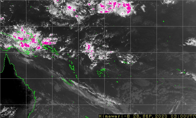
Tropical Disturbance Advisory Number B1 issued from RSMC NADI
Jan 13/2047 UTC 2006 UTC.
Tropical Depression 06F centre [999hPa] centre was located near 14.0S
174.0W at 131800 UTC. Position poor based on HR MTSAT EIR/VIS imagery
with animation and peripheral surface reports. Depression moving
southeast 10 knots. Maximum 10-minute average winds 20 to 25 knots
increasing to 35 knots within 60 miles of centre in the next 12 to 24
hours.
06F erupted overnight with rapid development. Organisation now good
and increasing. Deep convection cooling steadily. Primary band to
east wrapping tightly around llcc. Some indication though of
environmental influence. Outflow good to east and north but
developing elsewhere. Depression lies under divergent 250-hpa flow
and 20 to 25-kt shear. SST around 29C. Global models that have
captured the system move it rather rapidly southeast with some
intensification. Potential for 06F to become a cyclone in the next
24 hours is moderate to good.
The next Tropical Disturbance Advisory on Tropical Depression 06F
will be issued around 140230 UTC.
South Pacific: TROPICAL CYCLONE URMIL
Moderator: S2k Moderators
Forum rules

The posts in this forum are NOT official forecasts and should not be used as such. They are just the opinion of the poster and may or may not be backed by sound meteorological data. They are NOT endorsed by any professional institution or STORM2K. For official information, please refer to products from the National Hurricane Center and National Weather Service.
-
HURAKAN

- Professional-Met

- Posts: 46086
- Age: 38
- Joined: Thu May 20, 2004 4:34 pm
- Location: Key West, FL
- Contact:
South Pacific: TROPICAL CYCLONE URMIL
Last edited by HURAKAN on Sat Jan 14, 2006 1:58 am, edited 2 times in total.
0 likes

-
P.K.

- Professional-Met
- Posts: 5149
- Joined: Thu Sep 23, 2004 5:57 pm
- Location: Watford, England
- Contact:
Yet another one, looks like the low they identified on this chart from 4 hours ago. http://www.met.gov.fj/aifs_prods/0640.html
0 likes
-
HURAKAN
- Professional-Met
- Posts: 46086
- Age: 38
- Joined: Thu May 20, 2004 4:34 pm
- Location: Key West, FL
- Contact:
AN AREA OF CONVECTION HAS PERSISTED NEAR 14.8S 174.2W,
APPROXIMATELY 205 NM WEST OF PAGO PAGO, AMERICAN SAMOA. ANIMATED
SATELLITE IMAGERY SHOWS INCREASING CONVECTION ORGANIZATION OVER
A DEVELOPING LOW LEVEL CIRCULATION CENTER. UPPER LEVEL ANAYSIS
REVEALS LOW TO MODERATE VERTICAL WIND SHEAR AND FAVORABLE DIF-
FLUENCE ALOFT. MAXIMUM SUSTAINED SURFACE WINDS ARE ESTIMATED AT
20 TO 25 KNOTS. MINIMUM SEA LEVEL PRESSURE IS ESTIMATED TO BE
NEAR 1004 MB. THE POTENTIAL FOR THE DEVELOPMENT OF A SIGNIFICANT
TROPICAL CYCLONE WITHIN THE NEXT 24 HOURS IS POOR.
0 likes
-
MiamiensisWx


Looks like Tropical Depression 6F has been upgraded to Tropical Cyclone Urmil
GALE WARNING 015 issued from RSMC NADI Jan 13/2232 UTC 2006 UTC.
Correction to forecast time..
Tropical Cyclone Urmil [995hPa] centre was located near 15.3 South
174.1 West at 132100 UTC.
Position poor.
Repeat position 15.3S 174.1W at 132100 UTC.
Cyclone moving southeast at about 10 knots.
Cyclone intensifying.
Expect sustained winds of 35 knots close to the centre increasing to
45 knots in the next 12 to 24 hours. Expect winds over 33 knots
within 90 miles of centre.
Forecast position near 17.2S 173.5W at 140900 UTC
and near 18.9S 172.5W at 142100 UTC.
All vessels within 300 nautical miles of the centre are requested to
send reports every three hours to RSMC NADI. VOS reporting ships use
normal channels. Other vessels fax plus 679 6720190 or email naditcc
at met dot gov dot fj.
This warning cancels and replaces warning 013
0 likes


-
HURAKAN
- Professional-Met
- Posts: 46086
- Age: 38
- Joined: Thu May 20, 2004 4:34 pm
- Location: Key West, FL
- Contact:
GALE WARNING 015 issued from RSMC NADI Jan 14/0116 UTC 2006 UTC.
Correction to forecast time..
Tropical Cyclone Urmil [990hPa] centre was located near 16.1 South
173.6 West at 140000 UTC.
Position poor.
Repeat position 16.1S 173.6W at 140000 UTC.
Cyclone moving southeast at about 15 knots and expected to accelerate
further.
Cyclone intensifying.
Expect sustained winds of 40 knots close to the centre increasing to
45 knots in the next 12 hours. Expect winds over 33 knots within 100
miles of centre.
Forecast position near 18.8S 172.2W at 141200 UTC
and near 21.2S 171.7W at 150000 UTC.
All vessels within 300 nautical miles of the centre are requested to
send reports every three hours to RSMC NADI. VOS reporting ships use
normal channels. Other vessels fax plus 679 6720190 or email naditcc
at met dot gov dot fj.
This warning cancels and replaces warning 013
THE SYSTEM CONTINUES TO DEEPEN. PRESSURE: 990 MB, WINDS: 40 KNOTS!
0 likes
-
Dr. Jonah Rainwater

- Category 2

- Posts: 569
- Joined: Sat Jul 23, 2005 2:45 pm
- Location: Frisco, Texas
- Contact:
-
HURAKAN
- Professional-Met
- Posts: 46086
- Age: 38
- Joined: Thu May 20, 2004 4:34 pm
- Location: Key West, FL
- Contact:
Dr. Jonah Rainwater wrote:Er, 990mb? That storm's gotta be stronger than 40kts.
I wish all the basins used the same system.
THERE IS A SIMPLE RULE THAT INDICATES THAT AS WINDS INCREASE, PRESSURE DECREASE. BUT THE RULE DOESN'T IMPLY THAT IN EVERY OCEAN OR BASIN OR STORM THE RELATIONSHIP BETWEEN PRESSURE AND WIND HAS TO BE THE SAME. THE INDIAN AND PACIFIC OCEANS ARE CHARACTERIZED TO HAVE LOWER PRESSURES THAN THE ATLANTIC!
0 likes
-
HURAKAN
- Professional-Met
- Posts: 46086
- Age: 38
- Joined: Thu May 20, 2004 4:34 pm
- Location: Key West, FL
- Contact:

WTPS22 PGTW 140230
MSGID/GENADMIN/NAVPACMETOCCEN PEARL HARBOR HI/JTWC//
SUBJ/TROPICAL CYCLONE FORMATION ALERT/140222ZJAN2006//
RMKS/
1. FORMATION OF A SIGNIFICANT TROPICAL CYCLONE IS POSSIBLE WITHIN
200 NM EITHER SIDE OF A LINE FROM 14.8S 174.2W TO 23.0S 172.3W
WITHIN THE NEXT 06 TO 24 HOURS. AVAILABLE DATA DOES NOT JUSTIFY
ISSUANCE OF NUMBERED TROPICAL CYCLONE WARNINGS AT THIS TIME.
WINDS IN THE AREA ARE ESTIMATED TO BE 30 TO 35 KNOTS. METSAT IM
AGERY AT 132330Z INDICATES THAT A CIRCULATION CENTER IS LOCATED
NEAR 16.0S 173.8W. THE SYSTEM IS MOVING SOUTH-SOUTHEASTWARD AT
13 KNOTS.
2. REMARKS: THE AREA OF CONVECTION LOCATED NEAR 14.8S 174.2W, IS
NOW LOCATED NEAR 16.0S 173.8W, APPROXIMATELY 210 NM WEST-SOUTHWEST
OF PAGO PAGO, AMERICAN SAMOA. ANIMATED SATELLITE IMAGERY SHOWS A
CONTINUED INCREASE IN CONVECTION OVER A DEVELOPING LOW LEVEL CIRCU-
LATION CENTER. UPPER LEVEL ANAYSIS REVEALS LOW TO MODERATE VERTICAL
WIND SHEAR AND STRONG DIFFLUENCE ALOFT. MAXIMUM SUSTAINED SURFACE
WINDS ARE ESTIMATED AT 30 TO 35 KNOTS. MINIMUM SEA LEVEL PRESSURE
IS ESTIMATED TO BE NEAR 1000 MB. BASED ON INCREASING ORGANIZATION,
THE POTENTIAL FOR THE DEVELOPMENT OF A SIGNIFICANT TROPICAL CYCLONE
WITHIN THE NEXT 24 HOURS IS UPGRADED TO GOOD.
3. THIS ALERT WILL BE REISSUED, UPGRADED TO WARNING OR CANCELLED BY
150230Z.

THE JTWC IS ALWAYS SLOW TO REACT BUT THEY'RE REACTING TO URMIL!
0 likes
-
HURAKAN
- Professional-Met
- Posts: 46086
- Age: 38
- Joined: Thu May 20, 2004 4:34 pm
- Location: Key West, FL
- Contact:
Tropical Disturbance Advisory Number B2 issued from RSMC NADI
Jan 14/0223 UTC 2006 UTC.
Tropical Cyclone URMIL 06F [990hPa] centre was located near 16.1S
173.7W at 140000 UTC. Position poor based on HR MTSAT EIR/VIS imagery
with animation and peripheral surface reports. Depression moving
southeast 15 knots and expected to accelerate further. Maximum
10-minute average winds estimated at 40 knots close to the centre
increasing to 45 knots in the next 12 hours. Expect winds over 33
knots within 100 miles of centre.
Organisation increasing steadily. Primary band continues to wrap
tightly around llcc. Some intrusion of environmental air and shear
still apparent. Outflow good to east and north, fair to south and
restricted elsewhere. Dvorak analysis based on a 0.6 log-10 spiral
wrap giving a T3. PT=3. Thus T3.0/3.0/D1.5/24hrs. Cyclone lies under
divergent 250-hpa flow and 20 to 25-kt shear. SST around 29C. Global
models that have captured the system move it rather rapidly southeast
with some initial intensification.
FORECAST:
12hrs valid at 141200 UTC near 18.8S 172.2W mov SE at 15kt with 45 kt
close to the centre.
24hrs valid at 150000 UTC near 21.2S 171.7W mov SE at 20kt with 45 kt
close to the centre.
OUTLOOK:
36hrs valid at 151200 UTC near 24.8S 169.0W mov SE at 20kt with 50kt
close to the centre.
48hrs valid at 160000 UTC near 28.3S 167.7W mov SE at 20kt with 45kt
close to the centre.
The next Tropical Disturbance Advisory on Tropical Cyclone URMIL will
be issued around 1408000 UTC.
0 likes
-
Epsilon_Fan

- Category 1

- Posts: 353
- Joined: Fri Jan 13, 2006 1:03 pm
- Location: Charleston, SC
strong
Man, that thing really blew up... I guess they call them cyclones down in the SPac... if not typhoons?
0 likes
Who is online
Users browsing this forum: No registered users and 88 guests