CLIMATE PREDICTION CENTER/NCEP
January 12, 2006
Synopsis: Developing La Niña conditions are expected to continue during the next 3-6 months.
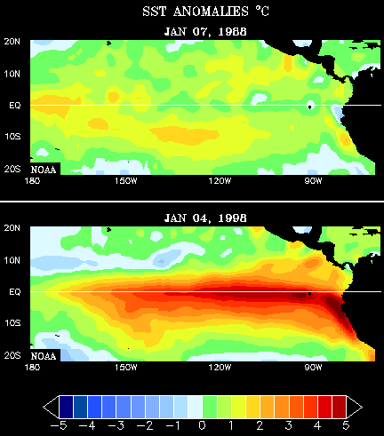
Equatorial SST anomalies greater than +0.5ºC were restricted to the region between Indonesia and 165ºE during December, while negative anomalies less than –0.5ºC were observed at most locations between the date line and the South American coast (Fig. 1). By the end of the month the SST departures were negative in all of the Niño regions (Fig. 2). During the last several months surface and subsurface temperature anomalies have decreased in the region between 180ºW and the South American coast (Fig. 3). During the same period persistent stronger-than-average low-level equatorial easterly winds were observed over the central Pacific.Since early November there has been a persistent pattern of enhanced tropical convection near 130ºE (Indonesia) and suppressed convection near the date line (180ºW). Collectively, the present oceanic and atmospheric anomalies are consistent with the development of La Niña conditions in the tropical Pacific.
Over the past several months most of the statistical and coupled model forecasts have trended towards cooler conditions in the tropical Pacific through mid-2006. The spread of the most recent statistical and coupled model forecasts (weak La Niña to ENSO-neutral) indicates some uncertainty in the outlooks (Fig. 4). However, current conditions (stronger-than-average easterly winds over the central equatorial Pacific) and recent cooling trends in observed oceanic conditions support the continuation of La Nina conditions in the tropical Pacific during the next 3-6 months.
Based on current conditions in the tropical Pacific, the most recent SST predictions,and on results from historical studies on the effects of cold episodes, we expect wetter-than-normal (drier-than-normal) conditions to prevail over Indonesia (central equatorial Pacific) during the remainder of the NH winter. That pattern of tropical precipitation favors a northward shift in the position of the jet stream over the eastern North Pacific during winter, which is usually accompanied by drier-than-normal conditions over southern California and Arizona. However, given the late onset of La Niña there is considerable uncertainty as to whether or not typical La Niña impacts will be experienced in the West during the remainder of NH winter.
http://www.cpc.ncep.noaa.gov/products/a ... _advisory/
For the first time Climate Prediction Center in it's monthly updates says a true la nina is now in the equatorial pacific.
CPC January Update for ENSO,La Nina Next 3-6 Months
Moderator: S2k Moderators
Forum rules

The posts in this forum are NOT official forecasts and should not be used as such. They are just the opinion of the poster and may or may not be backed by sound meteorological data. They are NOT endorsed by any professional institution or STORM2K. For official information, please refer to products from the National Hurricane Center and National Weather Service.
-
cycloneye

- Admin

- Posts: 148802
- Age: 69
- Joined: Thu Oct 10, 2002 10:54 am
- Location: San Juan, Puerto Rico
CPC January Update for ENSO,La Nina Next 3-6 Months
Last edited by cycloneye on Thu Jan 12, 2006 8:47 am, edited 2 times in total.
0 likes
Visit the Caribbean-Central America Weather Thread where you can find at first post web cams,radars
and observations from Caribbean basin members Click Here
and observations from Caribbean basin members Click Here

-
Matt-hurricanewatcher
-
Derek Ortt
-
Jim Hughes
- Category 3

- Posts: 825
- Joined: Sun Jul 24, 2005 1:52 pm
- Location: Martinsburg West Virginia
Well it's about time they WOKE UP and smelled the coffee. I have said this time and time again. Any one who has ever followed their outlooks over the past decade or more should know that they hardly ever actually tell you there is an ENSO phase out there until the damn thing is looking them square in the face.
Sorry if this sounds harsh but it is the truth. La Nina conditions were in the making months ago and they basically sat on their hands. Their job is to forecast and they need to quit being afraid of being wrong.
Why call it an outlook when it's already here. The Pacific NW should have been aware of these La Nina condtions a while back.
Jim
0 likes
-
weatherlover427
-
Jim Hughes
- Category 3
- Posts: 825
- Joined: Sun Jul 24, 2005 1:52 pm
- Location: Martinsburg West Virginia
weatherlover427 wrote:This is a shame. More drought out west and more hurricanes in the Atlantic. Just what we don't need.
Your right it is a little worrisome but the one bright side is the PDO is not in phase with it. It seems tilted to neutral and maybe even a slight positive phase is trying to show up. Not to sure what this means in the long run. I need to clear the cobwebs and look over things better. I have currently been on a hiatus from all types of weather forecasting....needed to get away from it for a while. To stressful for my liking......
Jim
0 likes
-
cycloneye
- Admin
- Posts: 148802
- Age: 69
- Joined: Thu Oct 10, 2002 10:54 am
- Location: San Juan, Puerto Rico
Matt-hurricanewatcher wrote:WOW looks like LA nina is coming!!!! That means a strong Cape Verde season....Also means this season should looks like 2004 or maybe more like 1995.
If La Nina hangs on until the summer months it will guarantee another active Atlantic Hurricane season.The question is how active the 2006 season will be with La Nina conditions and then looking at the other parameters how they will be some favorable and others not.A bad scenario for the 2006 season would be a perfect combination of La Nina to Neutral ENSO conditions,Warmer than average sst's in the Atlantic,Lower than average low pressures.Which of those parameters will be favorable or not when the summer months roll in? We will know by then what pattern shapes up so let's continue to watch how all the factors evolve in the next 6 months.

0 likes
Visit the Caribbean-Central America Weather Thread where you can find at first post web cams,radars
and observations from Caribbean basin members Click Here
and observations from Caribbean basin members Click Here


-
Scorpion
-
cycloneye
- Admin
- Posts: 148802
- Age: 69
- Joined: Thu Oct 10, 2002 10:54 am
- Location: San Juan, Puerto Rico
Scorpion wrote:Interesting that in total number of storms 96, 98, and 99 were not very impressive, at least compared to 04 which was weak Nino. I thought La Nina raised the number of named storms.
Yes La Nina is a big factor in terms of active Atlantic hurricane seasons.However also shows that not necessary La Nina is a cause for much more Atlantic Hurricane activity but other factors are the ones that make a season be very active or not.
0 likes
Visit the Caribbean-Central America Weather Thread where you can find at first post web cams,radars
and observations from Caribbean basin members Click Here
and observations from Caribbean basin members Click Here
-
NCHurricane

- Category 1

- Posts: 400
- Age: 54
- Joined: Sun Jul 24, 2005 2:50 pm
- Location: Winterville, North Carolina, USA
- Contact:

-
JonathanBelles
- Professional-Met

- Posts: 11430
- Age: 35
- Joined: Sat Dec 24, 2005 9:00 pm
- Location: School: Florida State University (Tallahassee, FL) Home: St. Petersburg, Florida
- Contact:
-
HurricaneJoe22
- Category 1
- Posts: 456
- Joined: Wed Sep 08, 2004 12:45 am
- Location: Temple, Texas
-
AussieMark

- Category 5

- Posts: 5858
- Joined: Tue Sep 02, 2003 6:36 pm
- Location: near Sydney, Australia
-
JonathanBelles
- Professional-Met
- Posts: 11430
- Age: 35
- Joined: Sat Dec 24, 2005 9:00 pm
- Location: School: Florida State University (Tallahassee, FL) Home: St. Petersburg, Florida
- Contact:
Who is online
Users browsing this forum: No registered users and 92 guests