Melbourne Diss vs MIami Discussions
Moderator: S2k Moderators
Forum rules

The posts in this forum are NOT official forecasts and should not be used as such. They are just the opinion of the poster and may or may not be backed by sound meteorological data. They are NOT endorsed by any professional institution or STORM2K. For official information, please refer to products from the National Hurricane Center and National Weather Service.


Melbourne Diss vs MIami Discussions
I live in S FL out the Melbourne home area and I find their discussions allot more informative than the Miami discussions.Do other people feel this way too.
0 likes
-
vbhoutex

- Storm2k Executive

- Posts: 29140
- Age: 74
- Joined: Wed Oct 09, 2002 11:31 pm
- Location: Cypress, TX
- Contact:
I don't live anywhere near that area, but do know some of the mets at the Melbourne NWS office. They are indeed very thorough and even meticulous in their analysis and discussions. I have heard a few others not be real happy with the MIA office. I'd like to hear from some in that area as to their feelings.
0 likes

I agree to a certain extent, but it has seemed when the hurricanes are nearing they have pretty good discussions or even if there is a disturbance out there. One thing I don't like is most of their disucssion are not signed so you don't know who is good and who is not. I used to look to Melbournes discussion last year anytime there might be athreat but have felt better with some of their discussions this season. So far as everyday weather - it is obvious some care about the disucssion and others do not - but most don't sign them (even initials).
0 likes
-
SouthFloridawx

- S2K Supporter

- Posts: 8346
- Age: 47
- Joined: Tue Jul 26, 2005 1:16 am
- Location: Sarasota, FL
- Contact:
I do like Melb. disco's for tropical development but, for my local disco's MIA suites me just fine.
MIA 9AM Disco,
000
FXUS62 KMFL 071450
AFDMFL
AREA FORECAST DISCUSSION
NATIONAL WEATHER SERVICE MIAMI FL
950 AM EST MON NOV 7 2005
.UPDATE...
SIMILAR PATTERN TO YESTERDAY SETTING UP WITH TINY SHRA MOVING IN
FROM THE ATLANTIC. THE 12Z MFL SOUNDING ALSO VERY MUCH LIKE 24
HOURS AGO ALBEIT A BIT SHALLOWER ON THE LOW LEVEL MOISTURE
CONTENT. BUT PWAT ONLY .07 LESS SO DO NOT EXPECT ANY DRASTIC
CHANGES. SO WILL LEAVE LOW POPS IN THE FORECAST AND TAKE OUT
MENTION OF EARLY MORNING WORDING FOR E CST SHRA AND INLAND FOG.
&&
.PREV DISCUSSION...
DISCUSSION...CURRENTLY...WIDELY SCATTERED SHOWERS MOVING WESTWARD
THROUGH THE ATLC COASTAL WATERS ON NE/E BREEZE. SHOWERS WEAKEN UPON
APPROACHING THE COAST BUT SOME ISOLATED LIGHT SHOWERS MAKING ONSHORE
BEFORE DISSIPATING.
OVERALL ALL PATTERN FOR THE SHORT TERM...TODAY THROUGH TUE NIGHT...
CHANGES VERY LITTLE. A COLD FRONT WASHES OUT OVER THE SE U.S. TO BE
REPLACED BY A SURFACE HIGH PRES RIDGE. THIS WILL KEEP S FLA IN A
RATHER DRY NE WIND FLOW WHICH WILL ALLOW THOUGH FOR MINIMAL POPS
ACROSS AREA TODAY THROUGH MON NIGHT. TEMPS AT OR SLIGHTLY ABOVE
CLIMO THROUGH THE PERIOD...EVEN THE W COAST WHERE AN AFTERNOON SEA
BREEZE CAN BE EXPECTED BUT NOT BEFORE MAXIMUM TEMPS REACHED.
IN THE EXTENDED PERIOD...WED THROUGH SUN...LITTLE CHANGE INITIALLY
ON WED I.E. A NE/E WIND FLOW WITH MINIMAL POPS(20%). NOW COMES THE
UNCERTAIN PART THU AND FRI. FOR THE THIRD NIGHT IN A ROW...GFS HAS
A FLIP-FLOPPED SOLUTION AS TO WHETHER OR NOT A COLD FRONT MOVES
THROUGH S FLA...AS EARLY AS FRI MORNING IN LATEST RUN. SOME OTHER
LONG RANGE MODELS SUPPORT THIS TO SOME EXTENT BUT SEEING VARIATION
THE PAST 3 NIGHTS...AM APPROACHING THIS WITH SOME TREPIDATION. BUT
..HERE GOES. SURFACE RIDGE N OF AREA BEGINS TO BREAK DOWN WED NIGHT
INTO THU AS THE COLD FRONT APPROACHES N FLA. FRONT WASHES OUT OVER
CENTRAL FLA EARLY FRI AND STRONG SURFACE RIDGE REBUILDS OVER THE SE
U.S. NET RESULT...MINIMAL POPS WITH FRONTAL PASSAGE AND WINDS...
AFTER BEING LIGHT AND VARIABLE THU...BECOME NORTHERLY FRI NIGHT
..THEN INCREASE AND BECOME NE OVER NEXT WEEKEND. ALAS...LITTLE
COOLING THOUGH...BACK TO CLIMO OR JUST A LITTLE BIT BELOW. MINIMAL
POPS AGAIN AND MAINLY ALONG E COAST.
MARINE...NE/E WINDS GENERALLY 15 KNOTS OR LESS ALL ZONES THROUGH
EARLY THU. WINDS BECOMING LIGHT AND VARIABLE...GENERALLY BELOW 10
KNOTS LATE THU...THEN NORTHERLY AND INCREASING LATE THU NIGHT WITH
WINDS NE AGAIN FRI. AT THIS TIME NO HIGHLIGHTS BUT SEAS IN ATLC
WATERS ON AN INCREASE AGAIN INTO NEXT WEEKEND.
FIRE WEATHER...NO PROBLEMS/CONCERNS AT THIS TIME.
&&
.MFL WATCHES/WARNINGS/ADVISORIES...
FL...NONE.
AM...NONE.
GM...NONE.
&&
$$
Melb. 9AM disco
000
FXUS62 KMLB 071412
AFDMLB
AREA FORECAST DISCUSSION
NATIONAL WEATHER SERVICE MELBOURNE FL
912 AM EST MON NOV 7 2005
.DISCUSSION...
WATER VAPOR SHOWS MAINLY ZONAL FLOW ACROSS THE CONUS. BAND OF CIRRUS
ACROSS NORTHERN FLORIDA AGAIN THIS MORNING AS A 60-70 KT JET STREAK
IS ACROSS THIS AREA. PESKY -SHRA ACTIVITY MORNING JUST OFFSHORE
CONTINUES TO WEAKEN AS IT APPROACHES THE COAST FROM THE EAST. WILL
CONTINUE TO HANDLE WITH NOWCASTS. COULD BE A SPRINKLE ALONG THE
SPACE AND TREASURE COASTS THIS MORNING BUT THEY WILL NOT AMOUNT TO
MUCH. A REINFORCING AREA OF HIGH PRESSURE WILL SLOWLY BUILD ACROSS
THE SOUTHEASTERN U.S. TODAY AND INTO TONIGHT KEEPING OUR FLOW
ONSHORE AND FROM THE NORTHEAST. AMPLE SUNSHINE PROGGED FOR
EAST-CENTRAL FLORIDA WITH HIGHS ONCE AGAIN TOPPING OUT IN THE LOWER
TO MID 80S. NO PLANNED CHANGES PRESENTLY TO THE ZONES OR GRIDS.
&&
.MARINE...CONTINUED GOOD SMALL CRAFT BOATING CONDITIONS ACROSS
COASTAL WATERS TODAY INTO TONIGHT WITH NO HEADLINES AS SEAS ACROSS
INTRACOASTAL WATERS WILL BE IN THE 2-3 FT RANGE. MAINLY LIGHT
EAST-NORTHEAST WINDS CONTINUING ACROSS THE REGION AS HIGH PRESSURE
REBUILDS ACROSS THE AREA.
&&
.AVIATION...VFR CONDITIONS FOR TODAY AND TONIGHT.
&&
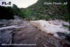
.HYDROLOGY...ST. JOHNS RIVER NEAR LAKE HARNEY AND SANFORD WILL VERY
SLOWLY CONTINUE TO SUBSIDE THIS WEEK...BUT WILL REMAIN AOA FLOOD
STAGE FOR THE NEXT FEW DAYS.
.MLB WATCHES/WARNINGS/ADVISORIES...NONE.
&&
$$
SHORT TERM...SEDLOCK
LONG TERM....GLITTO
MIA 9AM Disco,
000
FXUS62 KMFL 071450
AFDMFL
AREA FORECAST DISCUSSION
NATIONAL WEATHER SERVICE MIAMI FL
950 AM EST MON NOV 7 2005
.UPDATE...
SIMILAR PATTERN TO YESTERDAY SETTING UP WITH TINY SHRA MOVING IN
FROM THE ATLANTIC. THE 12Z MFL SOUNDING ALSO VERY MUCH LIKE 24
HOURS AGO ALBEIT A BIT SHALLOWER ON THE LOW LEVEL MOISTURE
CONTENT. BUT PWAT ONLY .07 LESS SO DO NOT EXPECT ANY DRASTIC
CHANGES. SO WILL LEAVE LOW POPS IN THE FORECAST AND TAKE OUT
MENTION OF EARLY MORNING WORDING FOR E CST SHRA AND INLAND FOG.
&&
.PREV DISCUSSION...
DISCUSSION...CURRENTLY...WIDELY SCATTERED SHOWERS MOVING WESTWARD
THROUGH THE ATLC COASTAL WATERS ON NE/E BREEZE. SHOWERS WEAKEN UPON
APPROACHING THE COAST BUT SOME ISOLATED LIGHT SHOWERS MAKING ONSHORE
BEFORE DISSIPATING.
OVERALL ALL PATTERN FOR THE SHORT TERM...TODAY THROUGH TUE NIGHT...
CHANGES VERY LITTLE. A COLD FRONT WASHES OUT OVER THE SE U.S. TO BE
REPLACED BY A SURFACE HIGH PRES RIDGE. THIS WILL KEEP S FLA IN A
RATHER DRY NE WIND FLOW WHICH WILL ALLOW THOUGH FOR MINIMAL POPS
ACROSS AREA TODAY THROUGH MON NIGHT. TEMPS AT OR SLIGHTLY ABOVE
CLIMO THROUGH THE PERIOD...EVEN THE W COAST WHERE AN AFTERNOON SEA
BREEZE CAN BE EXPECTED BUT NOT BEFORE MAXIMUM TEMPS REACHED.
IN THE EXTENDED PERIOD...WED THROUGH SUN...LITTLE CHANGE INITIALLY
ON WED I.E. A NE/E WIND FLOW WITH MINIMAL POPS(20%). NOW COMES THE
UNCERTAIN PART THU AND FRI. FOR THE THIRD NIGHT IN A ROW...GFS HAS
A FLIP-FLOPPED SOLUTION AS TO WHETHER OR NOT A COLD FRONT MOVES
THROUGH S FLA...AS EARLY AS FRI MORNING IN LATEST RUN. SOME OTHER
LONG RANGE MODELS SUPPORT THIS TO SOME EXTENT BUT SEEING VARIATION
THE PAST 3 NIGHTS...AM APPROACHING THIS WITH SOME TREPIDATION. BUT
..HERE GOES. SURFACE RIDGE N OF AREA BEGINS TO BREAK DOWN WED NIGHT
INTO THU AS THE COLD FRONT APPROACHES N FLA. FRONT WASHES OUT OVER
CENTRAL FLA EARLY FRI AND STRONG SURFACE RIDGE REBUILDS OVER THE SE
U.S. NET RESULT...MINIMAL POPS WITH FRONTAL PASSAGE AND WINDS...
AFTER BEING LIGHT AND VARIABLE THU...BECOME NORTHERLY FRI NIGHT
..THEN INCREASE AND BECOME NE OVER NEXT WEEKEND. ALAS...LITTLE
COOLING THOUGH...BACK TO CLIMO OR JUST A LITTLE BIT BELOW. MINIMAL
POPS AGAIN AND MAINLY ALONG E COAST.
MARINE...NE/E WINDS GENERALLY 15 KNOTS OR LESS ALL ZONES THROUGH
EARLY THU. WINDS BECOMING LIGHT AND VARIABLE...GENERALLY BELOW 10
KNOTS LATE THU...THEN NORTHERLY AND INCREASING LATE THU NIGHT WITH
WINDS NE AGAIN FRI. AT THIS TIME NO HIGHLIGHTS BUT SEAS IN ATLC
WATERS ON AN INCREASE AGAIN INTO NEXT WEEKEND.
FIRE WEATHER...NO PROBLEMS/CONCERNS AT THIS TIME.
&&
.MFL WATCHES/WARNINGS/ADVISORIES...
FL...NONE.
AM...NONE.
GM...NONE.
&&
$$
Melb. 9AM disco
000
FXUS62 KMLB 071412
AFDMLB
AREA FORECAST DISCUSSION
NATIONAL WEATHER SERVICE MELBOURNE FL
912 AM EST MON NOV 7 2005
.DISCUSSION...
WATER VAPOR SHOWS MAINLY ZONAL FLOW ACROSS THE CONUS. BAND OF CIRRUS
ACROSS NORTHERN FLORIDA AGAIN THIS MORNING AS A 60-70 KT JET STREAK
IS ACROSS THIS AREA. PESKY -SHRA ACTIVITY MORNING JUST OFFSHORE
CONTINUES TO WEAKEN AS IT APPROACHES THE COAST FROM THE EAST. WILL
CONTINUE TO HANDLE WITH NOWCASTS. COULD BE A SPRINKLE ALONG THE
SPACE AND TREASURE COASTS THIS MORNING BUT THEY WILL NOT AMOUNT TO
MUCH. A REINFORCING AREA OF HIGH PRESSURE WILL SLOWLY BUILD ACROSS
THE SOUTHEASTERN U.S. TODAY AND INTO TONIGHT KEEPING OUR FLOW
ONSHORE AND FROM THE NORTHEAST. AMPLE SUNSHINE PROGGED FOR
EAST-CENTRAL FLORIDA WITH HIGHS ONCE AGAIN TOPPING OUT IN THE LOWER
TO MID 80S. NO PLANNED CHANGES PRESENTLY TO THE ZONES OR GRIDS.
&&
.MARINE...CONTINUED GOOD SMALL CRAFT BOATING CONDITIONS ACROSS
COASTAL WATERS TODAY INTO TONIGHT WITH NO HEADLINES AS SEAS ACROSS
INTRACOASTAL WATERS WILL BE IN THE 2-3 FT RANGE. MAINLY LIGHT
EAST-NORTHEAST WINDS CONTINUING ACROSS THE REGION AS HIGH PRESSURE
REBUILDS ACROSS THE AREA.
&&
.AVIATION...VFR CONDITIONS FOR TODAY AND TONIGHT.
&&
.HYDROLOGY...ST. JOHNS RIVER NEAR LAKE HARNEY AND SANFORD WILL VERY
SLOWLY CONTINUE TO SUBSIDE THIS WEEK...BUT WILL REMAIN AOA FLOOD
STAGE FOR THE NEXT FEW DAYS.
.MLB WATCHES/WARNINGS/ADVISORIES...NONE.
&&
$$
SHORT TERM...SEDLOCK
LONG TERM....GLITTO
0 likes

-
jlauderdal
- S2K Supporter
- Posts: 7240
- Joined: Wed May 19, 2004 5:46 am
- Location: NE Fort Lauderdale
- Contact:
Re: Melbourne Diss vs MIami Discussions
boca wrote:I live in S FL out the Melbourne home area and I find their discussions allot more informative than the Miami discussions.Do other people feel this way too.
yes
0 likes
-
flashflood
- Tropical Storm

- Posts: 187
- Joined: Tue Nov 09, 2004 12:30 pm
- Location: S. FL

-
Incident_MET

- Professional-Met

- Posts: 63
- Joined: Tue Mar 28, 2006 10:22 pm
- Location: Floridana Beach, FL
Re: Melbourne Diss vs MIami Discussions
jlauderdal wrote:boca wrote:I live in S FL out the Melbourne home area and I find their discussions allot more informative than the Miami discussions.Do other people feel this way too.
yes
I agree...Melbourne is much more detailed....MIA's website is not bad though....Although, I often find myself trying to interpret what they are writing...often not legible or full of acronyms...and not grammatically correct. (and neither is this post).
0 likes
Downdraft wrote:I know most of the met's in Melbourne and they are a great group. In fact, one of them posts on this board although not as much as he used to. I don't feel free to give his name but his screen name is AJC3.
That's what makes this website the best on the internet...we actually have experts posting...and many observing.
0 likes

The Melbourne discussion is good, but I don't think the Miami discussion is lacking.
Frankly, I prefer the Key West AFD over all of them. They aren't averse to humor......plus, Key West's weather is usually more interesting than Miami's, Melbourne's, or Tampa's. You get island cloud lines, frequent waterspouts, outflow boundaries from afternoon thunderstorms over Cuba, and even the occasional bit of sea fog.
Frankly, I prefer the Key West AFD over all of them. They aren't averse to humor......plus, Key West's weather is usually more interesting than Miami's, Melbourne's, or Tampa's. You get island cloud lines, frequent waterspouts, outflow boundaries from afternoon thunderstorms over Cuba, and even the occasional bit of sea fog.
0 likes


-
Rainband
Rainband wrote:Tampa coordinates a lot with them during the hurricane season. I agree they are very informative.
What determines the location of these offices, actually? I understand having offices serving Miami, Key West, Tampa, Jacksonville, and Tallahassee...but why a Melbourne office and no Orlando? Is it simply because Orlando is fairly close to Tampa, and they needed a NWS office on the coast between Miami and Jax?
I remember on some occasions the last few years, the area AFDs were more thorough and informative in detailing possible scenarios for hurricanes than the NHC discussions were.
Of course, some of the guys writing the NHC discussions are more informative than others.
0 likes
Who is online
Users browsing this forum: No registered users and 76 guests