Invest 96L Near Az Islands,Comments,Sat Pics,Models Thread

This is the general tropical discussion area. Anyone can take their shot at predicting a storms path.

Moderator: S2k Moderators

Forum rules

The posts in this forum are NOT official forecasts and should not be used as such. They are just the opinion of the poster and may or may not be backed by sound meteorological data. They are NOT endorsed by any professional institution or STORM2K. For official information, please refer to products from the National Hurricane Center and National Weather Service.

Help Support Storm2K
Message
Author
User avatar
TheEuropean
Professional-Met
Professional-Met
Posts: 1797
Age: 60
Joined: Tue Sep 20, 2005 3:17 pm
Location: Voerde, Germany
Contact:

#81 Postby TheEuropean » Sun Oct 09, 2005 4:55 am

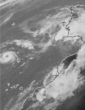
P.K. wrote:Well I do think it looks more comma like this morning, bit odd to get a comma over this high SSTs isn't it though? First visible image of the morning should be in fairly soon.


First visible image:

<IMG SRC="http://www.saevert.de/bilder/storm2k/051009madeira12.jpg">

Now the "eyewall" is open NW:

<IMG SRC="http://www.saevert.de/bilder/storm2k/051009madeira14.jpg">
0 likes   

krysof

#82 Postby krysof » Sun Oct 09, 2005 4:56 am

it looks like a mini hurricane
0 likes   

User avatar
P.K.
Professional-Met
Professional-Met
Posts: 5149
Joined: Thu Sep 23, 2004 5:57 pm
Location: Watford, England
Contact:

#83 Postby P.K. » Sun Oct 09, 2005 5:03 am

TheEuropean wrote:First visible image:


Ah there already are some, I tend to just use the Dundee images in this area. Hopefully it might be visible in one of the AVHRR or TERRA/AQUA images later.
0 likes   

AZS
Tropical Storm
Tropical Storm
Posts: 117
Joined: Sun Sep 18, 2005 5:50 pm
Location: PD, Azores Islands, Portugal

#84 Postby AZS » Sun Oct 09, 2005 5:12 am

:eek:

go away bad storm !!!!!!!!

sorry Madeira !!!!

Here, in one of the Azores islands, we have sun, winds of 15 mph, nothing more than that.
0 likes   

Matt-hurricanewatcher

#85 Postby Matt-hurricanewatcher » Sun Oct 09, 2005 6:39 am

This thing looks like a hurricane...
85h data shows a eyewall
quickscats show a tight wind field

banding/outflow has become much better defined.
A clear eye has pop out

Please some one get me out of this nightmare.
0 likes   

rainstorm

#86 Postby rainstorm » Sun Oct 09, 2005 7:25 am

looks impressive, why up classification?
0 likes   

HenkL
S2K Supporter
S2K Supporter
Posts: 2401
Joined: Fri Sep 10, 2004 5:33 pm
Location: Groningen, The Netherlands
Contact:

#87 Postby HenkL » Sun Oct 09, 2005 7:33 am

Picture at 12 UTC.

Image
0 likes   

Matt-hurricanewatcher

#88 Postby Matt-hurricanewatcher » Sun Oct 09, 2005 7:34 am

That is a hurricane :x

I hope they upgrade it to Vince at 11am!!!
0 likes   


Return to “Talkin' Tropics”

Who is online

Users browsing this forum: MadaTheConquistador, ncforecaster89, Teban54 and 64 guests