37N29W
Moderator: S2k Moderators
Forum rules
The posts in this forum are NOT official forecasts and should not be used as such. They are just the opinion of the poster and may or may not be backed by sound meteorological data. They are NOT endorsed by any professional institution or STORM2K. For official information, please refer to products from the National Hurricane Center and National Weather Service.
- HURAKAN
- Professional-Met

- Posts: 46086
- Age: 38
- Joined: Thu May 20, 2004 4:34 pm
- Location: Key West, FL
- Contact:
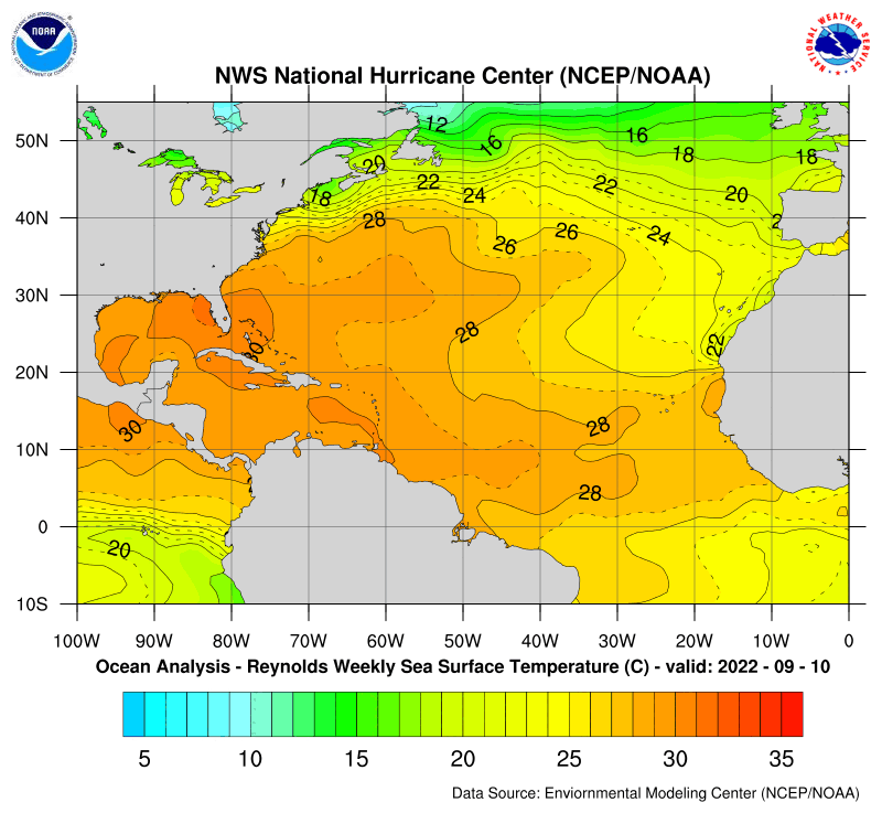
It certainly looks interesting, but it's at a very high latitude, and it's located in an area affected by the Canary Current, which is the reverse of the Gulf Stream, basically. Thereafter, the water temperature, as you can see in the map below, barely sustains a tropical system, and the low is moving to the NE toward cooler temperatures. Also, there seems to be a trough or frontal system is already picking this system up.


0 likes
Who is online
Users browsing this forum: No registered users and 140 guests


