aaah. its only a matter of time now.
<RICKY>
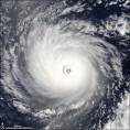
Hurricane Stan Recon Reports
Moderator: S2k Moderators
Forum rules

The posts in this forum are NOT official forecasts and should not be used as such. They are just the opinion of the poster and may or may not be backed by sound meteorological data. They are NOT endorsed by any professional institution or STORM2K. For official information, please refer to products from the National Hurricane Center and National Weather Service.
-
WeatherEmperor
- S2K Supporter

- Posts: 4806
- Age: 41
- Joined: Thu Sep 04, 2003 2:54 pm
- Location: South Florida
-
calculatedrisk
- Tropical Depression

- Posts: 76
- Joined: Fri Jul 15, 2005 3:39 pm
-
cycloneye

- Admin

- Posts: 148836
- Age: 69
- Joined: Thu Oct 10, 2002 10:54 am
- Location: San Juan, Puerto Rico
AF307 01HHA INVEST HDOB 23 KNHC
1741. 1756N 08302W 02310 0111 013 005 138 100 006 02467 0000000000
1742 1755N 08300W 01942 0093 339 002 152 132 003 02073 0000000000
1742. 1754N 08258W 01577 0070 288 003 170 150 003 01684 0000000000
1743 1753N 08255W 01211 0051 313 001 188 170 002 01296 0000000000
1743. 1752N 08253W 00853 0031 143 003 208 188 006 00907 0000000000
1744 1751N 08251W 00574 0006 166 009 220 212 009 00603 0000000000
1744. 1751N 08250W 00408 5002 146 008 228 228 009 00421 0000000000
1745 1750N 08248W 00369 5006 133 008 236 228 009 00376 0000000000
1745. 1749N 08246W 00382 5007 131 008 236 220 009 00388 0000000000
1746 1749N 08245W 00400 5006 140 008 236 218 008 00407 0000000000
1746. 1748N 08244W 00397 5006 130 008 232 228 008 00403 0000000000
1747 1748N 08242W 00398 5006 129 007 234 228 007 00404 0000000000
1747. 1747N 08241W 00396 5006 127 007 234 224 007 00403 0000000000
1748 1746N 08239W 00395 5006 137 008 238 220 009 00402 0000000000
1748. 1746N 08238W 00397 5006 139 009 240 216 010 00403 0000000000
1749 1745N 08236W 00396 5006 143 010 240 214 010 00402 0000000100
1749. 1745N 08235W 00397 5006 136 009 236 216 009 00403 0000000000
1750 1744N 08233W 00396 5006 132 009 236 220 010 00402 0000000000
1750. 1743N 08232W 00397 5006 119 009 232 228 009 00403 0000000000
1751 1743N 08231W 00396 5006 120 009 236 222 009 00403 0000000000
0 likes
Visit the Caribbean-Central America Weather Thread where you can find at first post web cams,radars
and observations from Caribbean basin members Click Here
and observations from Caribbean basin members Click Here

-
cycloneye
- Admin
- Posts: 148836
- Age: 69
- Joined: Thu Oct 10, 2002 10:54 am
- Location: San Juan, Puerto Rico
205
URNT11 KNHC 291759
97779 17484 50178 82600 04000 14010 24212 /0010
41015
RMK AF307 01HHA INVEST OB 10
URNT11 KNHC 291759
97779 17484 50178 82600 04000 14010 24212 /0010
41015
RMK AF307 01HHA INVEST OB 10
0 likes
Visit the Caribbean-Central America Weather Thread where you can find at first post web cams,radars
and observations from Caribbean basin members Click Here
and observations from Caribbean basin members Click Here
-
cycloneye
- Admin
- Posts: 148836
- Age: 69
- Joined: Thu Oct 10, 2002 10:54 am
- Location: San Juan, Puerto Rico
361
UZNT13 KNHC 291749
XXAA 79184 99183 70840 04584 99011 28443 08006 00097 27645 07508
92784 22435 05508 85517 18856 02011 70165 10857 03013 50589 05338
35509 40761 16122 32504 88999 77999
31313 09608 81730
61616 AF307 01HHA INVEST OB 09
62626 SPL 1830N08401W 1739 MBL WND 07008 AEV 20507 DLM WND 02009
010438 WL150 07507 081 =
XXBB 79188 99183 70840 04584 00011 28443 11879 20033 22850 18856
33762 15658 44705 11257 55597 02035 66575 00250 77570 00332 88565
00350 99541 02530 11505 04950 22455 10131 33449 10156 44439 11132
55412 13526 66400 16122
21212 00011 08006 11892 03007 22850 02011 33802 00512 44765 04012
55745 04512 66720 02511 77678 04012 88626 01010 99566 02011 11554
35510 22400 32504
31313 09608 81730
61616 AF307 01HHA INVEST OB 09
62626 SPL 1830N08401W 1739 MBL WND 07008 AEV 20507 DLM WND 02009
010438 WL150 07507 081 =
Dropsonde.
0 likes
Visit the Caribbean-Central America Weather Thread where you can find at first post web cams,radars
and observations from Caribbean basin members Click Here
and observations from Caribbean basin members Click Here
-
cycloneye
- Admin
- Posts: 148836
- Age: 69
- Joined: Thu Oct 10, 2002 10:54 am
- Location: San Juan, Puerto Rico
SXXX50 KNHC 291803
AF307 01HHA INVEST HDOB 24 KNHC
1751. 1742N 08229W 00397 5006 124 009 236 214 009 00404 0000000000
1752 1742N 08228W 00395 5006 121 010 240 212 011 00402 0000000000
1752. 1741N 08226W 00398 5006 115 010 236 222 011 00405 0000000000
1753 1740N 08225W 00396 5005 112 010 236 218 010 00404 0000000000
1753. 1740N 08224W 00396 5006 109 010 234 224 010 00403 0000000000
1754 1739N 08222W 00396 5006 107 009 234 222 010 00403 0000000000
1754. 1739N 08221W 00397 5006 111 009 234 230 009 00403 0000000000
1755 1738N 08219W 00397 5006 110 009 234 234 010 00403 0000000000
1755. 1737N 08218W 00389 5006 111 008 234 234 009 00395 0000000000
1756 1737N 08216W 00349 5009 110 009 236 236 009 00352 0000000000
1756. 1736N 08215W 00333 5011 111 009 238 238 010 00335 0000000000
1757 1735N 08214W 00337 5011 099 009 236 236 010 00338 0000000000
1757. 1734N 08213W 00336 5011 097 010 238 238 010 00338 0000000000
1758 1733N 08212W 00327 5011 109 010 240 240 011 00329 0000000000
1758. 1733N 08210W 00304 5013 110 011 240 240 012 00304 0000000000
1759 1733N 08209W 00305 5013 109 012 240 240 013 00305 0000000000
1759. 1733N 08207W 00305 5013 109 013 240 240 014 00305 0000000000
1800 1733N 08206W 00304 5013 110 014 240 240 015 00304 0000000000
1800. 1734N 08204W 00306 5013 111 015 240 240 015 00305 0000000000
1801 1734N 08203W 00305 5013 115 014 242 242 015 00304 0000000000
0 likes
Visit the Caribbean-Central America Weather Thread where you can find at first post web cams,radars
and observations from Caribbean basin members Click Here
and observations from Caribbean basin members Click Here
-
cycloneye
- Admin
- Posts: 148836
- Age: 69
- Joined: Thu Oct 10, 2002 10:54 am
- Location: San Juan, Puerto Rico
SXXX50 KNHC 291813
AF307 01HHA INVEST HDOB 25 KNHC
1801. 1734N 08201W 00304 5013 112 013 242 242 014 00304 0000000000
1802 1733N 08200W 00307 5013 106 012 240 240 013 00306 0000000000
1802. 1732N 08159W 00304 5014 104 014 242 242 014 00302 0000000000
1803 1730N 08158W 00306 5014 100 014 240 240 014 00305 0000000000
1803. 1729N 08157W 00305 5013 099 013 242 242 013 00304 0000000000
1804 1728N 08157W 00305 5013 100 012 242 242 013 00304 0000000000
1804. 1727N 08156W 00305 5013 110 012 244 236 012 00304 0000000000
1805 1725N 08155W 00304 5014 117 014 246 236 014 00303 0000000000
1805. 1724N 08154W 00305 5014 125 014 246 236 014 00304 0000000000
1806 1723N 08153W 00305 5014 125 013 246 238 013 00304 0000000000
1806. 1722N 08152W 00305 5013 119 011 244 244 012 00304 0000000000
1807 1720N 08152W 00304 5013 112 011 246 244 011 00304 0000000000
1807. 1719N 08151W 00306 5013 115 012 246 244 012 00305 0000000000
1808 1718N 08150W 00304 5014 115 012 244 244 013 00303 0000000000
1808. 1717N 08149W 00305 5013 120 013 248 242 013 00304 0000000000
1809 1715N 08148W 00306 5013 122 013 250 238 013 00305 0000000000
1809. 1714N 08147W 00305 5014 123 013 250 240 013 00303 0000000000
1810 1713N 08147W 00305 5014 121 012 248 240 012 00303 0000000000
1810. 1712N 08146W 00305 5014 124 012 250 240 012 00304 0000000000
1811 1711N 08145W 00305 5014 125 011 250 244 012 00304 0000000000
0 likes
Visit the Caribbean-Central America Weather Thread where you can find at first post web cams,radars
and observations from Caribbean basin members Click Here
and observations from Caribbean basin members Click Here
-
DESTRUCTION5

- Category 5

- Posts: 4430
- Age: 44
- Joined: Wed Sep 03, 2003 11:25 am
- Location: Stuart, FL
-
cycloneye
- Admin
- Posts: 148836
- Age: 69
- Joined: Thu Oct 10, 2002 10:54 am
- Location: San Juan, Puerto Rico
356
URNT11 KNHC 291806
97779 18024 50175 82000 03000 10013 24248 /0010
40915
RMK AF307 01HHA INVEST OB 11
URNT11 KNHC 291806
97779 18024 50175 82000 03000 10013 24248 /0010
40915
RMK AF307 01HHA INVEST OB 11
0 likes
Visit the Caribbean-Central America Weather Thread where you can find at first post web cams,radars
and observations from Caribbean basin members Click Here
and observations from Caribbean basin members Click Here
-
cycloneye
- Admin
- Posts: 148836
- Age: 69
- Joined: Thu Oct 10, 2002 10:54 am
- Location: San Juan, Puerto Rico
439
URNT11 KNHC 291828
97779 18144 50172 81700 03000 12016 25248 /0010
41215
RMK AF307 01HHA INVEST OB 12
URNT11 KNHC 291828
97779 18144 50172 81700 03000 12016 25248 /0010
41215
RMK AF307 01HHA INVEST OB 12
0 likes
Visit the Caribbean-Central America Weather Thread where you can find at first post web cams,radars
and observations from Caribbean basin members Click Here
and observations from Caribbean basin members Click Here


-
JamesFromMaine2

- Category 4

- Posts: 989
- Joined: Tue Jul 19, 2005 1:38 am
- Location: Portland Maine USA
- Contact:
Who is online
Users browsing this forum: No registered users and 85 guests