Invest 95L,Comments,Sat Pics,Models Thread
Moderator: S2k Moderators
Forum rules

The posts in this forum are NOT official forecasts and should not be used as such. They are just the opinion of the poster and may or may not be backed by sound meteorological data. They are NOT endorsed by any professional institution or STORM2K. For official information, please refer to products from the National Hurricane Center and National Weather Service.
-
hurricanefloyd5

- Category 5

- Posts: 1659
- Age: 45
- Joined: Sun May 02, 2004 10:53 am
- Location: Spartanburg
- Contact:

-
Coredesat
-
Huckster

- Category 1

- Posts: 394
- Age: 43
- Joined: Fri Aug 13, 2004 2:33 am
- Location: Baton Rouge, LA
- Contact:
jschlitz wrote:skysummit wrote:jschlitz wrote:skysummit wrote:Brent wrote:10:30pm TWO:
THE TROPICAL WAVE LOCATED ABOUT 1100 MILES EAST-SOUTHEAST OF THE
SOUTHERN WINDWARD ISLANDS CONTINUES TO SHOW SIGNS OF ORGANIZATION
AS IT MOVES WESTWARD AT 10-15 MPH. THIS LARGE SYSTEM HAS THE
POTENTIAL TO BECOME A TROPICAL DEPRESSION OVER THE NEXT COUPLE OF
DAYS.
Wow....they really get into it heh? I could've wrote that outlook.
In their defense so many of these come and go, not just in one year, but over the course of many years, it's best not to write War & Peace for every wave out there, esp. while we have a hurricane with the eyewall on the coast as we speak (er type...). They got bigger fish to fry at the moment.
I realize that, but this is not no ordinary wave...have you seen this thing? I guess they're saving their award winning outlooks for the next week when this wave really gets going.
I do think this one will develop....but we have definitely had our fair share of 'monster' waves this year that fizzled.
Here's my take on the whole "monster wave" thing. It seems like every year, we go through the motions of watching waves come off Africa go poof. We even start tracking the waves before they leave the coast. How many such waves have we done this to this year? How many of those really amazing looking waves have just fizzled out? I THINK all of them have, and for a couple of them, the ghosts came back later on. We've had nothing big develop in the Cape Verde region really. Our biggest, strongest, and worst hurricane this year came from a remnant of a TD combined with another innoculous looking wave. I don't remember hearing a lot about the waves that formed Dennis or Emily either, not until they got roughly in the area that our current area of interest is. I don't remember this wave coming off Africa at all, though it did of course.
I think what makes this one different from the other big bark but no bite waves is, it didn't come out with much fanfare, its been slowly gaining convection and organization, and it's in roughly the same geographic area that has been the staging area for several of the serious hurricanes of recent years (Lili, Isidore, Ivan, Dennis, and Emily all started to show their colors in that basic area whether they were classified there or the waves that spawned them started to organize pretty well).
My guess is that this one will continue the trend this season of relatively in-close development.
0 likes
-
weatherwindow

- Category 4

- Posts: 904
- Joined: Mon Sep 20, 2004 9:48 am
- Location: key west/ft lauderdale
IMHO, given the consistently unfavorable conditions which have persisted thru most of the tropical atlantic this season, 95L is, perhaps, in the only area and latitude with a reasonable chance at development. large envelope, decent convection. as far as track....as has been said in many posts, the intrusion of unseasonably deep troughs has created a persistent bias toward recurvature for the last two months. one is currently approaching the 95L's longitude...i believe the early gfdl runs are picking up on it. if the system were to develop east of about 50degW, it would likely gain significant latitude, if not recurve. another trough will be approaching 60W in about three days. if this is to be a caribbean long tracker, it will have to remain south of about 13degN. IMO, if it approaches 60W north of that latitude and the weakness verifies, it will recurve, possibly missing the islands altogether. that said, one of the greatest killers of all time, the great hurricane of 1780, formed in this area even later in the season and moved northnorthwest into a presumed weakness and devastated almost the entire lesser antilles..........rich
0 likes
-
Anonymous
Huckster wrote:I don't remember hearing a lot about the waves that formed Dennis or Emily either, not until they got roughly in the area that our current area of interest is. I don't remember this wave coming off Africa at all, though it did of course.
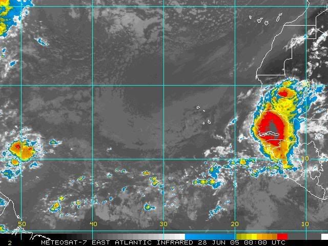
Well, I myself remember the wave that spawned Dennis very well. I thought it was such a classic example of an exiting tropical wave, I saved the image...little did I know what a monster hurricane was on the way.
0 likes
-
Matt-hurricanewatcher
-
senorpepr

- Military Met/Moderator

- Posts: 12542
- Age: 43
- Joined: Fri Aug 22, 2003 9:22 pm
- Location: Mackenbach, Germany
- Contact:
Matt-hurricanewatcher wrote:Quickscats coming in this morning shows that it now has a small LLC around 9 north/47 west. The convection is centered there with nice outflow/banding. I think this will be upgraded to a tropical depression by 5pm.
3 more for 1995
5 more for 1933
6 more for the record.
I believe your numbers are off.
4 more for 1995 (P, R, S, T)
6 more for 1933 (P, R, S, T, V, W)
7 more for the record.
...unless you're already giving 95L a name...
0 likes
-
Jim Hughes
- Category 3

- Posts: 825
- Joined: Sun Jul 24, 2005 1:52 pm
- Location: Martinsburg West Virginia
Matt-hurricanewatcher wrote:Quickscats coming in this morning shows that it now has a small LLC around 9 north/47 west. The convection is centered there with nice outflow/banding. I think this will be upgraded to a tropical depression by 5pm.
3 more for 1995
5 more for 1933
6 more for the record.
I guess it could because there has been an awful lot of ioniztion recently by way of all these increased particle but this would go against the 500 solar wind speed km/sec rule....it is still way above.
If it was to form it would have to be in the weakening solar wind trend... and sice it would still be above 500 km/sec ..then it would most likely end up being a fish storm....or east coast ...from what IMHO over the years.
Jim
0 likes
-
Jim Hughes
- Category 3
- Posts: 825
- Joined: Sun Jul 24, 2005 1:52 pm
- Location: Martinsburg West Virginia
Matt-hurricanewatcher wrote:Quickscats coming in this morning shows that it now has a small LLC around 9 north/47 west. The convection is centered there with nice outflow/banding. I think this will be upgraded to a tropical depression by 5pm.
3 more for 1995
5 more for 1933
6 more for the record.
BTW look here also...a few more days would be a better outllook time and I said this 17 days ago. It may not occur but I thought the solar wind speed would be high and it has been ... and it should be weakening on time.......Lets see what happens...9/6 last TD formation.
Jim
http://www.storm2k.org/phpbb2/viewtopic.php?t=72418
0 likes
-
cycloneye

- Admin

- Posts: 148841
- Age: 69
- Joined: Thu Oct 10, 2002 10:54 am
- Location: San Juan, Puerto Rico
ABNT20 KNHC 150905
TWOAT
TROPICAL WEATHER OUTLOOK
NWS TPC/NATIONAL HURRICANE CENTER MIAMI FL
530 AM EDT THU SEP 15 2005
FOR THE NORTH ATLANTIC...CARIBBEAN SEA AND THE GULF OF MEXICO...
THE NATIONAL HURRICANE CENTER IS ISSUING ADVISORIES ON HURRICANE
OPHELIA...LOCATED ABOUT 30 MILES EAST-NORTHEAST OF CAPE LOOKOUT
NORTH CAROLINA.
SATELLITE IMAGES INDICATE THAT THE TROPICAL WAVE LOCATED ABOUT 1000
MILES EAST-SOUTHEAST OF THE SOUTHERN WINDWARD ISLANDS REMAINS
WELL-ORGANIZED. THIS SYSTEM HAS THE POTENTIAL TO BECOME A TROPICAL
DEPRESSION OVER THE NEXT COUPLE OF DAYS AS IT MOVES TOWARD THE WEST
AT 10-15 MPH.
ELSEWHERE...TROPICAL STORM FORMATION IS NOT EXPECTED THROUGH
FRIDAY.
FORECASTER AVILA
0 likes
Visit the Caribbean-Central America Weather Thread where you can find at first post web cams,radars
and observations from Caribbean basin members Click Here
and observations from Caribbean basin members Click Here
-
cycloneye
- Admin
- Posts: 148841
- Age: 69
- Joined: Thu Oct 10, 2002 10:54 am
- Location: San Juan, Puerto Rico
THE NEXT FEATURE OF INTEREST FOR THE LOCAL REGION IS A LARGE
CONVECTIVE COMPLEX ACROSS THE CENTRAL TROPICAL ATLC LOCATED WITHIN
THE ITCZ. EXAMINATION OF THE PAST 7-10 DAYS OF DATA SUGGESTS TO ME
THAT THERE ARE TWO VORT CENTERS WITHIN THIS AREA OF DISTURBED
WEATHER...ONE A PIECE OF AN AEW AT 47.5W THAT WAS SEVERELY STRETCHED
THEN SPLIT AS IT EXITED AFRICA...AND REMAINS LINKED TO THE TROF AT
56 WEST...AND THEN NEXT A LOW LAT TROPICAL WAVE ALONG 45-46. CIMSS
LLVL VORT FIELDS AND RECENT QUIKSCAT PASSES SUGGEST AN ELONGATED
CYCLONIC CIRCULATION. WEAK ANTICYCLONIC SHEAR ALOFT AND DEEP
MOISTURE WITH THIS FEATURE OFFER THE POTENTIAL FOR FURTHER GRADUAL
ORGANIZATION INTO A TROPICAL CYCLONE OVER THE NEXT FEW DAYS. THE TWO
LLVL VORTS WILL LIKELY HAVE TO MERGE OR CONGEAL BEFORE THIS OCCURS.
NHC COMPUTER MODELS HAVE BEEN SHIFTING BACK AND FORTH BETWEEN AN
EVENTUAL NW AND WNW MOTION THROUGH 120 HOURS...WITH PAST TWO GFDL
RUNS LIFTING STRONGLY N OR NNW. HOWEVER...THIS SYSTEM HAS YET TO
DEVIATE FROM A WLY MOTION. A LARGE MID TO UPPER LEVEL CYCLONIC
CIRCULATION TO THE SW AND ACROSS THE SOUTHERN HEMISPHERE...AND
INCREASING MID LEVEL WEAKNESS N THRU NE OF THE LESSER ANTILLES
SHOULD PROVIDE THE ENVIRONMENT TO MAKE THAT NW AND THEN NLY TURN IN
A FEW DAYS. HOWEVER...THE FARTHER WEST THIS SYSTEM MOVES...THE LATER
THE TURN. THAT BEING SAID...ALL INTERESTS IN THE E AND NE CARIBBEAN
SHOULD MONITOR THIS SYSTEM CLOSELY.
The above from the AFD NWS San Juan.
Hey fellow members who live in the islands you have to stay alert and follow the progress of this developing system.
0 likes
Visit the Caribbean-Central America Weather Thread where you can find at first post web cams,radars
and observations from Caribbean basin members Click Here
and observations from Caribbean basin members Click Here
-
Anonymous
-
bvigal

- S2K Supporter

- Posts: 2276
- Joined: Sun Jul 24, 2005 8:49 am
- Location: British Virgin Islands
- Contact:
TROPICAL DEPRESSION INVEST 95L
INITIAL TIME 6Z SEP 15
DISCLAIMER ... THIS INFORMATION IS PROVIDED AS GUIDANCE. IT
REQUIRES INTERPRETATION BY HURRICANE SPECIALISTS AND SHOULD
NOT BE CONSIDERED AS A FINAL PRODUCT. PLEASE SEE THE TPC/NHC
OFFICIAL FORECAST.
FORECAST STORM POSITION
HOUR LATITUDE LONGITUDE HEADING/SPEED(KT)
0 9.0 46.1 270./12.0
6 10.8 46.5 346./18.0
STORM DISSIPATED AT 6 HRS AT THE ABOVE PSN.
^^What does this statement mean by "dissipated"??
0 likes
-
DESTRUCTION5

- Category 5
- Posts: 4430
- Age: 44
- Joined: Wed Sep 03, 2003 11:25 am
- Location: Stuart, FL


-
cycloneye
- Admin
- Posts: 148841
- Age: 69
- Joined: Thu Oct 10, 2002 10:54 am
- Location: San Juan, Puerto Rico
NATIONAL HURRICANE CENTER NORTH ATLANTIC OBJECTIVE AIDS FOR
TROPICAL DEPRESSION INVEST (AL952005) ON 20050915 1200 UTC
...00 HRS... ...12 HRS... ...24 HRS... ...36 HRS...
050915 1200 050916 0000 050916 1200 050917 0000
LAT LON LAT LON LAT LON LAT LON
BAMD 9.0N 46.6W 9.4N 49.1W 9.7N 51.5W 10.0N 53.6W
BAMM 9.0N 46.6W 9.8N 48.9W 10.5N 51.0W 11.3N 52.7W
A98E 9.0N 46.6W 9.2N 48.9W 9.5N 51.4W 9.9N 53.8W
LBAR 9.0N 46.6W 9.4N 49.1W 10.0N 51.9W 10.6N 54.7W
SHIP 25KTS 29KTS 35KTS 41KTS
DSHP 25KTS 29KTS 35KTS 41KTS
...48 HRS... ...72 HRS... ...96 HRS... ..120 HRS...
050917 1200 050918 1200 050919 1200 050920 1200
LAT LON LAT LON LAT LON LAT LON
BAMD 10.4N 55.3W 11.0N 57.9W 11.6N 60.2W 12.7N 63.0W
BAMM 12.0N 54.0W 12.9N 55.5W 13.7N 56.7W 14.8N 57.9W
A98E 10.0N 55.8W 11.0N 59.6W 12.0N 63.0W 13.7N 65.7W
LBAR 11.1N 57.3W 12.4N 61.3W 13.6N 64.0W 14.0N 65.4W
SHIP 50KTS 64KTS 75KTS 82KTS
DSHP 50KTS 64KTS 75KTS 82KTS
...INITIAL CONDITIONS...
LATCUR = 9.0N LONCUR = 46.6W DIRCUR = 272DEG SPDCUR = 11KT
LATM12 = 8.9N LONM12 = 44.4W DIRM12 = 270DEG SPDM12 = 11KT
LATM24 = 8.9N LONM24 = 42.2W
WNDCUR = 25KT RMAXWD = 40NM WNDM12 = 25KT
CENPRS = 1010MB OUTPRS = 1013MB OUTRAD = 150NM SDEPTH = D
RD34NE = 0NM RD34SE = 0NM RD34SW = 0NM RD34NW = 0NM
12:00z Models.
0 likes
Visit the Caribbean-Central America Weather Thread where you can find at first post web cams,radars
and observations from Caribbean basin members Click Here
and observations from Caribbean basin members Click Here