Mobile/Pensacola
Moderator: S2k Moderators
Forum rules

The posts in this forum are NOT official forecasts and should not be used as such. They are just the opinion of the poster and may or may not be backed by sound meteorological data. They are NOT endorsed by any professional institution or STORM2K. For official information, please refer to products from the National Hurricane Center and National Weather Service.
-
Ivanhater

- Storm2k Moderator

- Posts: 11219
- Age: 39
- Joined: Fri Jul 01, 2005 8:25 am
- Location: Pensacola
Mobile/Pensacola
well , it is extremely important to be glued to this storm...big hurricanes tend to jog close to the coast....this is a cat 5, and this we are in the cone and need to pay attention...if it does hit new orleans..God speed and my prayers are with you...i pray to God it doesnt jog this way
0 likes
-
flightpath
- Tropical Low

- Posts: 35
- Joined: Sun May 11, 2003 10:27 pm
- Location: metairie,LA

You think there still is a chance of Pensacola?? I really don't think so. While it could never be as bad, not even close, as a direct hit to N.O. I think if this storm heads back east it will really catch a lot of people off guard. Again, my opinion is that it will not come any further east than the LA/MS state line. If it does and you need some help with plywood Ivanhater, let me know.
0 likes
-
BroncoChuck
- Tropical Low
- Posts: 37
- Joined: Wed Jul 06, 2005 12:47 pm
- Location: Gulf Breeze, FL
- Contact:
In in Gulf Breeze and keeping an eye on things here. I hightly doubt there will be that signifiant of a "JOG" east but they are calling for 100+mph gust from the outter bands....
Just waiting and seeing at this point. Waiting to see if my job sends us home today or cancels work for tomorrow since we are all of 2500 feet from the sound and had flooding during Ivan...
Good luck everyone..
Just waiting and seeing at this point. Waiting to see if my job sends us home today or cancels work for tomorrow since we are all of 2500 feet from the sound and had flooding during Ivan...
Good luck everyone..
0 likes

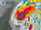
This storm is more than ~250 MILES accross, 908 millibars and falling, already 160 mph sustained and will increase further as wind speed catches up to the recent major pressure drop.
The whole lot of the places mentioned are going to get slammed by this storm, the placement of the crossing of the eye is becoming a bit more of an academic exercise as this point.
The storm surge on the east of the eye wall will extend out around 150 miles of eastern coastline, more or less.
Only the hight of that surge and the waves on top will vary.
0 likes
-
EmeraldCoast1

- S2K Supporter

- Posts: 114
- Joined: Tue Sep 30, 2003 10:35 am
- Location: Pensacola, FL

-
Opal storm
-
BroncoChuck
- Tropical Low
- Posts: 37
- Joined: Wed Jul 06, 2005 12:47 pm
- Location: Gulf Breeze, FL
- Contact:
-
BroncoChuck
- Tropical Low
- Posts: 37
- Joined: Wed Jul 06, 2005 12:47 pm
- Location: Gulf Breeze, FL
- Contact:
CFL wrote: I trust our local emergency management officials. If we need to evacuate or take some kind of action they will let us know.
I think I just pee'd my pants from laughing so hard
I know Escambia County is normally on the ball but Santa Rosa County where I live will wait till monday afternoon to decide anything....
Its sill to early to decide NOT to watch this thing anymore or think all is good in the world..... Cantoment is pretty far inland but you guys have lots of trees to fall on stuff......
0 likes
Slight NE turn prior to landfall doesn't necessarily mean that Pensacola would take a hit. It might be more like the MS/AL border rather than right on New Orleans. I've got a friend on NAS right now. The base is not even being evacuated at this point. They must feel some confidence in the track or they would be getting out.
0 likes
-
Ivanhater
- Storm2k Moderator
- Posts: 11219
- Age: 39
- Joined: Fri Jul 01, 2005 8:25 am
- Location: Pensacola
CFL wrote:Slight NE turn prior to landfall doesn't necessarily mean that Pensacola would take a hit. It might be more like the MS/AL border rather than right on New Orleans. I've got a friend on NAS right now. The base is not even being evacuated at this point. They must feel some confidence in the track or they would be getting out.
yes, but the eye is huge...if it does move northeast before landfall it will be very bad here
0 likes
-
gulfcoastdave

- Tropical Storm

- Posts: 100
- Joined: Mon Jun 13, 2005 1:33 pm
- Location: Milton,Fl
- Contact:
I saw the post on Pop for Pensacola , they used the city pop not the county which is 250-300 k
Now on storm..... I have heard some local Mets talking of a NE jog and a shift maybe in the path to a degree but every degree counts.
I just hate to go to bed thinking LA/MS border and wake up and see fl/al border
I just can not see this tsorm following the forecast path . This is by no means a wishcast.......... just with past storms they always turn before hitting coast. Maybe I need to leave the TV and computer alone for a few hours
0 likes
-
EmeraldCoast1
- S2K Supporter
- Posts: 114
- Joined: Tue Sep 30, 2003 10:35 am
- Location: Pensacola, FL
I totally understand the fear here. I was up crying last night, begging my my husband to get the kids up and evacuate before dawn. We don't even have plywood for the windows. We started checking on hotels further to our east only to find that most of them are full of MS and NOLA evacuees. We've almost reached the point where I'm not sure it's possible to evacuate all of Escambia and Santa Rosa counties. Where in the world are all these people going to go? Our traffic moves at a snail's pace on a regular day, much less if everyone tried to leave town at once.
0 likes
-
gulfcoastdave
- Tropical Storm
- Posts: 100
- Joined: Mon Jun 13, 2005 1:33 pm
- Location: Milton,Fl
- Contact:
EmeraldCoast1 wrote:Come on guys...let's not even kid around about this. So far, the track from NHC has been pretty good as it was with Ivan and Dennis as it got closer to landfall.
not trying to create anything their bud. I am just stating what I have heard and wonder about us in our area. The stroms stated by me and then you all turned. I am not saying NHC is wrong , just hard to believe the storm will do what they say by judging from past storms is all
0 likes
gulfcoastdave wrote:EmeraldCoast1 wrote:Come on guys...let's not even kid around about this. So far, the track from NHC has been pretty good as it was with Ivan and Dennis as it got closer to landfall.
not trying to create anything their bud. I am just stating what I have heard and wonder about us in our area. The stroms stated by me and then you all turned. I am not saying NHC is wrong , just hard to believe the storm will do what they say by judging from past storms is all
Seriously speaking, anyone in the 'cone' should just plain get the heck out. REALLY. I remember Camille and she wiped towns off the map in MS....
200 people died. From FLOODING and half of them were in WEST VIRGINIA.
The BOTTOM LINE, this is going to be a catastrophic event for anyone in the path of this thing. It's annular shape and she will not be moved.
So get out if you are in the cone in the coastal areas and seek high ground.
0 likes
-
krysof
Who is online
Users browsing this forum: No registered users and 42 guests