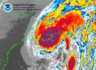
wxman57 wrote:Here's a slosh inundation map for the greater New Orleans area. I set it for Cat 4 moving to the north through the area. Check out the 20-21 foot deep surge into New Orleans.
WOW...


Moderator: S2k Moderators


SouthFLTropics wrote:Just so everyone in New Orleans understands the seriousness of the situation here is a quote from Mark Sudduth at Hurricanetrack.com.
"I am wrapping things up here in Naples and will travel north tomorrow morning. My plans are still up in the air. Let me say this: I will NOT go to New Orleans if Katrina makes landfall there as a category three or four. I am not going to put myself in that kind of danger. There is a chance I could get in and place some equipment- but it is not worth the risk of not being able to get out. So- I will be watching the future track of this potentially historic hurricane very closely."
Now if anyone has ever followed Mark's missions you will know that normally he and his team do whatever they can to get into the eye of the storm to gather research. Just hearing him say that he would not go to New Orleans for the landfall is enough to give me the chills. I have met Mark in person and read many of his reports. He takes his work very seriously. I don't recall a time when I have read his reports that he seemed so concerned.
SouthFLTropics
wxman57 wrote:Here's a slosh inundation map for the greater New Orleans area. I set it for Cat 4 moving to the north through the area. Check out the 20-21 foot deep surge into New Orleans.
<img src="http://myweb.cableone.net/nolasue/sloshnewcat4.gif">


storms in NC wrote:flightpath wrote:sorry, can't leave now. lots of work to do yet
maybe tonight just up to Hammond
Hammond? that is not to far from NOLA I would go up into Mississippi.

LCfromFL wrote:Southwest Airlines still has seats available on the morning flight tomorrow from New Orleans to Jacksonville, FL - flight #2493 leaves at 8:50 a.m. I just picked a random return in a week or so - cost $119 each leg.
<exhibiting Southern charm> Y'all over in the potential path of that monster...c'mon over and sit a spell...
...praying for those in her path...
Users browsing this forum: cycloneye, mixedDanilo.E and 52 guests


