WATS UP August 14, 2005

This is the general tropical discussion area. Anyone can take their shot at predicting a storms path.

Moderator: S2k Moderators

Forum rules

The posts in this forum are NOT official forecasts and should not be used as such. They are just the opinion of the poster and may or may not be backed by sound meteorological data. They are NOT endorsed by any professional institution or STORM2K. For official information, please refer to products from the National Hurricane Center and National Weather Service.

Help Support Storm2K
Message
Author
User avatar
dhweather
S2K Supporter
S2K Supporter
Posts: 6199
Joined: Sat Aug 14, 2004 9:29 pm
Location: Heath, TX
Contact:

WATS UP August 14, 2005

#1 Postby dhweather » Sun Aug 14, 2005 10:11 am

The following post is NOT an official forecast and should not be used as such. It is just the opinion of the poster and may or may not be backed by sound meteorological data. It is NOT endorsed by any professional institution including storm2k.org For Official Information please refer to the NHC and NWS products.

Western Atlantic Tropical Summary - WATS UP August 14, 2005

<img src="http://www.diamondheadweather.com/wats20050814.jpg">

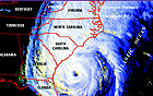
Tropical Storm Irene is headed out to sea, and will only be a threat to
shipping lanes.

Tropical Depression 10 was mauled by the trough and dry air, leaving
a weak circulation behind. I do not expect regeneration of this system
with the large amounts of dry air in the region.

Two tropical waves are moving through the Caribbean, firing up some
convection as they move westward into central America.
0 likes   

AnthonyC
Category 2
Category 2
Posts: 734
Joined: Fri Jan 07, 2005 4:38 pm

#2 Postby AnthonyC » Sun Aug 14, 2005 11:42 am

I think we should all keep our eyes on the GOM and Caribbean and forget about the Cape Verde region for the next week. I think something could develop in the GOM in the next few days and then strengthen into a TS and make landfall in Texas.

Anthony
0 likes   

User avatar
fci
S2K Supporter
S2K Supporter
Posts: 3324
Joined: Tue Sep 14, 2004 10:29 am
Location: Lake Worth, FL

#3 Postby fci » Sun Aug 14, 2005 1:02 pm

AnthonyC wrote:I think we should all keep our eyes on the GOM and Caribbean and forget about the Cape Verde region for the next week. I think something could develop in the GOM in the next few days and then strengthen into a TS and make landfall in Texas.

Anthony


TS in the GOM based on????
0 likes   

User avatar
webke
S2K Supporter
S2K Supporter
Posts: 290
Age: 70
Joined: Sun Sep 05, 2004 12:39 pm
Location: North Myrtle Beach SC

#4 Postby webke » Sun Aug 14, 2005 1:06 pm

Are you referring to JB's forecast or the ULL moving off of Florida.
0 likes   

susan
Tropical Depression
Tropical Depression
Posts: 82
Joined: Thu Aug 04, 2005 2:37 pm
Location: Gulf Coast

#5 Postby susan » Sun Aug 14, 2005 1:08 pm

I think if the wave currently in the Caribbean makes it into the GOM, we will have plenty to talk about..But at this point that is a lot of "if's"...
0 likes   

User avatar
Swimdude
Category 5
Category 5
Posts: 2270
Joined: Mon Jul 26, 2004 11:57 am
Location: Houston, TX

#6 Postby Swimdude » Sun Aug 14, 2005 1:40 pm

Awww look at TD#10...

This is all kinds of pitiful. :lol:
Image
0 likes   


Return to “Talkin' Tropics”

Who is online

Users browsing this forum: Hurricane2022, Hypercane_Kyle, mitchell, wwizard and 27 guests