ATL: FRANCINE - Remnants - Discussion

Moderator: S2k Moderators

Message
Author
Drewsey
Tropical Low
Tropical Low
Posts: 20
Joined: Fri Jun 05, 2020 7:53 pm
Location: Raceland, LA (Lafourche Parish)

Re: ATL: FRANCINE - Hurricane - Discussion

#821 Postby Drewsey » Wed Sep 11, 2024 7:22 am

Steve wrote:Not much happening yet. It’s cloudy, drizzly, winds out the east at10-15 and maybe 90% RH so saturated. Looking for the rains to start picking up in a few hours then the winds. Probably gonna be hitting until late this evening so there’s a fairly good chance at prolonged tropical storm conditions. All storms are different but some have similarities. We haven’t been hit by a system on this type of track in a while. I’m thinking Matthew October 2004 which we got about 6” of rain from. It was pretty short lived but the tracks were close. Like Zeta 2020, Francine shouldn’t have much of a back to it.

I think the city will be okay but I’m expecting no power by dinner time.


Yeah same thing Steve down in Central Lafourche. Light rain that’s about it. Wind not picking up yet. Almost forgot to go pull basketball goal down so did that little earlier with a head lamp. Cane field in the backyard not even swaying yet. I’m sure that will change in a few hours.
2 likes   

User avatar
chaser1
S2K Supporter
S2K Supporter
Posts: 5464
Age: 64
Joined: Sat Oct 15, 2005 5:59 pm
Location: Longwood, Fl

Re: ATL: FRANCINE - Hurricane - Discussion

#822 Postby chaser1 » Wed Sep 11, 2024 7:32 am

Drewsey wrote:
Steve wrote:Not much happening yet. It’s cloudy, drizzly, winds out the east at10-15 and maybe 90% RH so saturated. Looking for the rains to start picking up in a few hours then the winds. Probably gonna be hitting until late this evening so there’s a fairly good chance at prolonged tropical storm conditions. All storms are different but some have similarities. We haven’t been hit by a system on this type of track in a while. I’m thinking Matthew October 2004 which we got about 6” of rain from. It was pretty short lived but the tracks were close. Like Zeta 2020, Francine shouldn’t have much of a back to it.

I think the city will be okay but I’m expecting no power by dinner time.


Yeah same thing Steve down in Central Lafourche. Light rain that’s about it. Wind not picking up yet. Almost forgot to go pull basketball goal down so did that little earlier with a head lamp. Cane field in the backyard not even swaying yet. I’m sure that will change in a few hours.


Cane field? I was once in a customer's (Florida) back yard that had some huge thick bamboo. They sure were noisy from swaying and hitting each other just from a small breeze blowing. Not sure if that's how it is there?
0 likes   
Andy D

(For official information, please refer to the NHC and NWS products.)

User avatar
Steve
S2K Supporter
S2K Supporter
Posts: 9620
Joined: Sat Apr 05, 2003 11:41 pm
Location: Not a state-caster

Re: ATL: FRANCINE - Hurricane - Discussion

#823 Postby Steve » Wed Sep 11, 2024 7:34 am

chaser1 wrote:
Drewsey wrote:
Steve wrote:Not much happening yet. It’s cloudy, drizzly, winds out the east at10-15 and maybe 90% RH so saturated. Looking for the rains to start picking up in a few hours then the winds. Probably gonna be hitting until late this evening so there’s a fairly good chance at prolonged tropical storm conditions. All storms are different but some have similarities. We haven’t been hit by a system on this type of track in a while. I’m thinking Matthew October 2004 which we got about 6” of rain from. It was pretty short lived but the tracks were close. Like Zeta 2020, Francine shouldn’t have much of a back to it.

I think the city will be okay but I’m expecting no power by dinner time.


Yeah same thing Steve down in Central Lafourche. Light rain that’s about it. Wind not picking up yet. Almost forgot to go pull basketball goal down so did that little earlier with a head lamp. Cane field in the backyard not even swaying yet. I’m sure that will change in a few hours.


Cane field? I was once in a customer's (Florida) back yard that had some huge thick bamboo. They sure were noisy from swaying and hitting each other just from a small breeze blowing. Not sure if that's how it is there?


Yeah it is. When we lived down in Central Lafourche after Katrina our backyard was sugarcane fields as well. Wind rustles through jt.
0 likes   

otowntiger
Category 5
Category 5
Posts: 1921
Joined: Tue Aug 31, 2004 7:06 pm

Re: ATL: FRANCINE - Hurricane - Discussion

#824 Postby otowntiger » Wed Sep 11, 2024 7:38 am

Steve wrote:Not much happening yet. It’s cloudy, drizzly, winds out the east at10-15 and maybe 90% RH so saturated. Looking for the rains to start picking up in a few hours then the winds. Probably gonna be hitting until late this evening so there’s a fairly good chance at prolonged tropical storm conditions. All storms are different but some have similarities. We haven’t been hit by a system on this type of track in a while. I’m thinking Matthew October 2004 which we got about 6” of rain from. It was pretty short lived but the tracks were close. Like Zeta 2020, Francine shouldn’t have much of a back to it.

I think the city will be okay but I’m expecting no power by dinner time.

Where are you? You are right in that it appears there is/will be no real ‘backside’ to this storm. It’ll be a “halfacane” as they say. So if you’re in the path of this storm the worst part should occur well ahead of the center passage.
1 likes   

User avatar
storm_in_a_teacup
Category 1
Category 1
Posts: 421
Joined: Wed Aug 16, 2017 5:01 pm
Location: Huntsville, Alabama (originally from Houston)
Contact:

Re: ATL: FRANCINE - Hurricane - Discussion

#825 Postby storm_in_a_teacup » Wed Sep 11, 2024 7:49 am

chaser1 wrote:
storm_in_a_teacup wrote:I was hoping it would move east to avoid my family in Houston. Turns out I hoped too hard because now it's so far east it's gonna hit me :eek:


Will this be your first? If so, make sure you're not in a flooding prone area and that you're in a solid safe structure


I’m far inland in Northern Alabama so I don’t think it’s gonna be hurricane strength when it hits me, and I’ve been through many tropical storms before (I always evacuated from hurricanes so I’ve never been in a hurricane myself). Mostly I’m worried about tornadoes.
3 likes   
I know I can't straddle the atmosphere...just a tiny storm in your teacup, girl.

Drewsey
Tropical Low
Tropical Low
Posts: 20
Joined: Fri Jun 05, 2020 7:53 pm
Location: Raceland, LA (Lafourche Parish)

Re: ATL: FRANCINE - Hurricane - Discussion

#826 Postby Drewsey » Wed Sep 11, 2024 7:54 am

chaser1 wrote:
Drewsey wrote:
Steve wrote:Not much happening yet. It’s cloudy, drizzly, winds out the east at10-15 and maybe 90% RH so saturated. Looking for the rains to start picking up in a few hours then the winds. Probably gonna be hitting until late this evening so there’s a fairly good chance at prolonged tropical storm conditions. All storms are different but some have similarities. We haven’t been hit by a system on this type of track in a while. I’m thinking Matthew October 2004 which we got about 6” of rain from. It was pretty short lived but the tracks were close. Like Zeta 2020, Francine shouldn’t have much of a back to it.

I think the city will be okay but I’m expecting no power by dinner time.


Yeah same thing Steve down in Central Lafourche. Light rain that’s about it. Wind not picking up yet. Almost forgot to go pull basketball goal down so did that little earlier with a head lamp. Cane field in the backyard not even swaying yet. I’m sure that will change in a few hours.


Cane field? I was once in a customer's (Florida) back yard that had some huge thick bamboo. They sure were noisy from swaying and hitting each other just from a small breeze blowing. Not sure if that's how it is there?


Yeah Sugar Cane. Dont think cane stalks are as resilient as bamboo. I’d imagine that the cane farmers are watching this closely as “downed” cane typically produces 10-20% less yield.
1 likes   

TomballEd
Category 2
Category 2
Posts: 692
Age: 61
Joined: Wed Aug 16, 2023 4:52 pm
Location: Spring/Klein area, not Tomball

Re: ATL: FRANCINE - Hurricane - Discussion

#827 Postby TomballEd » Wed Sep 11, 2024 8:01 am

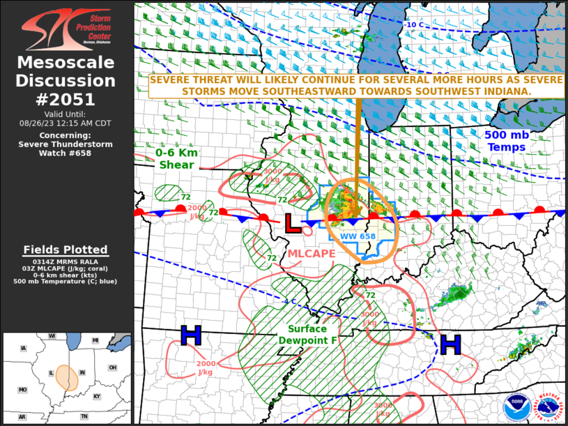
60% chance of a tornado watch being issued per SPC.

Image

DISCUSSION...The center of Francine has been migrating across and
northeast of the Gunnison Oil Platform vicinity of the northwestern
Gulf of Mexico during the past hour or so, and is still roughly 170
miles from its forecast south central Louisiana coastal landfall
later today. However, the leading edge of a broader convective
precipitation shield preceding Francine is beginning to overspread
coastal areas, accompanied by saturating thermodynamic profiles with
lapse rates trending moist adiabatic in mid-levels.

In the wake of this regime, and with the continued approach of
Francine, model forecast soundings suggest that a subtle increase in
boundary-layer temperatures and dew points may contribute to modest
destabilization by midday along coastal areas from west of
Boothville into the Vermilion Bay vicinity. It appears that this
will coincide with more notable strengthening of low-level wind
fields, which are forecast to contribute to enlarging low-level
hodographs increasingly supportive of convection with embedded
low-level mesocyclones potentially capable of producing tornadoes.

..Kerr/Edwards.. 09/11/2024
1 likes   

User avatar
Janie2006
Category 5
Category 5
Posts: 1329
Joined: Mon Sep 18, 2006 3:28 pm
Location: coastal Ms aka home of the hurricanes

Re: ATL: FRANCINE - Hurricane - Discussion

#828 Postby Janie2006 » Wed Sep 11, 2024 8:11 am

TomballEd wrote:60% chance of a tornado watch being issued per SPC.


Landfalling tropical cyclone….the chances of multiple tornado watches all the way to Gulf Shores are quite high indeed.
1 likes   

User avatar
wxman57
Moderator-Pro Met
Moderator-Pro Met
Posts: 22978
Age: 67
Joined: Sat Jun 21, 2003 8:06 pm
Location: Houston, TX (southwest)

Re: ATL: FRANCINE - Hurricane - Discussion

#829 Postby wxman57 » Wed Sep 11, 2024 8:15 am

Shell's Augur platform in western Garden Banks reporting 65 kts gusting 76 kts in NE eyewall. Plane seems to be finding winds 65-75 kts. Any higher winds would be over a very small area. Hoping the increasing wind shear along the path doesn't allow for strengthening.

https://aviationweather.gov/gfa/#obs
5 likes   

User avatar
Steve
S2K Supporter
S2K Supporter
Posts: 9620
Joined: Sat Apr 05, 2003 11:41 pm
Location: Not a state-caster

Re: ATL: FRANCINE - Hurricane - Discussion

#830 Postby Steve » Wed Sep 11, 2024 8:18 am

otowntiger wrote:
Steve wrote:Not much happening yet. It’s cloudy, drizzly, winds out the east at10-15 and maybe 90% RH so saturated. Looking for the rains to start picking up in a few hours then the winds. Probably gonna be hitting until late this evening so there’s a fairly good chance at prolonged tropical storm conditions. All storms are different but some have similarities. We haven’t been hit by a system on this type of track in a while. I’m thinking Matthew October 2004 which we got about 6” of rain from. It was pretty short lived but the tracks were close. Like Zeta 2020, Francine shouldn’t have much of a back to it.

I think the city will be okay but I’m expecting no power by dinner time.

Where are you? You are right in that it appears there is/will be no real ‘backside’ to this storm. It’ll be a “halfacane” as they say. So if you’re in the path of this storm the worst part should occur well ahead of the center passage.


About 3 miles NE of downtown New Orleans.
0 likes   

User avatar
Shawee
S2K Supporter
S2K Supporter
Posts: 103
Joined: Sun Aug 28, 2005 12:14 am
Location: New Orleans
Contact:

Re: ATL: FRANCINE - Hurricane - Discussion

#831 Postby Shawee » Wed Sep 11, 2024 8:22 am

Out here by the cemeteries we are also not counting the chickens yet. But this is about the best we could hope for, all things concidered. Wind and tropical drizzles starting to pick up now. We have a few more hatches to batten down, pool to lower, shutters to close, etc. Probably wasn’t the the best time to decide to refinish our wooden floors, but we started before the invest. Expecting the same Steve with regards to Entergy, but hopefully the loosest links were repaired post-Ida and we don’t have prolonged power outages like the poor souls in Houston had to endure. , we are glad have President Lee Shang and krewe on the job with her leadership. Like Lafourche, they are tough, and battle tested. Wishing the best to everyone down the bayou, across the lake and on the gulf coast!
1 likes   

User avatar
Steve
S2K Supporter
S2K Supporter
Posts: 9620
Joined: Sat Apr 05, 2003 11:41 pm
Location: Not a state-caster

Re: ATL: FRANCINE - Hurricane - Discussion

#832 Postby Steve » Wed Sep 11, 2024 8:22 am

wxman57 wrote:Shell's Augur platform in western Garden Banks reporting 65 kts gusting 76 kts in NE eyewall. Plane seems to be finding winds 65-75 kts. Any higher winds would be over a very small area. Hoping the increasing wind shear along the path doesn't allow for strengthening.

https://aviationweather.gov/gfa/#obs


Any idea how high their anemometer is?
1 likes   

User avatar
Steve
S2K Supporter
S2K Supporter
Posts: 9620
Joined: Sat Apr 05, 2003 11:41 pm
Location: Not a state-caster

Re: ATL: FRANCINE - Hurricane - Discussion

#833 Postby Steve » Wed Sep 11, 2024 8:29 am

Shawee wrote:Out here by the cemeteries we are also not counting the chickens yet. But this is about the best we could hope for, all things concidered. Wind and tropical drizzles starting to pick up now. We have a few more hatches to batten down, pool to lower, shutters to close, etc. Probably wasn’t the the best time to decide to refinish our wooden floors, but we started before the invest. Expecting the same Steve with regards to Entergy, but hopefully the loosest links were repaired post-Ida and we don’t have prolonged power outages like the poor souls in Houston had to endure. , we are glad have President Lee Shang and krewe on the job with her leadership. Like Lafourche, they are tough, and battle tested. Wishing the best to everyone down the bayou, across the lake and on the gulf coast!


Yeah for sure. I’m technically about Orleans Ave and Bayou St John but on the City Park side of the bayou. Hope you guys make out okay Shawee. Only issue for us so far was one of our boxers threw up yesterday. My other one is unfazed so far but I’m sure he’ll be under one of the beds if things get to howling. Our last one threw up for Katrina Gustav and Isaac. She was nervous anticipating storms so it was kind of weird to see my newer female also have issues. She’s 4 so was just a baby for Zeta. I saw a bunch of seagulls sitting on bayou St. John banks yesterday and a very large heron. Animals got to deal with stuff in their own ways which I’m sure they’ve evolved over to millennia to do so. But with domesticated dogs, they can’t look to their pack for support and when to know to go back into their den. It’s only a personal theory but I think they look to us for support and reassurance.
2 likes   

User avatar
dhweather
S2K Supporter
S2K Supporter
Posts: 6199
Joined: Sat Aug 14, 2004 9:29 pm
Location: Heath, TX
Contact:

Re: ATL: FRANCINE - Hurricane - Discussion

#834 Postby dhweather » Wed Sep 11, 2024 8:29 am

wxman57 wrote:Shell's Augur platform in western Garden Banks reporting 65 kts gusting 76 kts in NE eyewall. Plane seems to be finding winds 65-75 kts. Any higher winds would be over a very small area. Hoping the increasing wind shear along the path doesn't allow for strengthening.

https://aviationweather.gov/gfa/#obs


Latest obs from there - gust to 84kt

KAGI 111315Z AUTO 16072G84KT 1SM +DZ BR OVC012 26/25 A2905 RMK AO2 T02640245
0 likes   
The above post and any post by dhweather is NOT an official forecast and should not be used as such. It is just the opinion of the poster and may or may not be backed by sound meteorological data. It is NOT endorsed by any professional institution including storm2k.org. For official information, please refer to NWS products.

Frank P
S2K Supporter
S2K Supporter
Posts: 2776
Joined: Fri Aug 29, 2003 10:52 am
Location: Biloxi Beach, Ms
Contact:

Re: ATL: FRANCINE - Hurricane - Discussion

#835 Postby Frank P » Wed Sep 11, 2024 8:30 am

latest reports per RECON
Image
1 likes   

Stormlover70
Tropical Storm
Tropical Storm
Posts: 175
Age: 55
Joined: Fri Jun 21, 2024 5:31 am
Location: New port richey

Re: ATL: FRANCINE - Hurricane - Discussion

#836 Postby Stormlover70 » Wed Sep 11, 2024 8:31 am

Everyone stay safe. We all know how these storms can be unpredictable. Especially with the shear Tornado threat is real.
1 likes   

User avatar
Teban54
Category 5
Category 5
Posts: 3204
Joined: Sat May 19, 2018 1:19 pm

Re: ATL: FRANCINE - Hurricane - Discussion

#837 Postby Teban54 » Wed Sep 11, 2024 8:38 am

It does look like Francine is at most holding steady if not weakening slightly. Pressure has remained generally unchanged (and maybe risen a little bit), and any winds that support 80 kt (if any) are rather limited with unimpressive SFMR. I wouldn't rule out a slight bump at the last minute to Cat 2, however, and impacts will be the same regardless: tornados will be the biggest story.

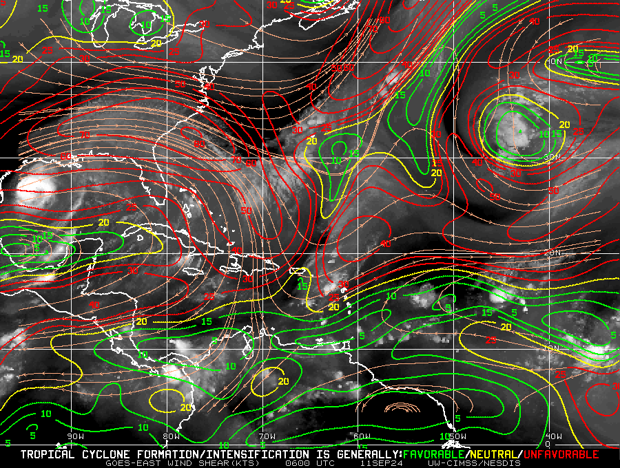
Remember that Francine has a rather impressive intensification phase last night when shear looked like this. This is why strong shear isn't automatically a death sentence.

Image
0 likes   

User avatar
Steve
S2K Supporter
S2K Supporter
Posts: 9620
Joined: Sat Apr 05, 2003 11:41 pm
Location: Not a state-caster

Re: ATL: FRANCINE - Hurricane - Discussion

#838 Postby Steve » Wed Sep 11, 2024 8:42 am

Stormlover70 wrote:Everyone stay safe. We all know how these storms can be unpredictable. Especially with the shear Tornado threat is real.


Yeah for sure. For those of you in St. Tammany, MS, AL and NW FL, stay close to your phones or weather radios. Watch the radar for individual storm cells embedded in bands because that’s where you are most likely to see rotation. Those EF0 and EF1 tornadoes can spin up rapidly not giving you much time to get to an interior room or lower level of your structure from when the warnings are issued. There very well could be 15-20 suspect areas as this landfalls. Moderate rain is coming through now. It just got a little darker and heavier with whatever is passing overhead now.
1 likes   

MEANINGLESS_NUMBERS
Category 1
Category 1
Posts: 329
Joined: Mon Nov 02, 2020 1:43 pm

Re: ATL: FRANCINE - Hurricane - Discussion

#839 Postby MEANINGLESS_NUMBERS » Wed Sep 11, 2024 8:43 am

Sheer increasing. No improvement on satellite. Recon is finding rising pressures. NHC's predicted strengthening may not happen.
0 likes   
Emily '87, Felix '95, Gert '99, Fabian '03, Humberto '19, Paulette '20, Teddy '20, Fiona '22, Lee '23, Ernesto '24

User avatar
GCANE
S2K Supporter
S2K Supporter
Posts: 11496
Joined: Mon Oct 22, 2007 8:03 am

Re: ATL: FRANCINE - Hurricane - Discussion

#840 Postby GCANE » Wed Sep 11, 2024 8:45 am

Mesoscale Discussion 2051
NWS Storm Prediction Center Norman OK
0750 AM CDT Wed Sep 11 2024

Areas affected...southeastern Louisiana coastal areas

Concerning...Severe potential...Watch possible

Valid 111250Z - 111615Z

Probability of Watch Issuance...60 percent

SUMMARY...The risk for occasional tornadoes may begin to increase
near southeastern Louisiana coastal areas by late morning (10
AM-Noon). Trends are being monitored for the possibility of a
tornado watch.

https://www.spc.noaa.gov/products/md/md2051.html
1 likes   


Return to “2024”

Who is online

Users browsing this forum: No registered users and 1 guest