
ATL: MILTON - Models
Moderator: S2k Moderators
Re: ATL: MILTON - Models
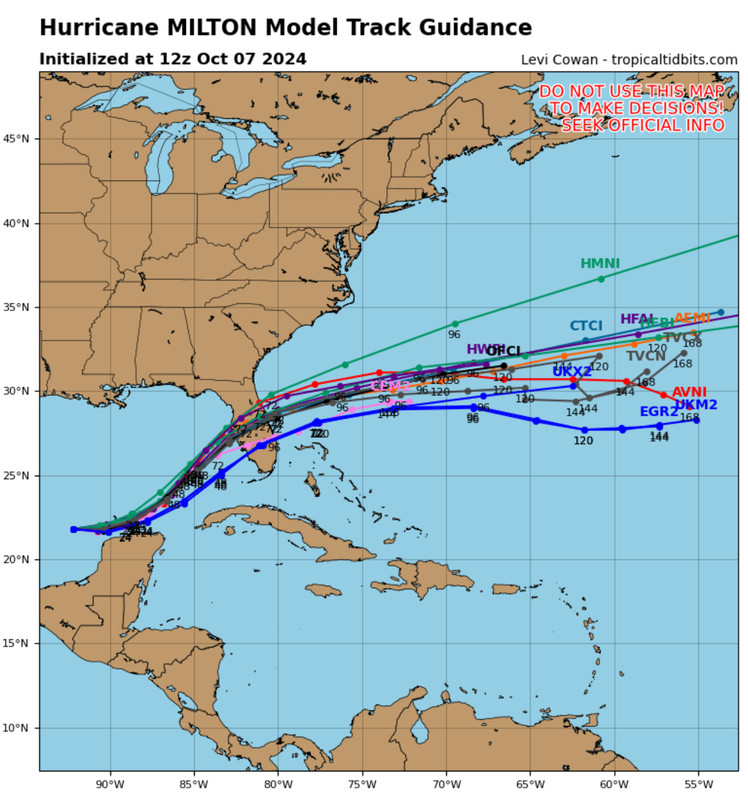
HAFS-A: Landfall near Madeira Beach, slightly right/south of 0z. Exits into the Atlanic south of New Smyrna Beach.
Last edited by BobHarlem on Mon Oct 07, 2024 6:40 am, edited 1 time in total.
0 likes

Re: ATL: MILTON - Models
Not sure if it means much but the NAVGEM has shifted south the last 3 cycles. Oops. Corrected model times
Sunday 12z: crystal river landfall
Sunday 18z: Hernando beach landfall
Monday 00z: Bradenton landfall
Sunday 12z: crystal river landfall
Sunday 18z: Hernando beach landfall
Monday 00z: Bradenton landfall
Last edited by ronjon on Mon Oct 07, 2024 6:50 am, edited 1 time in total.
0 likes
-
skillz305
- Category 1

- Posts: 312
- Joined: Sat Sep 08, 2018 11:10 am
- Location: Miami, Florida --> Vero Beach, Florida
Re: ATL: MILTON - Models
ronjon wrote:Not sure if it means much but the NAVGEM has shifted south the last 3 cycles.
Sunday 18z: crystal river landfall
Monday 00z: Hernando beach landfall
Monday 06z: Bradenton landfall
Do you have the 06z NAVGEM loop? I don’t see it on tropicaltidbits
0 likes
 Hurricanes: Andrew 1992 - Irene 1999 - Frances 2004 - Jeanne 2004 - Katrina 2005 - Wilma 2005 - Matthew 2016 - Irma 2017 - Ian 2022 - Nicole 2022 - Milton 2024
-
Hypercane_Kyle

- Category 5

- Posts: 3465
- Joined: Sat Mar 07, 2015 7:58 pm
- Location: Cape Canaveral, FL
Re: ATL: MILTON - Models
One thing that's catching my eye is the shear over Milton has been backing off at landfall on the GFS. Sounding shows ~25 knots (and increasing sharply). It was higher previously.
3 likes
My posts are my own personal opinion, defer to the National Hurricane Center (NHC) and other NOAA products for decision making during hurricane season.
-
Poonwalker
- Category 1
- Posts: 270
- Joined: Tue Sep 20, 2022 11:12 am
Re: ATL: MILTON - Models
Very concerning for Tampa. People are heeding the warnings though. Gas is gone and shelves empty. I suspect there will be a massive evacuation starting today and tomorrow.
0 likes
Re: ATL: MILTON - Models
skillz305 wrote:ronjon wrote:Not sure if it means much but the NAVGEM has shifted south the last 3 cycles.
Sunday 18z: crystal river landfall
Monday 00z: Hernando beach landfall
Monday 06z: Bradenton landfall
Do you have the 06z NAVGEM loop? I don’t see it on tropicaltidbits
06z not available yet. Sorry was off by one cycle. See my corrected post above.
1 likes
Re: ATL: MILTON - Models
06z UKMET now stronger and landfalling near Sarasota-Venice. Moved north and stronger from Naples landfall at 00z.
1 likes
-
Poonwalker
- Category 1
- Posts: 270
- Joined: Tue Sep 20, 2022 11:12 am
Re: ATL: MILTON - Models
Hypercane_Kyle wrote:One thing that's catching my eye is the shear over Milton has been backing off at landfall on the GFS. Sounding shows ~25 knots (and increasing sharply). It was higher previously.
I remember reading an essay regarding intensity forecasting and the challenges presented by major hurricanes. They in essence create their own environment. I believe a lot of effort in the new modeling has tried to address that.
0 likes
Re: ATL: MILTON - Models
Shear continues to lessen near landfall. It used to be in the 50s now using 60 hours it is just getting to the mid 30s. I don't think the strong shear will have enough time to drive the dry air behind Milton into the circulation enough to knock it down significantly. LOL, heat content at 60 for hour 36, hello loop current.
* GFS version *
* ATLANTIC 2024 SHIPS INTENSITY FORECAST *
* IR SAT DATA AVAILABLE, OHC AVAILABLE *
* MILTON AL142024 10/07/24 12 UTC *
TIME (HR) 0 6 12 18 24 36 48 60 72 84 96 108 120 132 144 156 168
V (KT) NO LAND 110 119 122 122 121 114 110 105 97 84 64 52 43 36 34 N/A N/A
V (KT) LAND 110 119 122 122 121 114 110 105 70 56 36 24 15 N/A N/A N/A N/A
V (KT) LGEM 110 122 128 129 126 120 116 110 70 59 46 34 24 16 N/A N/A N/A
Storm Type TROP TROP TROP TROP TROP TROP TROP TROP TROP TROP TROP EXTP EXTP EXTP TROP N/A N/A
SHEAR (KT) 8 11 11 10 9 19 27 34 35 50 57 68 66 60 47 N/A N/A
SHEAR ADJ (KT) 1 2 7 9 5 4 3 6 2 6 8 6 -3 -7 0 N/A N/A
SHEAR DIR 191 175 166 186 167 194 215 217 230 233 228 225 230 228 241 N/A N/A
SST (C) 31.1 31.0 30.6 30.6 30.9 30.7 30.2 30.3 29.7 28.7 27.8 27.9 27.4 27.7 27.8 N/A N/A
POT. INT. (KT) 170 171 171 171 171 172 172 173 165 149 136 138 131 135 136 N/A N/A
200 MB T (C) -51.2 -51.0 -50.8 -50.8 -50.8 -50.4 -50.2 -50.0 -50.5 -50.9 -51.1 -51.3 -52.3 -53.0 -52.7 N/A N/A
200 MB VXT (C) 0.4 0.6 0.6 0.8 0.9 1.4 1.6 2.2 1.3 0.8 0.7 0.3 0.7 0.2 0.2 N/A N/A
TH_E DEV (C) 7 9 8 8 8 8 6 5 2 1 2 3 2 3 4 N/A N/A
700-500 MB RH 66 61 60 57 56 47 46 50 53 48 40 33 34 32 37 N/A N/A
MODEL VTX (KT) 22 25 26 27 28 29 34 36 36 33 28 25 20 13 8 LOST LOST
850 MB ENV VOR 74 73 80 86 91 101 101 85 86 75 84 45 40 -10 -19 N/A N/A
200 MB DIV 19 26 35 15 -14 9 46 80 97 68 51 25 4 21 6 N/A N/A
700-850 TADV -8 -16 -19 -13 -11 -13 1 4 -8 -34 -43 -58 -50 -59 -46 N/A N/A
LAND (KM) 211 116 56 61 65 253 261 13 74 390 581 742 956 1231 1428 N/A N/A
LAT (DEG N) 21.8 21.8 21.7 22.0 22.2 23.8 25.6 27.3 28.9 29.8 30.2 30.9 32.1 xx.x xx.x N/A N/A
LONG(DEG W) 92.2 91.2 90.1 89.1 88.1 86.4 84.5 82.7 80.0 76.9 73.5 70.0 66.3 xxx.x xxx.x N/A N/A
STM SPEED (KT) 7 10 10 10 10 12 12 13 14 15 15 16 16 16 16 N/A N/A
HEAT CONTENT 39 33 22 20 19 60 31 27 40 31 18 13 9 7 7 N/A N/A
1 likes
-
MEANINGLESS_NUMBERS
- Category 2

- Posts: 503
- Joined: Mon Nov 02, 2020 1:43 pm
Re: ATL: MILTON - Models
BobHarlem wrote:HAFS-A: Landfall near Madeira Beach, slightly right/south of 0z. Exits into the Atlanic south of New Smyrna Beach.
https://i.imgur.com/mOYI4Ej.png
This would change Tampa forever.
0 likes
Emily '87, Felix '95, Gert '99, Fabian '03, Humberto '19, Paulette '20, Teddy '20, Fiona '22, Lee '23, Ernesto '24, Humberto/Imelda '25


-
Blown Away

- S2K Supporter

- Posts: 10253
- Joined: Wed May 26, 2004 6:17 am
Re: ATL: MILTON - Models
12z Early Suite… Slight shift S…
2 likes
Hurricane Eye Experience: David 79, Irene 99, Frances 04, Jeanne 04, Wilma 05… Hurricane Brush Experience: Andrew 92, Erin 95, Floyd 99, Matthew 16, Irma 17, Ian 22, Nicole 22…
-
SouthFLTropics

- Category 5
- Posts: 4258
- Age: 50
- Joined: Thu Aug 14, 2003 8:04 am
- Location: Port St. Lucie, Florida
Re: ATL: MILTON - Models
I think (although I could be wrong) that the shift in the consensus may be due to the ensembles. It appears that many of the ensembles are more south than the operational models.
0 likes
Fourth Generation Florida Native
Personal Storm History: David 79, Andrew 92, Erin 95, Floyd 99, Irene 99, Frances 04, Jeanne 04, Wilma 05, Matthew 16, Irma 17, Ian 22, Nicole 22, Milton 24
Personal Storm History: David 79, Andrew 92, Erin 95, Floyd 99, Irene 99, Frances 04, Jeanne 04, Wilma 05, Matthew 16, Irma 17, Ian 22, Nicole 22, Milton 24
-
DESTRUCTION5

- Category 5
- Posts: 4430
- Age: 44
- Joined: Wed Sep 03, 2003 11:25 am
- Location: Stuart, FL
Re: ATL: MILTON - Models
Anyone have the 06z Euro beyond 72h?
0 likes
GATOR NATION IS E V E R Y W H E R E !
-
SconnieCane
- Category 5
- Posts: 1013
- Joined: Thu Aug 02, 2018 5:29 pm
- Location: Madison, WI
Re: ATL: MILTON - Models
xironman wrote:Shear continues to lessen near landfall. It used to be in the 50s now using 60 hours it is just getting to the mid 30s. I don't think the strong shear will have enough time to drive the dry air behind Milton into the circulation enough to knock it down significantly. LOL, heat content at 60 for hour 36, hello loop current.* GFS version *
* ATLANTIC 2024 SHIPS INTENSITY FORECAST *
* IR SAT DATA AVAILABLE, OHC AVAILABLE *
* MILTON AL142024 10/07/24 12 UTC *
TIME (HR) 0 6 12 18 24 36 48 60 72 84 96 108 120 132 144 156 168
V (KT) NO LAND 110 119 122 122 121 114 110 105 97 84 64 52 43 36 34 N/A N/A
V (KT) LAND 110 119 122 122 121 114 110 105 70 56 36 24 15 N/A N/A N/A N/A
V (KT) LGEM 110 122 128 129 126 120 116 110 70 59 46 34 24 16 N/A N/A N/A
Storm Type TROP TROP TROP TROP TROP TROP TROP TROP TROP TROP TROP EXTP EXTP EXTP TROP N/A N/A
SHEAR (KT) 8 11 11 10 9 19 27 34 35 50 57 68 66 60 47 N/A N/A
SHEAR ADJ (KT) 1 2 7 9 5 4 3 6 2 6 8 6 -3 -7 0 N/A N/A
SHEAR DIR 191 175 166 186 167 194 215 217 230 233 228 225 230 228 241 N/A N/A
SST (C) 31.1 31.0 30.6 30.6 30.9 30.7 30.2 30.3 29.7 28.7 27.8 27.9 27.4 27.7 27.8 N/A N/A
POT. INT. (KT) 170 171 171 171 171 172 172 173 165 149 136 138 131 135 136 N/A N/A
200 MB T (C) -51.2 -51.0 -50.8 -50.8 -50.8 -50.4 -50.2 -50.0 -50.5 -50.9 -51.1 -51.3 -52.3 -53.0 -52.7 N/A N/A
200 MB VXT (C) 0.4 0.6 0.6 0.8 0.9 1.4 1.6 2.2 1.3 0.8 0.7 0.3 0.7 0.2 0.2 N/A N/A
TH_E DEV (C) 7 9 8 8 8 8 6 5 2 1 2 3 2 3 4 N/A N/A
700-500 MB RH 66 61 60 57 56 47 46 50 53 48 40 33 34 32 37 N/A N/A
MODEL VTX (KT) 22 25 26 27 28 29 34 36 36 33 28 25 20 13 8 LOST LOST
850 MB ENV VOR 74 73 80 86 91 101 101 85 86 75 84 45 40 -10 -19 N/A N/A
200 MB DIV 19 26 35 15 -14 9 46 80 97 68 51 25 4 21 6 N/A N/A
700-850 TADV -8 -16 -19 -13 -11 -13 1 4 -8 -34 -43 -58 -50 -59 -46 N/A N/A
LAND (KM) 211 116 56 61 65 253 261 13 74 390 581 742 956 1231 1428 N/A N/A
LAT (DEG N) 21.8 21.8 21.7 22.0 22.2 23.8 25.6 27.3 28.9 29.8 30.2 30.9 32.1 xx.x xx.x N/A N/A
LONG(DEG W) 92.2 91.2 90.1 89.1 88.1 86.4 84.5 82.7 80.0 76.9 73.5 70.0 66.3 xxx.x xxx.x N/A N/A
STM SPEED (KT) 7 10 10 10 10 12 12 13 14 15 15 16 16 16 16 N/A N/A
HEAT CONTENT 39 33 22 20 19 60 31 27 40 31 18 13 9 7 7 N/A N/A
Noted that on 06Z hurricane model runs; simulated IR looked "better" (worse for Florida) close to/at landfall compared to earlier runs. Still somewhat sheared and not nearly as impressive as peak, but still with some very intense core convection depicted (solid ring of sub -80 degrees C on the HAFS-A) and pressures remaining sub-950mb.
0 likes

Re: ATL: MILTON - Models
As if the UKMET is still making the TVCN consensus further south than if it would been out of the equation.
It would make a big difference for the Tampa metro area if it goes just south of Tampa Bay, over Tampa Bay or north of Tampa Bay.

It would make a big difference for the Tampa metro area if it goes just south of Tampa Bay, over Tampa Bay or north of Tampa Bay.
0 likes
-
toad strangler

- S2K Supporter
- Posts: 4546
- Joined: Sun Jul 28, 2013 3:09 pm
- Location: Earth
- Contact:
Re: ATL: MILTON - Models
DESTRUCTION5 wrote:Anyone have the 06z Euro beyond 72h?
6z Euro looks like it does into Tampa Bay
0 likes
My Weather Station
https://www.wunderground.com/dashboard/pws/KFLPORTS603
https://www.wunderground.com/dashboard/pws/KFLPORTS603

-
crownweather

- S2K Supporter
- Posts: 602
- Age: 51
- Joined: Sat Aug 12, 2006 9:21 am
- Location: Sturbridge, Massachusetts
- Contact:
Re: ATL: MILTON - Models
NDG wrote:DESTRUCTION5 wrote:Anyone have the 06z Euro beyond 72h?
I
It actually looks like the 06Z Euro aims right for Tampa. Ugh.
Sent from my iPhone using Tapatalk
0 likes
Rob Lightbown
Crown Weather Services
https://crownweather.com
Crown Weather Services
https://crownweather.com
Who is online
Users browsing this forum: No registered users and 35 guests