Teban54 wrote:StPeteMike wrote:CronkPSU wrote:while i generally agree with y'all about it being a good thing moving away faster, it also means more widespread damage further inland...
like those who mentioned Charlie, we had some of the worst damage ever here in central florida all the way up to Jax from a storm that landed hundreds of miles away
And on top of that, the faster forward speed would make the gusts and sustained winds higher. In an area that would probably see 85 mph in a storm moving 10 mph, you’re talking about close to 100 mph with a forward speed of 25 mph+.
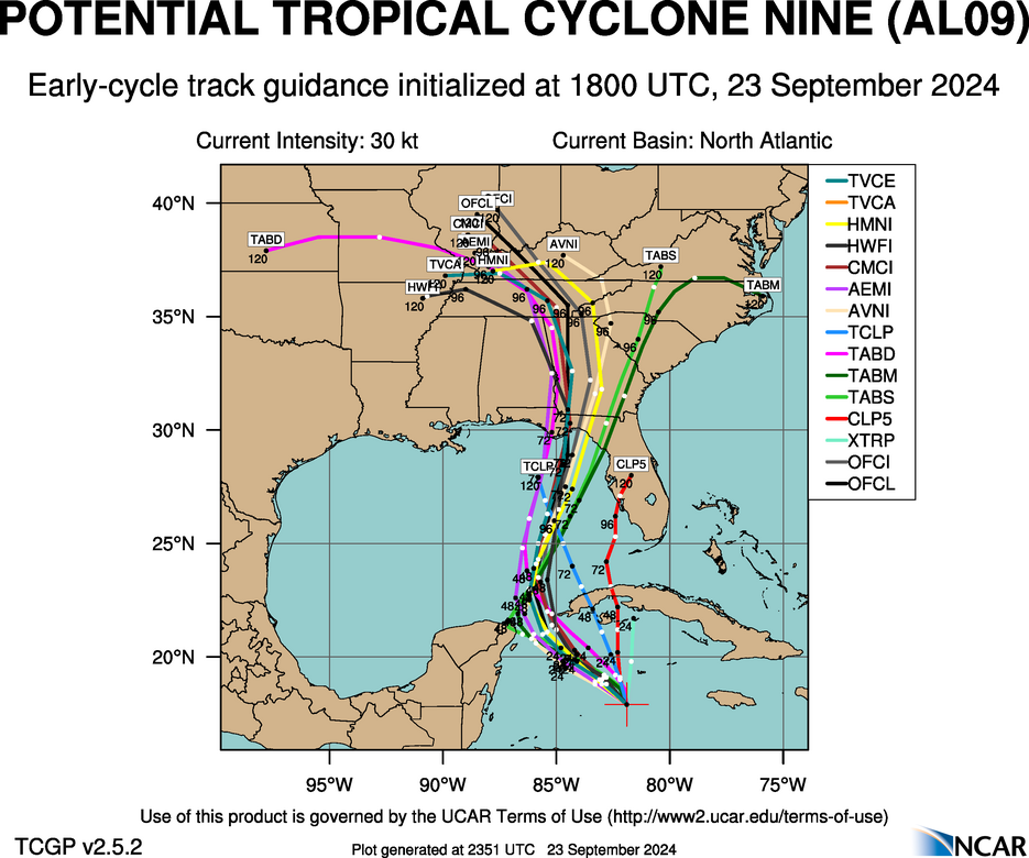
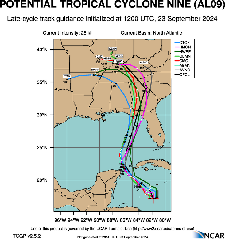
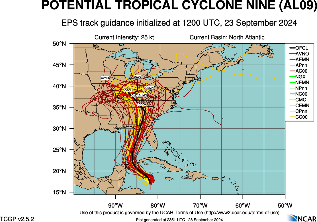
Can I get a quote for where it was said PTC 9 would be moving at 25 mph, in the first place? (Question not directed at you, more for ConvergenceZone and others who started these claims.)
As I just said in the discussion thread, NHC's forecast points in GoM averages to 17.3 mph, not 25.
If you go back to WXMANs post in the discussion thread, he mentioned and I quote, "For now, I have landfall northern Apalachee Bay Thursday afternoon. Moving north at 20 kts at landfall" and 20Knots correlates to 23 mph, And like the NHC, WXMAN also studies hurricanes for living, and that's his job, so when he speaks, I listen. Originally I thought 20Kts was 25 mph, but I just googled it and it's 23 mph


