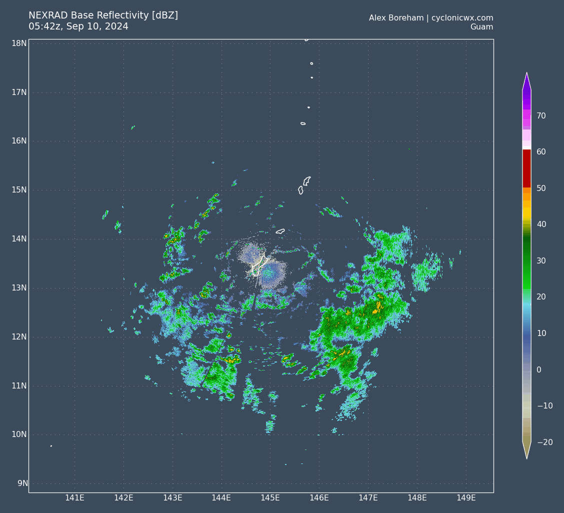
#37 Postby xtyphooncyclonex » Tue Sep 10, 2024 11:41 am
ADT supports 40 kts. Structure looking pretty solid at the moment.
UW - CIMSS
ADVANCED DVORAK TECHNIQUE
ADT-Version 9.1
Tropical Cyclone Intensity Algorithm
----- Current Analysis -----
Date : 10 SEP 2024 Time : 160000 UTC
Lat : 13:07:38 N Lon : 144:51:24 E
CI# /Pressure/ Vmax
2.8 / 998.5mb/ 41.0kt
Final T# Adj T# Raw T#
2.8 3.0 3.6
Center Temp : -83.2C Cloud Region Temp : -81.0C
Scene Type : UNIFORM CDO CLOUD REGION
Subtropical Adjustment : OFF
Extratropical Adjustment : OFF
Positioning Method : FORECAST INTERPOLATION
Ocean Basin : WEST PACIFIC
Dvorak CI > MSLP Conversion Used : CKZ Method
Tno/CI Rules : Constraint Limits : 0.7T/6hr
Weakening Flag : OFF
Rapid Dissipation Flag : OFF
0 likes
REMINDER: My opinions that I, or any other NON Pro-Met in this forum, are unofficial. Please do not take my opinions as an official forecast and warning. I am NOT a meteorologist. Following my forecasts blindly may lead to false alarm, danger and risk if official forecasts from agencies are ignored.