ATL: LEE - Models
Moderator: S2k Moderators

Re: ATL: LEE - Models
12z Euro builds strong 500 mb ridging over NE Canada forcing Lee on a N-NW path into New England. It happens in about a week and remains through 10 days. Still way too far off in the future for any certainty.
4 likes
-
SconnieCane
- Category 5

- Posts: 1013
- Joined: Thu Aug 02, 2018 5:29 pm
- Location: Madison, WI
Re: ATL: LEE - Models
Meanwhile, IR is looking like this latest round of "recovery" might be the real deal. Edit: Sorry, wrong thread. Meant to post in discussion.
Last edited by SconnieCane on Sat Sep 09, 2023 3:47 pm, edited 1 time in total.
1 likes

Re: ATL: LEE - Models
Tekken_Guy wrote:If 12z verifies what would that mean for us in NY and NJ?
New York and New Jersey is a BIG section of coast. That run is a lot worse for Montauk than it is for Atlantic CIty
0 likes
-
Tekken_Guy
- Tropical Storm

- Posts: 150
- Joined: Fri Sep 01, 2017 8:08 pm
Re: ATL: LEE - Models
mitchell wrote:Tekken_Guy wrote:If 12z verifies what would that mean for us in NY and NJ?
New York and New Jersey is a BIG section of coast. That run is a lot worse for Montauk than it is for Atlantic CIty
Say, Essex County NJ?
0 likes
Re: ATL: LEE - Models
Tekken_Guy wrote:mitchell wrote:Tekken_Guy wrote:If 12z verifies what would that mean for us in NY and NJ?
New York and New Jersey is a BIG section of coast. That run is a lot worse for Montauk than it is for Atlantic CIty
Say, Essex County NJ?
That model run shows landfall like 150+ miles to the East of Essex Cty, NJ. Offshore winds would dimnish storm surge in that area and it wouldnt be catastrophic most likely.

0 likes
-
Tekken_Guy
- Tropical Storm
- Posts: 150
- Joined: Fri Sep 01, 2017 8:08 pm
Re: ATL: LEE - Models
mitchell wrote:Tekken_Guy wrote:mitchell wrote:
New York and New Jersey is a BIG section of coast. That run is a lot worse for Montauk than it is for Atlantic CIty
Say, Essex County NJ?
That model run shows landfall like 150+ miles to the East of Essex Cty, NJ. Offshore winds would dimnish storm surge in that area and it wouldnt be catastrophic most likely.
https://i.imgur.com/lLAI98M.png
How would NYC itself fare?
0 likes
-
Hurricaneman

- Category 5
- Posts: 7404
- Age: 45
- Joined: Tue Aug 31, 2004 3:24 pm
- Location: central florida
Re: ATL: LEE - Models
The slower solutions for Lee would be bad for Eastern New England while a faster storm will most likely hit Atlantic Canada so it’s all in how fast or slow this makes the move
1 likes
Re: ATL: LEE - Models
The last two UK runs have Lee get as far W as 67.7W. More importantly imo they both don't have the lowest SLP until 0Z on 9/16, when it gets down to the low 940s. That's quite low for the usually conservative UK and tells me that a significantly stronger storm than the current strength is quite possible even going out a good number of days from now.
12Z
HURRICANE LEE ANALYSED POSITION : 19.8N 57.7W
ATCF IDENTIFIER : AL132023
LEAD CENTRAL MAXIMUM WIND
VERIFYING TIME TIME POSITION PRESSURE (MB) SPEED (KNOTS)
-------------- ---- -------- ------------- -------------
1200UTC 09.09.2023 0 19.8N 57.7W 955 79
0000UTC 10.09.2023 12 20.6N 58.9W 961 71
1200UTC 10.09.2023 24 21.4N 60.3W 957 80
0000UTC 11.09.2023 36 22.2N 61.4W 953 82
1200UTC 11.09.2023 48 22.8N 62.6W 953 84
0000UTC 12.09.2023 60 23.2N 64.0W 948 85
1200UTC 12.09.2023 72 23.5N 65.4W 949 90
0000UTC 13.09.2023 84 23.8N 66.3W 942 90
1200UTC 13.09.2023 96 24.1N 67.3W 953 74
0000UTC 14.09.2023 108 24.6N 67.5W 946 77
1200UTC 14.09.2023 120 25.8N 67.7W 952 76
0000UTC 15.09.2023 132 27.3N 67.3W 947 79
1200UTC 15.09.2023 144 28.8N 67.2W 944 81
0000UTC 16.09.2023 156 30.3N 66.7W 941 70
1200UTC 16.09.2023 168 32.2N 66.5W 949 68
1 likes
Personal Forecast Disclaimer:
The posts in this forum are NOT official forecasts and should not be used as such. They are just the opinion of the poster and may or may not be backed by sound meteorological data. They are NOT endorsed by any professional institution or storm2k.org. For official information, please refer to the NHC and NWS products.
The posts in this forum are NOT official forecasts and should not be used as such. They are just the opinion of the poster and may or may not be backed by sound meteorological data. They are NOT endorsed by any professional institution or storm2k.org. For official information, please refer to the NHC and NWS products.

-
Hypercane_Kyle

- Category 5
- Posts: 3465
- Joined: Sat Mar 07, 2015 7:58 pm
- Location: Cape Canaveral, FL
Re: ATL: LEE - Models
My guess is that, with the 12z Euro, the added curveball of 97L possibly becoming a TC and having an interaction on the path of Margot has a direct impact on Lee's track.
What a sticky forecast scenario.
What a sticky forecast scenario.
0 likes
My posts are my own personal opinion, defer to the National Hurricane Center (NHC) and other NOAA products for decision making during hurricane season.
Re: ATL: LEE - Models
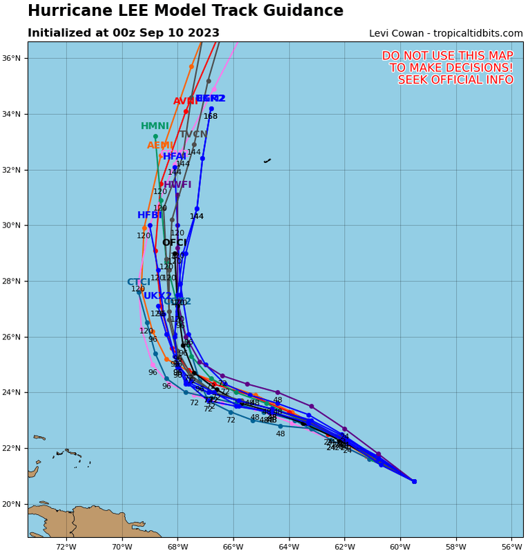
The 18Z GEFS has the most US hits yet by a good margin with 8 (26%) (9/16-7): 3 ME, 3 MA, 1 NY/RI, 1 NC
Last 6 GEFS:
18Z 9/9 26%
12Z 9/9 16%
6Z 9/9 16%
0Z 9/9 10%
18Z 9/8 10%
12Z 9/8 10%
Last 6 GEFS:
18Z 9/9 26%
12Z 9/9 16%
6Z 9/9 16%
0Z 9/9 10%
18Z 9/8 10%
12Z 9/8 10%
1 likes
Personal Forecast Disclaimer:
The posts in this forum are NOT official forecasts and should not be used as such. They are just the opinion of the poster and may or may not be backed by sound meteorological data. They are NOT endorsed by any professional institution or storm2k.org. For official information, please refer to the NHC and NWS products.
The posts in this forum are NOT official forecasts and should not be used as such. They are just the opinion of the poster and may or may not be backed by sound meteorological data. They are NOT endorsed by any professional institution or storm2k.org. For official information, please refer to the NHC and NWS products.
Re: ATL: LEE - Models
18z GFS is still over Nova Scotia, GFS Ensembles have spread out much more widely than 12z so confidence seems to be going down, new is including a few US Hits (including an OBX one). (But there also a few further east and out to sea as well)

Last edited by BobHarlem on Sat Sep 09, 2023 6:55 pm, edited 1 time in total.
2 likes

Re: ATL: LEE - Models
18z HAFS-B shows an unending EWRC before shear picks up as Lee makes its turn to the north.
0 likes
Irene '11 Sandy '12 Hermine '16 5/15/2018 Derecho Fay '20 Isaias '20 Elsa '21 Henri '21 Ida '21
I am only a meteorology enthusiast who knows a decent amount about tropical cyclones. Look to the professional mets, the NHC, or your local weather office for the best information.
I am only a meteorology enthusiast who knows a decent amount about tropical cyclones. Look to the professional mets, the NHC, or your local weather office for the best information.
-
Hurricaneman
- Category 5
- Posts: 7404
- Age: 45
- Joined: Tue Aug 31, 2004 3:24 pm
- Location: central florida
Re: ATL: LEE - Models
Looking at the current movement in terms of speed the Euro seems more correct as it seems the GFS is too fast with Lee
2 likes

Re: ATL: LEE - Models
I haven’t had much time to follow the progression of the models and Lee’s structure over the last 2 days but I wanted to ask a question about the future path in regards to intensity.
Early on I believe a couple models consistently had Lee making it pretty far west as a weaker system which didn’t verify in regards to strengthening (and/or other factors). Then the models missed some higher than anticipated shear and Lee took a much bigger hit than expected. With that said here we are now faced with another forecasted strengthening period and so my question is if this ends up getting knocked back down by shear or fails to deepen as modeled do the weaker model runs from the last few days still have Lee on the left side before the forecasted turn?
The models do show a west bend before the turn so I guess they expect it to turn west while forecasted stronger already… that’s really why I wanted to ask about weaker solutions at this time.
1 likes
-
PavelGaborik10
- Category 1

- Posts: 472
- Joined: Tue Sep 04, 2018 3:23 pm
Re: ATL: LEE - Models
Hurricaneman wrote:Looking at the current movement in terms of speed the Euro seems more correct as it seems the GFS is too fast with Lee
Ironically the ensembles of the Euro are actually East of the GFS for the most part.
We will see if OP is setting a trend in a few hours.
0 likes
Re: ATL: LEE - Models
Hmmm....25% of GFS ensemble runs now US east coast landfall. Combine that with the 12z Euro operational and are we seeing the beginning of future trends in model results? Still most of Euro ensembles are east of the operational. Until we see those shift, probably outliers at this point.
2 likes
Re: ATL: LEE - Models
Memories of Andrew. The troughs lifted out -north, ridge nosed in in front of Andrew - and John Hope amazed about it all
Is Lee going to slow down soon?
Is Lee going to slow down soon?
0 likes
-
gatorcane

- S2K Supporter

- Posts: 23708
- Age: 48
- Joined: Sun Mar 13, 2005 3:54 pm
- Location: Boca Raton, FL
Re: ATL: LEE - Models
crimi481 wrote:Memories of Andrew. The troughs lifted out -north, ridge nosed in in front of Andrew - and John Hope amazed about it all
Is Lee going to slow down soon?
Lee will turn north. The consensus is about as good as you will see for a turn
2 likes
Re: ATL: LEE - Models
I am 95% sure the forecast track is correct - and so was John Hope and NHC back then. Just a flash back.
0 likes
Who is online
Users browsing this forum: No registered users and 110 guests