
Moderator: S2k Moderators


I believe the models do take heat content as well as several other factors in their forecastrobbielyn wrote:i think position of the coc more east vs west over yucatán will be key if more over water and strengthens more quickly and becomes a hurricane then it should go poleward into panhandle more than peninsula. Also think heat content maybe not considered in the models as to intensity. this is a very interesting storm.
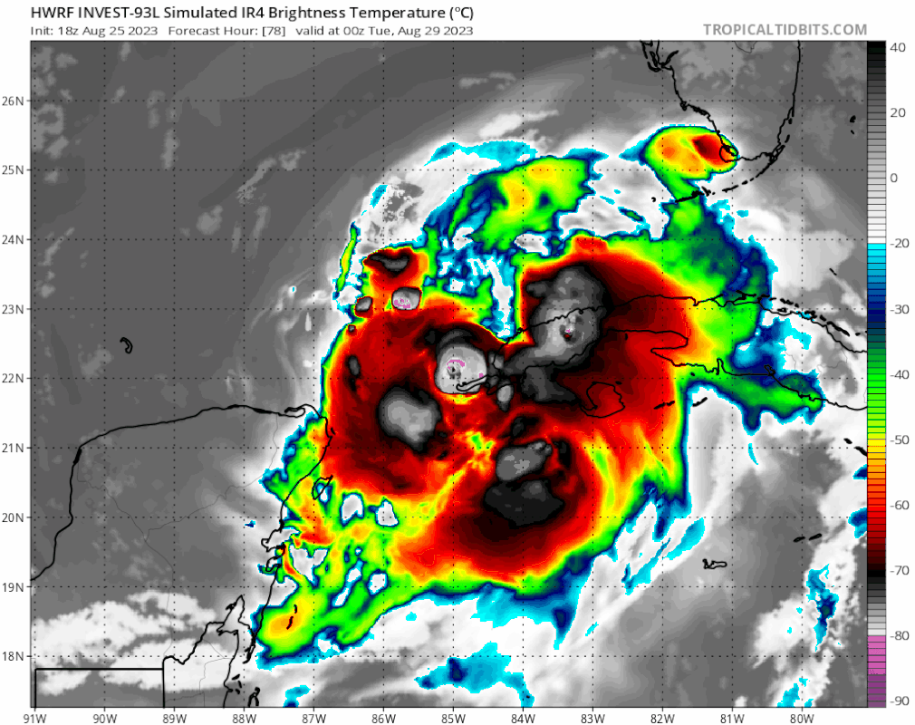
gatorcane wrote:That would cause serious issues for the Tampa area if that happened, 18Z HWRF:
https://i.postimg.cc/qvhVzDd3/hwrf-mslp-wind-93-L-fh84-111.gif
https://i.postimg.cc/BnrWD5qw/hwrf-sat-IR-93-L-fh78-108.gif
gatorcane wrote:That would cause serious issues for the Tampa area if that happened, 18Z HWRF:
https://i.postimg.cc/qvhVzDd3/hwrf-mslp-wind-93-L-fh84-111.gif
https://i.postimg.cc/BnrWD5qw/hwrf-sat-IR-93-L-fh78-108.gif
That setup would provide some very active weather for the whole peninsula...in reality, its the hwrf so its intensity is overdonegatorcane wrote:That would cause serious issues for the Tampa area if that happened, 18Z HWRF:


Up up and away from.se floridafloridasun wrote:
models have it going up up alway


NDG wrote:18z Euro has the vortex right by coast of the Yucatan over the next couple of days instead of further inland like previous runs which results on a further east position by 90hr.
https://i.imgur.com/A8uBhfy.gif

ElectricStorm wrote:https://i.imgur.com/E8atiBB.png

gatorcane wrote:18Z Euro shifts right and if you extrapolate out would put this very close to the Tampa area likely landfalling north of it but south of the 12Z which had landfall near Cedar Key:
https://i.postimg.cc/ZKRN1prR/ecmwf-z850-vort-watl-fh0-90.gif


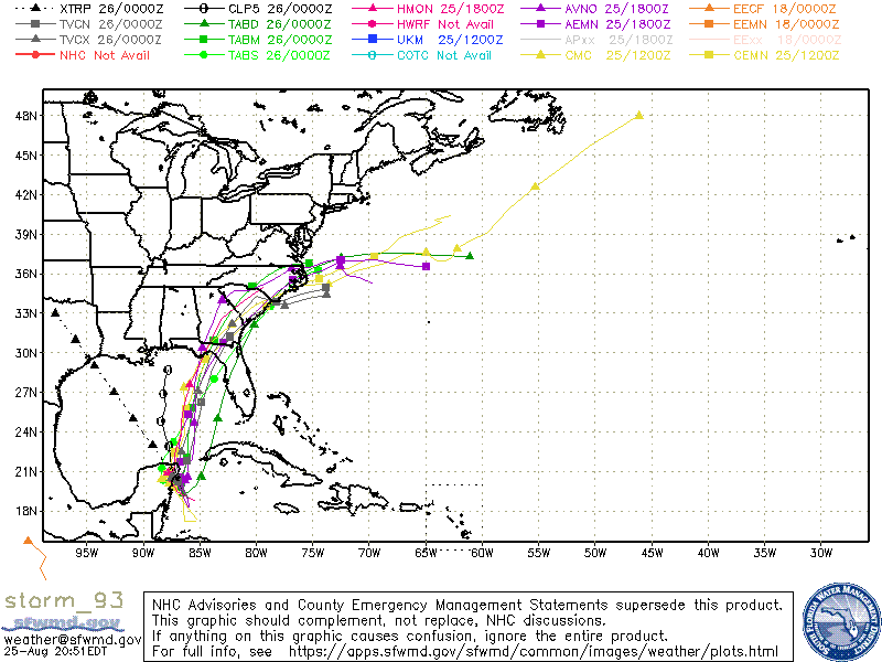
chris_fit wrote:18z mean looks to be W of the Ops. Big bend area. Stronger.


Spacecoast wrote:chris_fit wrote:18z mean looks to be W of the Ops. Big bend area. Stronger.
https://i.ibb.co/7kSYXSh/ef38.jpg
Users browsing this forum: No registered users and 70 guests


