ATL: INVEST 96L - Discussion

Moderator: S2k Moderators

Message
Author
User avatar
REDHurricane
Tropical Storm
Tropical Storm
Posts: 207
Age: 26
Joined: Sun Jul 03, 2022 2:36 pm
Location: Northeast Pacific Ocean

Re: ATL: INVEST 96L - Discussion

#41 Postby REDHurricane » Sun Jul 30, 2023 6:49 pm

It's dealing with a significant amount of shear:

Image

Image

Image
0 likes   

User avatar
cycloneye
Admin
Admin
Posts: 139329
Age: 67
Joined: Thu Oct 10, 2002 10:54 am
Location: San Juan, Puerto Rico

Re: ATL: INVEST 96L - Discussion

#42 Postby cycloneye » Sun Jul 30, 2023 7:47 pm

AL, 96, 2023073100, , BEST, 0, 220N, 515W, 30, 1011, LO
1 likes   
Visit the Caribbean-Central America Weather Thread where you can find at first post web cams,radars
and observations from Caribbean basin members Click Here

User avatar
cycloneye
Admin
Admin
Posts: 139329
Age: 67
Joined: Thu Oct 10, 2002 10:54 am
Location: San Juan, Puerto Rico

Re: ATL: INVEST 96L - Discussion

#43 Postby cycloneye » Sun Jul 30, 2023 8:05 pm

Up to 1.5.

TXNT22 KNES 310018
TCSNTL

A. TROPICAL DISTURBANCE (96L)

B. 31/0000Z

C. 22.0N

D. 52.0W

E. THREE/GOES-E

F. T1.5/1.5

G. IR/EIR/SWIR

H. REMARKS...CIRCULARLY DEFINED CLOUD LINES AND A CENTER LESS THAN 1.25
DEGREES FROM A LARGE COLD OVERCAST RESULTS IN A DT OF 2.0. MET IS 1.0. PT
IS 1.5. THE FT IS BASED ON THE PT BECAUSE CONVECTION IS FLUCTUATING.

I. ADDL POSITIONS

NIL


...TURK
1 likes   
Visit the Caribbean-Central America Weather Thread where you can find at first post web cams,radars
and observations from Caribbean basin members Click Here

zzzh
Category 2
Category 2
Posts: 547
Joined: Thu Sep 02, 2021 1:13 pm

Re: ATL: INVEST 96L - Discussion

#44 Postby zzzh » Sun Jul 30, 2023 9:02 pm

Image
Not a TD.
4 likes   

User avatar
ElectricStorm
Category 5
Category 5
Posts: 4597
Age: 23
Joined: Tue Aug 13, 2019 11:23 pm
Location: Skiatook, OK / Norman, OK

Re: ATL: INVEST 96L - Discussion

#45 Postby ElectricStorm » Sun Jul 30, 2023 9:29 pm

zzzh wrote:https://i.imgur.com/9HPg0EM.jpg
Not a TD.

Oh wow that's not nearly as close to being a TD as I thought it was. Good call by NHC not upgrading it then
3 likes   
I am in no way a professional. Take what I say with a grain of salt as I could be totally wrong. Please refer to the NHC, NWS, or SPC for official information.

Boomer Sooner!

User avatar
Woofde
Category 1
Category 1
Posts: 278
Joined: Tue Jul 06, 2021 11:33 am

Re: RE: Re: ATL: INVEST 96L - Discussion

#46 Postby Woofde » Sun Jul 30, 2023 10:16 pm

zzzh wrote:Image
Not a TD.
Yikes, yeah that's a mess. The area that's closest to becoming a circulation is well displaced from the convection too. It's going to need some time
0 likes   

User avatar
ElectricStorm
Category 5
Category 5
Posts: 4597
Age: 23
Joined: Tue Aug 13, 2019 11:23 pm
Location: Skiatook, OK / Norman, OK

Re: ATL: INVEST 96L - Discussion

#47 Postby ElectricStorm » Sun Jul 30, 2023 11:39 pm

0z revised to 35kts
96L INVEST 230731 0000 21.8N 51.7W ATL 35 1011
1 likes   
I am in no way a professional. Take what I say with a grain of salt as I could be totally wrong. Please refer to the NHC, NWS, or SPC for official information.

Boomer Sooner!

LarryWx
Category 5
Category 5
Posts: 5739
Joined: Sun Sep 07, 2003 2:04 pm
Location: GA

Re: ATL: INVEST 96L - Discussion

#48 Postby LarryWx » Mon Jul 31, 2023 1:16 am

Tropical Weather Outlook
NWS National Hurricane Center Miami FL
200 AM EDT Mon Jul 31 2023

For the North Atlantic...Caribbean Sea and the Gulf of Mexico:

1. Central Tropical Atlantic (AL96):
Shower and thunderstorm activity continues in association with an
area of low pressure located about 750 miles east-northeast of the
northern Leeward Islands. Environmental conditions are forecast to
be marginally favorable for development over the next few days, and
a tropical depression is likely to form during the next day or so.
The system is expected to move northwestward at about 15 mph today,
and then turn northward over the central subtropical Atlantic by
late tonight or Tuesday. Additional information on this system,
including gale warnings, can be found in High Seas Forecasts issued
by the National Weather Service.
* Formation chance through 48 hours...high...70 percent.
* Formation chance through 7 days...high...80 percent.
0 likes   
Personal Forecast Disclaimer:
The posts in this forum are NOT official forecasts and should not be used as such. They are just the opinion of the poster and may or may not be backed by sound meteorological data. They are NOT endorsed by any professional institution or storm2k.org. For official information, please refer to the NHC and NWS products.

Sciencerocks
Category 5
Category 5
Posts: 7287
Age: 38
Joined: Thu Jul 06, 2017 1:51 am

Re: ATL: INVEST 96L - Discussion

#49 Postby Sciencerocks » Mon Jul 31, 2023 2:05 am

Image
2 likes   

ChrisH-UK
Category 1
Category 1
Posts: 426
Joined: Sat May 29, 2021 8:22 am

Re: ATL: INVEST 96L - Discussion

#50 Postby ChrisH-UK » Mon Jul 31, 2023 4:52 am

96L looks to have no real change over night, now that the sun is coming up we will get a much better view on it.

Source - https://col.st/j1SEK

Image
0 likes   

User avatar
Teban54
Category 5
Category 5
Posts: 1974
Joined: Sat May 19, 2018 1:19 pm

Re: ATL: INVEST 96L - Discussion

#51 Postby Teban54 » Mon Jul 31, 2023 7:04 am

The 8am TWO changed from "marginally favorable" to "sufficiently favorable".
1. Central Tropical Atlantic (AL96):
Shower and thunderstorm activity continues in association with an
area of low pressure located about 700 miles east-northeast of the
northern Leeward Islands. However, the system does not currently
have a well-defined center of circulation. Environmental conditions
are forecast to be sufficiently favorable for development over the
next few days, and a tropical depression or storm is likely to form
during the next day or so. The system is expected to move
northwestward at 10 to 15 mph today, and then turn northward over
the central subtropical Atlantic by late tonight or Tuesday.
Additional information on this system, including gale warnings, can
be found in High Seas Forecasts issued by the National Weather
Service.
* Formation chance through 48 hours...high...70 percent.
* Formation chance through 7 days...high...80 percent.
1 likes   

User avatar
cycloneye
Admin
Admin
Posts: 139329
Age: 67
Joined: Thu Oct 10, 2002 10:54 am
Location: San Juan, Puerto Rico

Re: ATL: INVEST 96L - Discussion

#52 Postby cycloneye » Mon Jul 31, 2023 7:45 am

AL, 96, 2023073112, , BEST, 0, 223N, 530W, 35, 1011, LO
0 likes   
Visit the Caribbean-Central America Weather Thread where you can find at first post web cams,radars
and observations from Caribbean basin members Click Here

User avatar
cycloneye
Admin
Admin
Posts: 139329
Age: 67
Joined: Thu Oct 10, 2002 10:54 am
Location: San Juan, Puerto Rico

Re: ATL: INVEST 96L - Discussion

#53 Postby cycloneye » Mon Jul 31, 2023 10:34 am

The LLC is separating more and more from the convection.

Image
2 likes   
Visit the Caribbean-Central America Weather Thread where you can find at first post web cams,radars
and observations from Caribbean basin members Click Here

User avatar
Kingarabian
S2K Supporter
S2K Supporter
Posts: 15451
Joined: Sat Aug 08, 2009 3:06 am
Location: Honolulu, Hawaii

Re: ATL: INVEST 96L - Discussion

#54 Postby Kingarabian » Mon Jul 31, 2023 10:58 am

Best chance for development will be in about 24 hours I believe.
0 likes   
RIP Kobe Bryant

User avatar
gatorcane
S2K Supporter
S2K Supporter
Posts: 23499
Age: 46
Joined: Sun Mar 13, 2005 3:54 pm
Location: Boca Raton, FL

Re: ATL: INVEST 96L - Discussion

#55 Postby gatorcane » Mon Jul 31, 2023 11:05 am

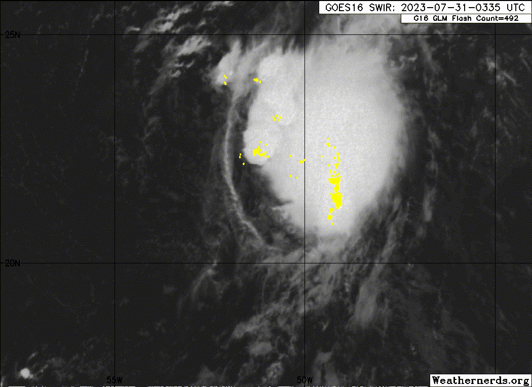
cycloneye wrote:The LLC is separating more and more from the convection.

https://i.imgur.com/hHw0K1J.gif


Not a good sign for development. The GFS also no longer shows development with 96l merging with a front a few days. The NHC might want to consider lowering development chances.
1 likes   

Sciencerocks
Category 5
Category 5
Posts: 7287
Age: 38
Joined: Thu Jul 06, 2017 1:51 am

Re: ATL: INVEST 96L - Discussion

#56 Postby Sciencerocks » Mon Jul 31, 2023 11:31 am

Image
1 likes   

User avatar
ElectricStorm
Category 5
Category 5
Posts: 4597
Age: 23
Joined: Tue Aug 13, 2019 11:23 pm
Location: Skiatook, OK / Norman, OK

Re: ATL: INVEST 96L - Discussion

#57 Postby ElectricStorm » Mon Jul 31, 2023 11:48 am

Looks terrible right now, way worse than yesterday. Has a lot of work to do to become a TC. Might have a better chance right before it merges with the front but that will probably be a very small window.
0 likes   
I am in no way a professional. Take what I say with a grain of salt as I could be totally wrong. Please refer to the NHC, NWS, or SPC for official information.

Boomer Sooner!

User avatar
cycloneye
Admin
Admin
Posts: 139329
Age: 67
Joined: Thu Oct 10, 2002 10:54 am
Location: San Juan, Puerto Rico

Re: ATL: INVEST 96L - Discussion

#58 Postby cycloneye » Mon Jul 31, 2023 12:53 pm

2 PM:

Central Tropical Atlantic (AL96):
Showers and thunderstorms associated with an area of low pressure
located about 650 miles northeast of the northern Leeward Islands
have become less organized since last night. However, the system is
producing a small area of gale-force winds well to the east of the
center. Environmental conditions still appear somewhat conducive
for a tropical depression or tropical storm to develop during the
next couple of days while the system moves northwestward and then
northward at 10 to 15 mph over the central subtropical Atlantic.
Additional information on this system, including gale warnings, can
be found in High Seas Forecasts issued by the National Weather
Service.
* Formation chance through 48 hours...medium...60 percent.
* Formation chance through 7 days...high...70 percent.
0 likes   
Visit the Caribbean-Central America Weather Thread where you can find at first post web cams,radars
and observations from Caribbean basin members Click Here

ChrisH-UK
Category 1
Category 1
Posts: 426
Joined: Sat May 29, 2021 8:22 am

Re: ATL: INVEST 96L - Discussion

#59 Postby ChrisH-UK » Mon Jul 31, 2023 2:03 pm

96L is looking a mess with the low circulation split form the upper circulation,

Image
0 likes   

User avatar
wxman57
Moderator-Pro Met
Moderator-Pro Met
Posts: 22484
Age: 66
Joined: Sat Jun 21, 2003 8:06 pm
Location: Houston, TX (southwest)

Re: ATL: INVEST 96L - Discussion

#60 Postby wxman57 » Mon Jul 31, 2023 2:06 pm

Looking like we'll have to wait for later in August for Emily. Or, with any luck, September.
3 likes   


Return to “2023”

Who is online

Users browsing this forum: No registered users and 17 guests