ATL: LEE - Post-Tropical - Discussion
Moderator: S2k Moderators
-
ElectricStorm

- Category 5

- Posts: 5139
- Age: 25
- Joined: Tue Aug 13, 2019 11:23 pm
- Location: Norman, OK
Re: ATL: INVEST 95L - Discussion
I don't like this one at all, could be a very impactful one down the road
0 likes
B.S Meteorology, University of Oklahoma '25
Please refer to the NHC, NWS, or SPC for official information.
Please refer to the NHC, NWS, or SPC for official information.
-
cycloneye

- Admin

- Posts: 149275
- Age: 69
- Joined: Thu Oct 10, 2002 10:54 am
- Location: San Juan, Puerto Rico
Re: ATL: INVEST 95L - Discussion
Woofde wrote:This could be a long thread if it follows the modeling. These are the storms everyone looks for to make a season. Definitely would be watching this if I was in the Islands.
Watching very closely from PR. I am sure our friends in the Leewards and Virgin Islands are watching too and we have members from those islands.
3 likes
Visit the Caribbean-Central America Weather Thread where you can find at first post web cams,radars
and observations from Caribbean basin members Click Here
and observations from Caribbean basin members Click Here


-
Sciencerocks
- Category 5
- Posts: 10181
- Age: 40
- Joined: Thu Jul 06, 2017 1:51 am
-
Craters
- Category 1

- Posts: 428
- Joined: Sat Aug 24, 2013 2:34 pm
- Location: Alvin, TX (south of Houston)
Re: ATL: INVEST 95L - Discussion
Well, this one certainly has "that look." Dang it.
1 likes
Nothing that I post here should ever be treated as a forecast or anything resembling one. Please check with your local NWS office or the NHC for forecasts, watches, and warnings.
Re: ATL: INVEST 95L - Discussion
SFLcane wrote:If this gets into the Caribbean watch out..
You think it will get that far south??
0 likes
-
Iceresistance

- Category 5
- Posts: 9579
- Age: 22
- Joined: Sat Oct 10, 2020 9:45 am
- Location: Tecumseh, OK/Norman, OK
Re: ATL: INVEST 95L - Discussion
Ianswfl wrote:SFLcane wrote:If this gets into the Caribbean watch out..
You think it will get that far south??
Irma 2017 kept diving SW, if she did it, then 95L (Eventually Lee) can do it.
0 likes
Bill 2015 & Beta 2020
Winter 2020-2021
All observations are in Tecumseh, OK unless otherwise noted.
Winter posts are focused mainly for Oklahoma & Texas.
Take any of my forecasts with a grain of salt, refer to the NWS, SPC, and NHC for official information
Never say Never with weather! Because ANYTHING is possible!
Winter 2020-2021
All observations are in Tecumseh, OK unless otherwise noted.
Winter posts are focused mainly for Oklahoma & Texas.
Take any of my forecasts with a grain of salt, refer to the NWS, SPC, and NHC for official information
Never say Never with weather! Because ANYTHING is possible!
Re: ATL: INVEST 95L - Discussion
This could be the northeast caribbean threat that WXman has been warning us about. Probably a peak season long track whopper that ends up as a centerpiece of the season. The look, location, heading and calendar say watch out.
3 likes
-
ConvergenceZone
.gif)
- Category 5
- Posts: 5241
- Joined: Fri Jul 29, 2005 1:40 am
- Location: Northern California
Re: ATL: INVEST 95L - Discussion
Although this will probably be 90% likely to go out to sea away from the US mainland , based on position, climatology, and what the models are seeing, I think it's definitely a threat for the islands.
0 likes

Re: ATL: INVEST 95L - Discussion
Very impressive already. If Franklin isn't the strongest storm of the season my guess is that this one will be. MH potential imo.
1 likes
-
WalterWhite

- Category 1
- Posts: 342
- Joined: Fri Mar 17, 2023 5:53 pm
Re: ATL: INVEST 95L - Discussion
kevin wrote:Very impressive already. If Franklin isn't the strongest storm of the season my guess is that this one will be. MH potential imo.
There is a real chance 95L could become a Category V hurricane if it recurves out to sea. The MDR at record-warm temperatures.
1 likes

Re: ATL: INVEST 95L - Discussion
WalterWhite wrote:kevin wrote:Very impressive already. If Franklin isn't the strongest storm of the season my guess is that this one will be. MH potential imo.
There is a real chance 95L could become a Category V hurricane if it recurves out to sea. The MDR at record-warm temperatures.
or, if the 12z gfs is right, it will be nothing lol
1 likes
Re: ATL: INVEST 95L - Discussion
mantis83 wrote:WalterWhite wrote:kevin wrote:Very impressive already. If Franklin isn't the strongest storm of the season my guess is that this one will be. MH potential imo.
There is a real chance 95L could become a Category V hurricane if it recurves out to sea. The MDR at record-warm temperatures.
or, if the 12z gfs is right, it will be nothing lol
Hard to trust the GFS with how inconsistent it is run to run. Will be interesting to see if the Euro trends weaker.
0 likes
-
Hypercane_Kyle

- Category 5
- Posts: 3465
- Joined: Sat Mar 07, 2015 7:58 pm
- Location: Cape Canaveral, FL
Re: ATL: INVEST 95L - Discussion
mantis83 wrote:WalterWhite wrote:kevin wrote:Very impressive already. If Franklin isn't the strongest storm of the season my guess is that this one will be. MH potential imo.
There is a real chance 95L could become a Category V hurricane if it recurves out to sea. The MDR at record-warm temperatures.
or, if the 12z gfs is right, it will be nothing lol
GFS struggling highly with genesis this year. It's been doing this dance with 95L for a few days now, whereas the Euro has been very consistent. But it does point to more hostile conditions in the MDR than earlier anticipated.
3 likes
My posts are my own personal opinion, defer to the National Hurricane Center (NHC) and other NOAA products for decision making during hurricane season.
-
ConvergenceZone
- Category 5
- Posts: 5241
- Joined: Fri Jul 29, 2005 1:40 am
- Location: Northern California
Re: ATL: INVEST 95L - Discussion
WalterWhite wrote:kevin wrote:Very impressive already. If Franklin isn't the strongest storm of the season my guess is that this one will be. MH potential imo.
There is a real chance 95L could become a Category V hurricane if it recurves out to sea. The MDR at record-warm temperatures.
I agree. Hopefully Bermuda won't be in the track of this one if it does get that strong...
0 likes
-
Stratton23
- Category 5
- Posts: 3524
- Joined: Fri Jul 21, 2023 10:59 pm
- Location: Katy, Tx
Re: ATL: INVEST 95L - Discussion
The GFS has a notorious bias for making the background environment look unfavorable, and thats simply not true, the environment is primed for this thing to take off, now its a question if this thing goes south of the islands or north, any land interaction will be key
1 likes
-
cycloneye
- Admin
- Posts: 149275
- Age: 69
- Joined: Thu Oct 10, 2002 10:54 am
- Location: San Juan, Puerto Rico
Re: ATL: INVEST 95L - Discussion
Stratton23 wrote:The GFS has a notorious bias for making the background environment look unfavorable, and thats simply not true, the environment is primed for this thing to take off, now its a question if this thing goes south of the islands or north, any land interaction will be key
I think you meant south of the Greater Antilles islands right?
1 likes
Visit the Caribbean-Central America Weather Thread where you can find at first post web cams,radars
and observations from Caribbean basin members Click Here
and observations from Caribbean basin members Click Here
-
USTropics
- Professional-Met

- Posts: 2737
- Joined: Sun Aug 12, 2007 3:45 am
- Location: Florida State University
Re: ATL: INVEST 95L - Discussion
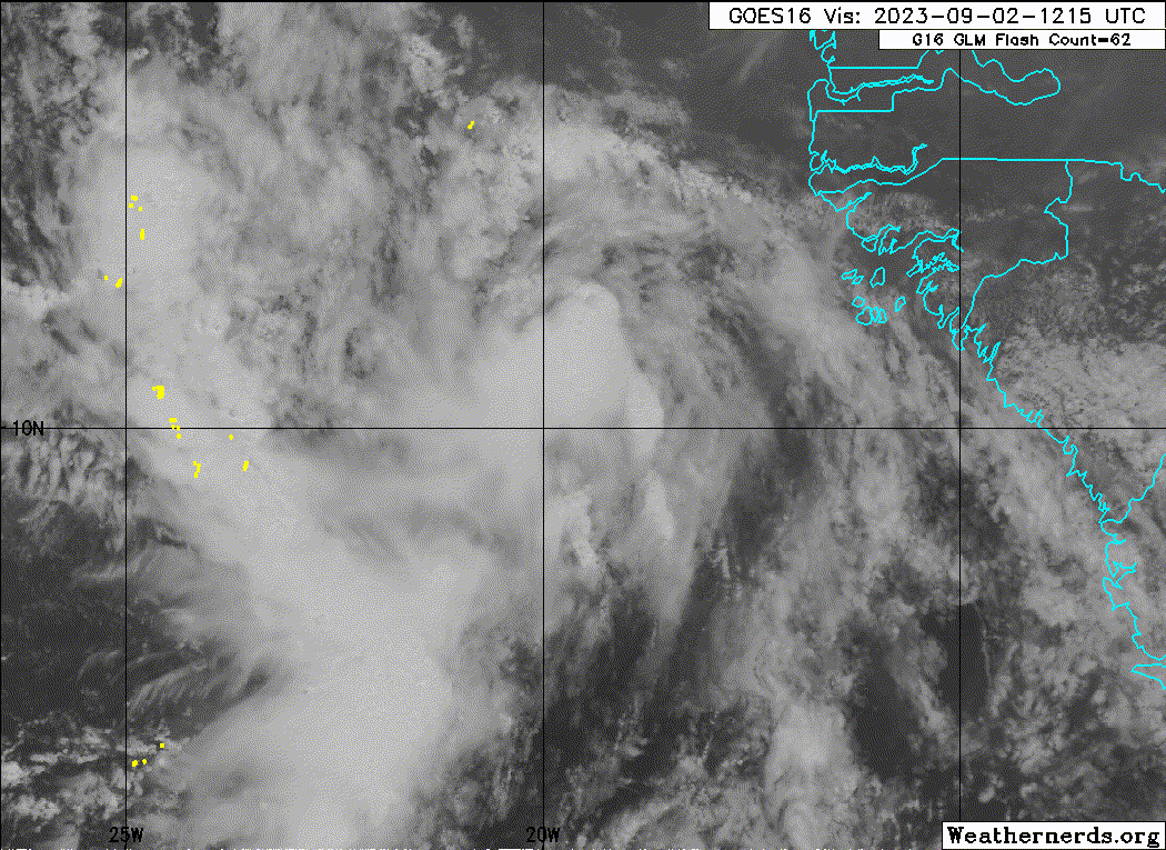
Looking at visible, we have this healthy wave pouch with a distinct AEW troughing pattern (purple) along with our wave axis (green):

This creates an offset mid-level circulation (MLC), that's vaguely outlined here (orange):

What occurs is we have two points of interest along the eastern flank of the pouch, where vorticity is favored on the northern and southern wave axis (highlighted in red):

While a LLC can develop anywhere within the AEW pouch domain, broadly outlined in blue, both vorticity lobes will typical continue to pivot around the mid-level circulation:

We can see this is the general setup analyzed on the 12z GFS:

As far as the short-term forecast, models have backed off on development for two distinct reasons. In the first 72 hours, both the GFS and ECMWF forecast unidirectional shear. This is where we have weak steering currents from the low levels up to the mid level of the atmosphere (highlighted in red). Meanwhile, wind speed is increasing with heights in a consistent direction (pink). This creates a tilted structure that we can see on visible, with a displacement of the mid-level circulation to the west of the wave axis (this is why the western flank of the AEW is convectively active).

While shear relaxes thereafter, consistent vort training of the northern lobe has the moisture envelope associated with 95L more to the north with each run. In addition, models have trended towards a stronger Katia (and trended more south). This creates increased flow directly to the north of 95L, and this begins to strip some of the moisture envelope away:


This creates an offset mid-level circulation (MLC), that's vaguely outlined here (orange):
What occurs is we have two points of interest along the eastern flank of the pouch, where vorticity is favored on the northern and southern wave axis (highlighted in red):
While a LLC can develop anywhere within the AEW pouch domain, broadly outlined in blue, both vorticity lobes will typical continue to pivot around the mid-level circulation:
We can see this is the general setup analyzed on the 12z GFS:
As far as the short-term forecast, models have backed off on development for two distinct reasons. In the first 72 hours, both the GFS and ECMWF forecast unidirectional shear. This is where we have weak steering currents from the low levels up to the mid level of the atmosphere (highlighted in red). Meanwhile, wind speed is increasing with heights in a consistent direction (pink). This creates a tilted structure that we can see on visible, with a displacement of the mid-level circulation to the west of the wave axis (this is why the western flank of the AEW is convectively active).
While shear relaxes thereafter, consistent vort training of the northern lobe has the moisture envelope associated with 95L more to the north with each run. In addition, models have trended towards a stronger Katia (and trended more south). This creates increased flow directly to the north of 95L, and this begins to strip some of the moisture envelope away:
15 likes
-
Stratton23
- Category 5
- Posts: 3524
- Joined: Fri Jul 21, 2023 10:59 pm
- Location: Katy, Tx
-
eastcoastFL

- Category 5
- Posts: 3996
- Age: 44
- Joined: Thu Apr 12, 2007 12:29 pm
- Location: Palm City, FL
Re: ATL: INVEST 95L - Discussion
Hurricane models at least keep it a sloppy mess through 90 hours.
0 likes
Personal Forecast Disclaimer:
The posts in this forum are NOT official forecast and should not be used as such. They are just the opinion of the poster and may or may not be backed by sound meteorological data. They are NOT endorsed by any professional institution or storm2k.org. For official information, please refer to the NHC and NWS products.
The posts in this forum are NOT official forecast and should not be used as such. They are just the opinion of the poster and may or may not be backed by sound meteorological data. They are NOT endorsed by any professional institution or storm2k.org. For official information, please refer to the NHC and NWS products.
Who is online
Users browsing this forum: No registered users and 30 guests