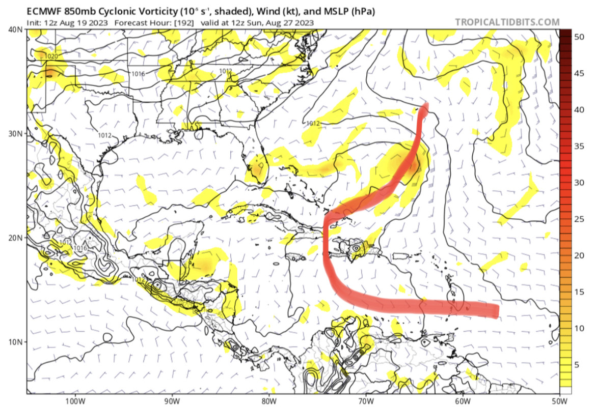
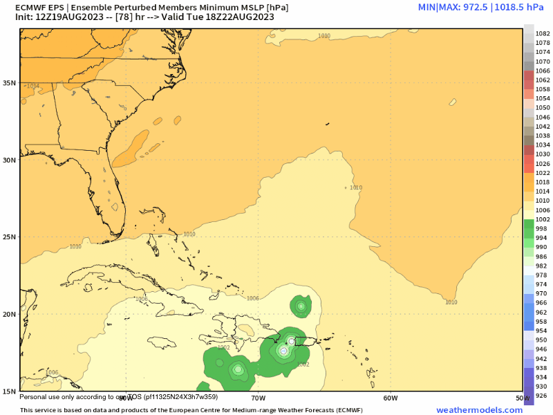
Crazy track. IMO we are 1-2 model runs away from 90L getting trapped and kept in Caribbean or NW after GA’s.
Moderator: S2k Moderators


Blown Away wrote:[url]https://i.postimg.cc/wxb6GfNk/642-A4116-9-C6-F-452-B-94-C8-D1-A3-B949-CEF1.jpg [/url]
Crazy track. IMO we are 1-2 model runs away from 90L getting trapped and kept in Caribbean or NW after GA’s.
cycloneye wrote:Blown Away wrote:[url]https://i.postimg.cc/wxb6GfNk/642-A4116-9-C6-F-452-B-94-C8-D1-A3-B949-CEF1.jpg [/url]
Crazy track. IMO we are 1-2 model runs away from 90L getting trapped and kept in Caribbean or NW after GA’s.
Why you say is going to get trapped?


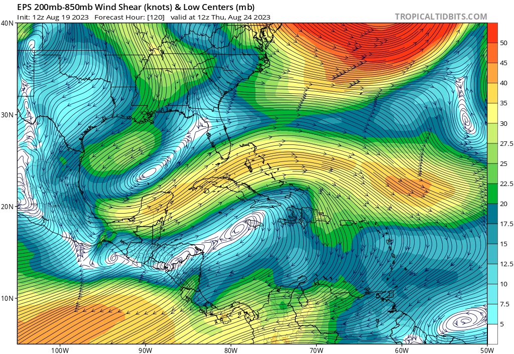
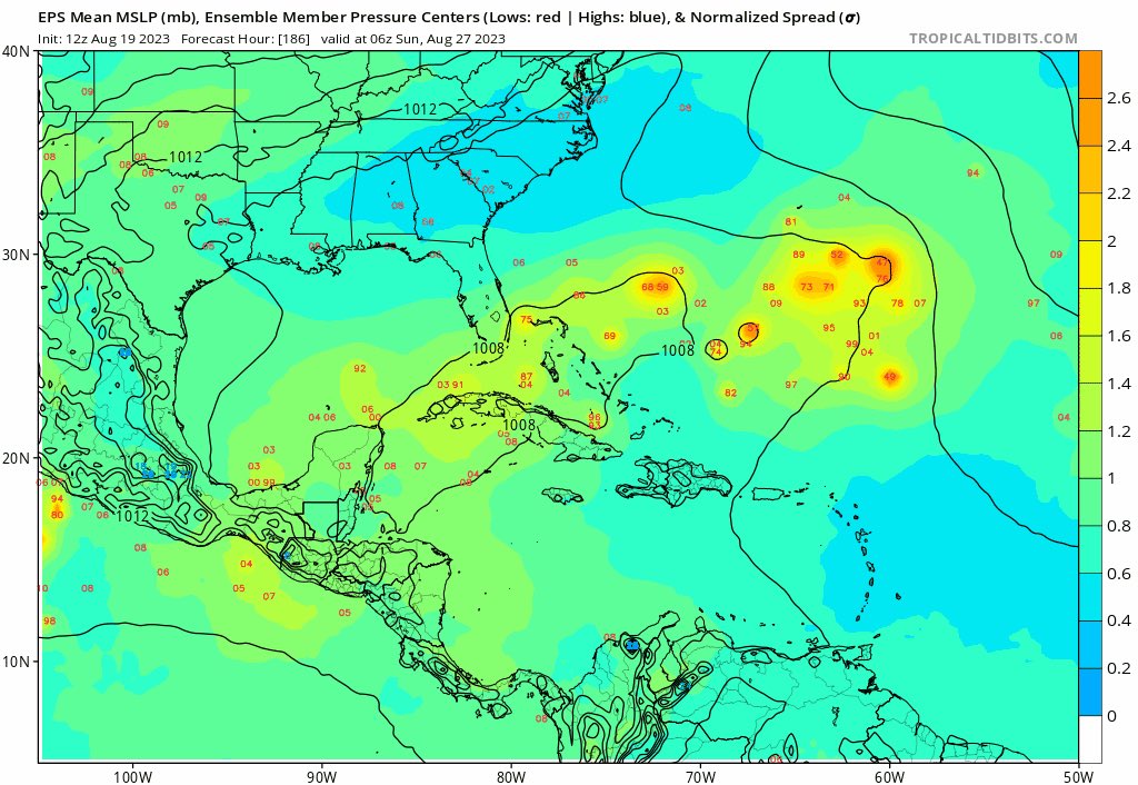
gatorcane wrote:EPS consensus shows a lot of shear in the area just north of Hispaniola. No wonder the ensembles are generally not as strong:
https://i.postimg.cc/HLTYZg9s/eps-shear-watl-21.png


Ianswfl wrote:Could we see something similar to Jeanne? Weak hurricane or TS into Haiti, reorganizes after getting shredded then gets trapped and moves west? Models a couple days ago was showing this.


ElectricStorm wrote:0z GFS gets to 993mb before Hispanola, and then slams Bermuda at 962mb.
Kind of an odd track on this run but if it can get north of the islands intact I think there's potential for a more significant storm.


Users browsing this forum: Google Adsense [Bot] and 126 guests