Moderator: S2k Moderators


Long runner in June is a bit unusual.Spacecoast wrote:12z EC Ensemble:
 [/Tweet]
 Hurricanes: Andrew 1992 - Irene 1999 - Frances 2004 - Jeanne 2004 - Katrina 2005 - Wilma 2005 - Matthew 2016 - Irma 2017 - Ian 2022 - Nicole 2022 - Milton 2024

Teban54 wrote:
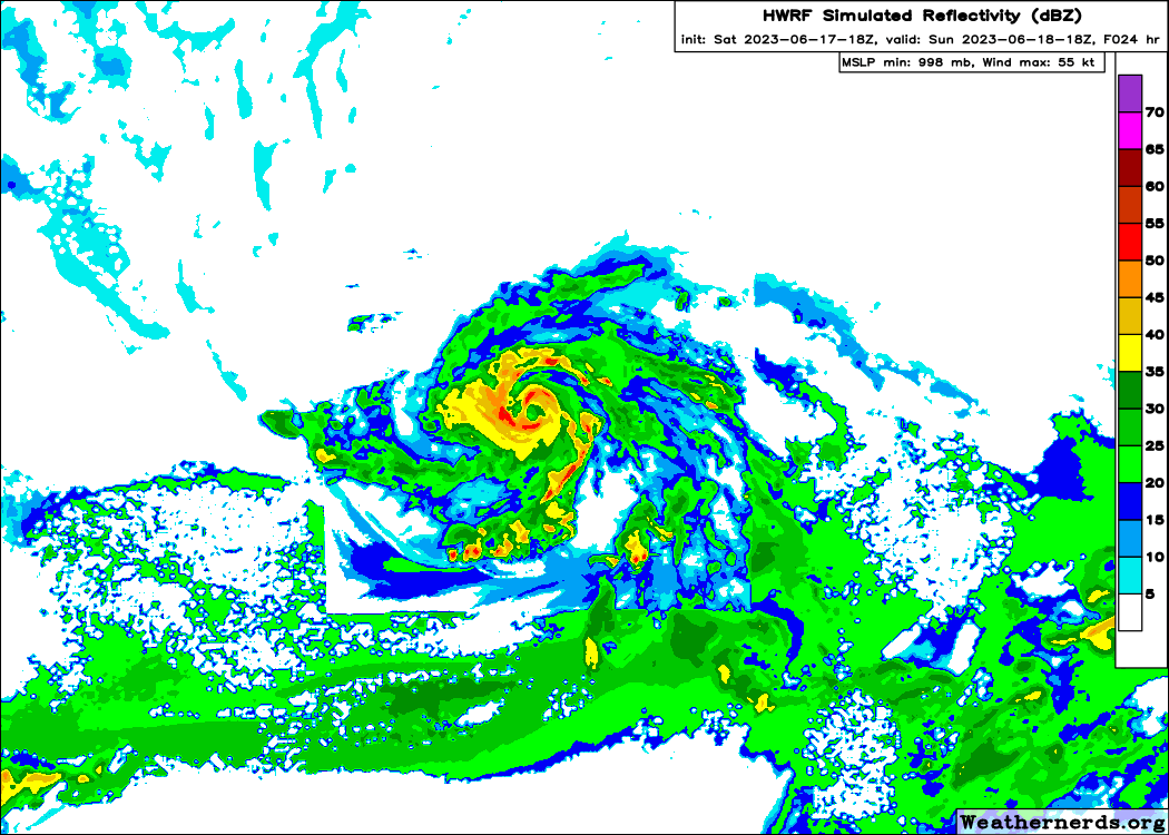
So HAFS-A and HAFS-B are even more aggressive intensity-wise than HWRF? Wow.

Ianswfl wrote:Teban54 wrote:
So HAFS-A and HAFS-B are even more aggressive intensity-wise than HWRF? Wow.
I can't remember, it's such a blur but I recall didn't the hafs model predict the intensity and track of Ian pretty well and no one believed it would get that strong?

Users browsing this forum: No registered users and 79 guests