TXNT28 KNES 190006
TCSNTL
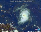
A. TROPICAL DISTURBANCE (92L)
B. 18/2330Z
C. 10.7N
D. 35.9W
E. THREE/GOES-E
F. T1.5/1.5
G. IR/EIR/SWIR
H. REMARKS...3.5/10 BROKEN BANDING YIELDS A DT=1.5. MET=1.0. PT=1.5. THE
FT IS BASED ON THE PT SINCE BANDING FEATURE ARE NOT CONSISTENT AND
CLEAR-CUT AND AN ADJUSTMENT WAS MADE TO THE MET.
I. ADDL POSITIONS
NIL
...LEE
TCSNTL
A. TROPICAL DISTURBANCE (92L)
B. 18/2330Z
C. 10.7N
D. 35.9W
E. THREE/GOES-E
F. T1.5/1.5
G. IR/EIR/SWIR
H. REMARKS...3.5/10 BROKEN BANDING YIELDS A DT=1.5. MET=1.0. PT=1.5. THE
FT IS BASED ON THE PT SINCE BANDING FEATURE ARE NOT CONSISTENT AND
CLEAR-CUT AND AN ADJUSTMENT WAS MADE TO THE MET.
I. ADDL POSITIONS
NIL
...LEE