AL, 98, 2022110706, , BEST, 0, 252N, 682W, 40, 1004, SS, 34, NEQ, 240, 240, 0, 0, 1009, 270, 200, 50, 0, L, 0, , 0, 0, INVEST, M, 0, , 0, 0, 0, 0, genesis-num, 039,
ATL: NICOLE - Post-Tropical - Discussion
Moderator: S2k Moderators
-
Europa non è lontana

- Tropical Storm

- Posts: 121
- Joined: Wed Nov 11, 2020 10:01 pm


Re: ATL: INVEST 98L - Discussion
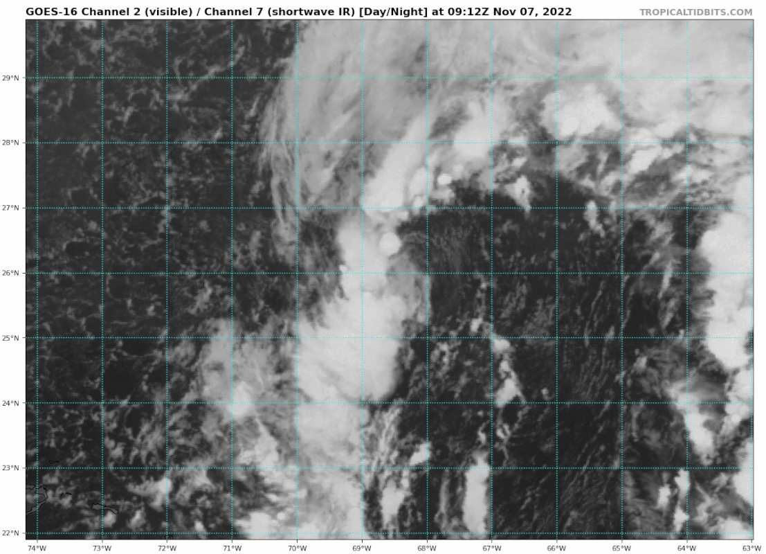
Looks like no PTC, we will be getting Nicole at 09z.
From FNMOC:

From FNMOC:
0 likes
-
AJC3

- Admin

- Posts: 4156
- Age: 62
- Joined: Tue Aug 31, 2004 7:04 pm
- Location: Ballston Spa, New York
- Contact:
Re: ATL: INVEST 98L - Discussion
Landy wrote:Looks like no PTC, we will be getting Nicole at 09z.
From FNMOC:
https://cdn.discordapp.com/attachments/857017650042503178/1039084818220204032/image.png
Yep, given the ASCAT data, initializing it as a STS looks like the right call here
6 likes
-
cycloneye

- Admin
- Posts: 149550
- Age: 69
- Joined: Thu Oct 10, 2002 10:54 am
- Location: San Juan, Puerto Rico
Re: ATL: INVEST 98L - Discussion
Has taken the left turn.

3 likes
Visit the Caribbean-Central America Weather Thread where you can find at first post web cams,radars
and observations from Caribbean basin members Click Here
and observations from Caribbean basin members Click Here
-
cycloneye
- Admin
- Posts: 149550
- Age: 69
- Joined: Thu Oct 10, 2002 10:54 am
- Location: San Juan, Puerto Rico
Re: ATL: NICOLE - Subtropical Storm - Discussion
3 likes
Visit the Caribbean-Central America Weather Thread where you can find at first post web cams,radars
and observations from Caribbean basin members Click Here
and observations from Caribbean basin members Click Here

Re: ATL: INVEST 98L - Discussion
CrazyC83 wrote:In my personal opinion, the G-IV mission should be moved up to tomorrow. While the track forecast has fairly decent confidence, we need to know how conducive the environment is for strengthening and if the front is playing any role.
Given the 0z GFS left (south) slide down the coast I agree…NOAA49 should have been up before now so that models have time to digest the data. Ian was a very good example of the need of that data.
3 likes
-
cycloneye
- Admin
- Posts: 149550
- Age: 69
- Joined: Thu Oct 10, 2002 10:54 am
- Location: San Juan, Puerto Rico
Re: ATL: NICOLE - Subtropical Storm - Discussion

2 likes
Visit the Caribbean-Central America Weather Thread where you can find at first post web cams,radars
and observations from Caribbean basin members Click Here
and observations from Caribbean basin members Click Here
-
Sciencerocks
- Category 5

- Posts: 10186
- Age: 40
- Joined: Thu Jul 06, 2017 1:51 am

-
cycloneye
- Admin
- Posts: 149550
- Age: 69
- Joined: Thu Oct 10, 2002 10:54 am
- Location: San Juan, Puerto Rico
Re: ATL: NICOLE - Subtropical Storm - Discussion
0 likes
Visit the Caribbean-Central America Weather Thread where you can find at first post web cams,radars
and observations from Caribbean basin members Click Here
and observations from Caribbean basin members Click Here
Re: ATL: NICOLE - Subtropical Storm - Discussion
cycloneye wrote:https://i.imgur.com/4DdYvao.png
While there seems to be confidence that intensification is likely as it reaches the bahamas there seems to be less confidence in where Nicole makes landfall. It would be a good time at some point today to check the ICON model since it’s my opinion it is very accurate on where Nicole will make landfall.
1 likes
-
Blown Away

- S2K Supporter

- Posts: 10253
- Joined: Wed May 26, 2004 6:17 am
Re: ATL: NICOLE - Subtropical Storm - Discussion
Looks more NW
0 likes
Hurricane Eye Experience: David 79, Irene 99, Frances 04, Jeanne 04, Wilma 05… Hurricane Brush Experience: Andrew 92, Erin 95, Floyd 99, Matthew 16, Irma 17, Ian 22, Nicole 22…

Re: ATL: NICOLE - Subtropical Storm - Discussion
Is there a southern warm core lobe working its way down to the surface? If so Nicole might maintain an elongated circulation all the way to landfall. That would limit the intensity forecast but mean TS winds over a larger area.
0 likes
-
cycloneye
- Admin
- Posts: 149550
- Age: 69
- Joined: Thu Oct 10, 2002 10:54 am
- Location: San Juan, Puerto Rico
Re: ATL: NICOLE - Subtropical Storm - Discussion
First recon mission from NOAA is now underway and it was added as it was not on Sundays TCPOD.
1 likes
Visit the Caribbean-Central America Weather Thread where you can find at first post web cams,radars
and observations from Caribbean basin members Click Here
and observations from Caribbean basin members Click Here

Re: ATL: NICOLE - Subtropical Storm - Discussion
I can recall at least 3 or 4 invests this year that looked better than Nicole and were never classified. Its first recon pass looks classifiable I guess, but it may or may not support TS intensity (40 kt FL, 30 kt SFMR).
0 likes
Irene '11 Sandy '12 Hermine '16 5/15/2018 Derecho Fay '20 Isaias '20 Elsa '21 Henri '21 Ida '21
I am only a meteorology enthusiast who knows a decent amount about tropical cyclones. Look to the professional mets, the NHC, or your local weather office for the best information.
I am only a meteorology enthusiast who knows a decent amount about tropical cyclones. Look to the professional mets, the NHC, or your local weather office for the best information.

Re: ATL: NICOLE - Subtropical Storm - Discussion
Don't look for Nicole's satellite presentation of a subtropical system to change much during the day today as persistently shown by the models. Is not supposed to start becoming better organized until at least tomorrow morning.

2 likes

Re: ATL: NICOLE - Subtropical Storm - Discussion
A day ago I posted that Andrew was crushed by a relentless high and as it was coming into Miami it picked up strength in the very hot waters and dipped down to Homestead 20 miles to its south. Andrew was a tight dry storm so there is a difference in strength but the direction from where it’s coming and where it could go has me curious. A strong trough expected later will not pull it north in time.
0 likes
Re: ATL: NICOLE - Subtropical Storm - Discussion
The biggest impacts whether Nicole becomes a hurricane or not will be north of the center of Nicole, widespread 20'+ foot waves will be a big problem for many coastal communities especially in Volusia County.

0 likes
Re: ATL: NICOLE - Subtropical Storm - Discussion
cane5 wrote:cycloneye wrote:https://i.imgur.com/4DdYvao.png
While there seems to be confidence that intensification is likely as it reaches the bahamas there seems to be less confidence in where Nicole makes landfall. It would be a good time at some point today to check the ICON model since it’s my opinion it is very accurate on where Nicole will make landfall.
Yes, please someone explain where to find the ICON model as I think I’m trusting it more than most at this point. Not to say I won’t look at others, but I’m just doing my own little “science experiment” with it, if you will.
1 likes
Cleo - 1964, Betsy - 1965, David - 1979, Andrew - 1992, Charlie (Francis, Ivan, Jeanne) - 2004, Irma - 2017, Ian - 2022, Milton - 2024
Re: ATL: NICOLE - Subtropical Storm - Discussion
Nicole is located between the northern edge of the cutoff UL Low and the bottom of the UL trough.
This places Nicole in a minimum 355K PV.
Of all the places to be, this is the best spot for intensification.
This places Nicole in a minimum 355K PV.
Of all the places to be, this is the best spot for intensification.
4 likes
Who is online
Users browsing this forum: No registered users and 11 guests