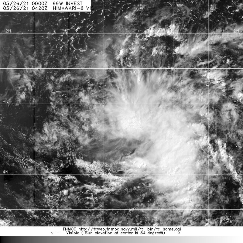
WPAC: CHOI-WAN - Post-Tropical

Moderator: S2k Moderators

Message
Author
User avatar
Hayabusa
Category 5
Category 5
Posts: 3766
Joined: Sun Sep 16, 2018 1:05 pm

WPAC: CHOI-WAN - Post-Tropical

#1 Postby Hayabusa » Tue May 25, 2021 11:41 pm

98W renumbered
99W.INVEST

99W.INVEST.15kts.1004mb.7N.147E

Image
Last edited by Hayabusa on Sat Jun 05, 2021 4:15 am, edited 4 times in total.
0 likes   
ヤンデレ女が寝取られるているのを見たい!!!
ECMWF ensemble NWPAC plots: https://ecmwfensnwpac.imgbb.com/
Multimodel NWPAC plots: https://multimodelnwpac.imgbb.com/
GFS Ensemble NWPAC plots (16 & 35 day forecast): https://gefsnwpac.imgbb.com/
Plots updated automatically

User avatar
Hayabusa
Category 5
Category 5
Posts: 3766
Joined: Sun Sep 16, 2018 1:05 pm

Re: WPAC: INVEST 99W

#2 Postby Hayabusa » Wed May 26, 2021 8:21 pm

18Z EPS
Image
0 likes   
ヤンデレ女が寝取られるているのを見たい!!!
ECMWF ensemble NWPAC plots: https://ecmwfensnwpac.imgbb.com/
Multimodel NWPAC plots: https://multimodelnwpac.imgbb.com/
GFS Ensemble NWPAC plots (16 & 35 day forecast): https://gefsnwpac.imgbb.com/
Plots updated automatically

User avatar
Hayabusa
Category 5
Category 5
Posts: 3766
Joined: Sun Sep 16, 2018 1:05 pm

Re: WPAC: INVEST 99W

#3 Postby Hayabusa » Wed May 26, 2021 8:25 pm

99W INVEST 210527 0000 6.6N 146.9E WPAC 20 1008
0 likes   
ヤンデレ女が寝取られるているのを見たい!!!
ECMWF ensemble NWPAC plots: https://ecmwfensnwpac.imgbb.com/
Multimodel NWPAC plots: https://multimodelnwpac.imgbb.com/
GFS Ensemble NWPAC plots (16 & 35 day forecast): https://gefsnwpac.imgbb.com/
Plots updated automatically

User avatar
Nancy Smar
Category 5
Category 5
Posts: 1081
Age: 23
Joined: Wed Aug 16, 2017 10:03 pm

Re: WPAC: INVEST 99W

#4 Postby Nancy Smar » Wed May 26, 2021 8:55 pm

ABPW10 PGTW 270130
MSGID/GENADMIN/JOINT TYPHOON WRNCEN PEARL HARBOR HI//
SUBJ/SIGNIFICANT TROPICAL WEATHER ADVISORY FOR THE WESTERN AND
/SOUTH PACIFIC OCEANS REISSUED/270130Z-270600ZMAY2021//
RMKS/
1. WESTERN NORTH PACIFIC AREA (180 TO MALAY PENINSULA):
A. TROPICAL CYCLONE SUMMARY: NONE.
B. TROPICAL DISTURBANCE SUMMARY:
(1) AN AREA OF CONVECTION (INVEST 99W) HAS PERSISTED NEAR 6.6N
146.9E, APPROXIMATELY 425 NM SOUTH-SOUTHEAST OF GUAM. ANIMATED
MULTISPECTRAL SATELLITE IMAGERY REVEALS DEEP CONVECTION TO THE NORTH
OF A DEFINED LOW LEVEL CIRCULATION CENTER (LLCC). A 261847Z 91 GHZ
COLOR COMPOSITE MICROWAVE IMAGE DEPICTS FORMATIVE CONVECTIVE BANDING
OVER THE NORTHERN SEMICIRCLE OF THE LLCC. INVEST 99W IS LOCATED
WITHIN A FAVORABLE ENVIRONMENT CHARACTERIZED BY LOW (5-10KTS)
VERTICAL WIND SHEAR, WARM (29-30 DEGREES CELSIUS) SEA SURFACE
TEMPERATURES, AND DIVERGENCE ALOFT. MODEL GUIDANCE INDICATES THAT
THIS SYSTEM WILL STEADILY CONSOLIDATE AS IT TRACKS WESTWARD.
MAXIMUM SUSTAINED SURFACE WINDS ARE ESTIMATED AT 15 TO 20 KNOTS.
MINIMUM SEA LEVEL PRESSURE IS ESTIMATED TO BE NEAR 1008 MB. THE
POTENTIAL FOR THE DEVELOPMENT OF A SIGNIFICANT TROPICAL CYCLONE
WITHIN THE NEXT 24 HOURS IS LOW.
(2) AN AREA OF CONVECTION (INVEST 90W) HAS PERSISTED NEAR 5.7N
157.9E, APPROXIMATELY 373 NM EAST-SOUTHEAST OF CHUUK. ANIMATED
MULTISPECTRAL SATELLITE IMAGERY DEPICTS A PARTIALLY EXPOSED LOW
LEVEL CIRCULATION WITH FLARING CONVECTION OVER THE EASTERN
SEMICIRCLE. A 262110Z ASCAT-A PASS REVEALS STRONGER WINDS (20-25KTS)
NORTH OF THE CONSOLIDATING CIRCULATION WITH WEAKER WINDS ELSEWHERE.
UPPER LEVEL ANALYSIS INDICATES LOW (10-15KTS) VERTICAL WIND SHEAR
AND A DEVELOPING EQUATORWARD OUTFLOW CHANNEL. SEA SURFACE
TEMPERATURES ARE FAVORABLE FOR DEVELOPMENT AT 29-30 DEGREES CELSIUS.
GLOBAL MODELS ARE IN GOOD AGREEMENT THAT INVEST 90W WILL CONTINUE TO
TRACK WESTWARD AS IT DEVELOPS. MAXIMUM SUSTAINED SURFACE WINDS ARE
ESTIMATED AT 20 TO 25 KNOTS. MINIMUM SEA LEVEL PRESSURE IS ESTIMATED
TO BE NEAR 1008 MB. THE POTENTIAL FOR THE DEVELOPMENT OF A
SIGNIFICANT TROPICAL CYCLONE WITHIN THE NEXT 24 HOURS IS LOW.
(3) NO OTHER SUSPECT AREAS.
C. SUBTROPICAL SYSTEM SUMMARY: NONE.
2. SOUTH PACIFIC AREA (WEST COAST OF SOUTH AMERICA TO 135 EAST):
A. TROPICAL CYCLONE SUMMARY: NONE.
B. TROPICAL DISTURBANCE SUMMARY: NONE.
C. SUBTROPICAL SYSTEM SUMMARY: NONE.
3. JUSTIFICATION FOR REISSUE: ADDED PARAGRAPHS 1.B.(1) AND 1.B.
(2). //
NNNN
1 likes   

User avatar
Hayabusa
Category 5
Category 5
Posts: 3766
Joined: Sun Sep 16, 2018 1:05 pm

Re: WPAC: INVEST 99W

#5 Postby Hayabusa » Fri May 28, 2021 2:51 am

Image

Image
0 likes   
ヤンデレ女が寝取られるているのを見たい!!!
ECMWF ensemble NWPAC plots: https://ecmwfensnwpac.imgbb.com/
Multimodel NWPAC plots: https://multimodelnwpac.imgbb.com/
GFS Ensemble NWPAC plots (16 & 35 day forecast): https://gefsnwpac.imgbb.com/
Plots updated automatically

User avatar
Hayabusa
Category 5
Category 5
Posts: 3766
Joined: Sun Sep 16, 2018 1:05 pm

Re: WPAC: INVEST 99W

#6 Postby Hayabusa » Fri May 28, 2021 3:13 pm

99W INVEST 210528 1800 6.0N 138.4E WPAC 15 1010

Image
0 likes   
ヤンデレ女が寝取られるているのを見たい!!!
ECMWF ensemble NWPAC plots: https://ecmwfensnwpac.imgbb.com/
Multimodel NWPAC plots: https://multimodelnwpac.imgbb.com/
GFS Ensemble NWPAC plots (16 & 35 day forecast): https://gefsnwpac.imgbb.com/
Plots updated automatically

User avatar
Hayabusa
Category 5
Category 5
Posts: 3766
Joined: Sun Sep 16, 2018 1:05 pm

Re: WPAC: INVEST 99W

#7 Postby Hayabusa » Sat May 29, 2021 1:46 am

ABPW10 PGTW 290600
MSGID/GENADMIN/JOINT TYPHOON WRNCEN PEARL HARBOR HI//
SUBJ/SIGNIFICANT TROPICAL WEATHER ADVISORY FOR THE WESTERN AND
/SOUTH PACIFIC OCEANS/290600Z-300600ZMAY2021//
REF/A/MSG/JOINT TYPHOON WRNCEN PEARL HARBOR HI/290521ZMAY2021//
AMPN/REF A IS A TROPICAL CYCLONE FORMATION ALERT.//
RMKS/
(2) THE AREA OF CONVECTION (INVEST 99W) PREVIOUSLY LOCATED
NEAR 5.1N 142.3E IS NOW LOCATED NEAR 6.8N 135.7E, APPROXIMATELY 74
NM EAST-SOUTHEAST OF REPUBLIC OF PALAU. ANIMATED MULTISPECTRAL
SATELLITE IMAGERY DEPICTS CONVECTIVE BANDING WRAPPING INTO A LOW
LEVEL CIRCULATION CENTER (LLCC). ANALYSIS INDICATES A MARGINALLY
FAVORABLE ENVIRONMENT FOR DEVELOPMENT CHARACTERIZED BY WARM (30-31C)
SEA SURFACE TEMPERATURES, AND LOW (<15 KTS) VWS OFFSET BY MINIMAL
OUTFLOW ALOFT. GLOBAL MODELS ARE IN GOOD AGREEMENT THAT INVEST 99W
WILL CONTINUE TO TRACK WEST-NORTHWESTWARD AS IT CONSOLIDATES AND
STRENGTHENS. MAXIMUM SUSTAINED SURFACE WINDS ARE ESTIMATED AT 15 TO
20 KNOTS. MINIMUM SEA LEVEL PRESSURE IS ESTIMATED TO BE NEAR 1006
MB. THE POTENTIAL FOR THE DEVELOPMENT OF A SIGNIFICANT TROPICAL
CYCLONE WITHIN THE NEXT 24 HOURS IS UPGRADED TO MEDIUM.
0 likes   
ヤンデレ女が寝取られるているのを見たい!!!
ECMWF ensemble NWPAC plots: https://ecmwfensnwpac.imgbb.com/
Multimodel NWPAC plots: https://multimodelnwpac.imgbb.com/
GFS Ensemble NWPAC plots (16 & 35 day forecast): https://gefsnwpac.imgbb.com/
Plots updated automatically

Subtrop
Category 1
Category 1
Posts: 452
Joined: Sun Feb 21, 2021 9:45 pm

Re: WPAC: INVEST 99W

#8 Postby Subtrop » Sat May 29, 2021 1:54 am

99W INVEST 210529 0600 6.8N 135.7E WPAC 20 1008
0 likes   

User avatar
Nancy Smar
Category 5
Category 5
Posts: 1081
Age: 23
Joined: Wed Aug 16, 2017 10:03 pm

Re: WPAC: INVEST 99W

#9 Postby Nancy Smar » Sat May 29, 2021 3:35 am

TROPICAL DEPRESSION 1004 HPA AT 06N 136E WNW 10 KT.
0 likes   

User avatar
cycloneye
Admin
Admin
Posts: 139329
Age: 67
Joined: Thu Oct 10, 2002 10:54 am
Location: San Juan, Puerto Rico

Re: WPAC: Tropical Depression 99W

#10 Postby cycloneye » Sat May 29, 2021 8:05 am

TXPQ22 KNES 291206
TCSWNP

A. TROPICAL DISTURBANCE (99W)

B. 29/1130Z

C. 5.9N

D. 134.7E

E. THREE/HIMAWARI-8

F. T1.5/1.5

G. IR/EIR/SWIR

H. REMARKS...THIS INTENSITY ESTIMATE WAS DERIVED USING 4 KM IR
DATA. CONSOLIDATING CONVECTION ASSOCIATED WITH LLCC. 3/10 BANDING FOR
A DT=1.5. MET=1.0. PT=1.5. FT IS BASED ON DT.

I. ADDL POSITIONS

NIL


...LEE
0 likes   
Visit the Caribbean-Central America Weather Thread where you can find at first post web cams,radars
and observations from Caribbean basin members Click Here

User avatar
mrbagyo
Category 5
Category 5
Posts: 3615
Age: 32
Joined: Thu Apr 12, 2012 9:18 am
Location: 14.13N 120.98E
Contact:

Re: WPAC: Tropical Depression 99W

#11 Postby mrbagyo » Sat May 29, 2021 9:48 am

Image
0 likes   
The posts in this forum are NOT official forecast and should not be used as such. They are just the opinion of the poster and may or may not be backed by sound meteorological data. They are NOT endorsed by any professional institution or storm2k.org. For official information, please refer to RSMC, NHC and NWS products.

User avatar
Hayabusa
Category 5
Category 5
Posts: 3766
Joined: Sun Sep 16, 2018 1:05 pm

Re: WPAC: Tropical Depression 04W

#12 Postby Hayabusa » Sat May 29, 2021 1:42 pm

90W may got a TCFA first but 99W got upgraded straight to a TC first and that's w/o a TCFA.
99W INVEST 210529 1800 6.4N 134.5E WPAC 25 1003

04W.INVEST
0 likes   
ヤンデレ女が寝取られるているのを見たい!!!
ECMWF ensemble NWPAC plots: https://ecmwfensnwpac.imgbb.com/
Multimodel NWPAC plots: https://multimodelnwpac.imgbb.com/
GFS Ensemble NWPAC plots (16 & 35 day forecast): https://gefsnwpac.imgbb.com/
Plots updated automatically

User avatar
Hayabusa
Category 5
Category 5
Posts: 3766
Joined: Sun Sep 16, 2018 1:05 pm

Re: WPAC: Tropical Depression 04W

#13 Postby Hayabusa » Sat May 29, 2021 1:48 pm

HWRF 12Z peaks it to cat 2 before making landfall
Image
0 likes   
ヤンデレ女が寝取られるているのを見たい!!!
ECMWF ensemble NWPAC plots: https://ecmwfensnwpac.imgbb.com/
Multimodel NWPAC plots: https://multimodelnwpac.imgbb.com/
GFS Ensemble NWPAC plots (16 & 35 day forecast): https://gefsnwpac.imgbb.com/
Plots updated automatically

User avatar
aspen
Category 5
Category 5
Posts: 8057
Joined: Sat Oct 12, 2019 7:10 pm
Location: Connecticut, USA

Re: WPAC: Tropical Depression 04W

#14 Postby aspen » Sat May 29, 2021 2:33 pm

Hayabusa wrote:HWRF 12Z peaks it to cat 2 before making landfall
https://i.imgur.com/TtA8aF1.png

The HWRF also shows an extremely offset MLC for much of the cyclone’s life, and dry air attempting to get in. It seems that wind shear will be a huge problem for 04W to overcome and is probably one of the reasons why the GFS doesn’t show it intensifying beyond a marginal TS.
0 likes   
Irene '11 Sandy '12 Hermine '16 5/15/2018 Derecho Fay '20 Isaias '20 Elsa '21 Henri '21 Ida '21

I am only a meteorology enthusiast who knows a decent amount about tropical cyclones. Look to the professional mets, the NHC, or your local weather office for the best information.

User avatar
Hayabusa
Category 5
Category 5
Posts: 3766
Joined: Sun Sep 16, 2018 1:05 pm

Re: WPAC: Tropical Depression 04W

#15 Postby Hayabusa » Sat May 29, 2021 3:52 pm

1st warning typhoon forecast
Image
0 likes   
ヤンデレ女が寝取られるているのを見たい!!!
ECMWF ensemble NWPAC plots: https://ecmwfensnwpac.imgbb.com/
Multimodel NWPAC plots: https://multimodelnwpac.imgbb.com/
GFS Ensemble NWPAC plots (16 & 35 day forecast): https://gefsnwpac.imgbb.com/
Plots updated automatically

User avatar
aspen
Category 5
Category 5
Posts: 8057
Joined: Sat Oct 12, 2019 7:10 pm
Location: Connecticut, USA

Re: WPAC: Tropical Depression 04W

#16 Postby aspen » Sat May 29, 2021 6:15 pm

That’s a lot of OHC coming up in a few days.
Image
0 likes   
Irene '11 Sandy '12 Hermine '16 5/15/2018 Derecho Fay '20 Isaias '20 Elsa '21 Henri '21 Ida '21

I am only a meteorology enthusiast who knows a decent amount about tropical cyclones. Look to the professional mets, the NHC, or your local weather office for the best information.

Subtrop
Category 1
Category 1
Posts: 452
Joined: Sun Feb 21, 2021 9:45 pm

Re: WPAC: Tropical Depression 04W

#17 Postby Subtrop » Sat May 29, 2021 8:10 pm

WTPQ50 RJTD 300000
RSMC TROPICAL CYCLONE ADVISORY
NAME TD
ANALYSIS
PSTN 300000UTC 05.9N 133.1E FAIR
MOVE ALMOST STATIONARY
PRES 1004HPA
MXWD 030KT
GUST 045KT
FORECAST
24HF 310000UTC 08.8N 132.1E 80NM 70%
MOVE N 08KT
PRES 998HPA
MXWD 035KT
GUST 050KT
48HF 010000UTC 11.0N 129.9E 130NM 70%
MOVE NW 09KT
PRES 996HPA
MXWD 040KT
GUST 060KT
72HF 020000UTC 13.5N 127.2E 200NM 70%
MOVE NW 09KT
PRES 996HPA
MXWD 040KT
GUST 060KT
96HF 030000UTC 17.1N 126.1E 280NM 70% TROPICAL DEPRESSION
0 likes   

User avatar
wxman57
Moderator-Pro Met
Moderator-Pro Met
Posts: 22484
Age: 66
Joined: Sat Jun 21, 2003 8:06 pm
Location: Houston, TX (southwest)

Re: WPAC: Tropical Depression 04W

#18 Postby wxman57 » Sat May 29, 2021 9:56 pm

HWRF is the only model that doesn't dissipate the storm east of Luzon next Thursday. It's also the only model that takes it into Luzon. Not sure what JTWC is doing by indicating a strengthening typhoon east of Luzon next Thursday. Very odd forecast given current guidance of dissipation in the same location. Models DO have a strengthen typhoon east of Luzon next Thursday, but it's the disturbance behind this one.
0 likes   

User avatar
Kingarabian
S2K Supporter
S2K Supporter
Posts: 15451
Joined: Sat Aug 08, 2009 3:06 am
Location: Honolulu, Hawaii

Re: WPAC: Tropical Depression 04W

#19 Postby Kingarabian » Sun May 30, 2021 2:58 am

I'm sure this is a TS. Some mid shear though.
Image
0 likes   
RIP Kobe Bryant

Meteophile
Tropical Depression
Tropical Depression
Posts: 50
Joined: Tue May 12, 2020 3:38 pm

Re: WPAC: Tropical Depression 04W

#20 Postby Meteophile » Sun May 30, 2021 3:19 am

If the LLC is right below the CDO, it could intensify quickly due to favorable conditions in the next day or two, changing the overall forecasts.

If the LLC is north of the CDO as the visible satellite makes me think, it may already have windshear and still has to organize, which may be difficult due to uncertain conditions in the next days.


Edit: did the last ASCAT pass say it's just a bunch of convection or the center is on the right ?

Image
0 likes   


Return to “2021”

Who is online

Users browsing this forum: No registered users and 11 guests