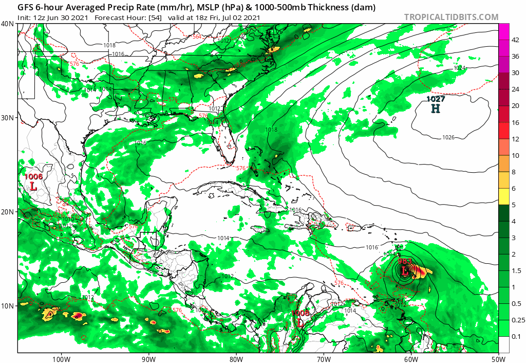
SFLcane wrote:12z GFS is bombing this into a hurricane before the islands.
https://i.postimg.cc/vmvjGVkF/gfs-jpeg.gif
I sure do hope intensity is way off for this. It needs to be much weaker or things are going to get rough.
Moderator: S2k Moderators


SFLcane wrote:12z GFS is bombing this into a hurricane before the islands.
https://i.postimg.cc/vmvjGVkF/gfs-jpeg.gif

SFLcane wrote:12z GFS is bombing this into a hurricane before the islands.
https://i.postimg.cc/vmvjGVkF/gfs-jpeg.gif
SFLcane wrote:12z GFS is bombing this into a hurricane before the islands.
https://i.postimg.cc/vmvjGVkF/gfs-jpeg.gif
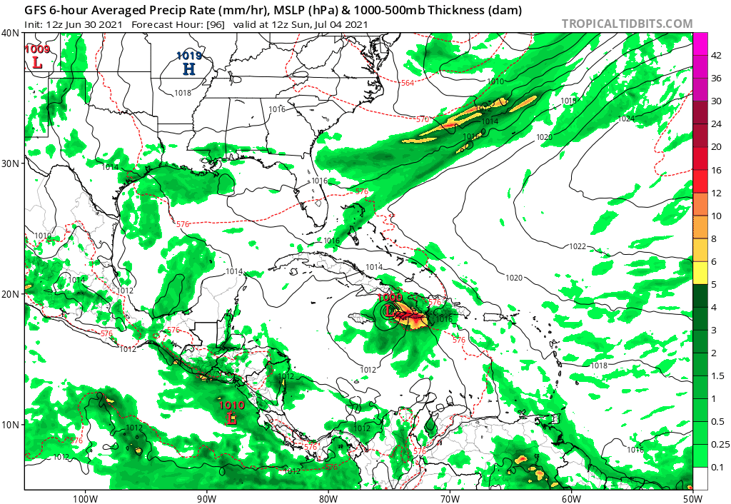
kevin wrote:12z GFS landfalls in the southern tip of Haiti @90 hours, 981 mbar in the previous frame.


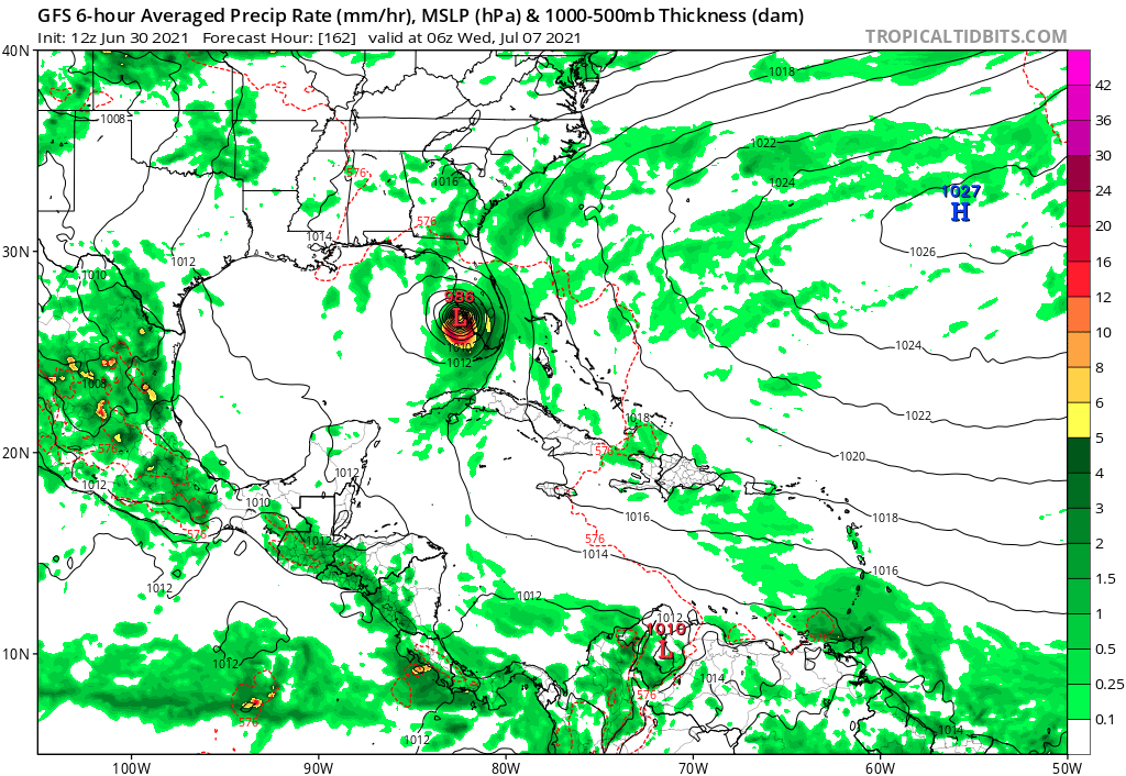
eastcoastFL wrote:Gfs crosses western Cuba before restrengthening in the eastern gulf and hitting the big bend area around 975mb
Users browsing this forum: No registered users and 18 guests


