

Kingarabian wrote:kevin wrote:Kingarabian wrote:* GFS version *
* ATLANTIC 2021 SHIPS INTENSITY FORECAST *
* IR SAT DATA AVAILABLE, OHC AVAILABLE *
* LARRY AL122021 09/05/21 06 UTC *
TIME (HR) 0 6 12 18 24 36 48 60 72 84 96 108 120 132 144 156 168
V (KT) NO LAND 105 103 102 100 99 95 95 94 96 99 99 101 95 90 85 72 52
V (KT) LAND 105 103 102 100 99 95 95 94 96 99 99 101 95 90 85 72 52
V (KT) LGEM 105 102 99 97 96 94 95 99 103 105 105 101 94 88 69 53 45
Storm Type TROP TROP TROP TROP TROP TROP TROP TROP TROP TROP TROP TROP TROP TROP EXTP EXTP EXTP
SHEAR (KT) 8 9 9 11 9 6 7 7 9 7 5 12 18 20 34 25 38
SHEAR ADJ (KT) 0 -2 -1 -1 2 3 3 2 -3 0 1 -1 -1 10 10 -1 7
SHEAR DIR 252 252 254 261 277 291 271 283 283 192 137 188 223 223 209 182 202
SST (C) 27.5 27.6 27.8 27.9 27.9 28.0 29.1 29.2 29.5 29.3 29.0 28.2 27.8 25.2 17.5 13.1 11.0
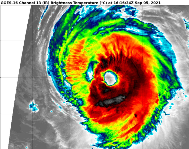
This hasn't peaked at all. More to come. This has all the ingredients to get to Cat.5. Recon should also be in around its peak just incase Dvorak pulls a choke job.
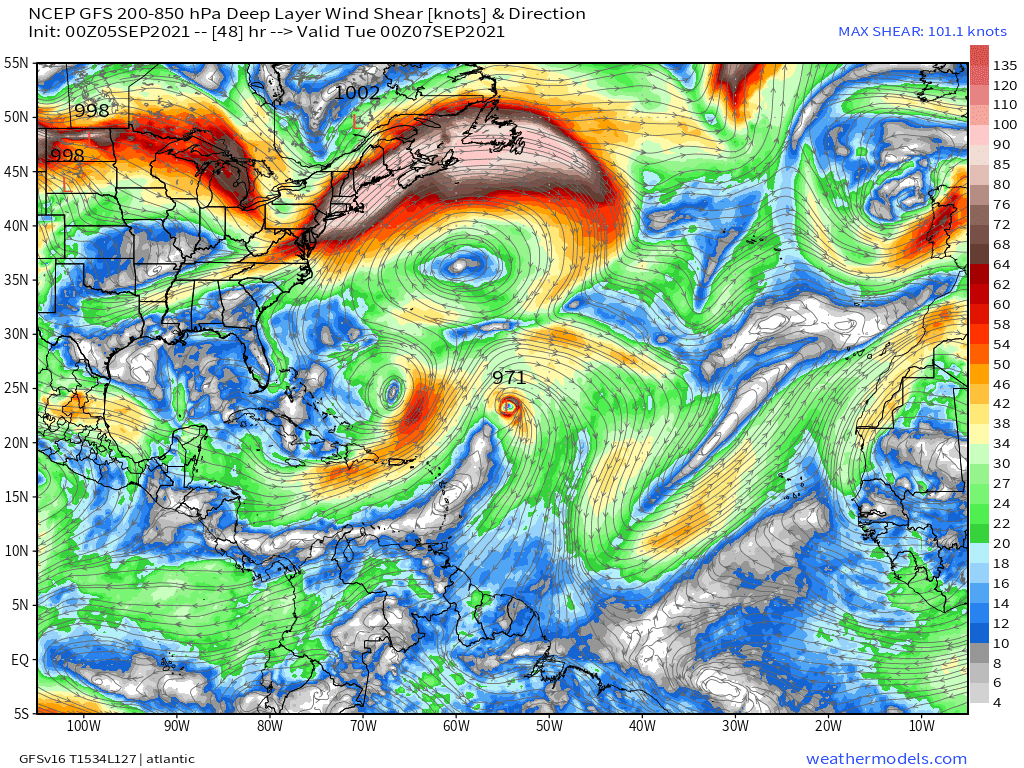
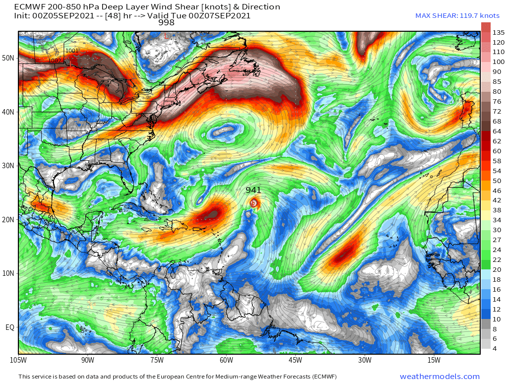
Do you also have the the shear forecast according to the Euro? Since the NHC discussion mentions that GFS and the euro still differ quite a bit in terms of their shear forecast during the next 48 hours (where euro shows more shear).
Very similar shear from what I can see. Could argue the Euro has less shear over the next 48 hours compared to the GFS. The Euro is more bullish on this compared to the GFS.
GFS:
https://i.postimg.cc/vZj8Trk8/image.png
Euro:
https://i.postimg.cc/qvt0PtRP/image.png
Sorta. Notice how on the ECMWF TUTT is stronger, which is likely to induce southwesterly shear and based on the streamlines that surround the storm, the ULAC is likely of similar intensity, maybe the ECMWF has a stronger ULAC. Nevertheless, the storm may be strong enough to fight off the TUTT.


