Hypercane_Kyle wrote:Wouldn't be totally surprised to see an EWRC take place overnight. HWRF has been hinting that would happen and a massive eye would appear after that.
Appears that’s what occurring as the eye is shrinking.
Moderator: S2k Moderators

Hypercane_Kyle wrote:Wouldn't be totally surprised to see an EWRC take place overnight. HWRF has been hinting that would happen and a massive eye would appear after that.


CrazyC83 wrote:Based on the latest trends, I'd assess the current intensity at 110 kt.


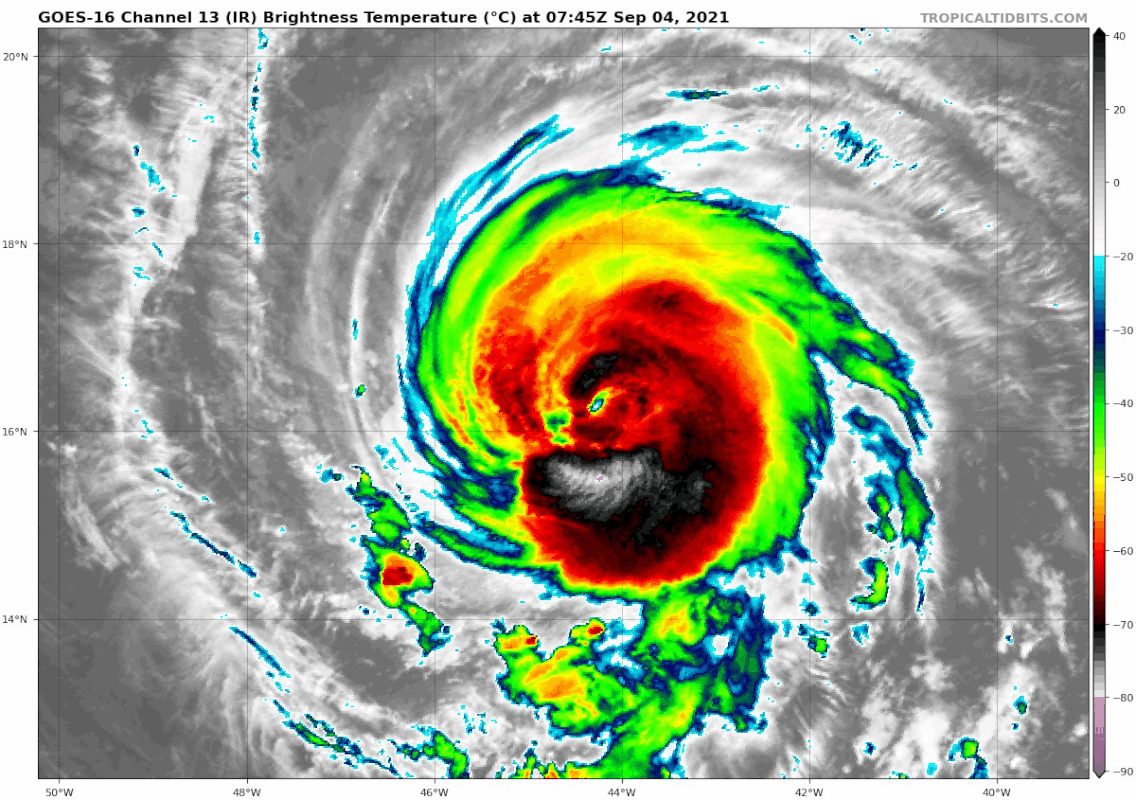


Hypercane_Kyle wrote:Larry does look like he wants to go annular at some point.
DorkyMcDorkface wrote:Hypercane_Kyle wrote:Larry does look like he wants to go annular at some point.
https://i.imgur.com/92yLHRW.jpg
According to the SHIPS index it's there already:## ANNULAR HURRICANE INDEX (AHI) AL122021 LARRY 09/04/21 12 UTC ##
## PASSED SCREENING STEP, MIGHT BE ANNULAR, CALCULATE AHI FROM DISCRIMINANT ANALYSIS ##
## AHI= 1 (AHI OF 100 IS BEST FIT TO ANN. STRUC., 1 IS MARGINAL, 0 IS NOT ANNULAR) ##
Users browsing this forum: No registered users and 29 guests


