ATL: INVEST 90L - Discussion

Moderator: S2k Moderators

Message
Author
User avatar
Nimbus
Category 5
Category 5
Posts: 4933
Joined: Mon Jul 19, 2004 10:54 am

Re: ATL: INVEST 90L - Discussion

#41 Postby Nimbus » Fri Jul 23, 2021 4:48 pm

jaxfladude wrote:No big surprise with this system, right? Just some heavy einds and rains for Northeastern Florida\Southeastern Georgia?


There is the feeder band running back through JAX that may bring some heavy rain for a while.
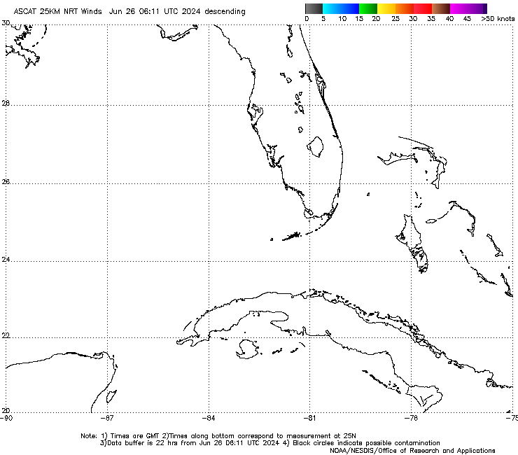
Center looks like it is staying east of florida for now.
0 likes   

User avatar
Jr0d
S2K Supporter
S2K Supporter
Posts: 1177
Joined: Tue Aug 27, 2019 10:52 am
Location: Cayo Hueso

Re: ATL: INVEST 90L - Discussion

#42 Postby Jr0d » Fri Jul 23, 2021 5:11 pm

Even though the convection is waning near the center, I think it could already be a depression. Im thinking it will eventually turn west.
0 likes   

User avatar
jdray
Category 3
Category 3
Posts: 846
Joined: Tue Aug 31, 2004 10:07 pm
Location: NE Florida

Re: ATL: INVEST 90L - Discussion

#43 Postby jdray » Fri Jul 23, 2021 5:12 pm

psyclone wrote:I'm gonna wishcast some cooling showers from this. Yesterday's high of 97 and low of 80 @ tampa was a tad much.


I'm fully onboard with this wishcast. We've had way too much rain the past month. Just had another 4 inches in 1 hour last night. And now the moisture feeding this thing is sitting on top of us.
0 likes   

User avatar
toad strangler
S2K Supporter
S2K Supporter
Posts: 4178
Joined: Sun Jul 28, 2013 3:09 pm
Location: Earth
Contact:

Re: ATL: INVEST 90L - Discussion

#44 Postby toad strangler » Fri Jul 23, 2021 5:36 pm

0 likes   

User avatar
NDG
S2K Supporter
S2K Supporter
Posts: 14947
Joined: Sun Jul 09, 2006 10:14 pm
Location: Orlando, FL

Re: ATL: INVEST 90L - Discussion

#45 Postby NDG » Fri Jul 23, 2021 6:15 pm

ChrisH-UK wrote:ASCAT from 20:12 UTC is showing 30knt winds. The models have winds no where near this and the one that does has 50 knot winds tomorrow, which I would consider the model been stupid.


https://www.ospo.noaa.gov/data/atmosphere/ascat/MetopB/WINDS/cur_25km/zooms/WMBds75.png


ASCAT was from 11:35 this morning not this afternoon. Those winds were along the convection and mid level vortex when it was being sheared to the south earlier.
If you are going to say that models are stupid at least know how to read the time stamp on the bottom and not the top of when the ASCAT pass was done.
1 likes   

User avatar
toad strangler
S2K Supporter
S2K Supporter
Posts: 4178
Joined: Sun Jul 28, 2013 3:09 pm
Location: Earth
Contact:

Re: ATL: INVEST 90L - Discussion

#46 Postby toad strangler » Fri Jul 23, 2021 6:20 pm

These type of systems regardless of development can be the sneakiest of all versions of tropical weather in the amount of rain they can lay down. Looks like this guy won’t just stall and wreak havoc anywhere but gotta be wary in areas prone to flooding in excessive rains.
0 likes   

AlphaToOmega
Category 5
Category 5
Posts: 1448
Joined: Sat Jun 26, 2021 10:51 am
Location: Somewhere in Massachusetts

Re: ATL: INVEST 90L - Discussion

#47 Postby AlphaToOmega » Fri Jul 23, 2021 6:34 pm

ZCZC MIATWOAT ALL
TTAA00 KNHC DDHHMM

Tropical Weather Outlook
NWS National Hurricane Center Miami FL
800 PM EDT Fri Jul 23 2021

For the North Atlantic...Caribbean Sea and the Gulf of Mexico:

1. An elongated low pressure area centered about 150 miles east of
Daytona Beach, Florida, continues to produce some showers and
thunderstorms. This system has become better organized since
yesterday, and a tropical depression could form over the weekend
while the low meanders offshore or near the Florida peninsula.
Interests in Florida should monitor the progress of this system.
* Formation chance through 48 hours...medium...50 percent.
* Formation chance through 5 days...medium...50 percent.

Forecaster Blake
0 likes   

jaxfladude
Category 5
Category 5
Posts: 1246
Joined: Wed Aug 24, 2005 9:36 pm
Location: Jacksonville, Fla

Re: ATL: INVEST 90L - Discussion

#48 Postby jaxfladude » Fri Jul 23, 2021 6:43 pm

:uarrow: :uarrow:
Slowly ticking up....hope this is an quick and meh system and NOT an omen for real hurricane season....(Elsa better not be a another track preview either)
0 likes   
Stay safe y'all

AlphaToOmega
Category 5
Category 5
Posts: 1448
Joined: Sat Jun 26, 2021 10:51 am
Location: Somewhere in Massachusetts

Re: ATL: INVEST 90L - Discussion

#49 Postby AlphaToOmega » Fri Jul 23, 2021 6:45 pm

jaxfladude wrote::uarrow: :uarrow:
Slowly ticking up....hope this is an quick and meh system and NOT an omen for real hurricane season....


Wind shear will prevent this from becoming a hurricane. A strong tropical storm is likely, though.
0 likes   

User avatar
toad strangler
S2K Supporter
S2K Supporter
Posts: 4178
Joined: Sun Jul 28, 2013 3:09 pm
Location: Earth
Contact:

Re: ATL: INVEST 90L - Discussion

#50 Postby toad strangler » Fri Jul 23, 2021 7:02 pm

The eternal conservative tropical met Andy is :)

 http://twitter.com/andyhazelton/status/1418721765337993219


0 likes   

Sciencerocks
Category 5
Category 5
Posts: 7300
Age: 38
Joined: Thu Jul 06, 2017 1:51 am

Re: ATL: INVEST 90L - Discussion

#51 Postby Sciencerocks » Fri Jul 23, 2021 7:03 pm

Image
0 likes   

User avatar
wxman57
Moderator-Pro Met
Moderator-Pro Met
Posts: 22506
Age: 66
Joined: Sat Jun 21, 2003 8:06 pm
Location: Houston, TX (southwest)

Re: ATL: INVEST 90L - Discussion

#52 Postby wxman57 » Fri Jul 23, 2021 7:11 pm

I have it moving inland near Cape Canaveral/Kennedy by early Sunday afternoon with pressure maybe 1010mb. Very weak.
1 likes   

User avatar
toad strangler
S2K Supporter
S2K Supporter
Posts: 4178
Joined: Sun Jul 28, 2013 3:09 pm
Location: Earth
Contact:

Re: ATL: INVEST 90L - Discussion

#53 Postby toad strangler » Fri Jul 23, 2021 7:22 pm

90L enhanced action inbound to my backyard

Image
4 likes   

User avatar
Nimbus
Category 5
Category 5
Posts: 4933
Joined: Mon Jul 19, 2004 10:54 am

Re: ATL: INVEST 90L - Discussion

#54 Postby Nimbus » Fri Jul 23, 2021 8:09 pm

Upper level low to the southeast of this so it looks like the High will eventually capture it, might drag it southwest across South Florida into the gulf.
0 likes   

AlphaToOmega
Category 5
Category 5
Posts: 1448
Joined: Sat Jun 26, 2021 10:51 am
Location: Somewhere in Massachusetts

Re: ATL: INVEST 90L - Discussion

#55 Postby AlphaToOmega » Fri Jul 23, 2021 8:22 pm

Invest 90L
As of 00:00 UTC Jul 24, 2021:

Location: 29.6°N 78.7°W
Maximum Winds: 25 kt Gusts: nan kt
Minimum Central Pressure: 1015 mb
Environmental Pressure: 1017 mb
Radius of Circulation: 150 nm
Radius of Maximum Wind: 75 nm
0 likes   

User avatar
toad strangler
S2K Supporter
S2K Supporter
Posts: 4178
Joined: Sun Jul 28, 2013 3:09 pm
Location: Earth
Contact:

Re: ATL: INVEST 90L - Discussion

#56 Postby toad strangler » Fri Jul 23, 2021 8:24 pm

Image
0 likes   

User avatar
InfernoFlameCat
Category 5
Category 5
Posts: 1966
Age: 21
Joined: Mon Dec 14, 2020 10:52 am
Location: Buford, GA

Re: ATL: INVEST 90L - Discussion

#57 Postby InfernoFlameCat » Fri Jul 23, 2021 8:50 pm

wxman57 wrote:I have it moving inland near Cape Canaveral/Kennedy by early Sunday afternoon with pressure maybe 1010mb. Very weak.

If Wxman has this forming, prepare for CAT 5! I personally still think this will not form btw.
1 likes   
I am by no means a professional. DO NOT look at my forecasts for official information or make decisions based on what I post.

Goal: to become a registered expert over tropical and subtropical cyclones.

User avatar
Blown Away
S2K Supporter
S2K Supporter
Posts: 9874
Joined: Wed May 26, 2004 6:17 am

Re: ATL: INVEST 90L - Discussion

#58 Postby Blown Away » Fri Jul 23, 2021 8:52 pm

Quite a lighting show offshore to the NE from Stuart Florida. Definitely some consistent disturbed weather going on.
0 likes   
Hurricane Eye Experience: David 79, Irene 99, Frances 04, Jeanne 04, Wilma 05... EYE COMING MY WAY IN 2024…
Hurricane Brush Experience: Andrew 92, Erin 95, Floyd 99, Matthew 16, Irma 17, Ian 22, Nicole 22…

User avatar
toad strangler
S2K Supporter
S2K Supporter
Posts: 4178
Joined: Sun Jul 28, 2013 3:09 pm
Location: Earth
Contact:

Re: ATL: INVEST 90L - Discussion

#59 Postby toad strangler » Fri Jul 23, 2021 9:03 pm

0 likes   

User avatar
eastcoastFL
Category 5
Category 5
Posts: 3438
Age: 42
Joined: Thu Apr 12, 2007 12:29 pm
Location: Palm City, FL

Re: ATL: INVEST 90L - Discussion

#60 Postby eastcoastFL » Fri Jul 23, 2021 9:05 pm

Image
2 likes   
Personal Forecast Disclaimer:
The posts in this forum are NOT official forecast and should not be used as such. They are just the opinion of the poster and may or may not be backed by sound meteorological data. They are NOT endorsed by any professional institution or storm2k.org. For official information, please refer to the NHC and NWS products.


Return to “2021”

Who is online

Users browsing this forum: No registered users and 1 guest